Great Glacier Trail
View Photos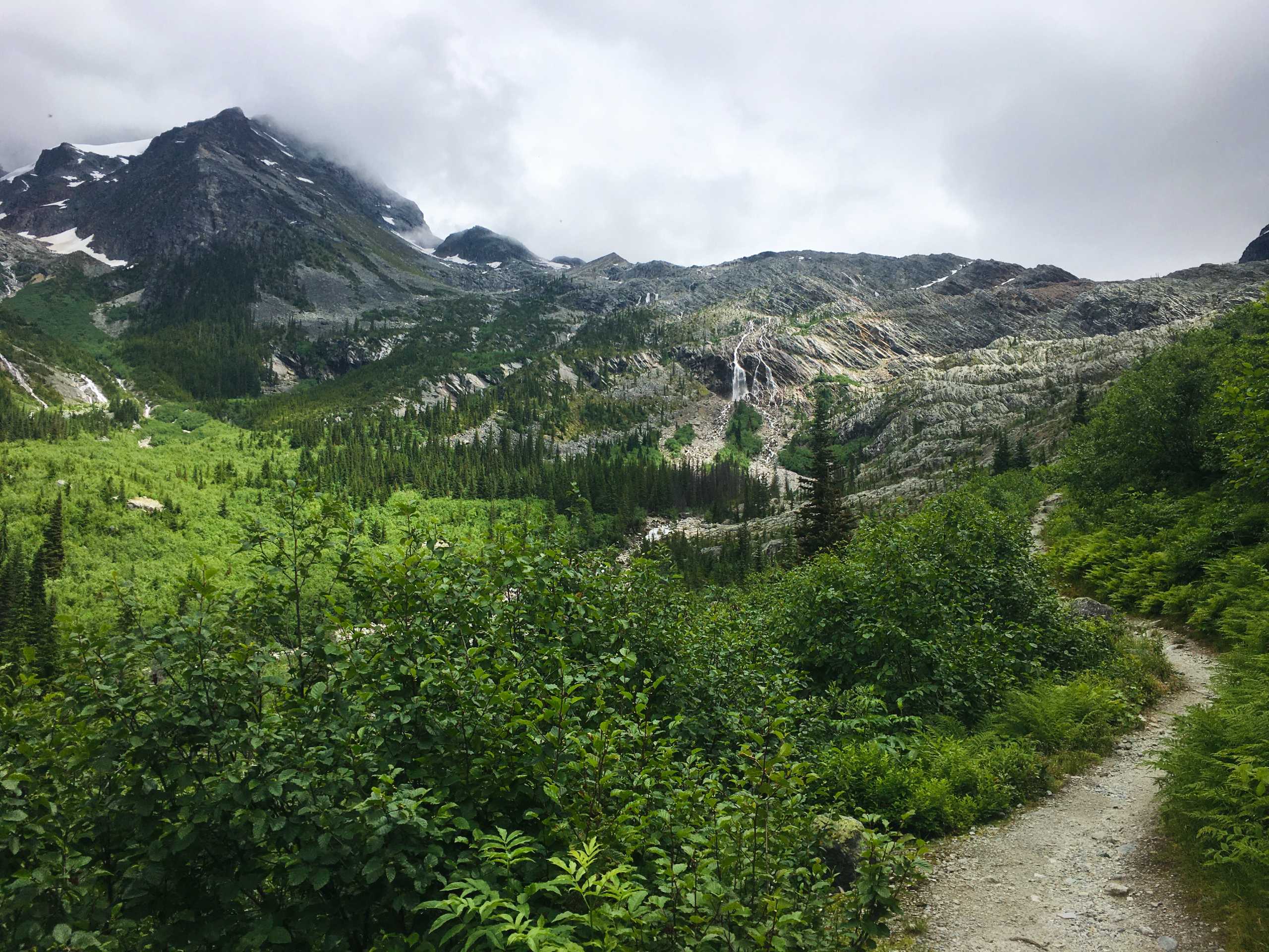
Great Glacier Trail
Difficulty Rating:
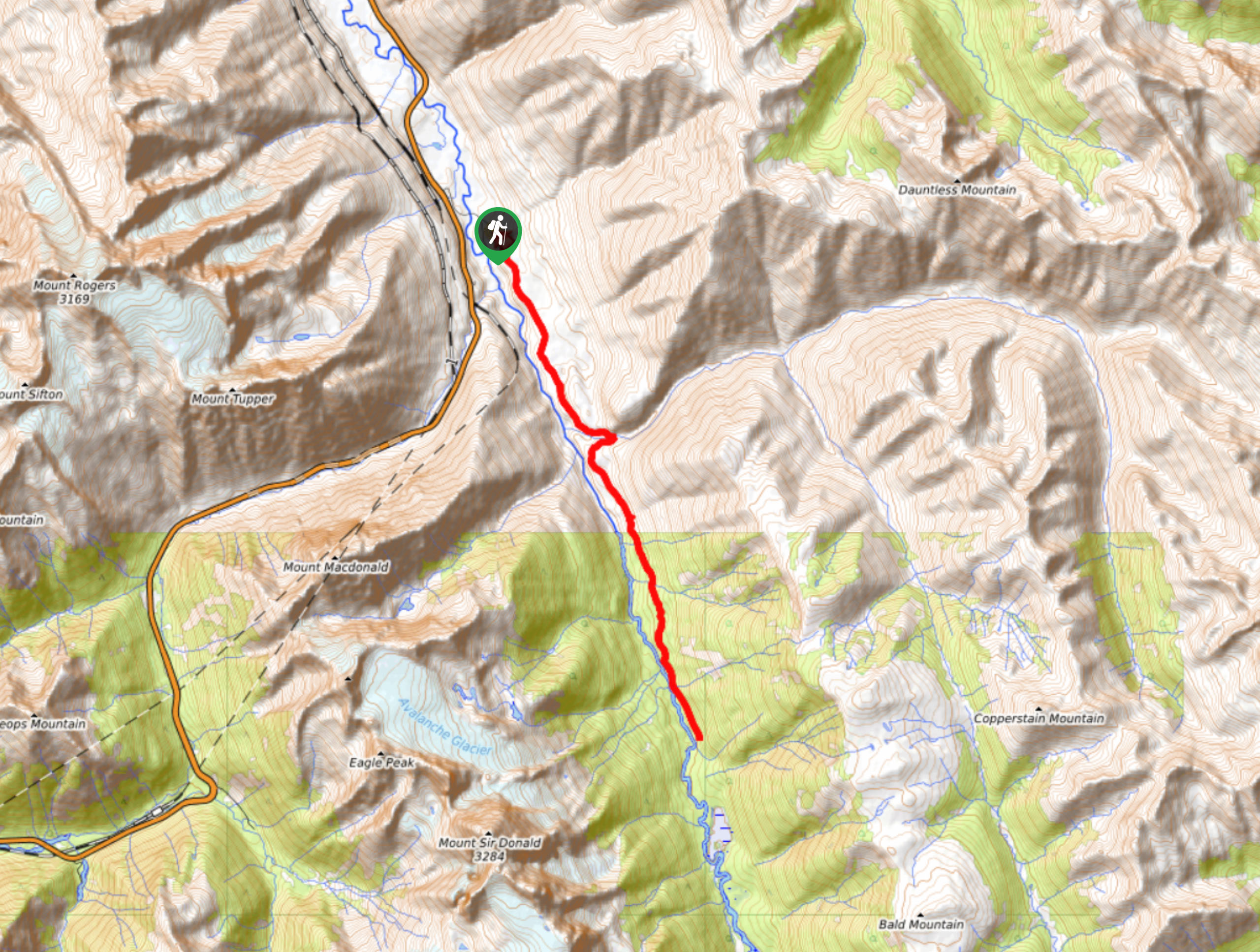
The Great Glacier Trail is an 4.9mi out-and back hiking route in Glacier National Park that features waterfalls, as well as amazing views of the Vaux Glacier and Mount Sir Donald. This hiking route travels along some fairly easy terrain and has a small elevation gain, making it a fun trek for hikers of all skill levels, including families. This is a low effort/high reward hiking route that should definitely be on your list if you are looking to explore the natural beauty of Glacier National Park.
Getting there
To reach the parking area for the Great Glacier Trail from Revelstoke, head east on BC-1 E for 37.3mi and park at the roadside parking lot on your right to access the trailhead. Alternatively, you can turn right 984ft after the parking lot to access the parking at Illecillewaet Campground and shave 0.6mi off the beginning of your hike.

About
| When to do | May-October |
| Backcountry Campsites | Illecillewaet Campground |
| Pets allowed | Yes - On Leash |
| Family friendly | Yes |
| Route Signage | Average |
| Crowd Levels | High |
| Route Type | Out and back |
Great Glacier Trail
Elevation Graph
Weather
Great Glacier Trail Description
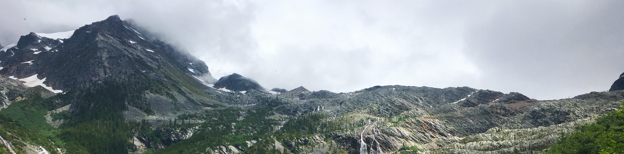
The Great Glacier Trail is a popular hike in Glacier National Park due to its easy-to-navigate terrain, beautiful landscape, and scenic views. The trail climbs uphill through the forest on a well-worn path that largely skirts alongside the Illecillewaet River for the length of the route. Hiking along the forested route, you will be able to hear the rushing waters of the river as you make your way past some immense boulders that are scattered throughout the area on the way to a bridge crossing. While crossing the bridge over Asulkan Brook, you will be able to spot a waterfall next to Vaux Glacier, as well as Cheops and Grizzly mountains to the northwest across Highway 1.
After the bridge crossing, the trail will begin to climb uphill through the forest along a series of switchbacks, eventually opening up to offer amazing views of the glacier. The next part of the trail is fairly exposed, first along some rocky terrain, before coming to a beautiful alpine meadow. Continue along the trail as you take in the awesome views of Vaux Glacier and Mount Sir Donald, eventually making your way over a shallow creek by hopping across some large boulders. Having reached the end of the trail, rest up and have a quick snack while enjoying the scenic views before setting back out on the Great Glacier Trail to return to your vehicle below.
Similar hikes to the Great Glacier Trail hike
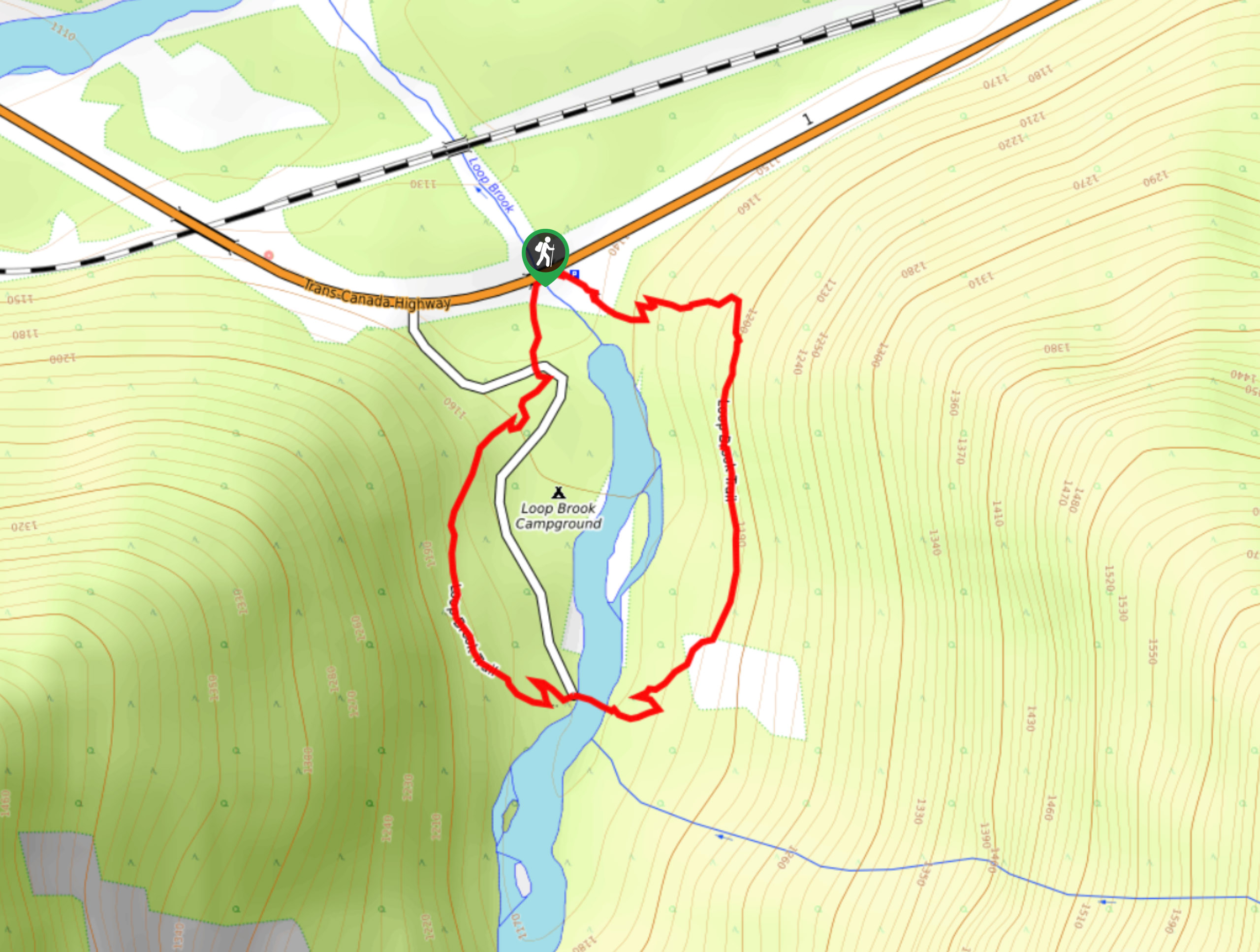
Loop Brook Trail
The Loop Brook Trail is a short, informative hiking route that will take you through the scenic valley to visit…
Bostock Creek Trail
The Bostock Creek Trail is a 9.5mi out-and-back hiking route that climbs uphill alongside the rushing waters of…
Beaver River Trail
The Beaver River Trail is a 14.0miout-and-back hiking route that travels into the backcountry of Glacier National Park…
Comments