
Loop Brook Trail
View Photos
Loop Brook Trail
Difficulty Rating:
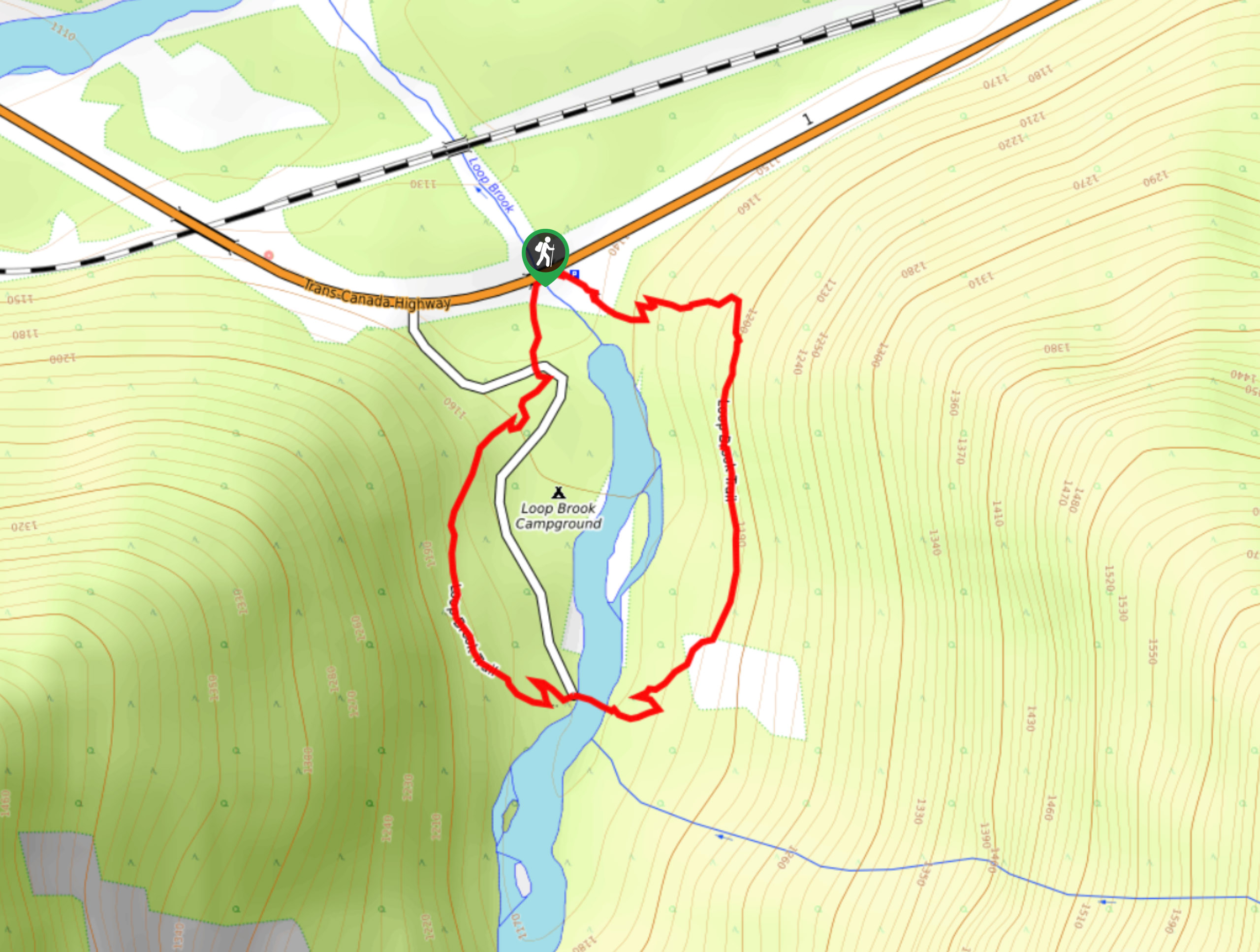
The Loop Brook Trail is a short, informative hiking route that will take you through the scenic valley to visit the stone remnants of an old railway trestle. Along the hike you will find informative signs that highlight the history of the area and experience the sights of nearby mountains including Bonney Mountain and the Bonney Glacier. This route is perfect for anyone looking to combine a love of history with the outdoors.
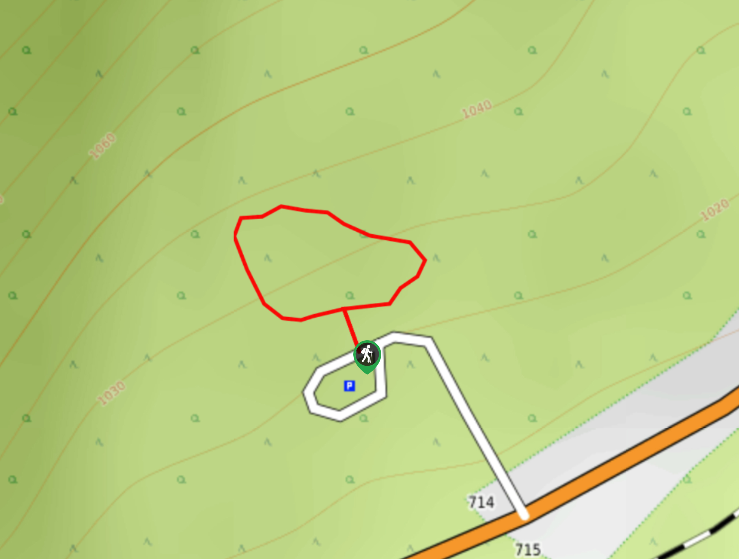
Getting there
To reach the Loop Brook trailhead from Revelstoke, drive east on BC-1 E for 37.1mi and turn right at the small roadside parking area to access the trail.

About
| When to do | June-October |
| Backcountry Campsites | Loop Brook Campground |
| Pets allowed | Yes - On Leash |
| Family friendly | Yes |
| Route Signage | Average |
| Crowd Levels | Low |
| Route Type | Circuit |
Loop Brook Trail
Elevation Graph
Weather
Loop Brook Trail Description
The Loop Brook Trail is a short hiking route in Glacier National Park that skirts around the edges of Loop Brook Campground on an interpretive trail that is packed with local history. Easily accessible from Highway 1, this 1.0mi trail passes by a series of stone pillars that once stood as supports for a railway trestle but now serve as a reminder of a bygone era. Along this trail, you will have scenic views of the valley along the bubbling waters of Loop Brook and, in nice weather, a good sightline up to Bonney Mountain and Bonney Glacier. This route offers the perfect opportunity to stop along the highway and stretch your legs while taking in the amazing sights and interesting local history.
Similar hikes to the Loop Brook Trail hike
Great Glacier Trail
The Great Glacier Trail is an 4.9mi out-and back hiking route in Glacier National Park that features waterfalls,…
Rockgarden Trail
The Rockgarden Trail is a quick little hike along the side of Highway 1 in Glacier National Park that features…
Hemlock Grove Boardwalk
Stroll along the well-maintained paths of the Hemlock Grove Boardwalk to experience the scenic woodland views that can be found…
Comments