
Video Peak Trail
View Photos
Video Peak Trail
Difficulty Rating:
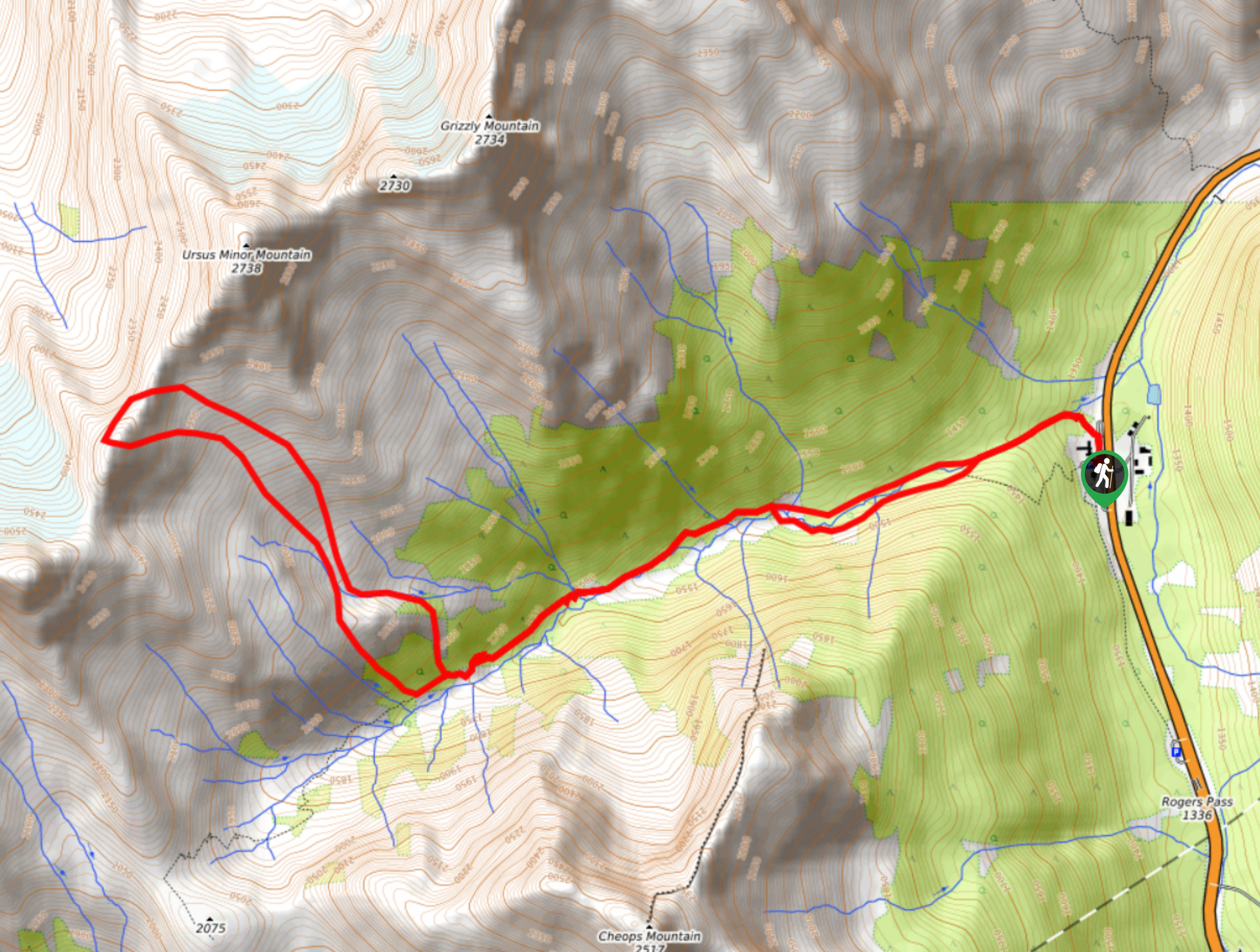
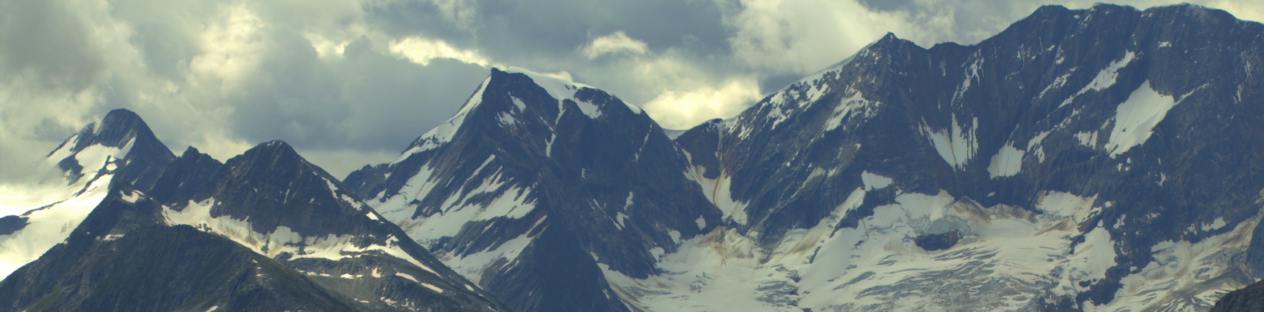
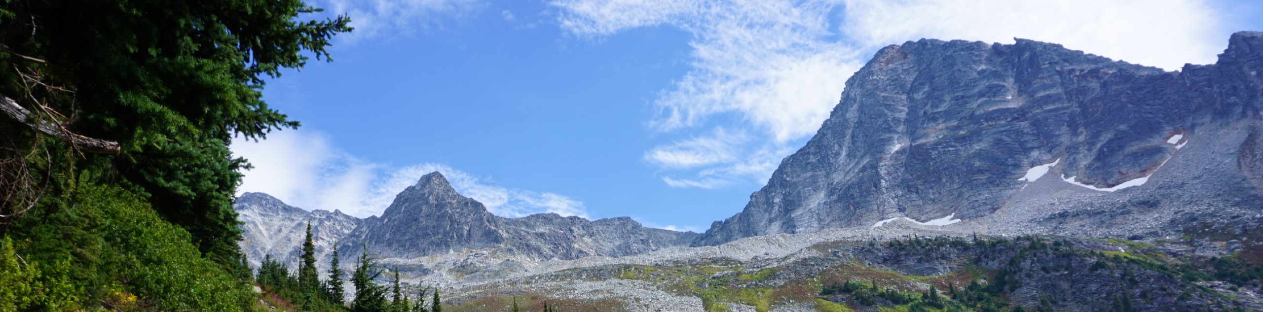
The Video Peak Trail is a scenic 8.4mi hiking route in Glacier National Park that takes you through a picturesque alpine valley on the way to the summit. Along the trail, you will hike through a dense stretch of forest and cross over several creeks before breaking out into the alpine landscape and making your ascent of the mountain. From there, you will experience amazing views over the parks and the countless mountain peaks that mark the rugged landscape.
Getting there
To get to the parking area for the Video Peak Trail from Revelstoke, make your way east on BC-1 for 40.3mi and turn left at the Rogers Pass Compound. Continue on for 131ft, and make a right turn onto Roger Pass Summit Road, where you will find the parking lot on your immediate left.

About
| When to do | May-September |
| Backcountry Campsites | No |
| Pets allowed | No |
| Family friendly | No |
| Route Signage | Average |
| Crowd Levels | Low |
| Route Type | Lollipop |
Video Peak Trail
Elevation Graph
Weather
Video Peak Trail Description
The Video Peak Trail is a challenging uphill hiking route that will take you through an alpine valley before breaking off from the main trail on a northward path to the summit. This route initially follows the Balu Pass Trail as it climbs between the Cheops and Grizzly mountains. Due to the area being frequently inhabited by bears, the trail is often closed, so make sure to check the status of the route before setting out on your hike. Additionally, hikers looking to utilize this trail should always travel in groups of four or more, bring bear spray, and make lots of noise to avoid any potentially dangerous encounters.
Setting out from the parking area, the trail climbs up through the heavily forested valley alongside the rushing waters of Connaught Creek before breaking out into a beautiful alpine meadow. From here, the route breaks towards the north on a course that leads up to the summit of Video Peak. Along this section of the trail, hikers will be able to take in the amazing views of the valley and the surrounding mountains. Reaching the summit, you will be able to breathe the crisp mountain air and look out over the numerous peaks that characterize the rugged landscape within Glacier National Park. After taking in the sights, head back downhill towards the main trail and follow the creek to return to the parking area.
Similar hikes to the Video Peak Trail hike
Hermit Trail
Hike along the Hermit Trail for a physically demanding but ultimately rewarding journey up to an alpine campsite in Glacier…
Bostock Creek Trail
The Bostock Creek Trail is a 9.5mi out-and-back hiking route that climbs uphill alongside the rushing waters of…
Avalanche Crest Trail
Hike along the Avalanche Crest Trail to experience beautiful mountain top views and spot many of the frigid glaciers that…
Comments