Avalanche Crest Trail
View Photos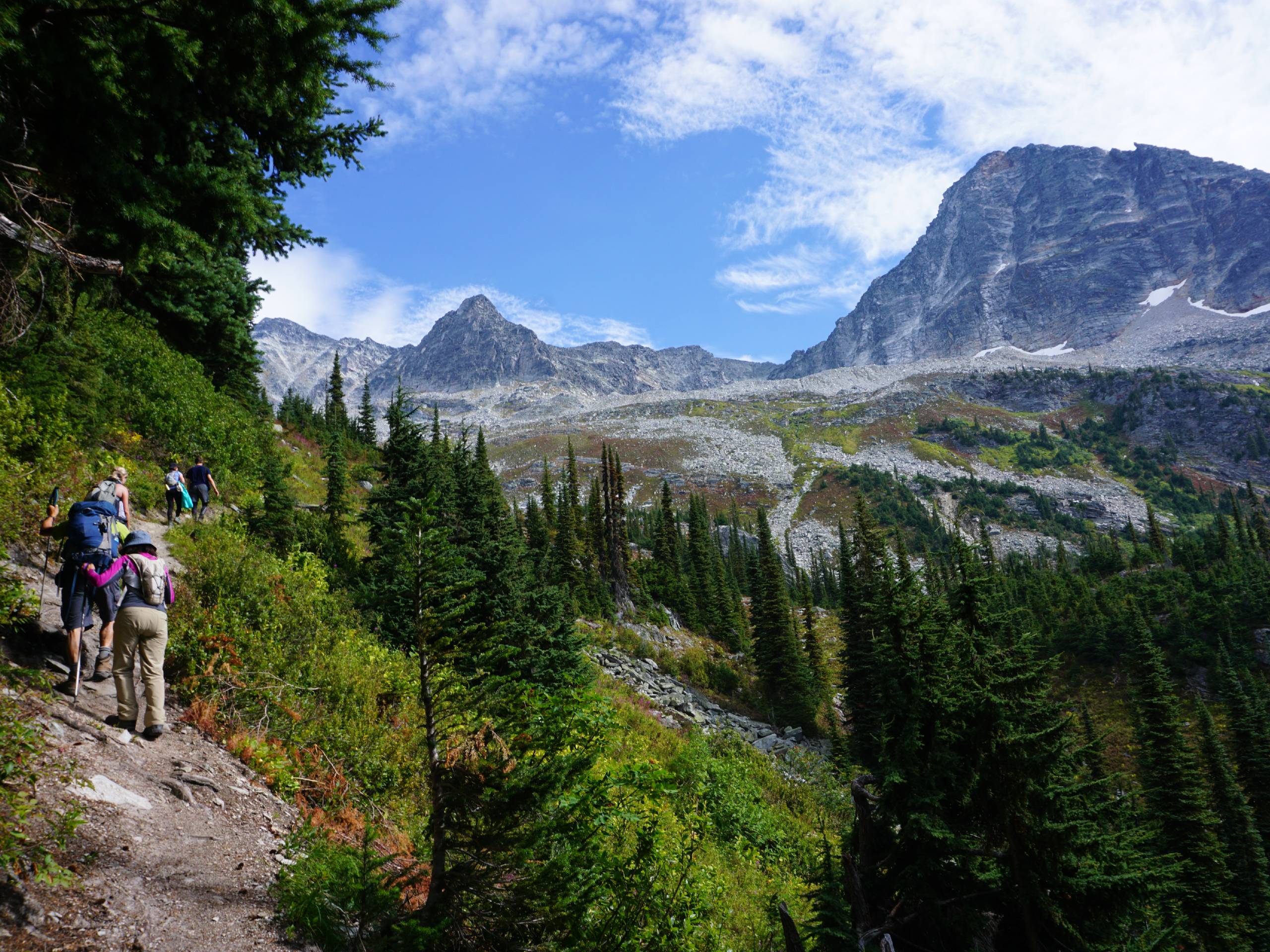
Avalanche Crest Trail
Difficulty Rating:
Hike along the Avalanche Crest Trail to experience beautiful mountain top views and spot many of the frigid glaciers that can be found within Glacier National Park. Along the trail, you will hike through scenic rainforests of cedar and hemlock on the way to an amazing lookout over the alpine landscape. The end of this trail is a bit technical and challenging, but the views along the way are definitely worth the effort.
Getting there
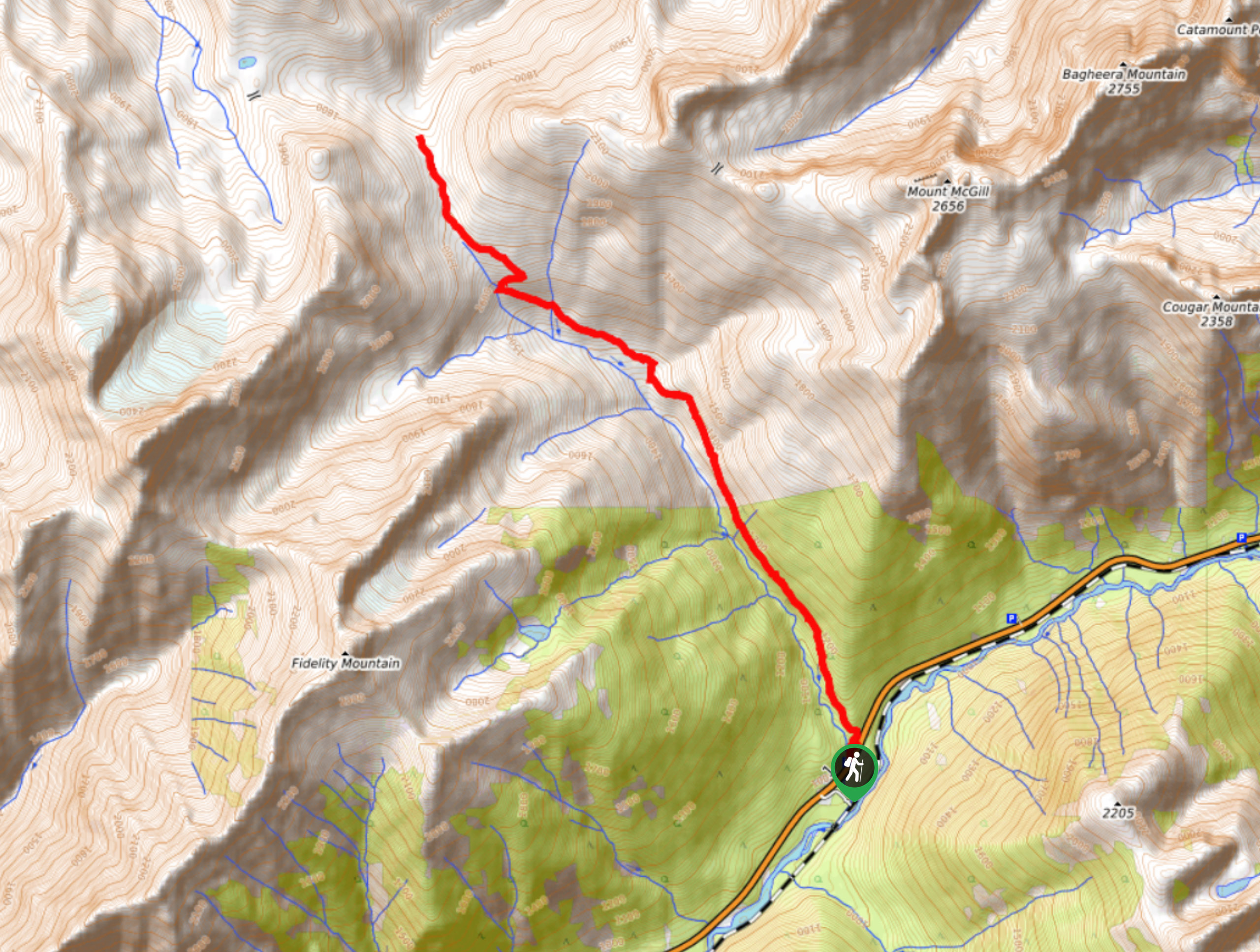
To get to the parking area for the Avalanche Crest Trail from Revelstoke, drive east on BC-1 E for 37.9mi and turn right to access the parking area and trailhead at Illecillewaet Campground.

About
| When to do | May-October |
| Backcountry Campsites | illecillewaet Campground |
| Pets allowed | No |
| Family friendly | No |
| Route Signage | Average |
| Crowd Levels | Moderate |
| Route Type | Lollipop |
Avalanche Crest Trail
Elevation Graph
Weather
Avalanche Crest Trail Description
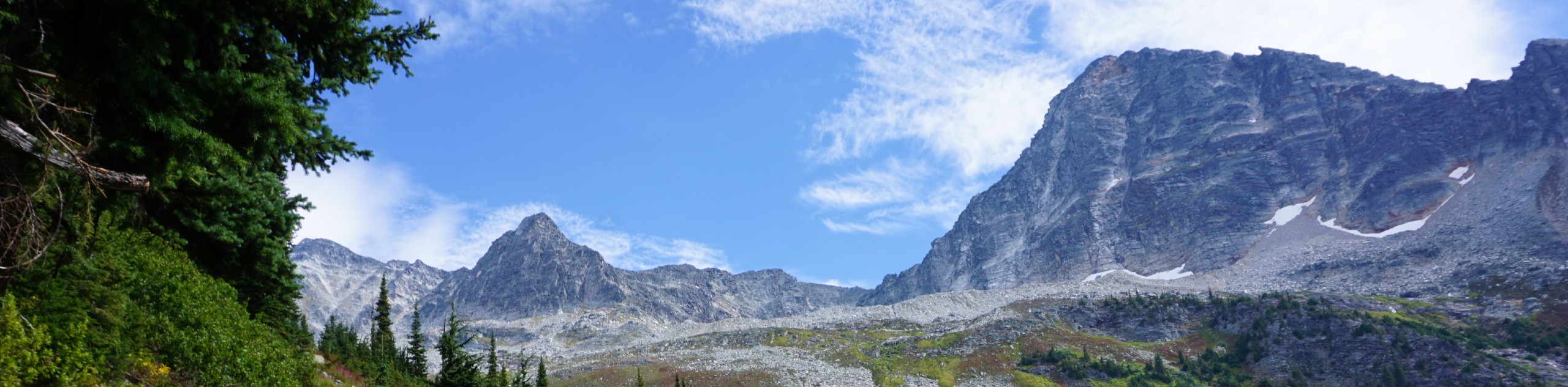
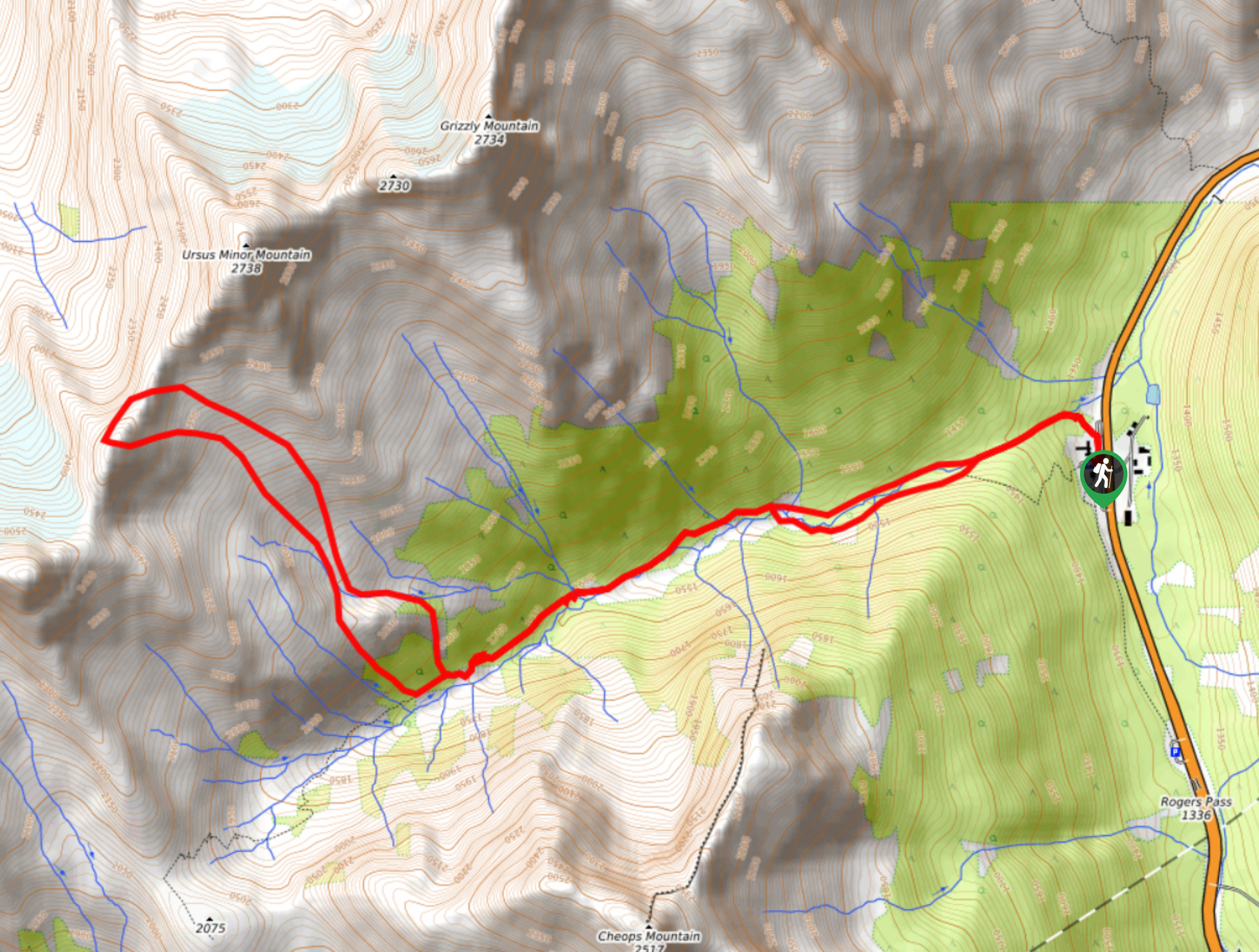
The Avalanche Crest Trail is a wonderfully scenic hiking route in Glacier National Park that will take you on an uphill climb through a stretch of cedar and hemlock forest on the way to Avalanche Mountain. Along this route, you will catch glimpses of nearby glaciers through the dense cover of the rainforest before arriving at an alpine bowl with amazing views of Avalanche Glacier. Near the top of the route, the trail splits off in two directions, with the right path setting out on a loop along the ridge to Avalanche Mountain.
This is not an official route, and it eventually becomes challenging to traverse. There are beautiful views in all directions, so don’t worry about pressing on around the loop and only take the trail as far as you comfortably can. Looking out to the west from this amazing vantage point, you will be able to see Cheops and Grizzly mountains, and to the east, Uto Peak and Mount Sir Donald will be standing before you. When you have had enough of the spectacular mountain top views, head back down the Avalanche Crest Trail to return to your vehicle below
Similar hikes to the Avalanche Crest Trail hike
Hermit Trail
Hike along the Hermit Trail for a physically demanding but ultimately rewarding journey up to an alpine campsite in Glacier…
Video Peak Trail
The Video Peak Trail is a scenic 8.4mi hiking route in Glacier National Park that takes you through…
Bostock Creek Trail
The Bostock Creek Trail is a 9.5mi out-and-back hiking route that climbs uphill alongside the rushing waters of…
Comments