Coral Creek Trail
View Photos
Coral Creek Trail
Difficulty Rating:
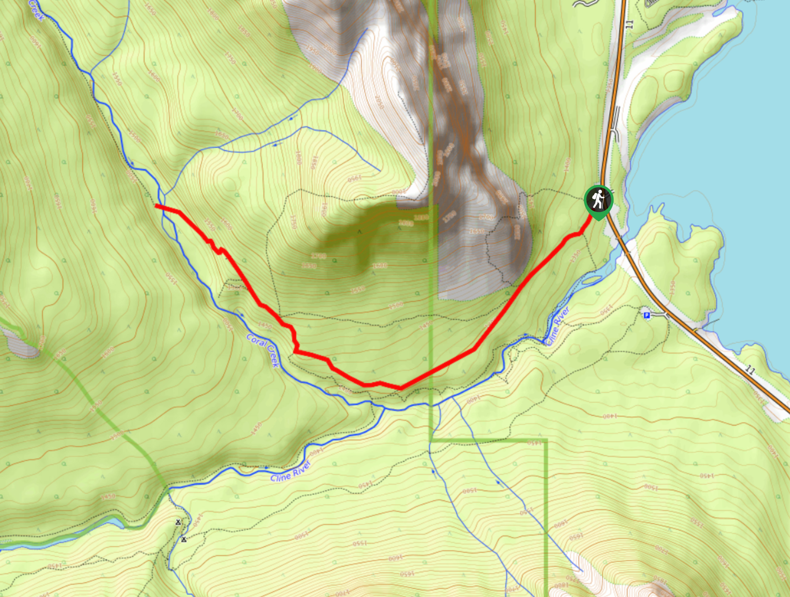
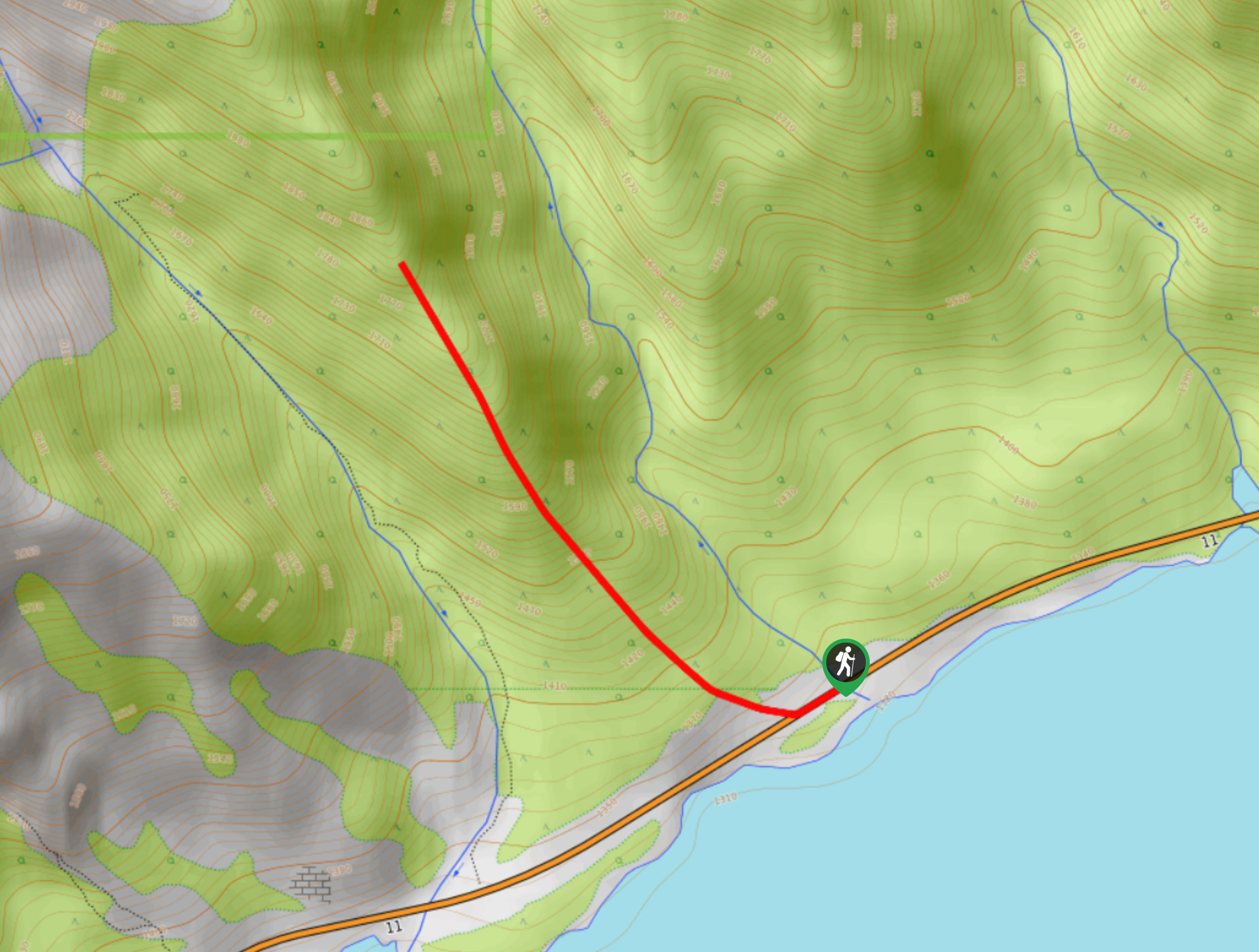
The trail up to Coral Creek begins along the Cline River. You can see the effects of the 2013 floods here as you make your way upstream, above the impressive canyon. You’ll hike to the confluence of the Cline River and Coral Creek, following Coral Creek to the mouth of the canyon. Here, a wide-open valley appears, marking an ideal turnaround point.
Getting there
From the Saskatchewan River Crossing, travel eastbound on Highway 11 for 26.1mi to the Coral Creek staging area on the left. Pull into the short road and park at the end for the trailhead.

About
| When to do | May–September |
| Backcountry Campsites | No |
| Pets allowed | Yes |
| Family friendly | Yes |
| Route Signage | Average |
| Crowd Levels | Moderate |
| Route Type | Out and back |
Coral Creek Trail
Elevation Graph
Weather
Coral Creek Hike Description
Taking the Coral Creek Trail is a beautiful half-day hike that provides views of Abraham Lake and the river valley above the canyon. It’s linked to some backpacking routes, so you may see other hikers gearing up for multi-day adventures in the parking area. Note that this trail can be muddy in early spring as the snow melts.
Begin along the trail, hiking up the looker’s right side of the Cline River. Walk along the high cliffs of the canyon as you make your way to the confluence with Coral Creek. Continue hiking, passing some junctions along the way. A junction for the canyon loop veers off to the left after 1.3mi. Continue straight, hiking upstream for another 1.2mi before turning back and returning the way you came.
Similar hikes to the Coral Creek Trail hike
Marble Mountain Hike
Getting to the Marble Mountain trailhead can be tricky and out of the way, but this remote trail is sure…
Paula’s Ridge Hike
Paula’s Ridge Hike is just east of Mount Abraham and offers incredible views of Abraham Lake. If you are looking…
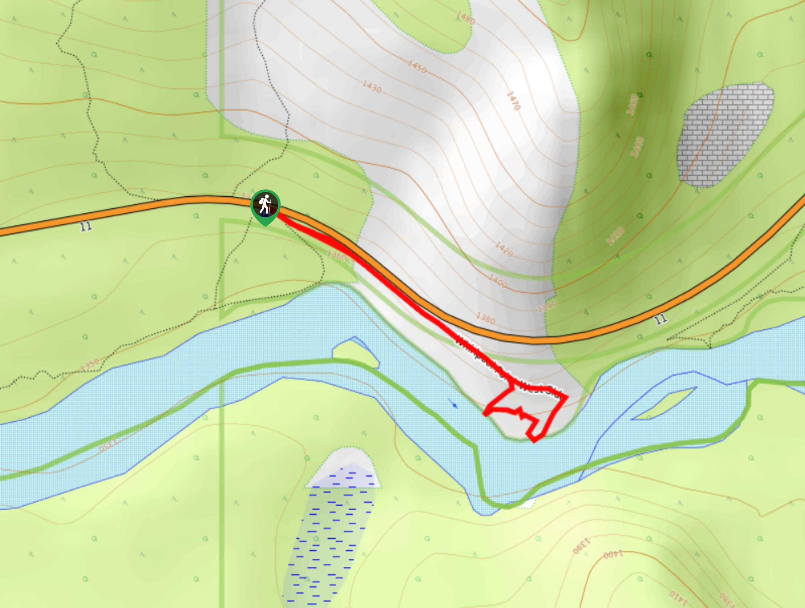
Whirlpool Point
The hike to Whirlpool Point is a beautiful stroll up the North Saskatchewan River. The trail is close to Saskatchewan…
Comments