Cautley Spout and the Calders Walk
View Photos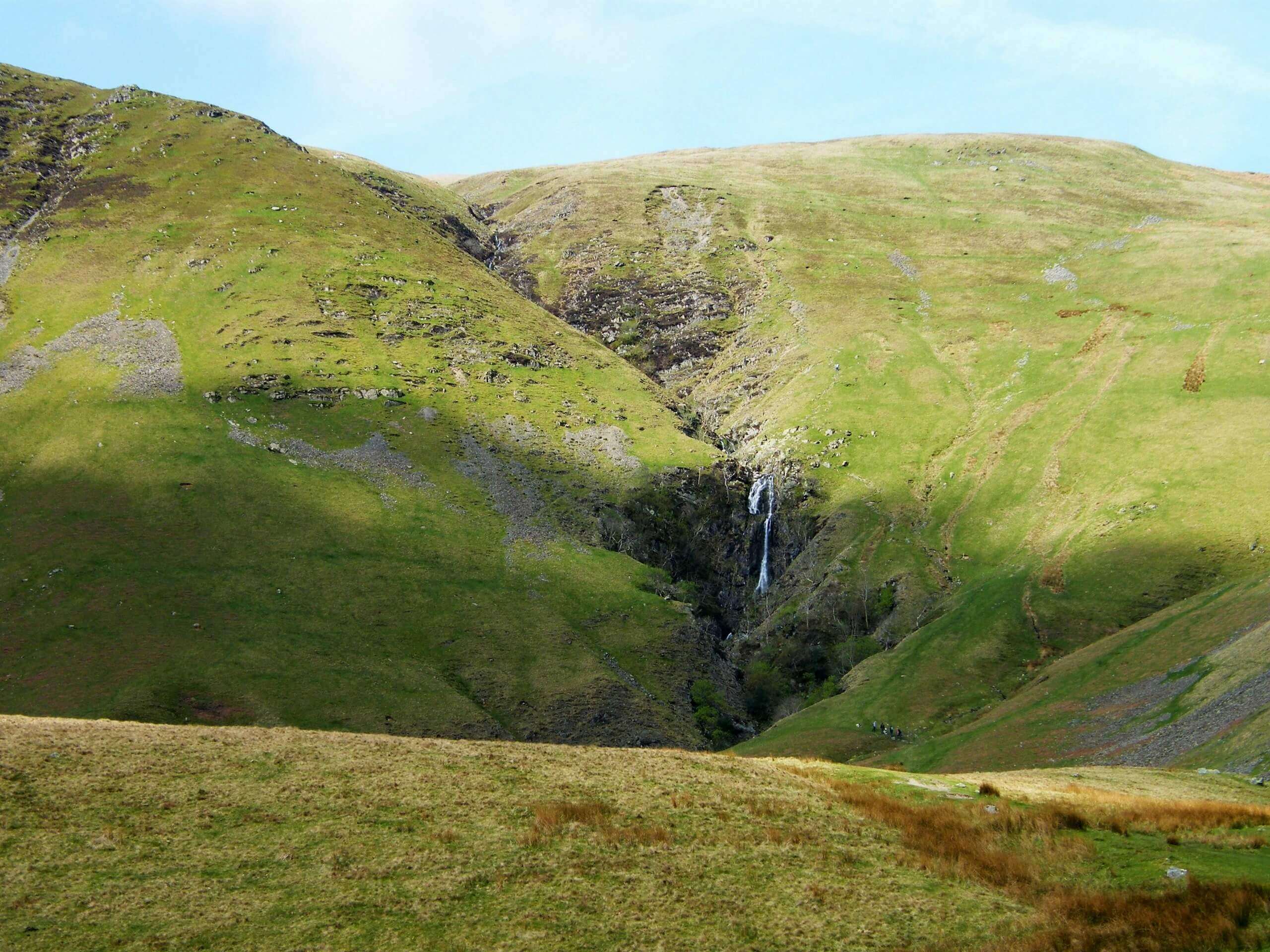
Cautley Spout and the Calders Walk
Difficulty Rating:
The Cautley Spout and the Calders Walk is a difficult adventure in Yorkshire Dales National Park that will produce gorgeous views of the surrounding landscape. While out on the trail, you will climb up the steep hillside and make your way across the moorland terrain to reach a beautifully scenic waterfall before traversing several hilltops on the return. There is a fair amount of elevation gain that makes this route challenging; however, it does follow along a good path, making it manageable for casual and seasoned walkers alike.
Getting there
To get to the trailhead for the Cautley Spout and the Calders Walk from Kendal, head southeast on Castle Street/A684 for 10.6mi and turn right onto Finkle Street, following it for 299ft. At the roundabout, take the first exit onto Back Lane and continue on for 0.3mi, keeping straight onto Long Lane. After 420ft, you will arrive at the trailhead.

About
| Backcountry Campground | No |
| When to do | March-November |
| Pets allowed | Yes |
| Family friendly | No |
| Route Signage | Average |
| Crowd Levels | Moderate |
| Route Type | Circuit |
Cautley Spout and the Calders Walk
Elevation Graph
Weather
Cautley Spout and the Calders Walk Description
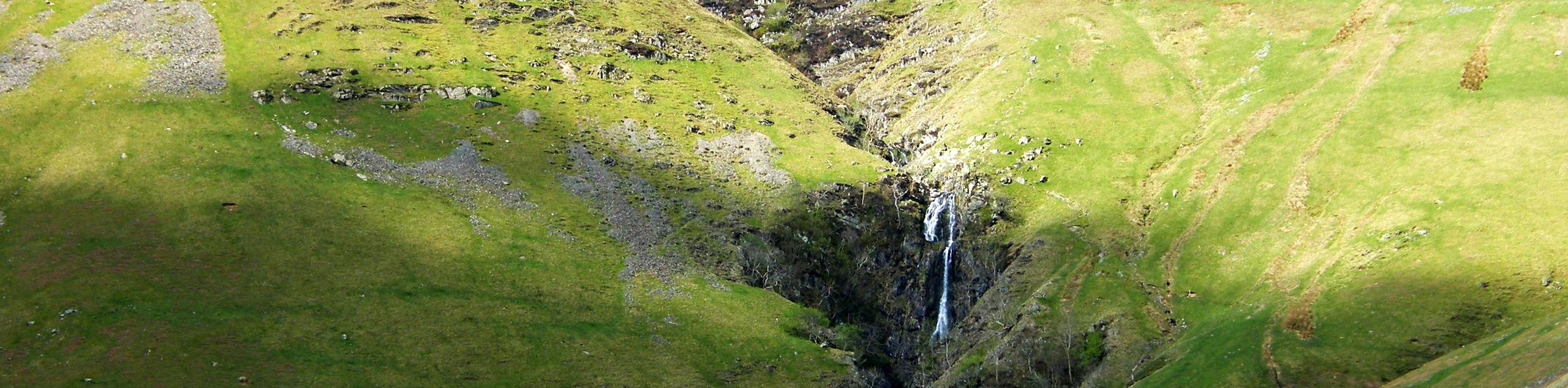
While it may be a challenging adventure, the Cautley Spout and the Calders Walk is a stunning excursion that will unveil some gorgeous landscape views within the Yorkshire Dales. Rugged hilltops, beautiful valley views, and the charming Cautley Spout waterfall all await on this wonderful trail.
Setting out from the trailhead in Sedbergh, you will head to the northeast across the open countryside, meeting up with the River Rawthey and following its winding banks to the north along the valley floor. Eventually, you will break off to the northwest and begin the steep climb uphill along the moor that will bring you to Cautley Spout.
After taking in the gorgeous views of the cascading waterfall, you will head to the southwest on the most rugged leg of the journey that will take you across several fells. After traversing the summit of the Calf, you will turn more directly to the south to make your way over the summit of Calders and Arant Haw, as you descend the steep hillside on the way back to the trailhead in Sedbergh. This trail can also be done clockwise to get the steep climb out of the way right off the bat.
Similar hikes to the Cautley Spout and the Calders Walk hike
Old Gang Smelt Mill and Reeth High Moor Walk
The Old Gang Smelt Mill and Reeth High Moor Walk is a rough and rugged adventure that will take you…
Hawes and Sedbusk Walk
The Hawes and Sedbusk Walk is a great family-friendly adventure in Yorkshire Dales National Park that will take you through…
Malham Tarn Upland Farm Walk
The Malham Tarn Upland Farm Walk is a fantastic route in Yorkshire Dales National Park that will take you around…
Comments