
Malham Tarn Upland Farm Walk
View Photos
Malham Tarn Upland Farm Walk
Difficulty Rating:
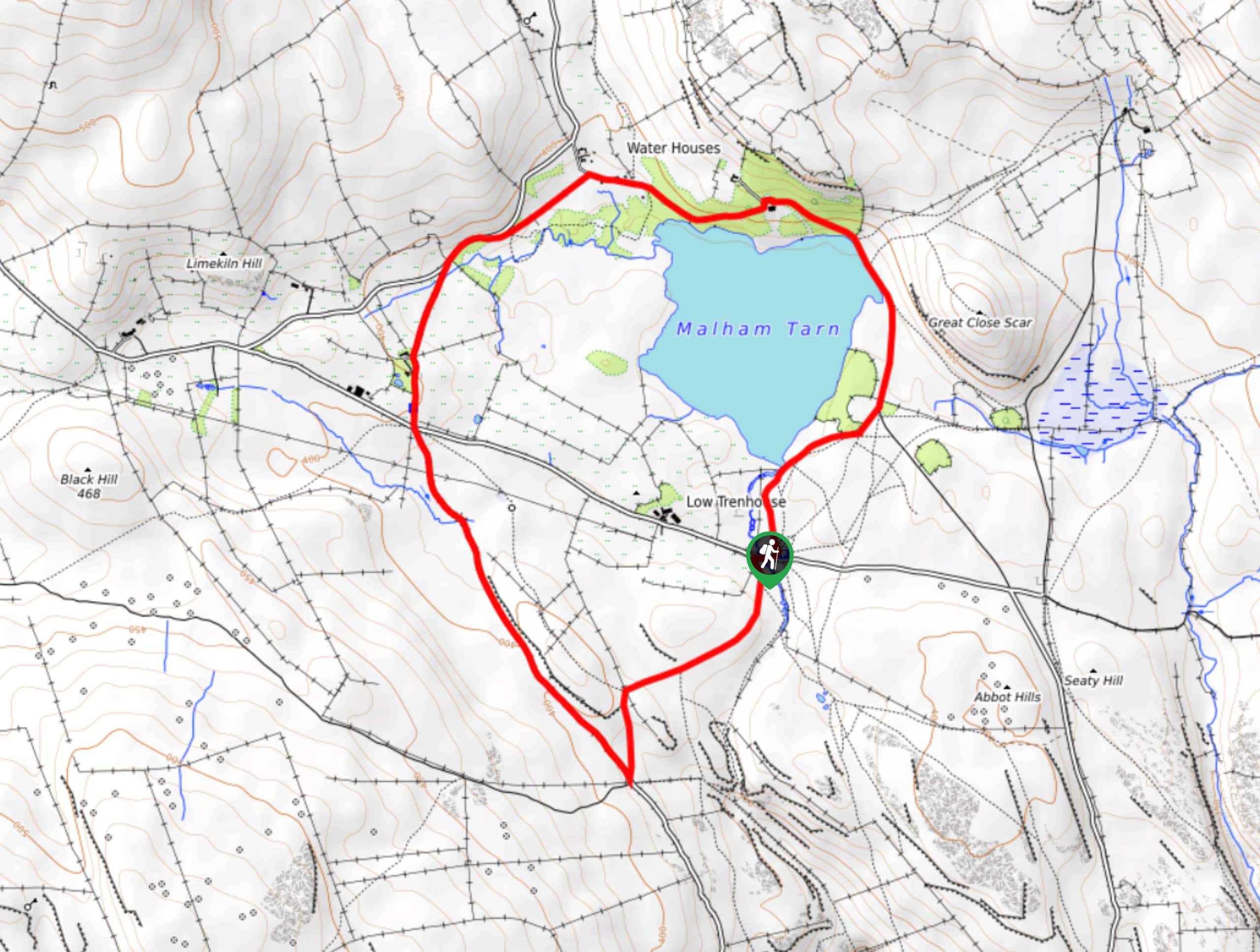
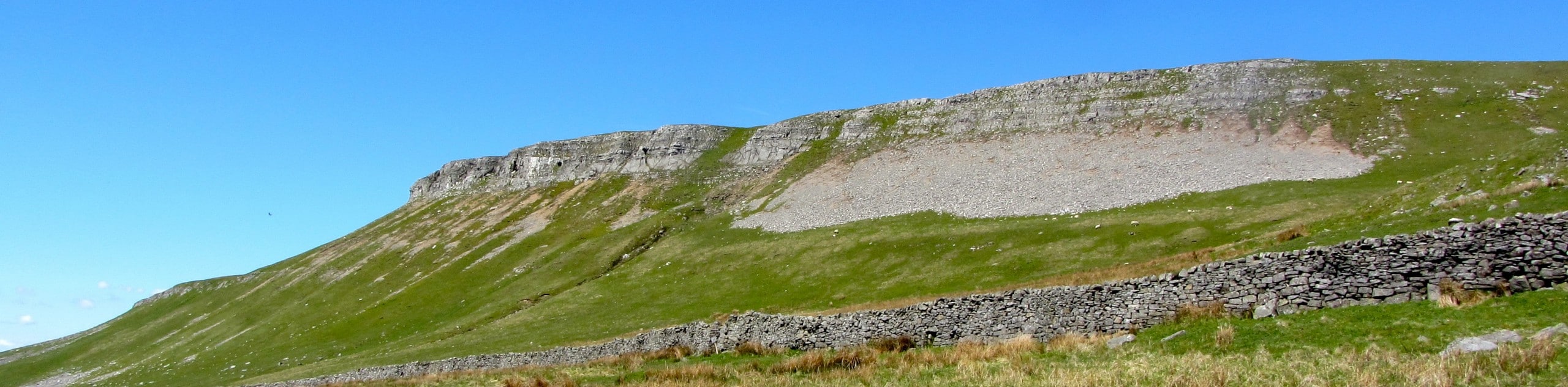
The Malham Tarn Upland Farm Walk is a fantastic route in Yorkshire Dales National Park that will take you around a lake with views across the moor. While out walking this trail, you will traverse the rugged terrain of the moor and enjoy breathtaking views across Malham Tarn as you walk around its scenic shoreline. If you are looking to improve this walk further, take the short detour south to visit the impressive Malham Tarn, a massive limestone wall.
Getting there
To reach the trailhead for the Malham Tarn Upland Farm Walk from Malham, drive north on Cove Road for 2.7mi and turn right to continue on for another 0.9mi. Keep straight onto Pennine Way for 350ft and turn left to enter the car park.

About
| Backcountry Campground | No |
| When to do | Year-Round |
| Pets allowed | Yes - On Leash |
| Family friendly | Yes |
| Route Signage | Average |
| Crowd Levels | Moderate |
| Route Type | Circuit |
Malham Tarn Upland Farm Walk
Elevation Graph
Weather
Malham Tarn Upland Farm Walk Description
Featuring the barren, yet beautiful terrain of the moor and stunning views across a mountain lake, the Malham Tarn Upland Farm Walk is a charming adventure that will showcase some of the natural beauty that can be found within Yorkshire Dales National Park. Terrain here isn’t overly difficult either, making this a great walk for beginners and casuals that want to experience the landscape of the region.
Setting out from the car park, you will head north across the moorland terrain, where you will very quickly arrive at the scenic shores of Malham Tarn. Keep left along the trail as you skirt around the edge of the lake, enjoying the scenic views across the calm surface of the water with stunning limestone rock formations looming overhead.
After working around the shores of the lake and meeting up with the road, you will follow it to the southwest to make your way across the scenic landscape of the moor. Reaching the southwest corner of the route, you can take a detour to the southeast that will lead you to the impressive site of Malham Cove, a large, horseshoe-shaped wall of limestone that towers over the landscape. If you would rather continue along the trail, turn your attention to the northeast to traverse the moor for a short distance on the return to the car park.
Similar hikes to the Malham Tarn Upland Farm Walk hike
Old Gang Smelt Mill and Reeth High Moor Walk
The Old Gang Smelt Mill and Reeth High Moor Walk is a rough and rugged adventure that will take you…
Hawes and Sedbusk Walk
The Hawes and Sedbusk Walk is a great family-friendly adventure in Yorkshire Dales National Park that will take you through…
Buckden Circular Walk
The Buckden Circular Walk is a lovely adventure in Yorkshire Dales National Park that will provide scenic views overlooking Wharfedale…
Comments