Opal Cone hike
View Photos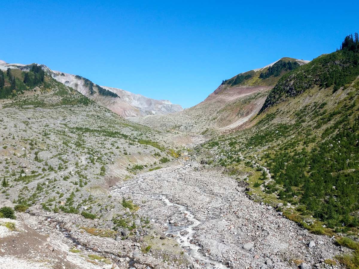
Opal Cone hike
Difficulty Rating:
For endless breathtaking vistas, embark on the Opal Cone hike, located within Garibaldi Provincial Park. While long in nature at 21.7mi, the hike is not overly challenging, with a gently rolling trail rising in elevation.
Getting there
Take Hwy #99 north to Squamish. In Squamish exit right at the B.C. Parks sign marked for ’Garibaldi Park Diamond Head’ onto Mamquam Road. You will eventually see another sign pointing you left, for Garibaldi Park Diamond Head. From this sign it's about 10 minutes to reach the parking lot.

About
| When to do | July to September |
| Backcountry Campsites | No |
| Pets allowed | No |
| Family friendly | No |
| Route Signage | Average |
| Crowd Levels | Moderate |
| Route Type | Out and back |
Opal Cone
Elevation Graph
Weather
Route Description for Opal Cone
Be warned, the Opal Cone is a long dayhike, at over 21.7mi. If you’re fit, this is a great dayhike, and not having to pack in gear makes you go fast. Many end up stopping at Elfin Lakes and pitching a tent, making this a two-day trip.
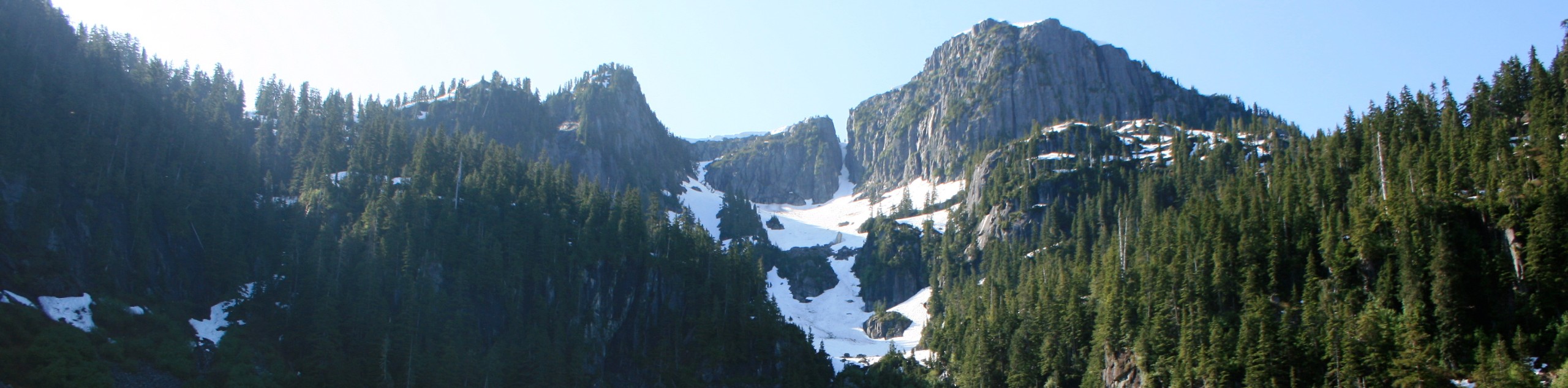
Start the Opal Cone hike from the Diamond Head parking lot, through the yellow gates. Follow an old access road towards Red Heather Meadow for the first 3.1mi. The first half of the climb is relatively easy, and also no real views. Once at the Red Heather Meadow, take a rest in the shelter there, then proceed from the meadow following the trail marked for hikers (not mountain bikers).
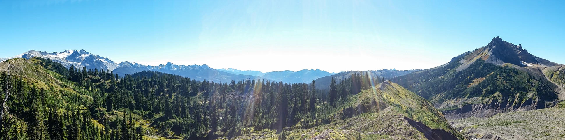
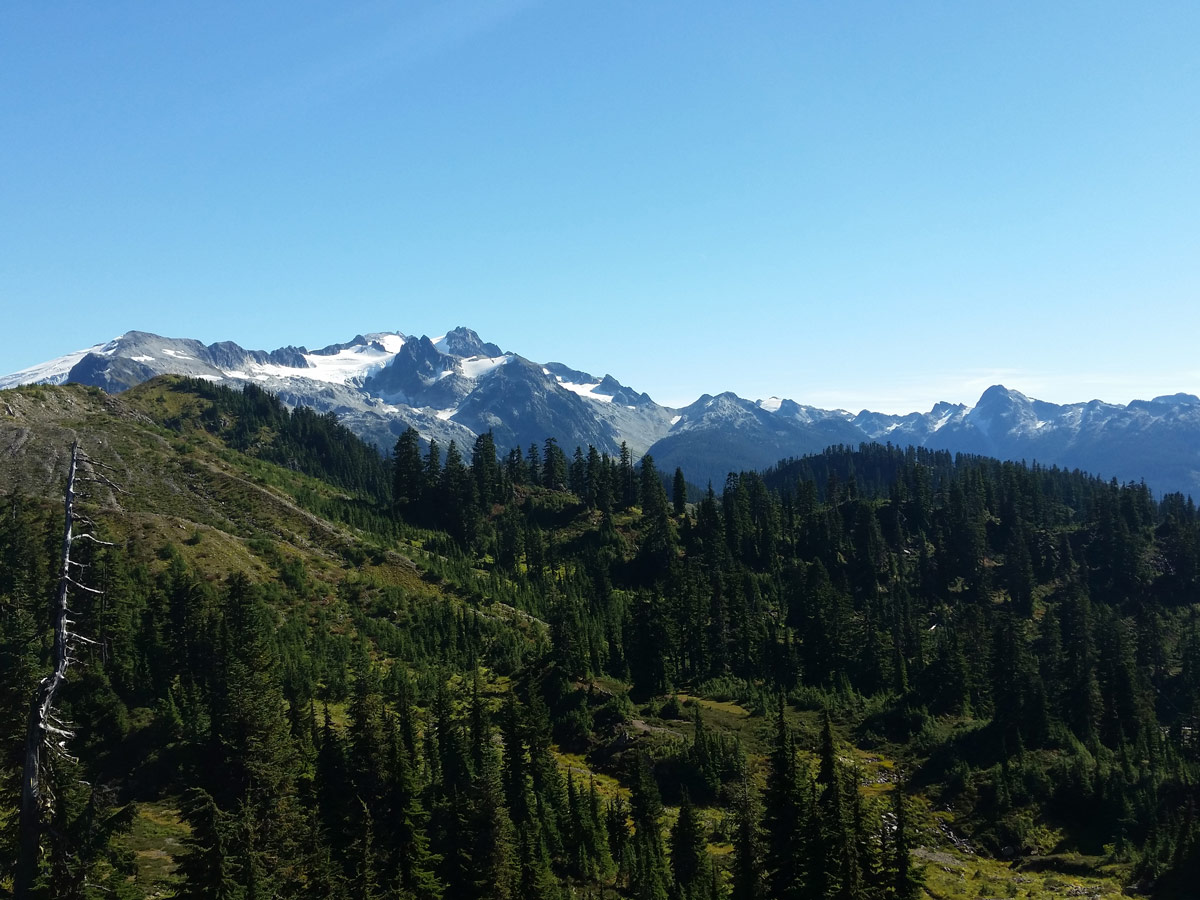
You’ll soon emerge from Paul Ridge to the first clearing, where you’ll begin to get a sense of the views that await. Atwell Peak looms off in the distance, and you’ll continue to follow the trail as it drops down towards Elfin Lakes.
Once you reach Elfin Lakes, stop to appreciate the view and if you are camping here for the night, you can drop your gear. After a rest and snack break, make your way towards the trail junction marked for Opal Cone/Mamquam Lakes.
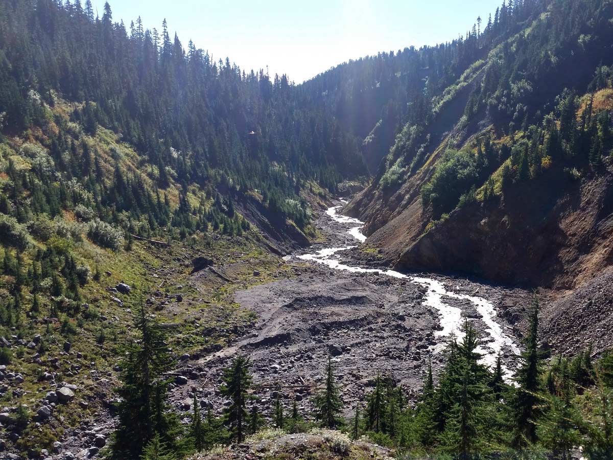
Continue downwards towards the next fork in the road. Follow the signs for Opal Cone/ Mamquam Lake as it continues to roll along. Soon, you’ll approach a large creek, though it may be dry during the summer, and enter the forest again, which provides some much-needed shade coverage.
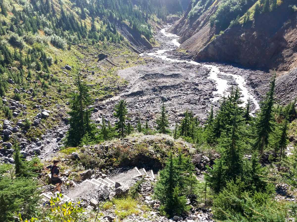
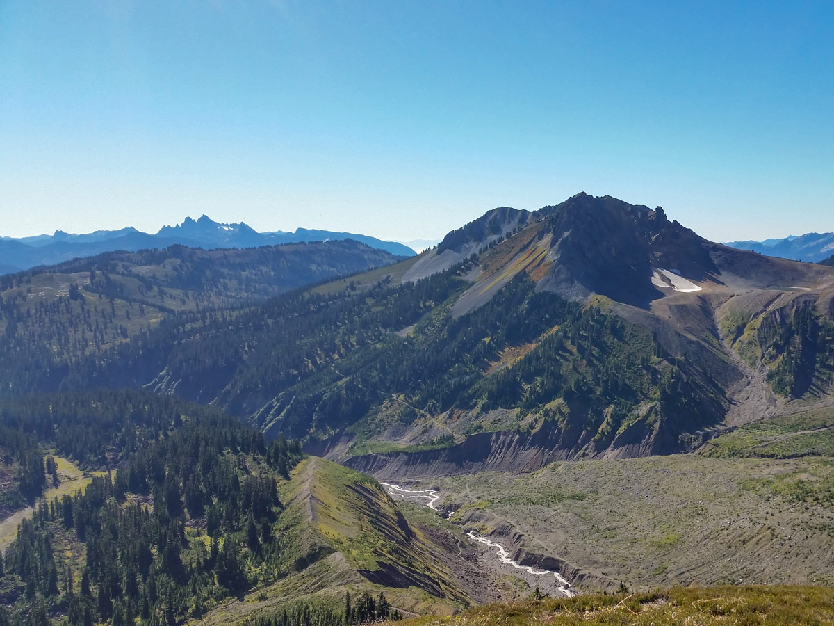
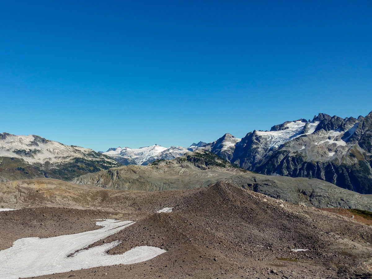
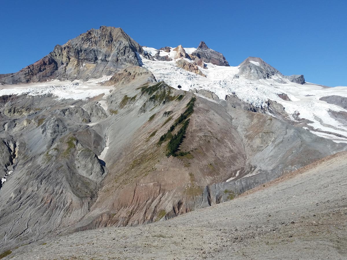
Follow the path as it weaves up and down, before opening up to a view of Ring Creek in an expansive valley which was carved out by the retreat of an ancient glacier. From here, you’ll be able to spot Opal Cone, towering above the creek.
Keep an eye out for the occasional orange flag, though you won’t need it as the trail is well-established and easy to follow. As you approach Ring Creek, cross the newly rebuilt bridge, but be cautious as there are no handrails. This is also a good spot to refill your water bottle if you haven’t done so yet.
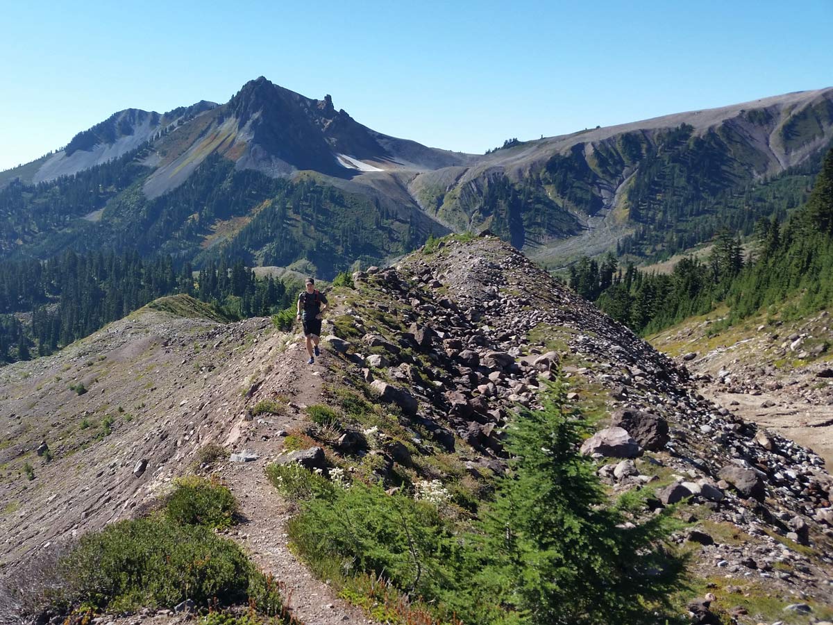
After crossing Ring Creek, the Moraine slope awaits you on the other side. This is a steady, uphill climb with no break for quite some time. Follow as the trail begins to switchback, before arriving at a verdant meadow that may be in full bloom depending on the time of year you visit.
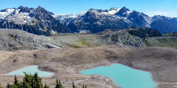
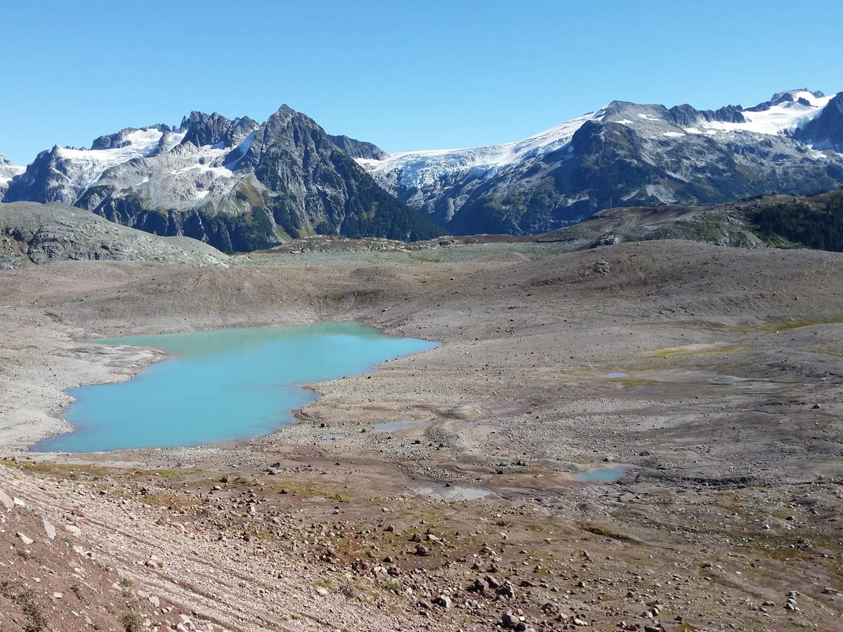
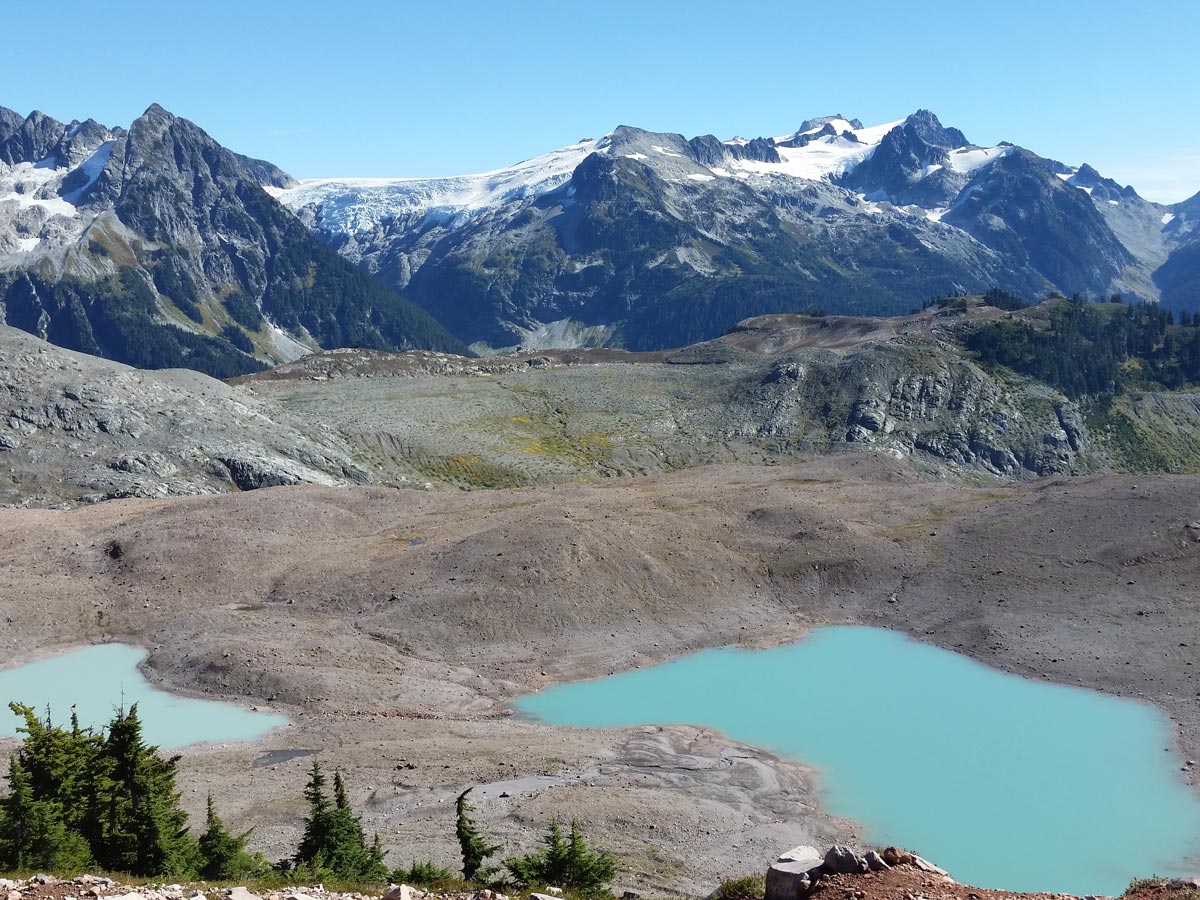
Contrasting to the lush meadow you just passed, you’ll now arrive at a moon-like landscape. Here, spot a bright, turquoise lake, walk just pass the water to find a trail marker on your left. The sign should direct you towards Opal Cone. Follow the trail up a steep incline.
From this point forward is the most difficult terrain of the entire hike, but you are not too far from the summit. The trail ascends up a very steep section of loose dirt and will funnel you out towards a large boulder. Some route finding is required in this part, but with the help from some cairns you can find your way up the trail. From the large boulder, cairns will take you along the ‘trail’ to the left, and you will be able to see the final stretch of path you must follow to reach Opal Cone.
After you’ve made your way to the summit, you can actually hike around the entire rim of the crater (cinder cone) of this extinct volcano if you wish. While it is worthwhile exploring the rim, the views don’t get any better than from this spot on the summit.
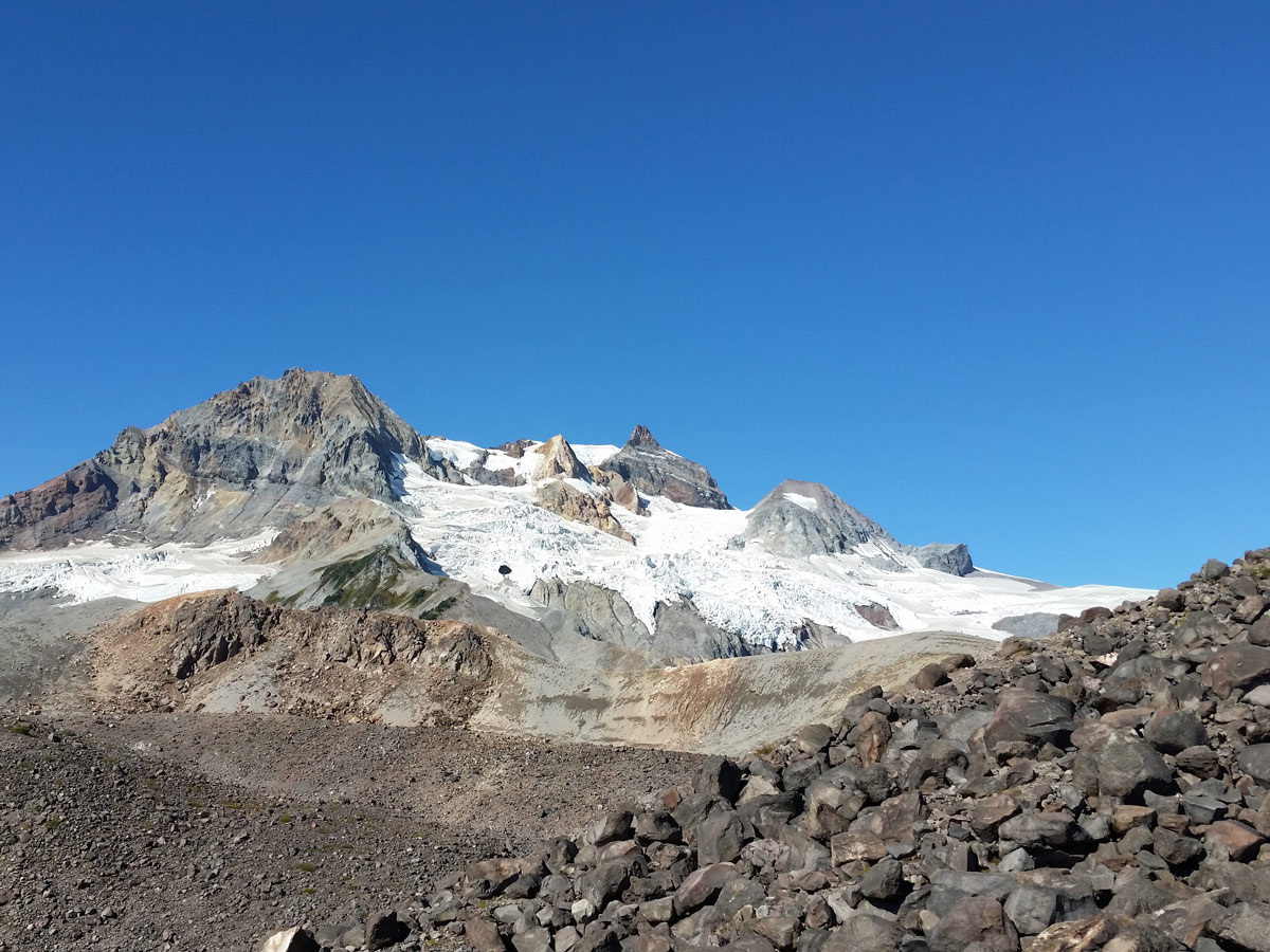
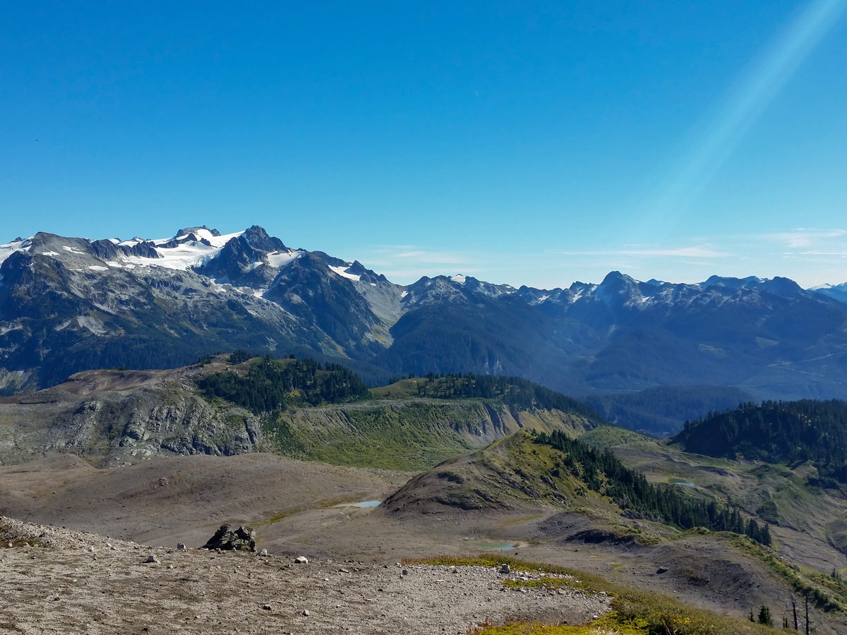
To the west you will get a magnificent view of Mount Garibaldi, Atwell Peak and Little Diamond Head. You can see the impressive Garibaldi Neve at the foot of Garibaldi to the northwest. To the southwest you can see Gargoyles and Columnar Peak. Directly south you can see the Elfin Lakes campsite where you came from. And to the southeast you can see Pyramid Mountain and the Mamquam Massif looming behind the turquoise lake which starkly contrasts the barren, rocky landscape.
Return the way you came. If you complete this entirely in one-day, great job. If you end up spending the night at Elfin Lakes, then that’s a great reward for a wonderful day out hiking around Squamish!
Insider Hints
The Opal Cone hike is a very hard dayhike at 35 km, and is often done as a hike from the Elfin Lake Campground.

Similar hikes to the Opal Cone hike
Skyline Ridge Trail
The Skyline Ridge Trail is a challenging 12.5mi uphill hiking route near Squamish that sets out from Stawamus…
Beth Lake
The 10.7mi trek to Beth Lake will take hikers along an easy to navigate service road through the…
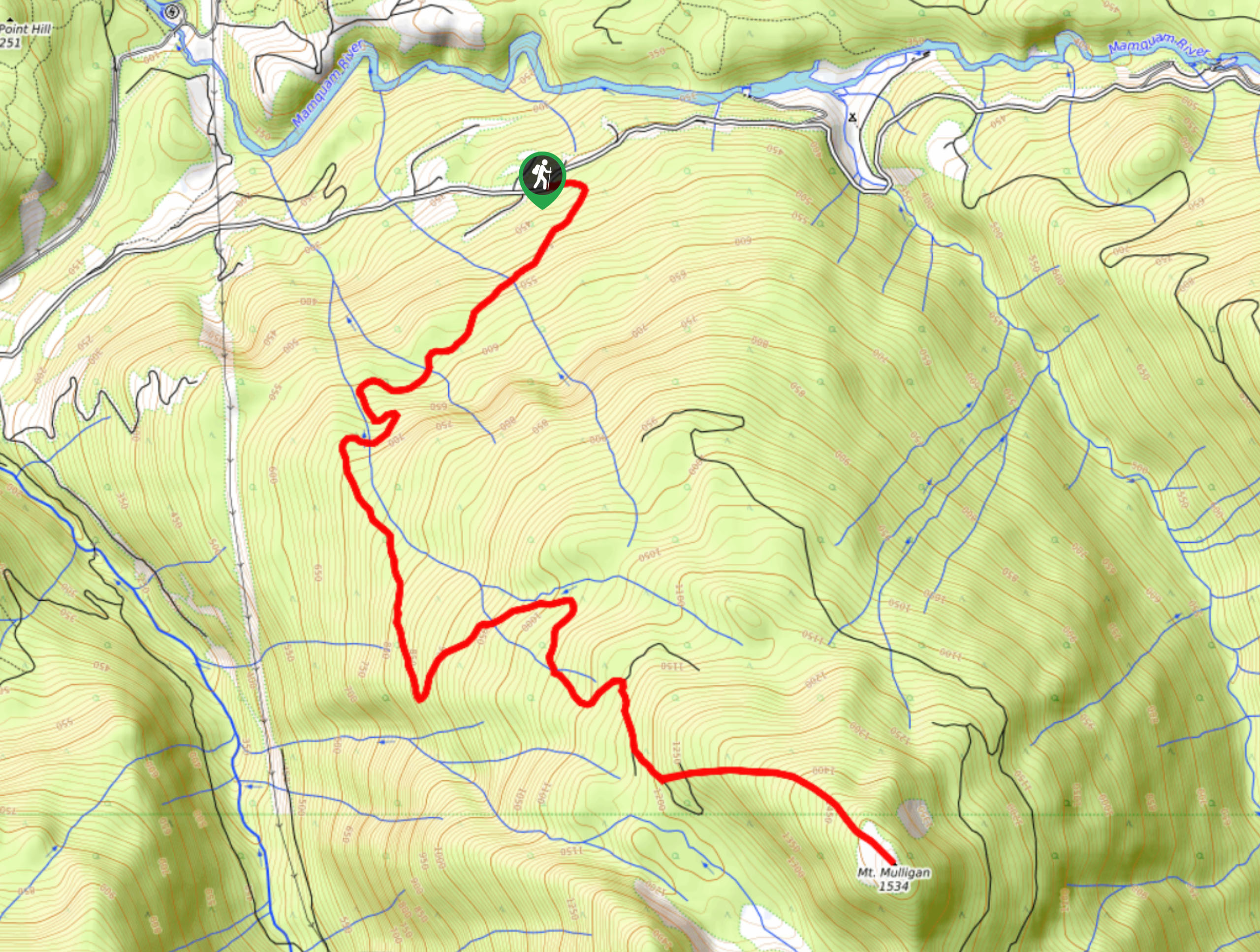
Mount Mulligan Trail
Hiking along the Mount Mulligan Trail is a difficult affair due to the steep incline of the route, but this…
Stella Winster 4 years ago
Fantastic hike. Could be difficult if you decide to go in one day, but relatively easy from Elfin lakes. Just bring enough water.
Emma Stanley 5 years ago
great trail and views. i met a friendly community of hikers. memorable hiking experience.
loneranger 5 years ago
Even though I prefer hiking alone, I decided to bring some company here. Nice to have someone to share the pain with you.
Amethyst S. 5 years ago
Hikes in this park ain't gonna be shorter huh? This hike is pretty demanding, but it's not that surprising for its elevation.
Wade Atkinson 5 years ago
Not my favorite hike, but a good workout, and had a wonderful view of the peaking vistas.
Molly Pineda 5 years ago
This is a great trail and Opal Cone will have a nice perfect view from all around. It has various viewpoints you can go to on top. You can see the mountains and lakes. You can also have fun sliding on the snow if you like.
aeropanda 5 years ago
The all-embracing beauty was mesmerizing. The lakes are pretty, nestled in the beautiful meadows. Too difficult to finish in one day. I highly recommend camping!