Crooked Falls hike
View Photos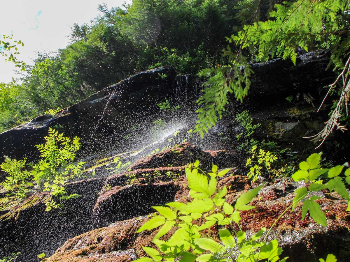
Crooked Falls hike
Difficulty Rating:
Experience the magical waterfall on the Crooked Falls hike, located in Upper Squamish. Wander through peaceful forests on this challenging hike, then take in the beautiful view of the Sigurd Creek tumbling down the mountain face.
Getting there
Drive north along Highway 99 to Squamish. Turn left onto Squamish Valley Road, across from the entrance to Alice Lake Provincial Park. From here, it will be about 15.5mi to reach the trailhead. Most of the drive from here is on the paved, Squamish Valley Road, but the final few kilometers will be on a gravel forest service road.

About
| When to do | All-seasons |
| Backcountry Campsites | No |
| Pets allowed | Yes |
| Family friendly | No |
| Route Signage | Average |
| Crowd Levels | Moderate |
| Route Type | Out and back |
Crooked Falls
Elevation Graph
Weather
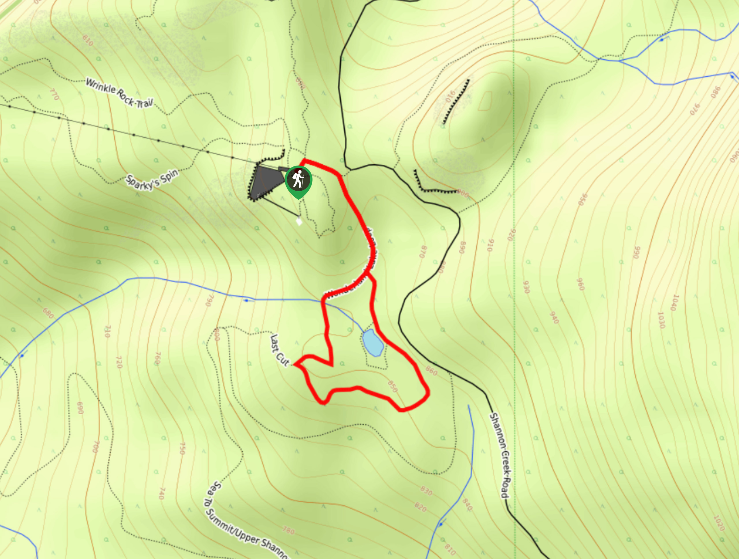
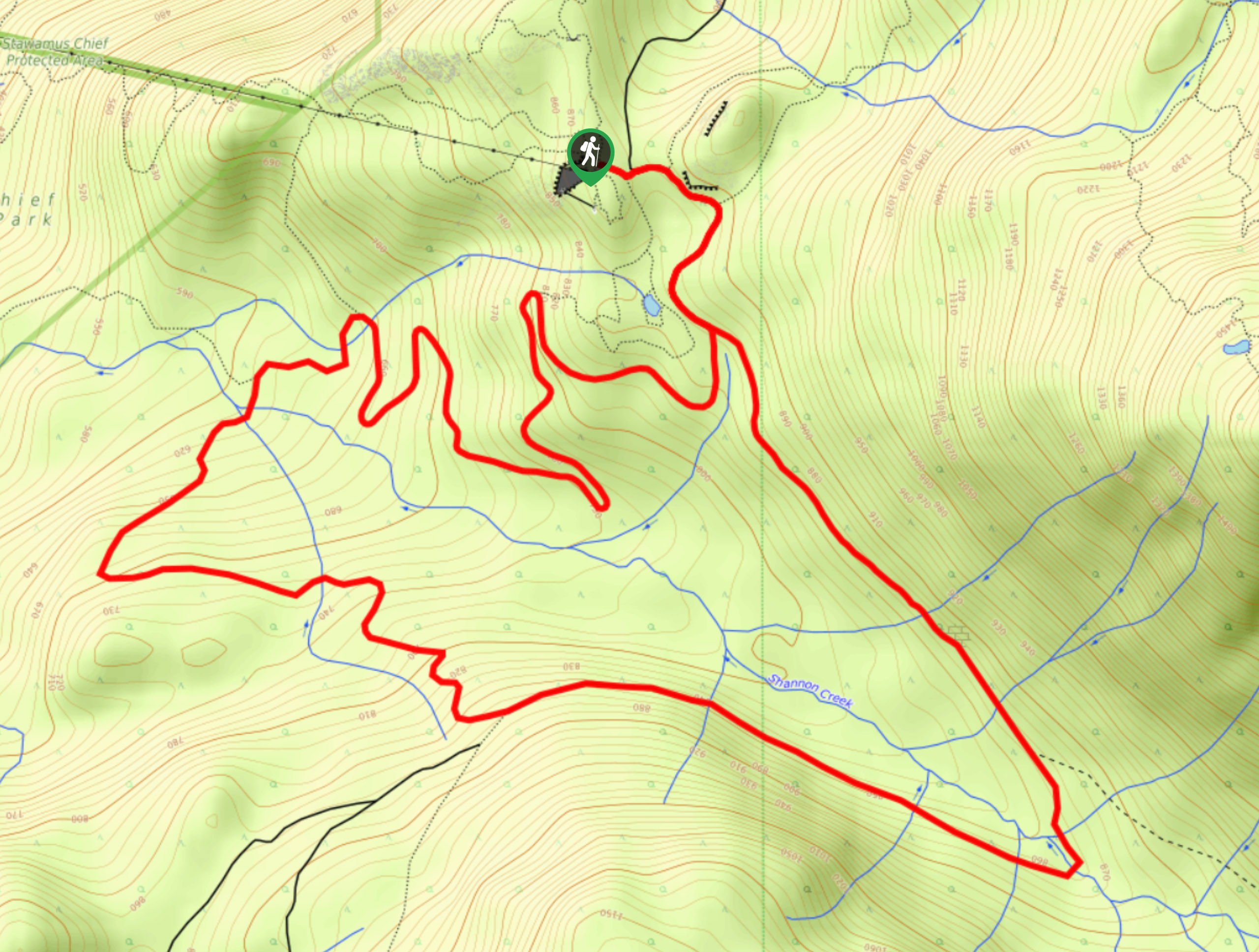
Route Description for Crooked Falls
To start the Crooked Falls hike, park your car next to Ashlu Creek and find the yellow sign on a utility pole that says Sigurd Trailon, where the trailhead begins. The initial stretch sets out on an old logging road, heading uphill. This section of road has large, loose rocks, so watch your step.
About 12 minutes into the hike, the trail will level out and become a wider path, though in the spring, the road can be quite muddy.
The road suddenly veers right and upwards, once you hit the corner, you’ll arrive at the Sigurd Trail which is marked in the trees.
From here, the trail inclines at a gradual pace. Follow the orange markers until the trail levels out again, keeping eyes to the right where you’ll find a mossy rock wall that is quite interesting to see up close.
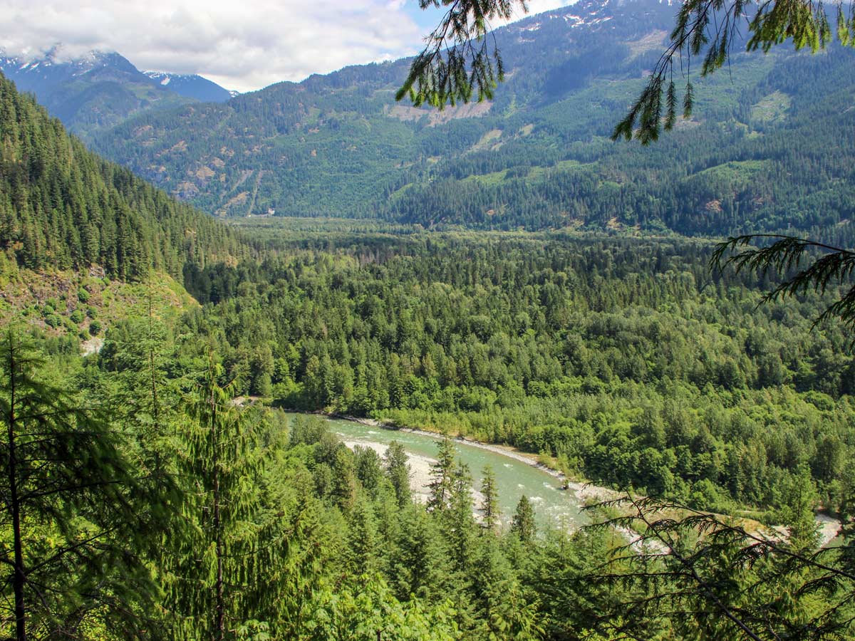
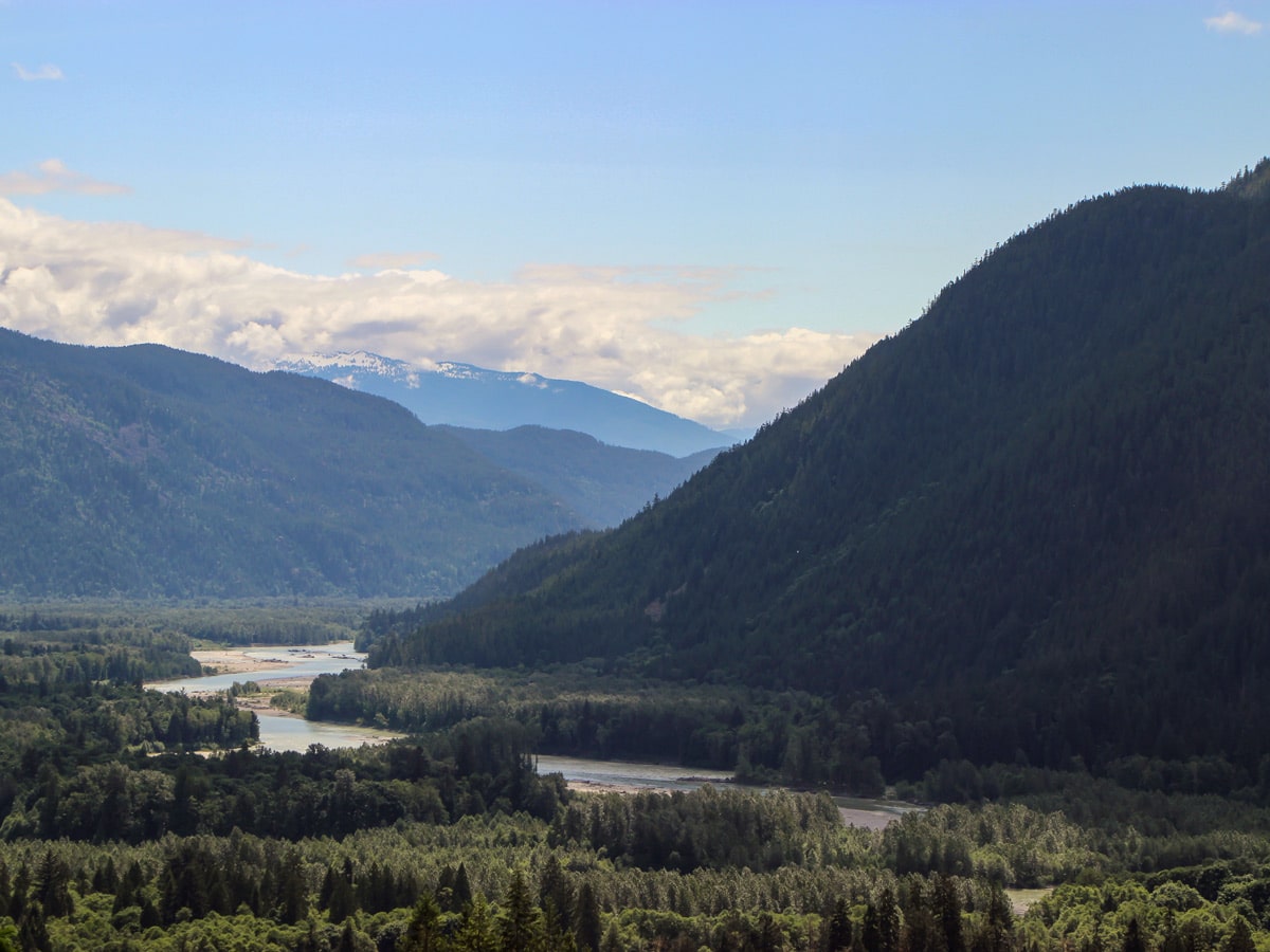
Take a look to your left and you’ll notice a beautiful viewpoint overlooking the Squamish River and surrounding mountain range. Just past the lookout, the path will sharply turn right, taking you uphill into a thick forest.
The trail becomes trickier from this point on with rocks and roots littering the trail, watch your footing as you head almost entirely uphill from this spot, until you reach the falls.
Another few meters in, another viewpoint will emerge, this time on your left-hand side overlooking a large portion of Squamish. Continue uphill and if you spot orange markers in the tree off-trail, ignore those and keep following the orange, square marked trail.
At times, you may need to use your hands to help pull you up, but not too worry, it shouldn’t be too difficult. Take your time.
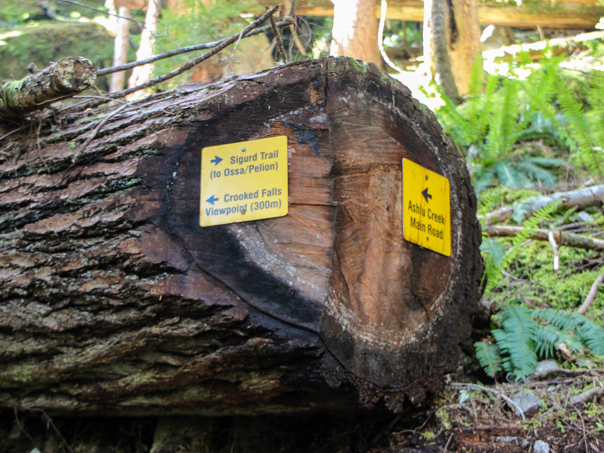
After about an hour and fifteen minutes, you should reach a junction. Spot the yellow sign tacked to a fallen tree pointing you towards Crooked Falls, to the left. You’re almost there!
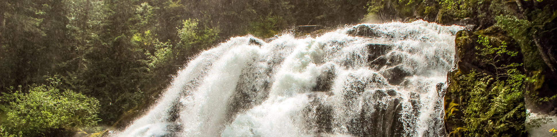
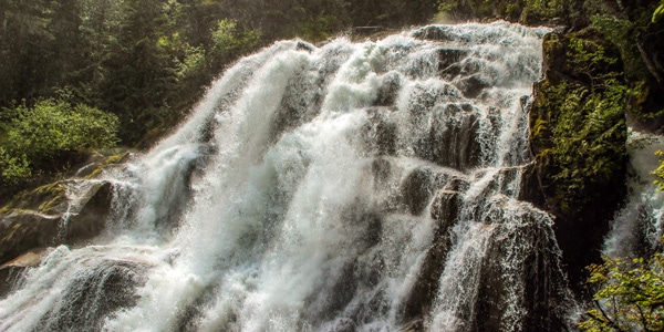
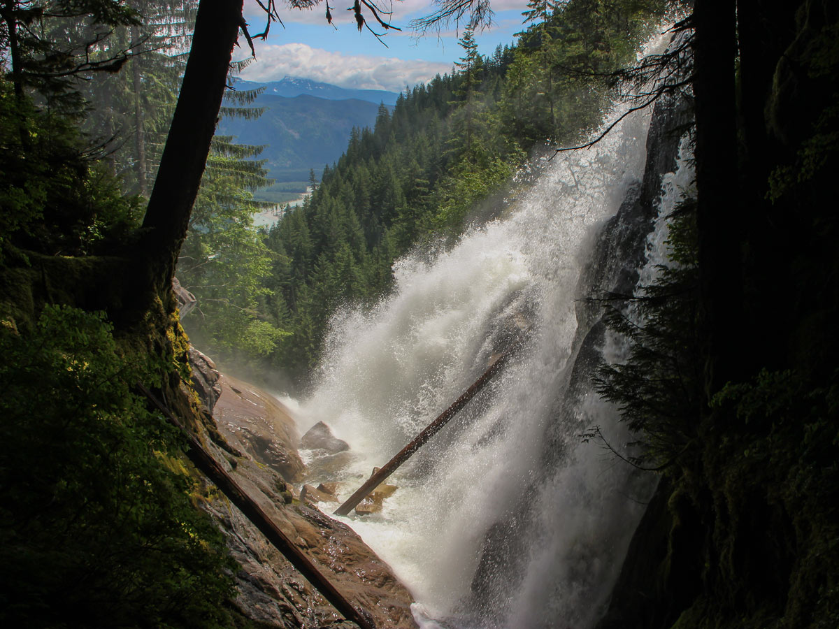
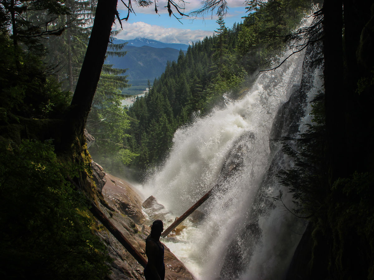
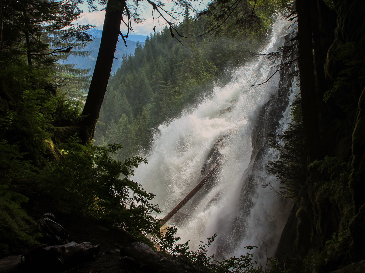
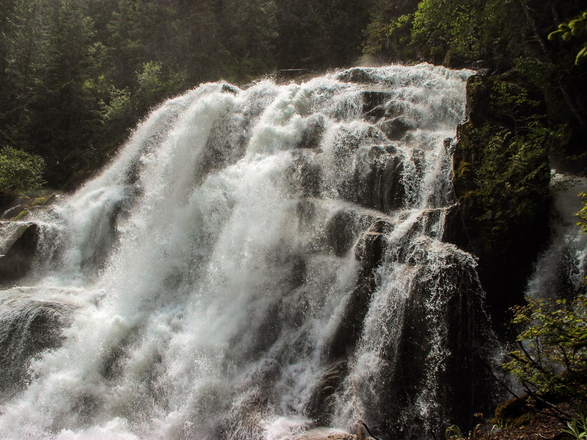
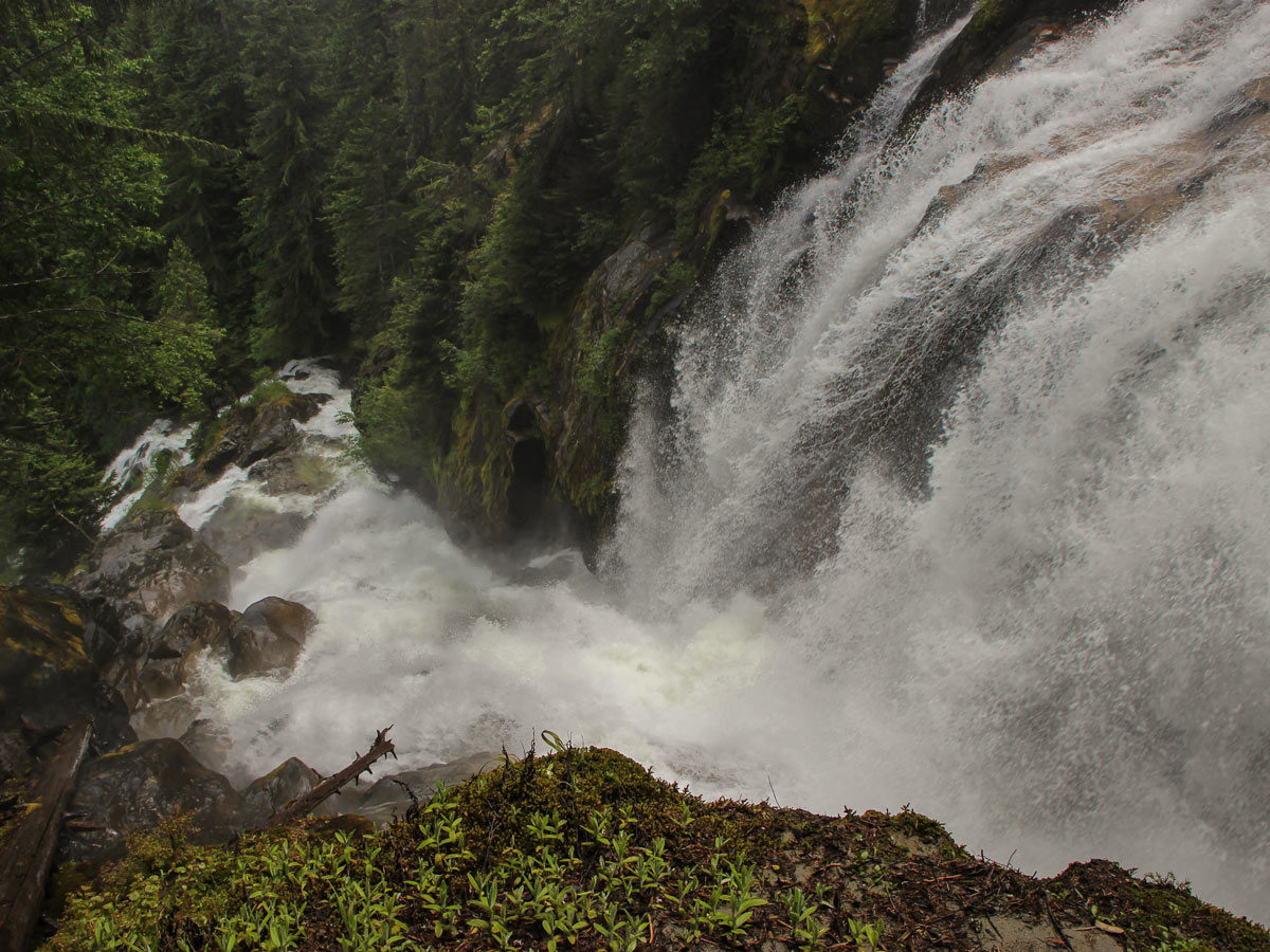
Listen to the roaring, rushing falls as you approach. You’ll likely hear them before you see them. Suddenly, enter a clearing to take in the majestic falls. If you head to the right, slide down a slippery trail to see a sideview of the falls. To look directly at the falls, head left to drop down to two natural platforms.
From here, carefully peak over the edge to watch as the water ‘crooks’ down the rockface. On the leftmost platform, proceed with caution as you will get wet from this spot by the waterfall’s mighty spray.
Enjoy the falls, refuel, and retrace your steps back down to your car.
Insider Hints
Crooked Falls is usually hikeable year-round. Spring is the best time to see the falls during the runoff. It’s a classic hike to leave for the shoulder seasons.
While not difficult based on kilometers, this trail can be tricky due to some technical terrain and very slippery areas. This route is not recommended for beginner hikers.

Similar hikes to the Crooked Falls hike
Four Lakes Trail
The Four Lakes Trail is a 4.5mi hiking route that travels through Alice Lake Provincial Park on a…
Wonderland Lake Loop
The Wonderland Lake Loop is a short trail that sets out from the top of the Sea to Sky Gondola…
Shannon Basin Loop
The Shannon Basin Loop is a 5.9mi lollipop trail near Squamish, BC, that sets out from the top…
Emma Stanley 5 years ago
oh so lovely! there's a lookout rock that you can climb early in the trail to get a breathtaking view of the river valley.
Molly Pineda 5 years ago
Great hike with great reward. Nice incline, not too challenging, quiet trail, & great views from the two viewpoints.
Niamh Gorget 5 years ago
An excellent hike with a cruel trail. Some parts of the trail disappear and you're just following orange markers nailed to trees. It's confusing but not that hard!
aeropanda 5 years ago
About an hour and a half hike one way. Well worth it. Crooked Falls is one of the best.
verdanaf. 5 years ago
The hike to the waterfall was great. Some scenic viewpoints are looking down towards the Squamish River. A moderate climb you shouldn't miss.
metamorphiks 5 years ago
The view of the falls was nice. Good leg burner on the way up.
Sonya Strut 5 years ago
Impressive view of the falls. The trail is easy to find and well-marked. It's a good place to get away from the bustling city and have a great hike.