
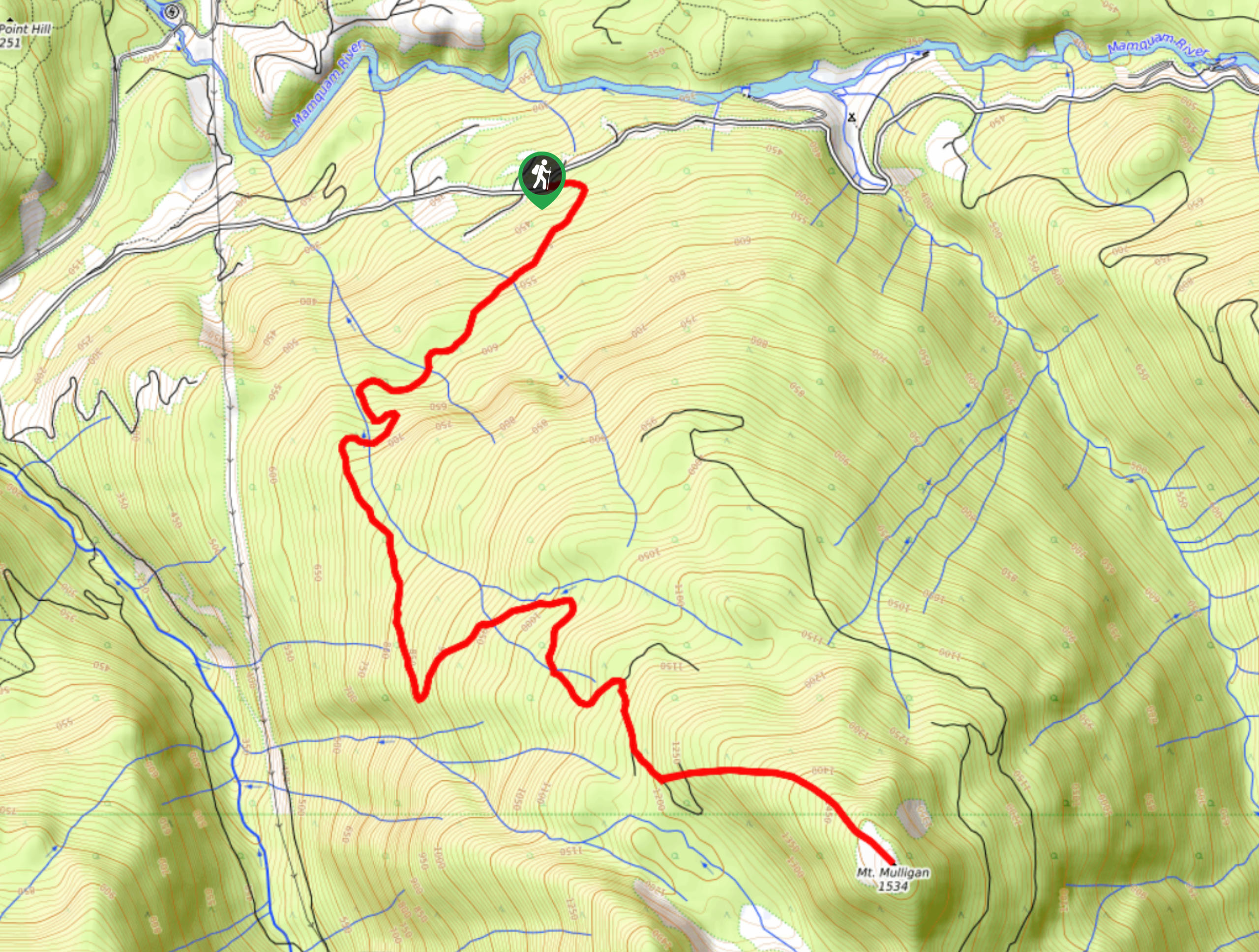
Mount Mulligan Trail
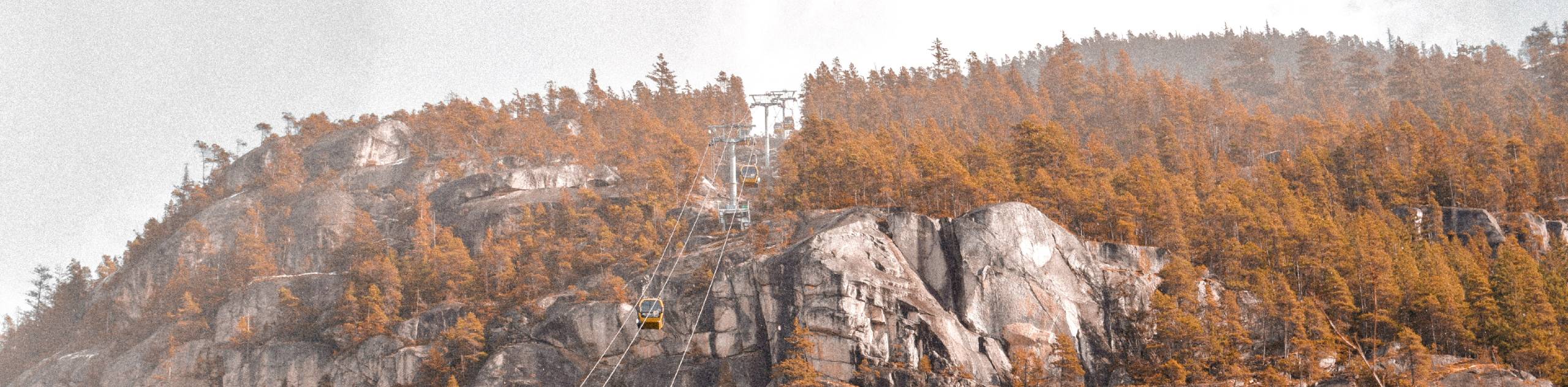
View Photos
Mount Mulligan Trail
Difficulty Rating:
Hiking along the Mount Mulligan Trail is a difficult affair due to the steep incline of the route, but this is offset by the amazing views that hikers will find on the summit. This 9.5mi hiking route climbs uphill along a forest service road and through the forest cover to provide a manageable path to the top of the peak. From there, you will have a commanding view over the Squamish Valley and its surrounding mountainous landscape.
Getting there
To get to the trailhead for the Mount Mulligan Trail from the Sea to Sky Gondola, make your way north on BC-99 for 1.0mi and make a right turn on Mamquam River Forest Service Road. Continue straight for 4.3mi and turn right at the fork in the road to access the trailhead.

About
| When to do | Year-round |
| Backcountry Campsites | No |
| Pets allowed | Yes - On Leash |
| Family friendly | No |
| Route Signage | Average |
| Crowd Levels | Low |
| Route Type | Out and back |
Mount Mulligan Trail
Elevation Graph
Weather
Mount Mulligan Trail Description
The Mount Mulligan Trail is a largely forested out-and-back hiking route near Squamish, BC that climbs uphill along a logging road before breaking off on the ascent of the summit. The route climbs at a rather steep grade, packing an elevation gain of 1136m along the length of the trail, however, the terrain isn’t overly technical which makes it a pleasant hike up to the summit. The area is also a popular destination for winter activities like skiing and snowshoeing.
From the peak, hikers will have amazing views overlooking the Squamish area and the multitude of mountains that frame the landscape. To the east you will be able to spot the Stawamus Chief and the rugged peaks of the Tantalus Range, and to the northwest you will have a sightline stretching across Mamquam and into Garibaldi Provincial Park. Hikers can also traverse the optional trail extension to Anif Peak to the south in order to bundle two summits into this awesome hike.
Similar hikes to the Mount Mulligan Trail hike
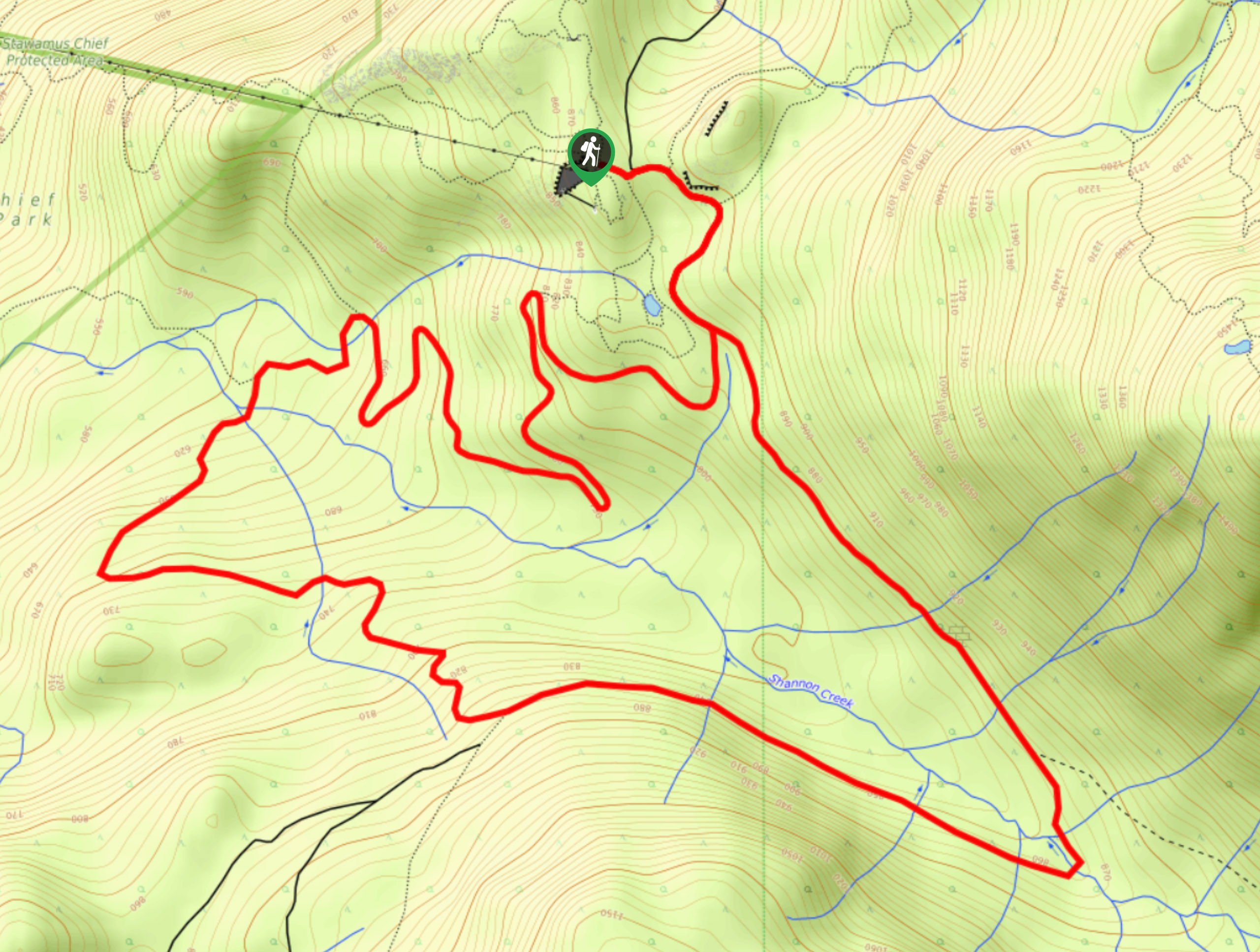
Shannon Basin Loop
The Shannon Basin Loop is a 5.9mi lollipop trail near Squamish, BC, that sets out from the top…
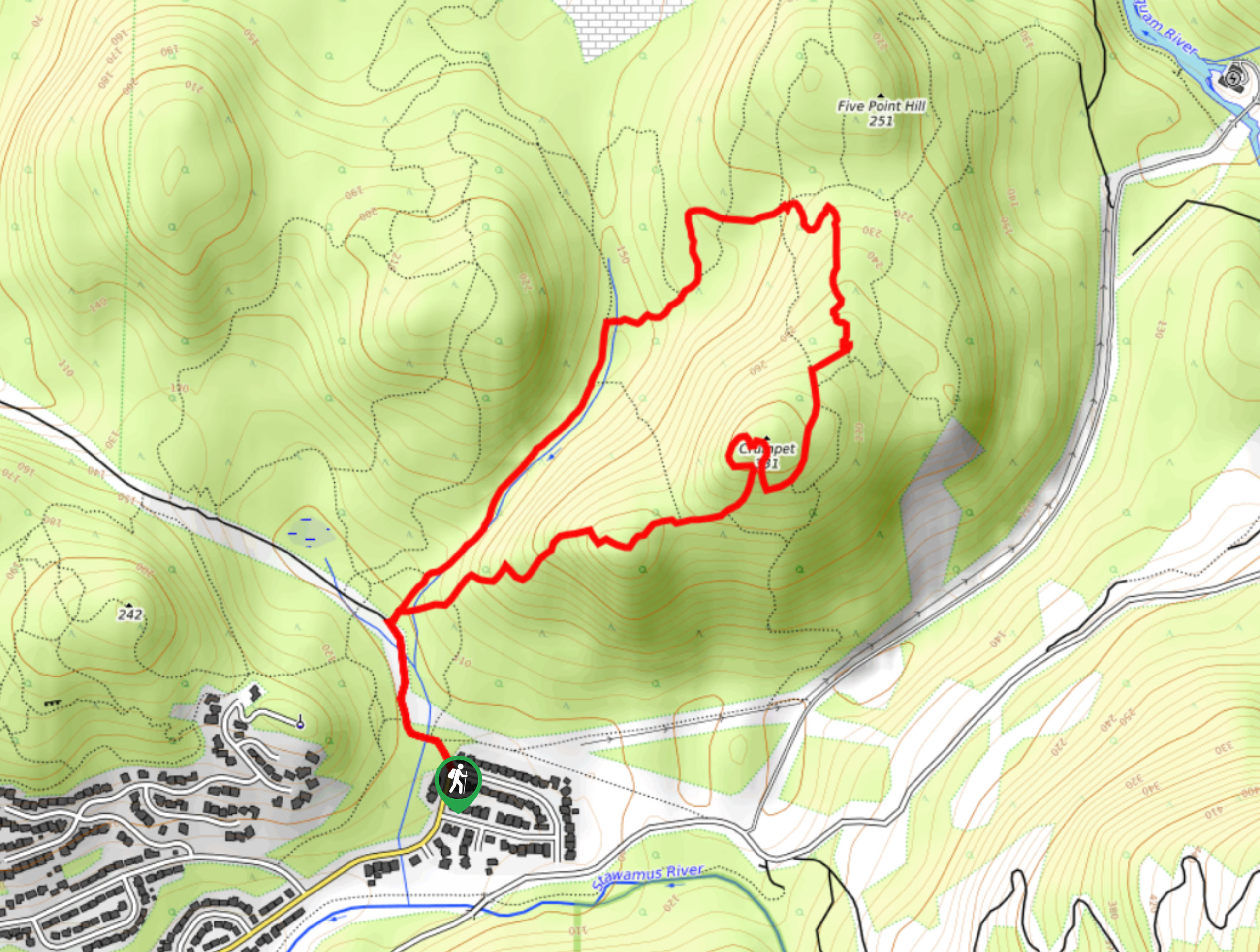
Mount Crumpit Trail
If you are into short hikes that will get your heart pumping and also have amazing mountain views, then the…
Skyline Ridge Trail
The Skyline Ridge Trail is a challenging 12.5mi uphill hiking route near Squamish that sets out from Stawamus…
Comments