
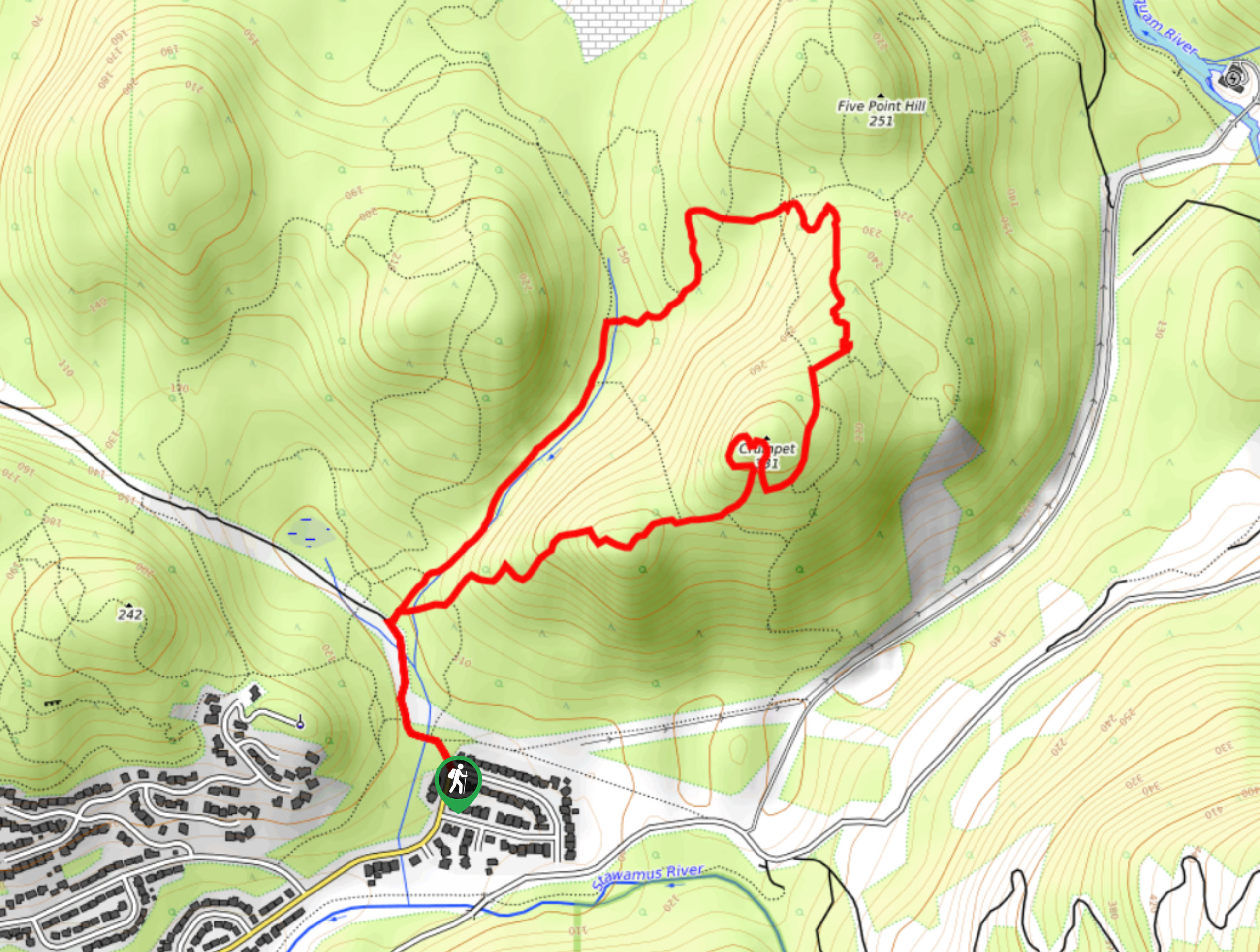
Mount Crumpit Trail
View Photos
Mount Crumpit Trail
Difficulty Rating:
If you are into short hikes that will get your heart pumping and also have amazing mountain views, then the Mount Crumpit Trail should definitely be on your radar. This 2.9mi route in Squamish traverses some steep and rocky sections of trail that can be a bit hard to identify due to a lack of trail markers, making a GPS or trail map a necessity. Hikers that succeed in making their way along the trail will be rewarded with awesome views of the Stawamus Chief, Howe Sound, and the nearby Tantalus Range.
Getting there
To reach the trailhead for Mount Crumpit from the Sea to Sky Highway in Squamish, turn right off the highway onto Clarke Drive and continue on for 591ft. From here, make another right onto Guilford Drive before turning left onto Westway Avenue after 0ft. Stay on Westway Avenue for 1.3mi, where you will find the trailhead on the outside edge of the bend in the road.

About
| When to do | May-October |
| Backcountry Campsites | No |
| Pets allowed | Yes |
| Family friendly | No |
| Route Signage | Poor |
| Crowd Levels | Moderate |
| Route Type | Lollipop |
Mount Crumpit Trail
Elevation Graph
Weather
Mount Crumpit Trail Description
The Mount Crumpit Trail is a forested hiking route just east of Squamish that climbs steeply uphill to provide a sweeping view over the valley, with sights including the prominent granite dome of the Stawamus Chief and the expansive waters of Howe Sound. Hikers should make sure to wear proper hiking footwear and bring a GPS or good trail map, as the route can be very confusing to navigate and contains steep, rocky sections of trail. The area surrounding Mount Crumpit is also home to several mountain bike trails, so be sure to keep an eye out for passing bikes while out on the trail. This route is a great option if you are looking for a short hike with some moderately challenging terrain and amazing views of the forest and mountains around Squamish.
Similar hikes to the Mount Crumpit Trail hike
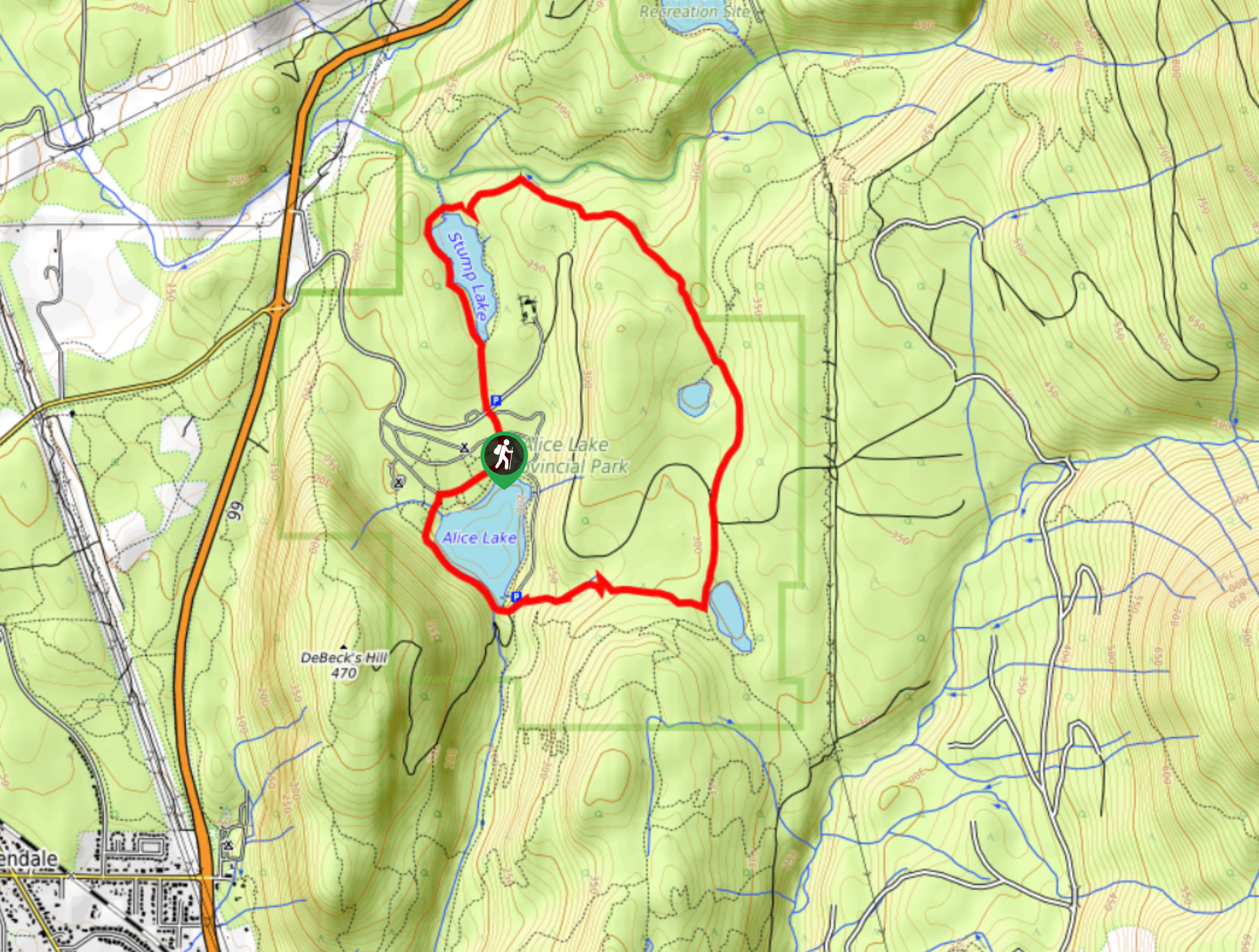
Four Lakes Trail
The Four Lakes Trail is a 4.5mi hiking route that travels through Alice Lake Provincial Park on a…
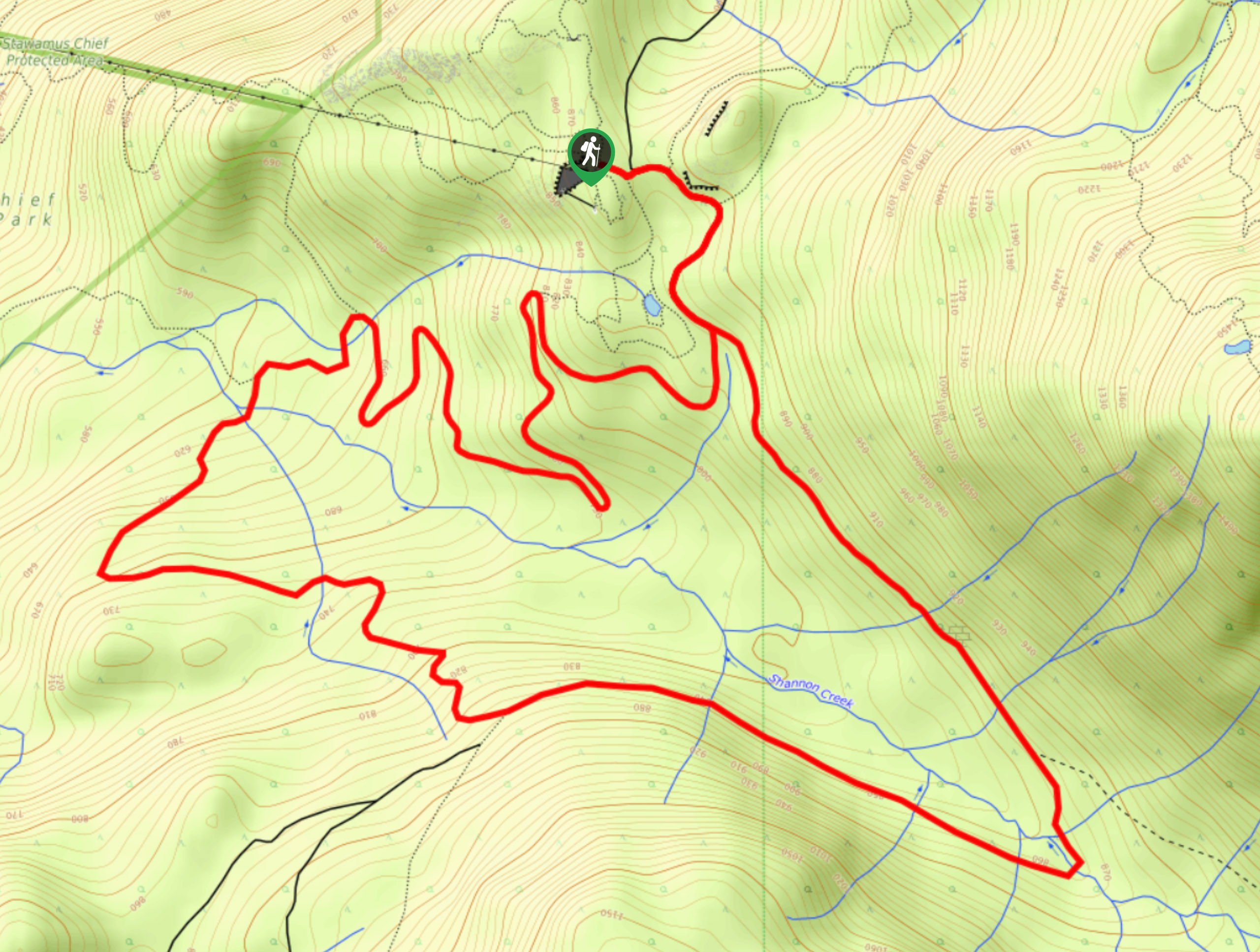
Shannon Basin Loop
The Shannon Basin Loop is a 5.9mi lollipop trail near Squamish, BC, that sets out from the top…
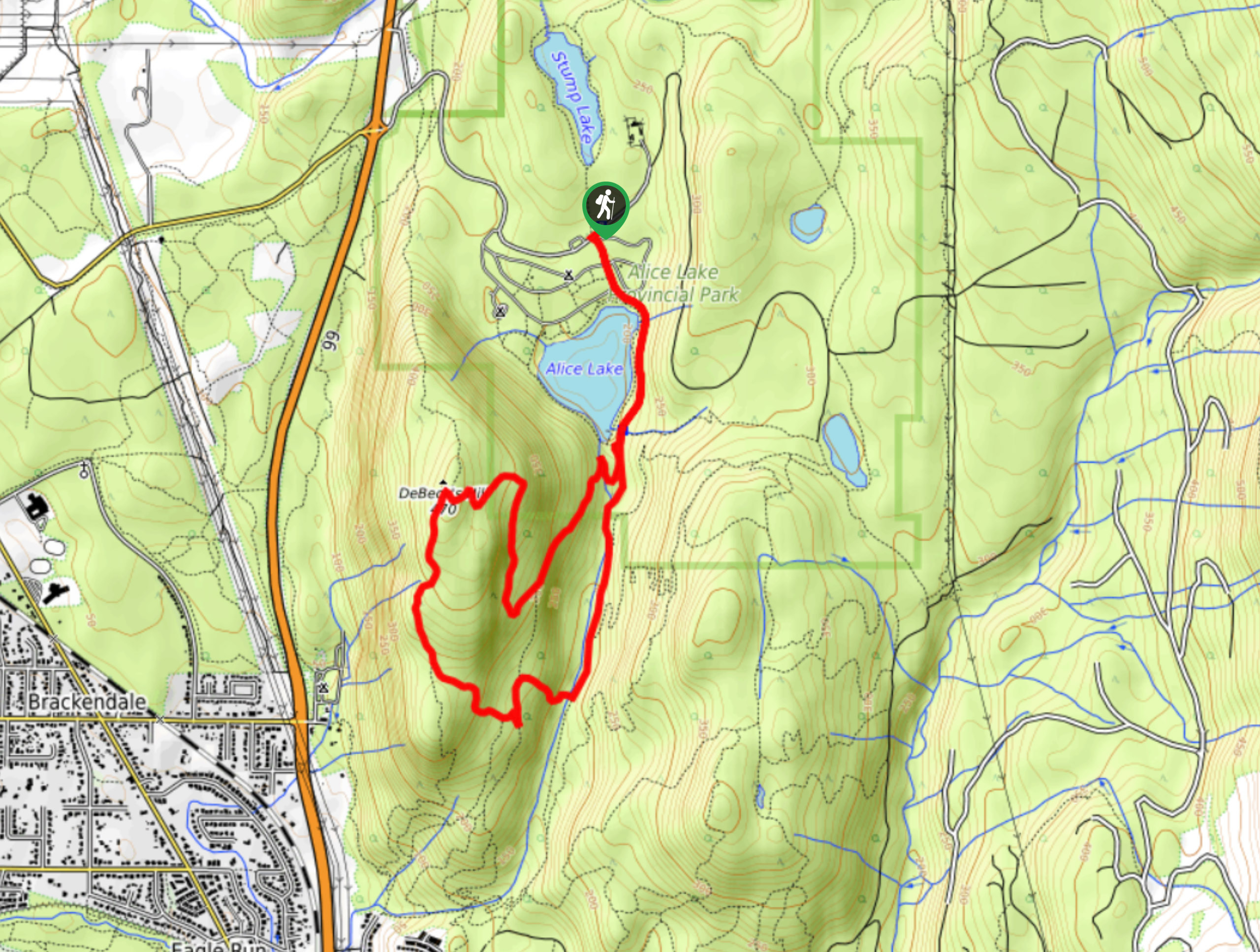
Jack’s Trail to DeBeck’s Hill
Jack’s Trail to DeBeck’s Hill is a scenic 8.7km hiking route through the forests of Alice Lake Provincial Park that…
Comments