Makki Hills Hike
View Photos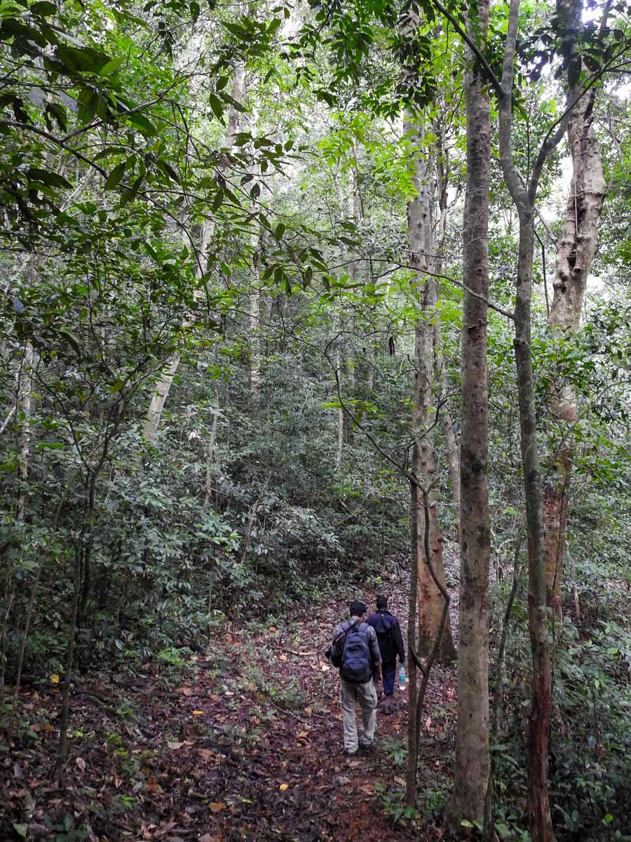
Makki Hills Hike
Difficulty Rating:
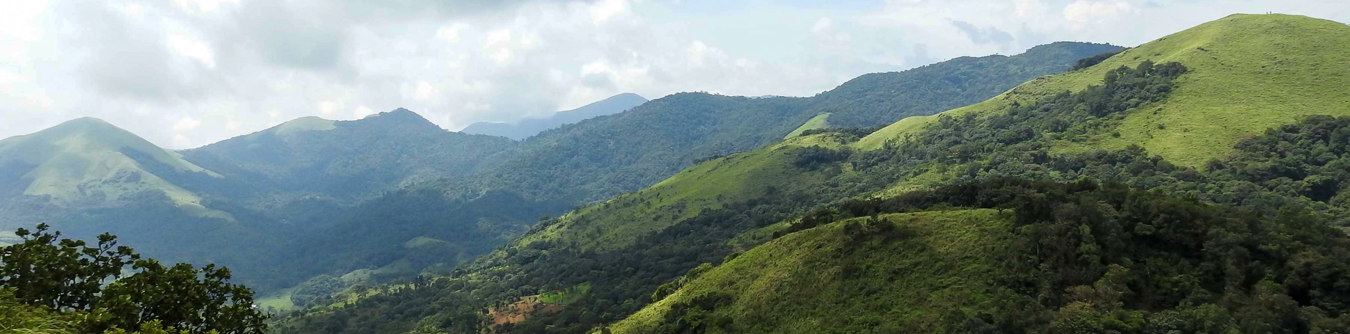
The Makki Hill ranges are located in the western slope of the Ghats. Their lush, tropical rainforests are surrounded by the Periya range and Wayanad Wildlife Sanctuary. The region is historically noted in British Indian history as the first spot where a tribal uprising, organized by a local king, took place against the British. To this day, the core zone of the forest is impenetrable, but the buffer zone is accessible by specified paths which make up the Makki Hill hike.
Getting there
The reporting point is the Munneswarankunnu forest office. The destination is 8.7mi from Mananthavady town. Take the Mananthavadi-Thalassery road until Thalapuzha. From here, take a Jeep another 2.5mi to reach Muneeswarankunnu.

About
| When to do | November to March |
| Backcountry Campsites | No |
| Family friendly | Older Children only |
| Route Signage | Average |
| Crowd Levels | Moderate |
| Route Type | Lollipop |
Makki Hills Hike
Elevation Graph
Weather
Route Description for Makki Hills Hike
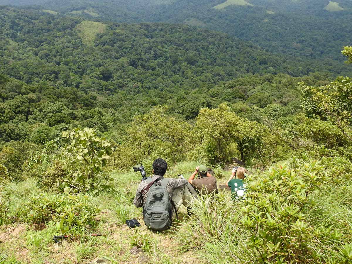
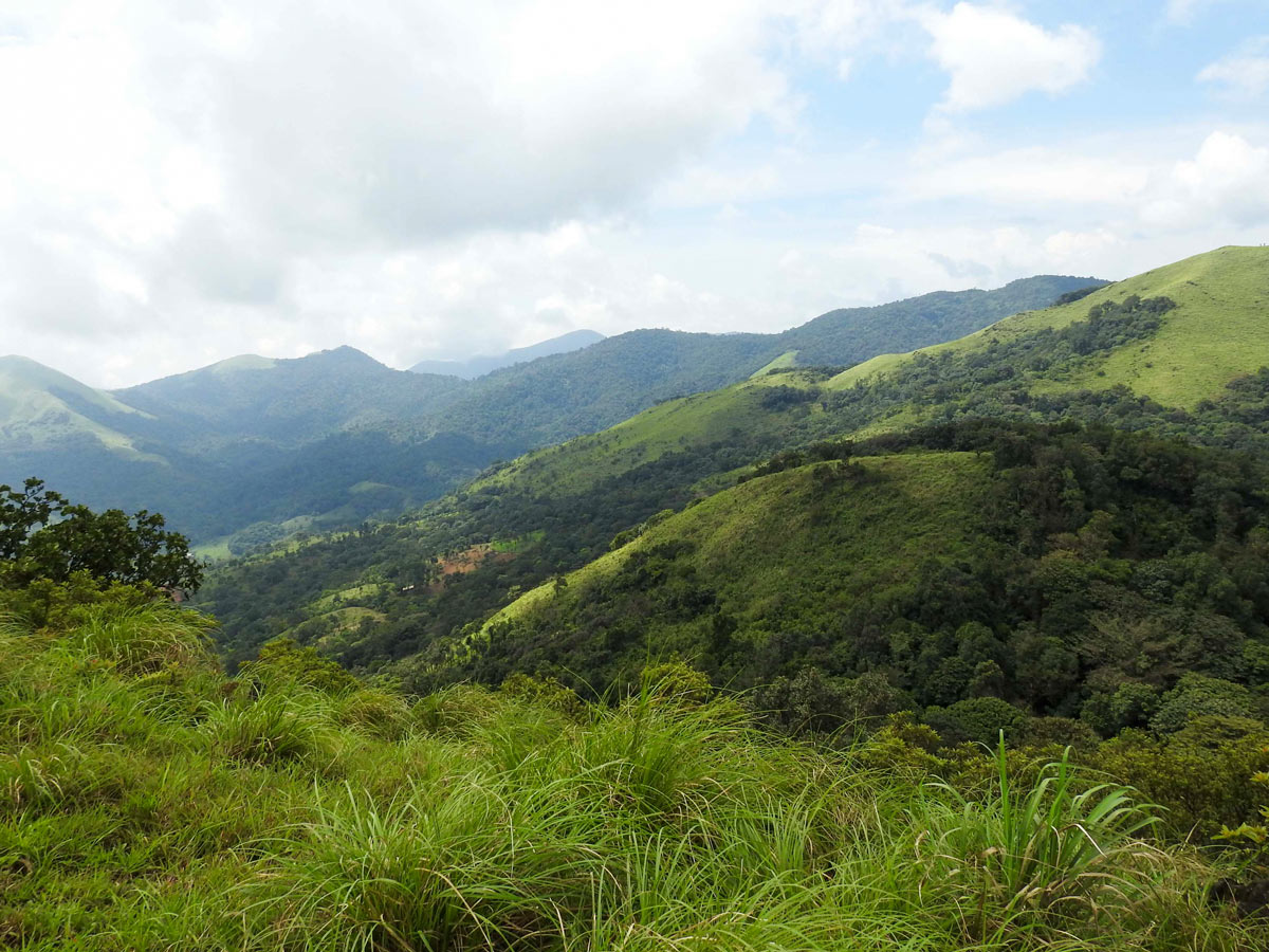
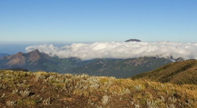
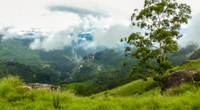
The starting point for the Makki Hill hike is at Muneeswaran Kunnu, a hillock with a 280-degree view at Mount Muneeswaran.
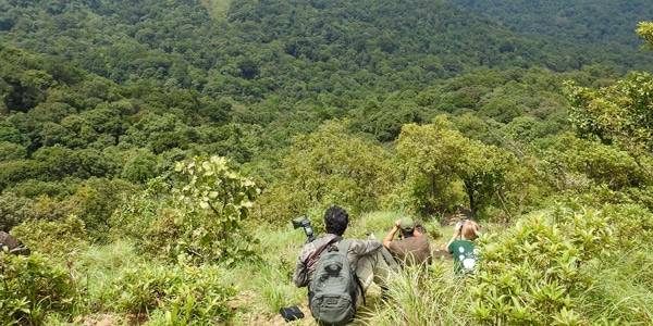
A short hike through the Makki rainforest leads to the nearby peak and grassland. It is an ideal place to view both sunrise and sunset.
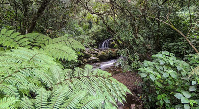
Trail to the deep forest path, then slowly head down hill from the peak through grassland. The trail here involves crossing forest streams, before hiking through deep jungle to visit fast-flowing seasonal waterfalls.
The forest has four layers of canopy, akin to a tropical rainforest. Stop for a photo among the huge candle-shaped trees towering in the sky, wrapped in stragglers and elephant creepers. The middle canopy, holding epiphytic ferns and orchids, is home to many forest birds.
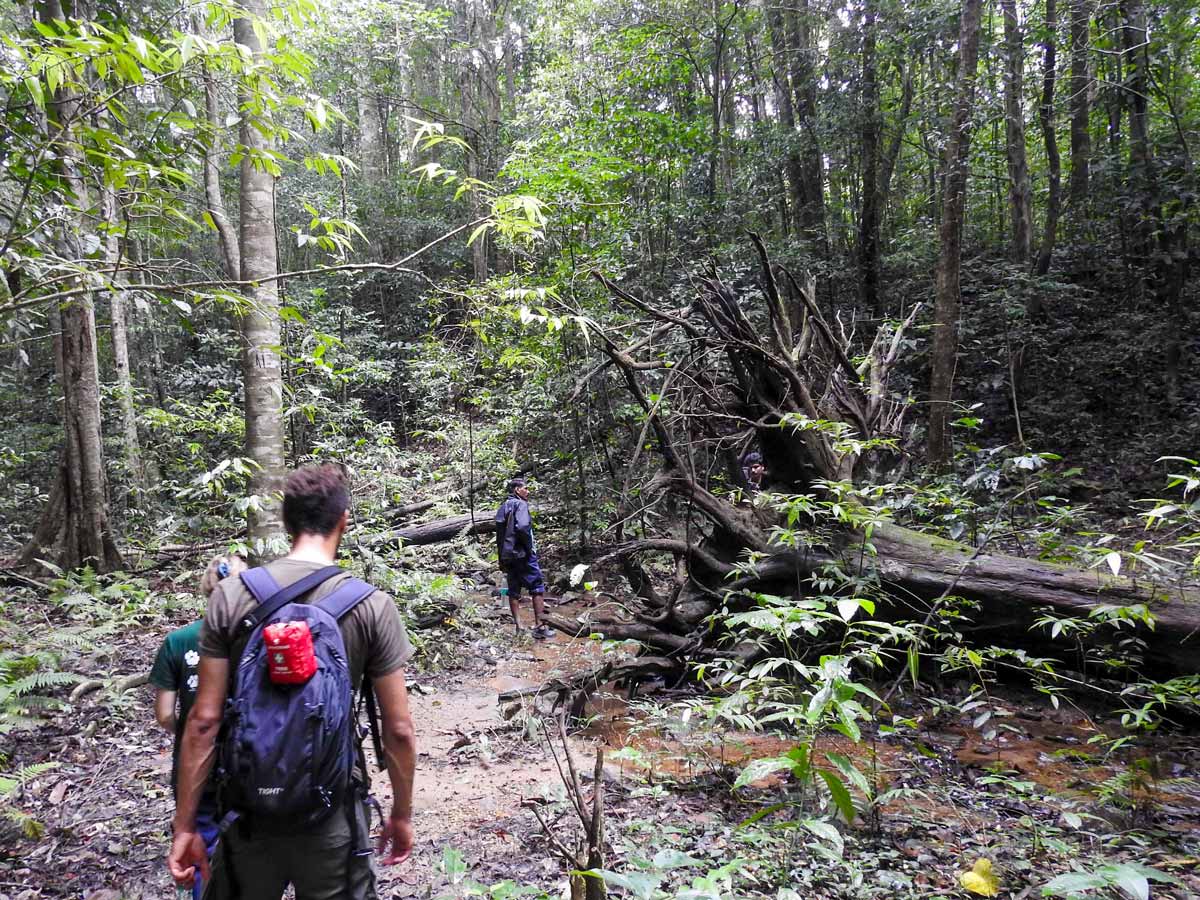
As you continue further down through the forest, spot stick insects, leaf insects, and tree frogs, which are the highlights of the lower canopy.
Finally, reach the forest floor, which is home to an innumerable number of insects and amphibians. The clucks and doodle-doo of jungle fowl running across the trail add another note to the combined song of the rainforest.
Insider Hints
There are no self-guided walking options possible, you must be with a guide.
The Makki Hills hiking zone offers two more trails, one to the Surya Mudi 'Sun Mount' and other to Makki peak, which you can suggest to your guide if you’d like more of a challenge.
The bugs can be bothersome in this area, especially mosquitoes. We recommend packing bug spray.
Similar hikes to the Makki Hills Hike hike
Cloud Forest Walk
This Cloud Forest walk takes place in a national park, home to a dedicated nature reserve, protecting high-altitude flora and…
Meesapulimala Hike
Meesapulimala is the second-highest peak in Southwestern Ghats at a height of 8661ft, overlooking the east escarpment of…
Lakshmi Hills Hike
Named after a tea factory division, this cliffy ridge trail on the west side of Munnar is popularly called Lakshmi…
Comments