Doris Lake Hike
View Photos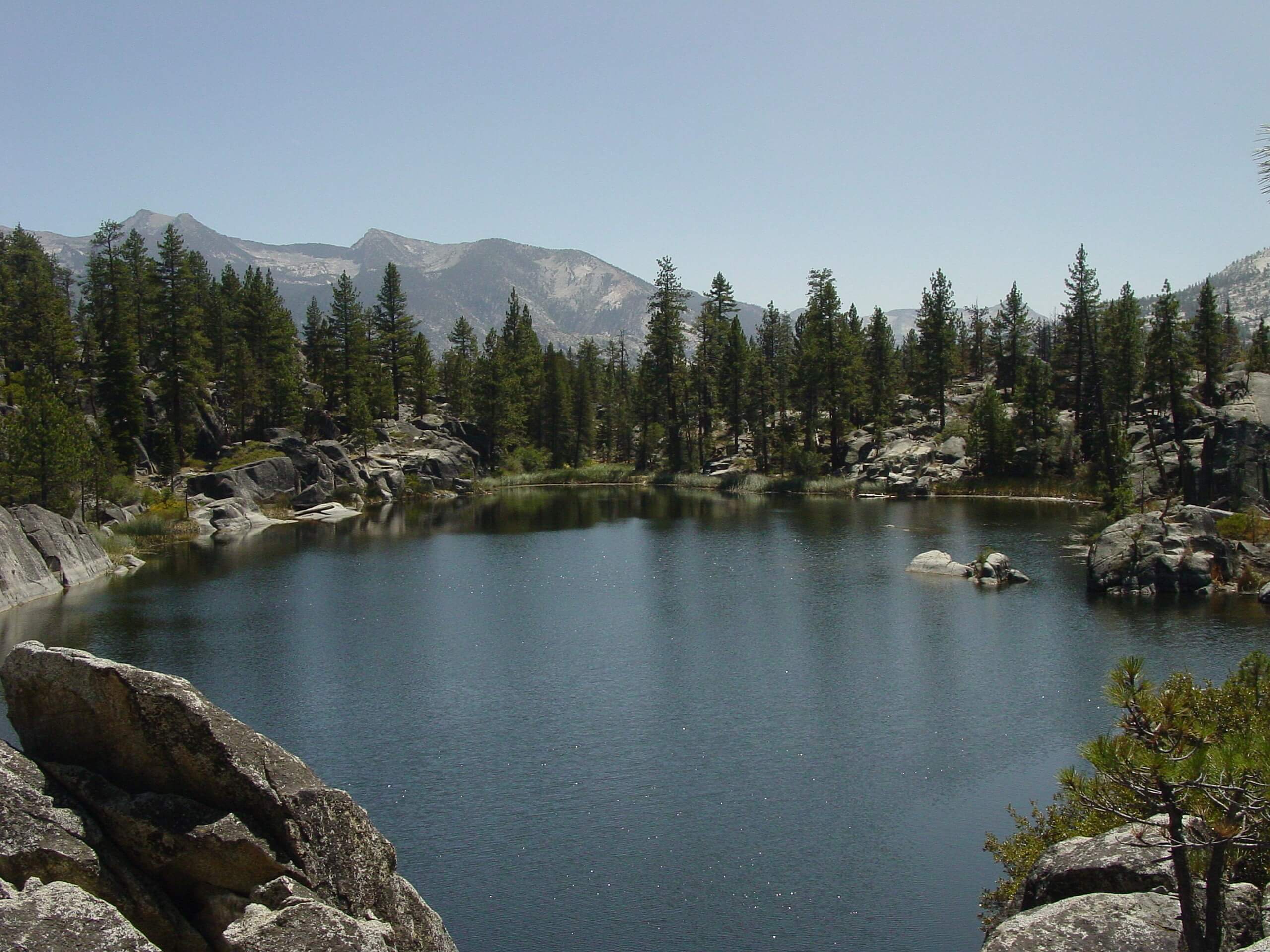
Doris Lake Hike
Difficulty Rating:
Immerse yourself in California’s high country along the Doris Lake Hike. This fun family adventure exposes wonderful views as you wander through granite gardens adorned with pine trees up to the postcard perfect alpine lake.
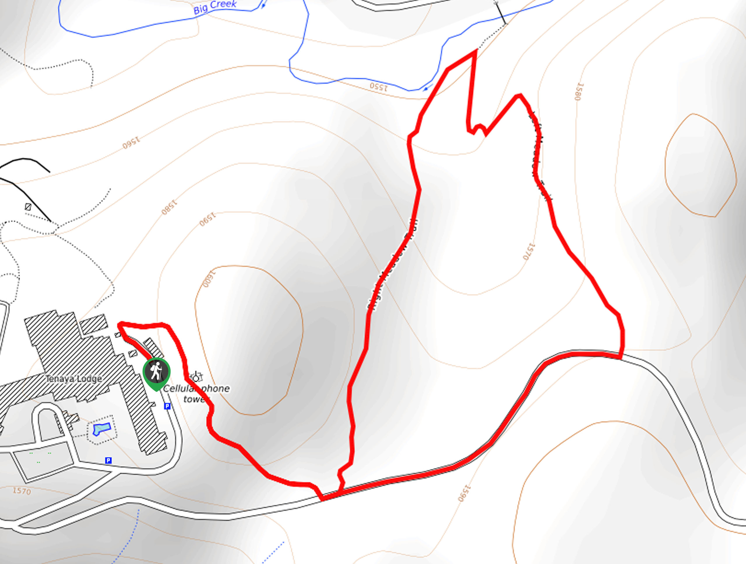
Getting there
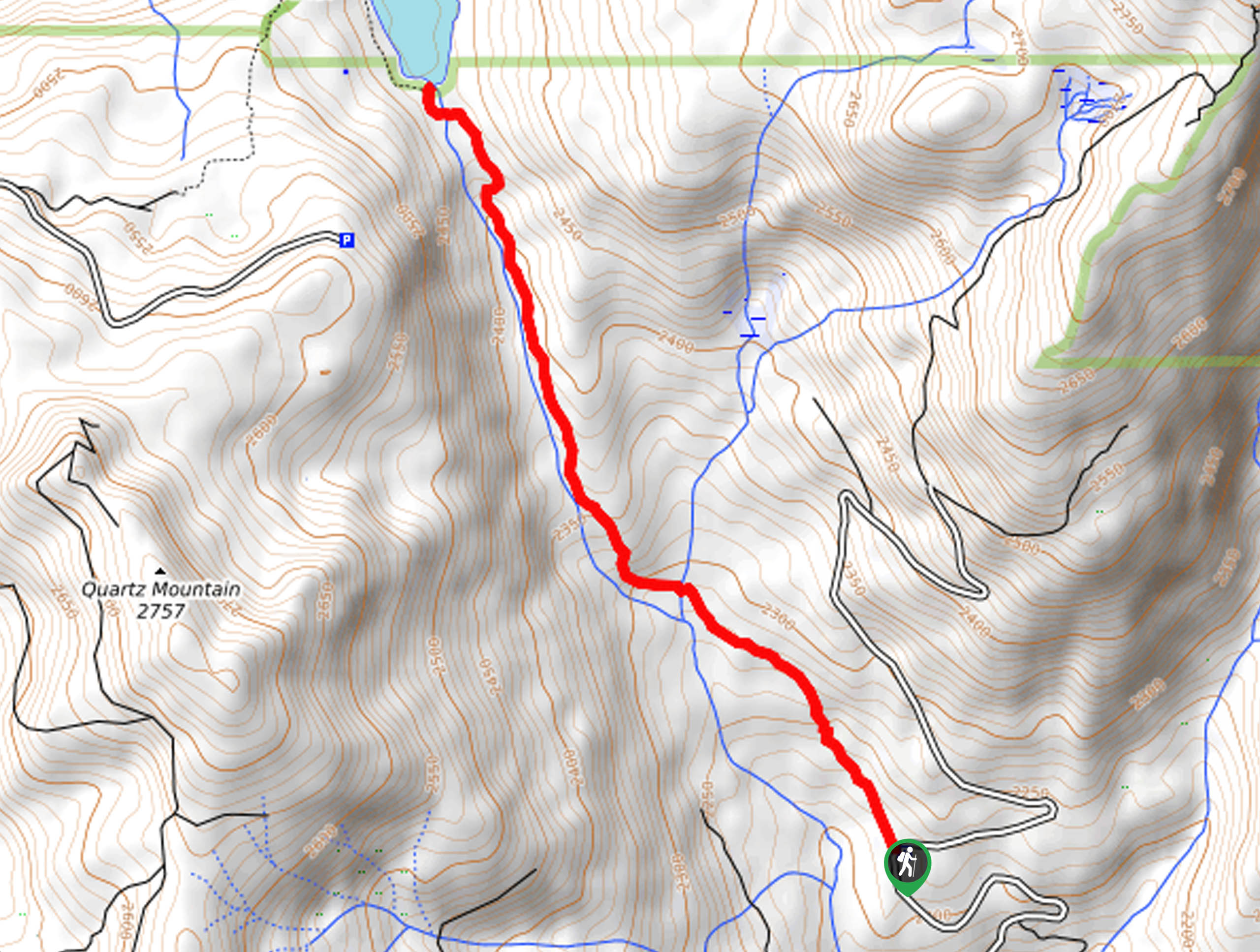
The Doris Lake Hike departs from the Mono Springs Trailhead off Kaiser Pass Road.

About
| Backcountry Campground | No |
| When to do | March-October |
| Pets allowed | Yes - On Leash |
| Family friendly | Yes |
| Route Signage | Average |
| Crowd Levels | Moderate |
| Route Type | Out and back |
Doris Lake Hike
Elevation Graph
Weather
Doris Lake Hike Description
We love the Doris Lake Hike for a quick, spontaneous escape into nature. This easy-going, family-friendly adventure through the granite terrain can be enjoyed by hikers of all skill levels and ages. Note much of the terrain is exposed, so make sure you dress accordingly, and in the summer, wear sun protection to beat over-exposure. We also love to take a dip in the refreshing alpine waters in the warmer weather, so bring a suit! Additionally, as much of the route is rocky and uneven, we suggest wearing a pair of sturdy pair of footwear.
Embark on your adventure along the Doris Lake Trail from the Mono Springs Trailhead. From here, hike northeast along the only route through the sparse tree shade of the evergreen and through granite outcrops. When trekking in the spring, you will also enjoy the sights of vibrant wildflowers sprouting from the terrain. Soon you will encounter a trail junction, keep right here, and you will be diverted onto the Doris Lake Trail. This path will guide you through the granite gardens and meadows to the alpine lake.
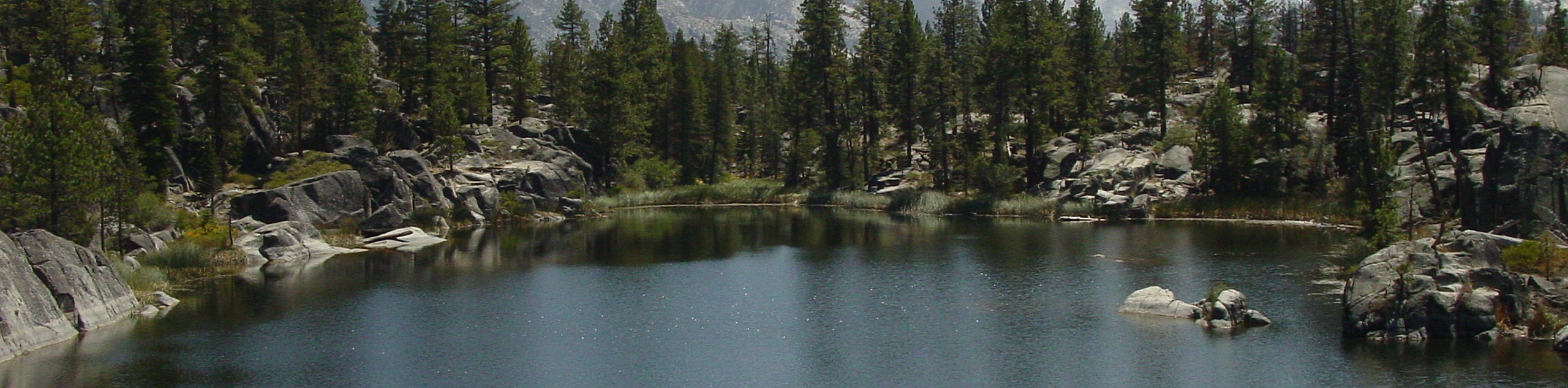
From the shoreline of Doris Lake, you will be overwhelmed by the beauty of the charming lake bounded by craggy granite bluffs. You will likely notice those enjoying the waters and basking in the sun on the granite slabs in warmer weather. After enjoying the scenes, and dipping your toes in the waters, retrace your footing along the path back to the trailhead.
Similar hikes to the Doris Lake Hike hike
Chiquito Pass Trail
The Chiquito Pass Trail is arguably one of the most scenic adventures in the Sierra National Forest. Wander up through…
Davis Flat Trail
Experience the grandeur of the Sierra Nevada Mountains as you hike through the Kings River Valley, bounded by rolling hills.…
Right and Left Meadows Loop
The Right and Left Meadows Loop, central to its name, also travels through woodlands. Wander through lush meadowlands abundant with…
Comments