Chiquito Pass Trail
View Photos
Chiquito Pass Trail
Difficulty Rating:
The Chiquito Pass Trail is arguably one of the most scenic adventures in the Sierra National Forest. Wander up through enchanting woodlands adorned with granite outcrops and vibrant wildflowers on your way up to the shimmering lake.
Getting there
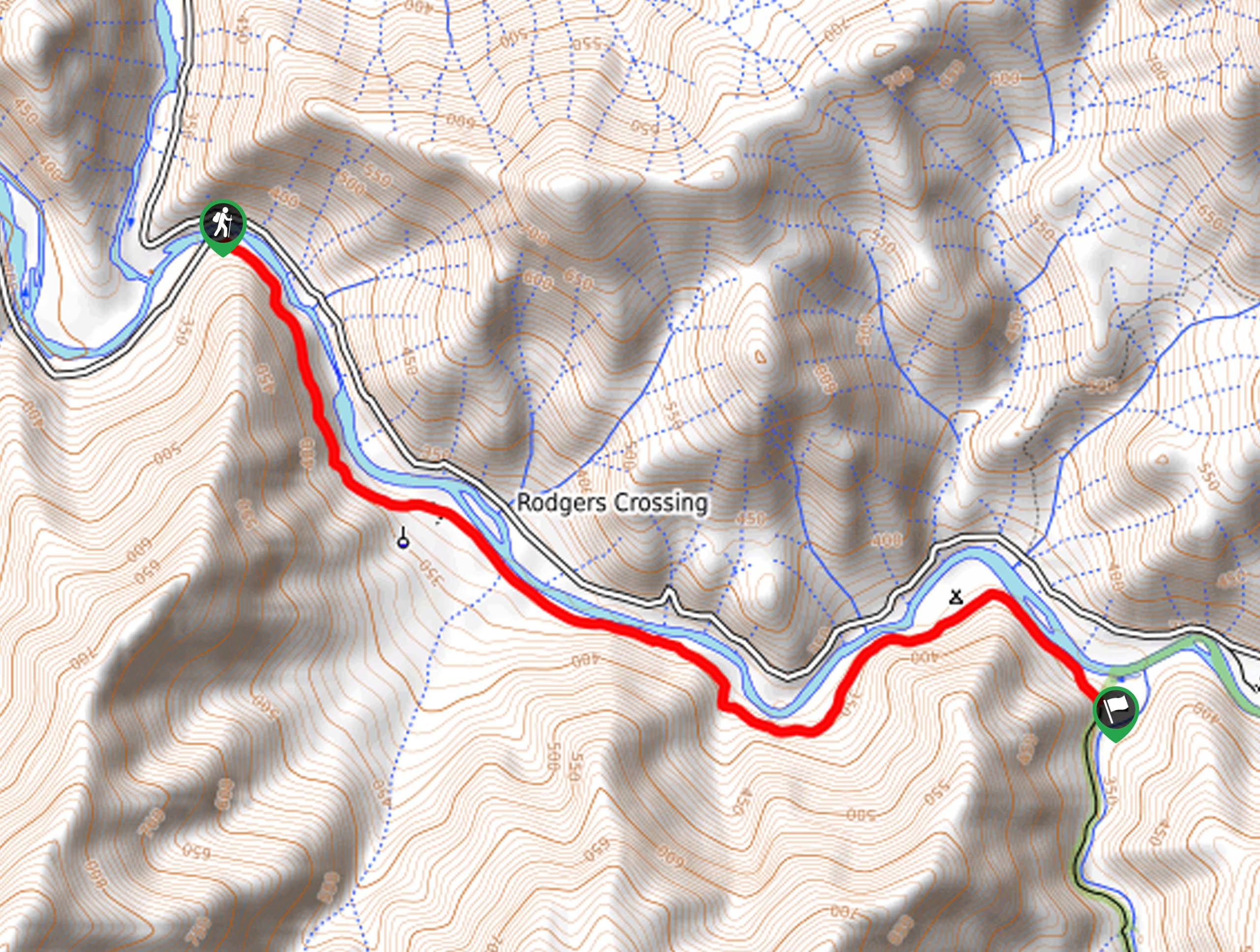
Access to the trailhead is off Route 5S05.

About
| Backcountry Campground | No |
| When to do | April-October |
| Pets allowed | Yes - On Leash |
| Family friendly | Yes |
| Route Signage | Average |
| Crowd Levels | Moderate |
| Route Type | Out and back |
Chiquito Pass Trail
Elevation Graph
Weather
Chiquito Pass Hike Description
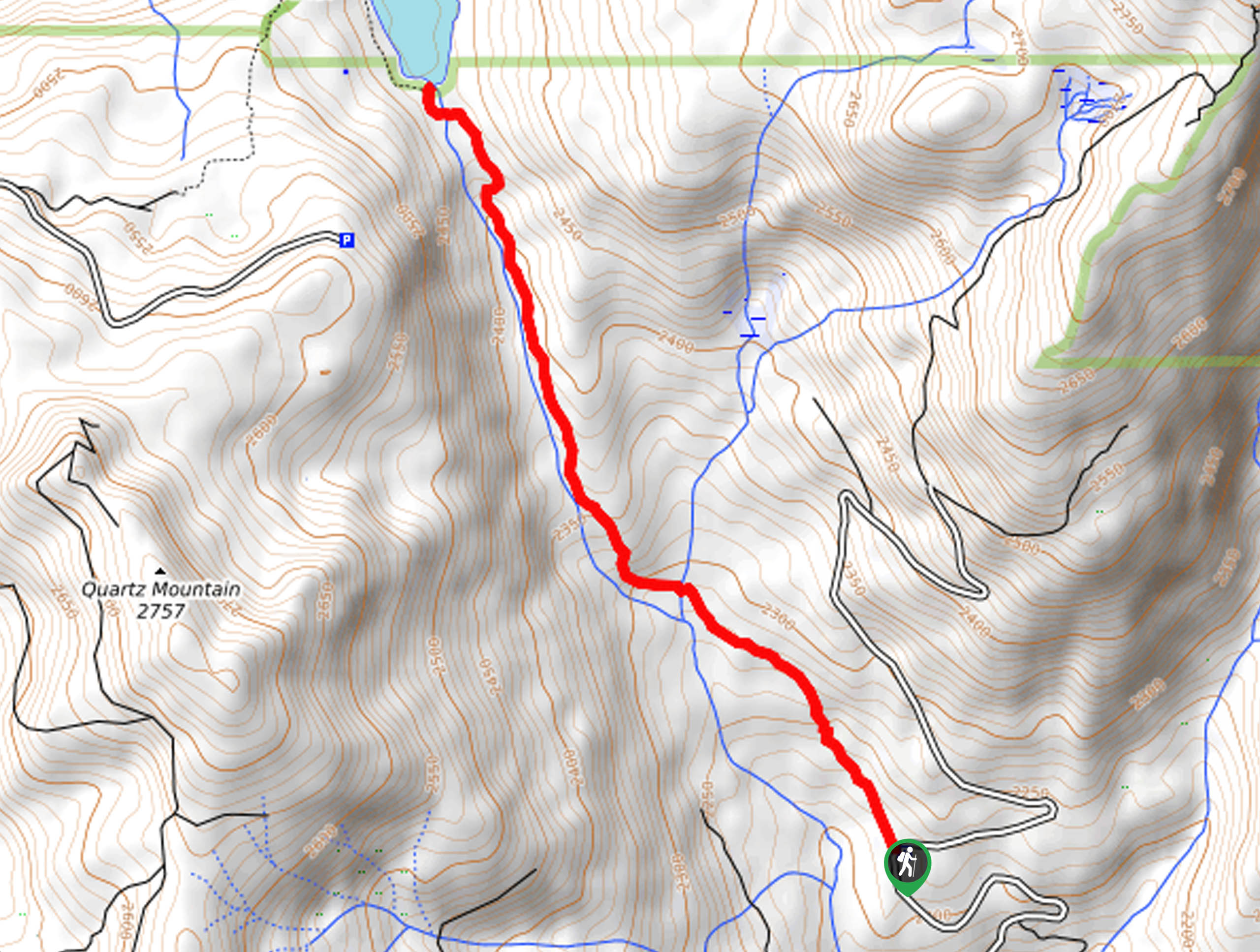
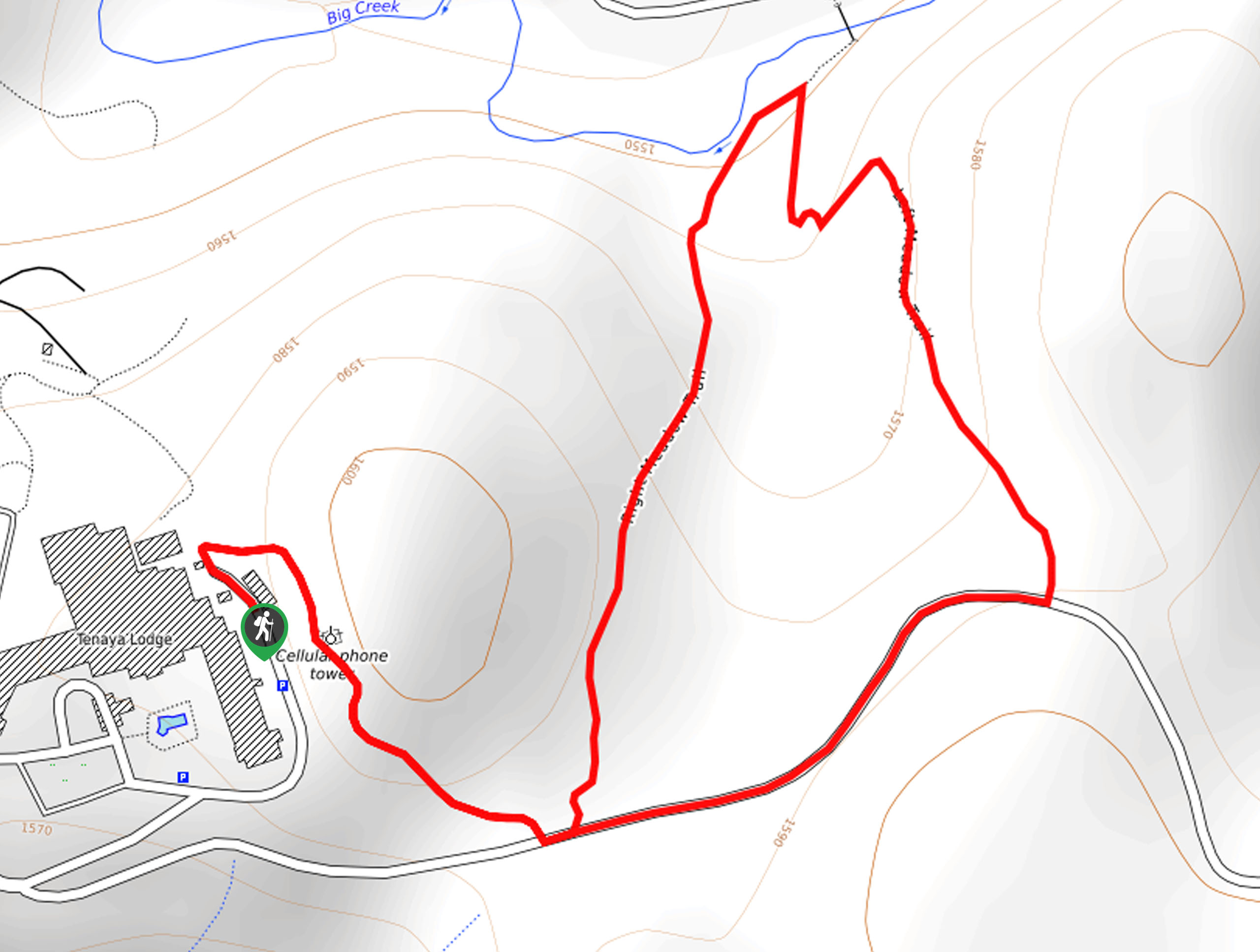
This hike provides a tranquil experience. Hikers of all skill levels and ages can easily manage this easy-going adventure through the woodlands and up to the charming lake. The terrain along this scenic route is rocky and uneven, so we encourage hikers to wear a sturdy pair of footwear—your ankles will thank us! Additionally, the path is prone to washouts, so the trail GPS may prove useful.
Setting out from the trailhead, the Chiquito Pass Trail follows the Chiquito Pass Trail northwest. Gradually climbing, the path will guide you into the woodlands and past several granite outcrops and bluffs. Enjoy the seclusion of this forested adventure, and mind your footing on the uneven terrain. Eventually, after climbing deep into the wilderness, the trail will approach Chiquito Creek, signaling you are approaching the lake.
Soon you will reach the shores of the charming alpine lake. Revel in the beauty of the shimmering waters encircled by verdant evergreens. After exploring the shoreline, retrace your footing along the path all the way back to the trailhead.
Similar hikes to the Chiquito Pass Trail hike
Wuh-Ki'o Trail
The Wuh-Ki'o Trail is an unassumingly picturesque adventure in the Sierra National Forest. Traveling through meadowlands, brush, over bridges, and…
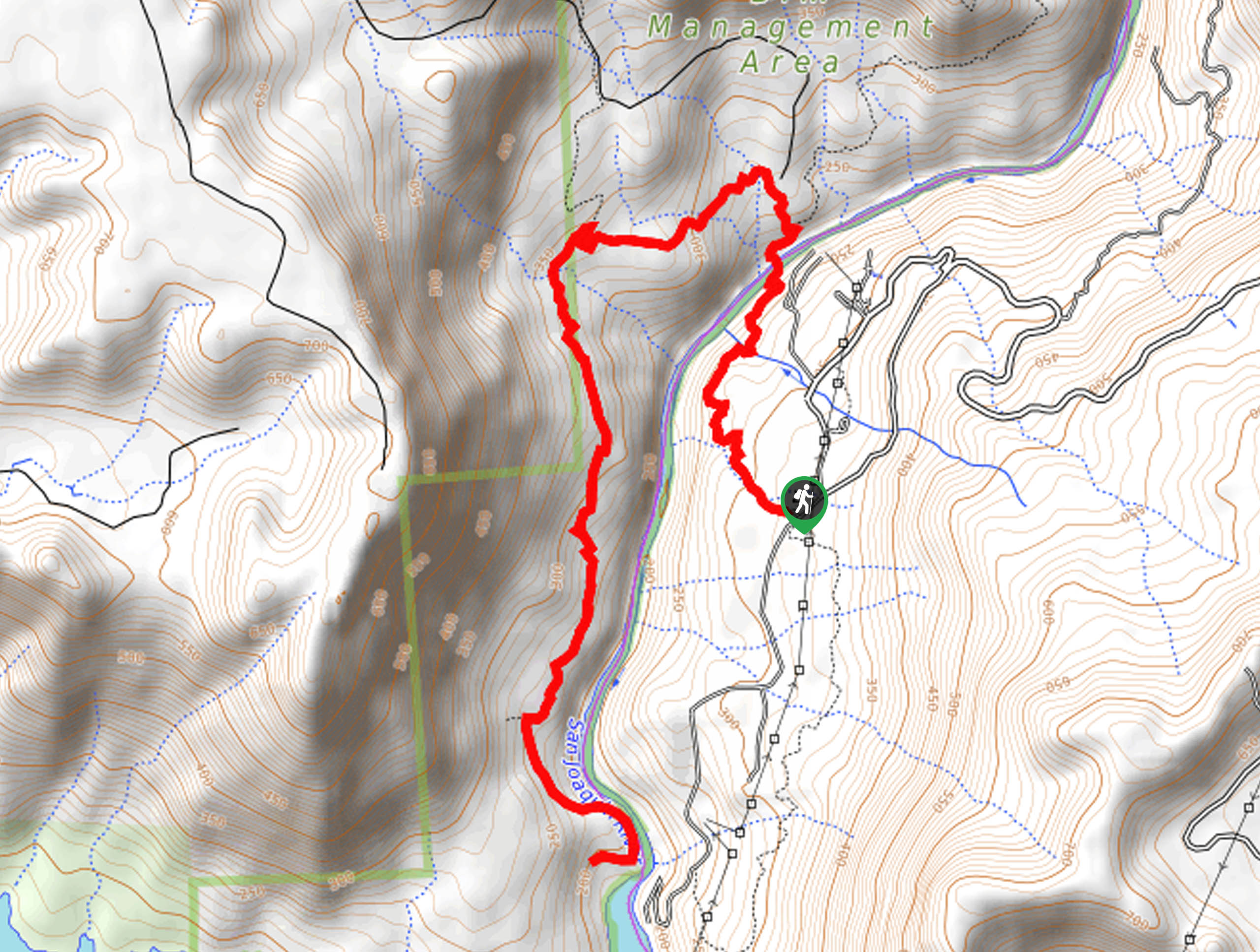
Davis Flat Trail
Experience the grandeur of the Sierra Nevada Mountains as you hike through the Kings River Valley, bounded by rolling hills.…
Right and Left Meadows Loop
The Right and Left Meadows Loop, central to its name, also travels through woodlands. Wander through lush meadowlands abundant with…
Comments