
Right and Left Meadows Loop
View Photos
Right and Left Meadows Loop
Difficulty Rating:
The Right and Left Meadows Loop, central to its name, also travels through woodlands. Wander through lush meadowlands abundant with wildflowers and amongst towering red firs and pines to Big Creek and around the loop. We love this quick nature walk, and you will too.
Getting there
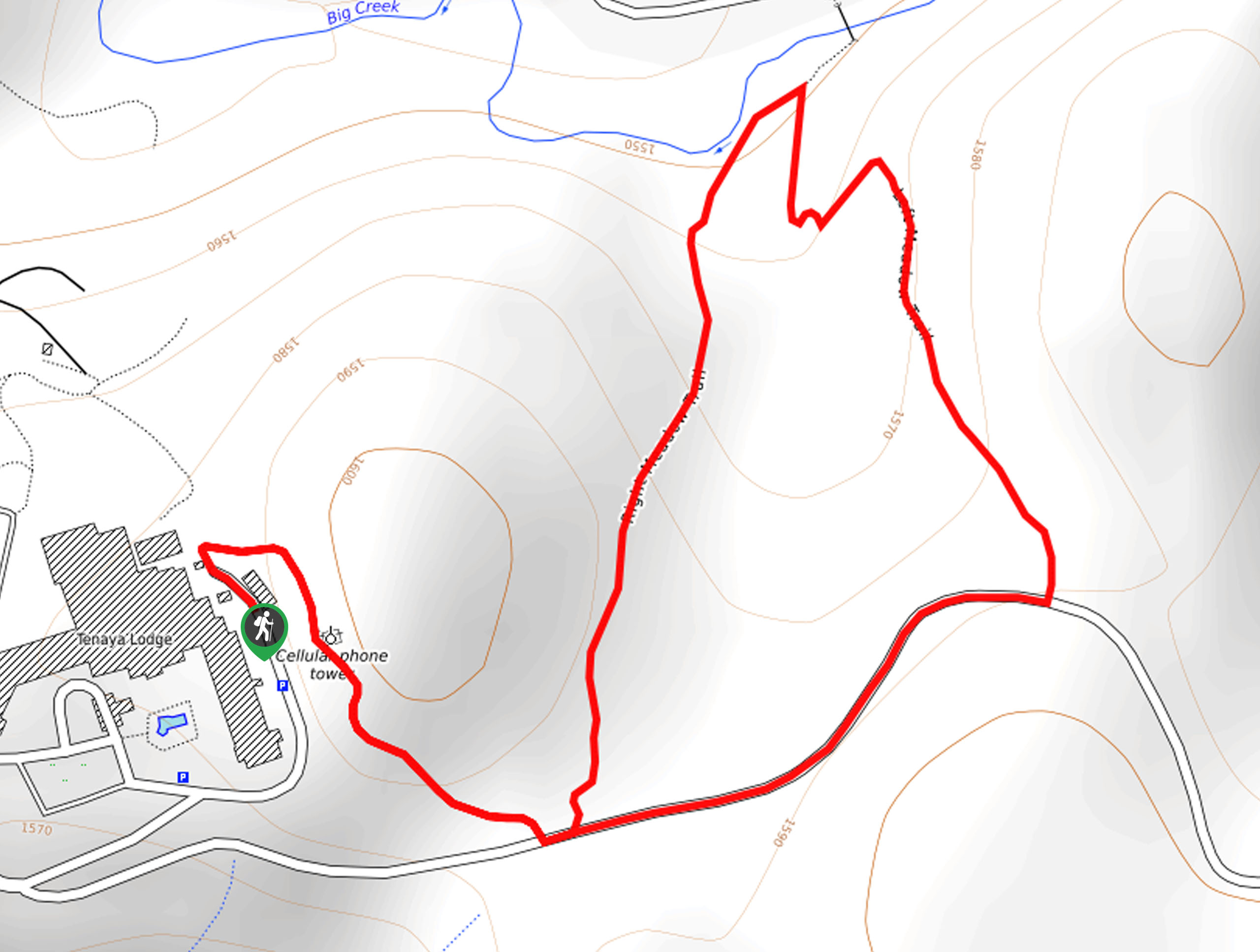
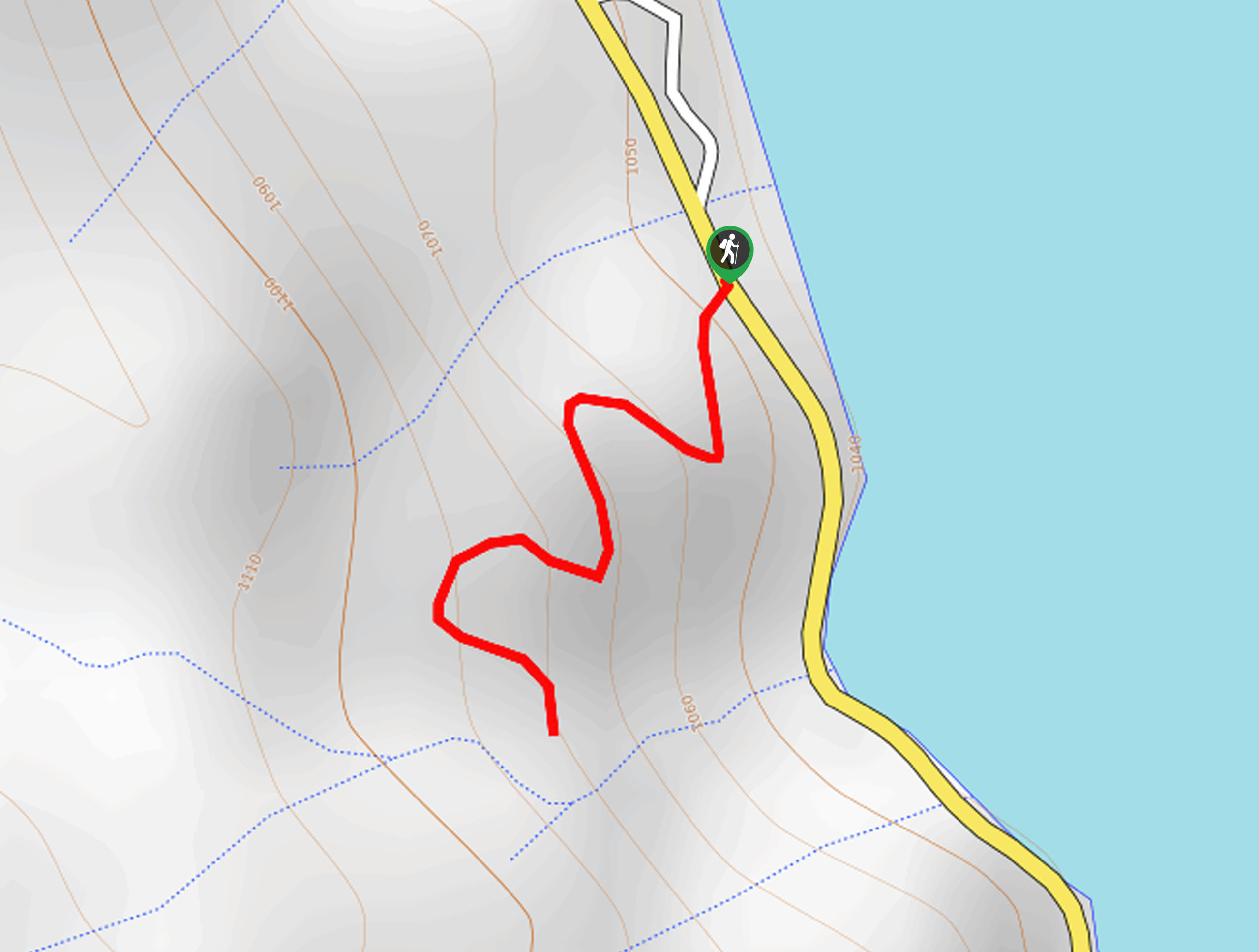
The Right and Left Meadows Loop departs from the trailhead off Jackson/Big Sandy Road.

About
| Backcountry Campground | No |
| When to do | Year-round |
| Pets allowed | Yes - On Leash |
| Family friendly | Yes |
| Route Signage | Average |
| Crowd Levels | Low |
| Route Type | Lollipop |
Right and Left Meadows Loop
Elevation Graph
Weather
Right and Left Meadows Loop Description
The Right and Left Meadows Loop is an excellent choice for your next adventure. Get outside and reconnect with nature as you walk through woodlands and meadows and along an alpine creek. Easy-going and family-friendly, this trek makes for a relaxing adventure in the Sierra National Park. Open year-round, this route required snowshoes or microspikes after a snowfall to easily navigate the likely icy terrain.
Your journey along the Right and Left Meadows Loop begins from the trailhead off Jackson/Big Sandy Road. Track the connector trail east past the cellphone tower to an intersection. Here, veer left, and you will be diverted onto the Right Meadow Trail. Follow this route through mixed-conifer forest adorned with granite outcrops before opening to the meadowlands. Gradually descending, you will eventually reach Big Creek. Wander northeast along the creek, then turn right onto the Left Meadow Trail.
The Left Meadow Trail will climb through the meadow and towering pines. At the trail’s end, hike west along the Jackson/Big Sandy Road before reconnecting with the connector trail, past the cell tower, and back to the trailhead.
Similar hikes to the Right and Left Meadows Loop hike
Chiquito Pass Trail
The Chiquito Pass Trail is arguably one of the most scenic adventures in the Sierra National Forest. Wander up through…
Davis Flat Trail
Experience the grandeur of the Sierra Nevada Mountains as you hike through the Kings River Valley, bounded by rolling hills.…
Way of the Mono Trail
The Way of the Mono Trail is an awesome adventure above Bass Lake in the Sierra National Forest. Wander through…
Comments