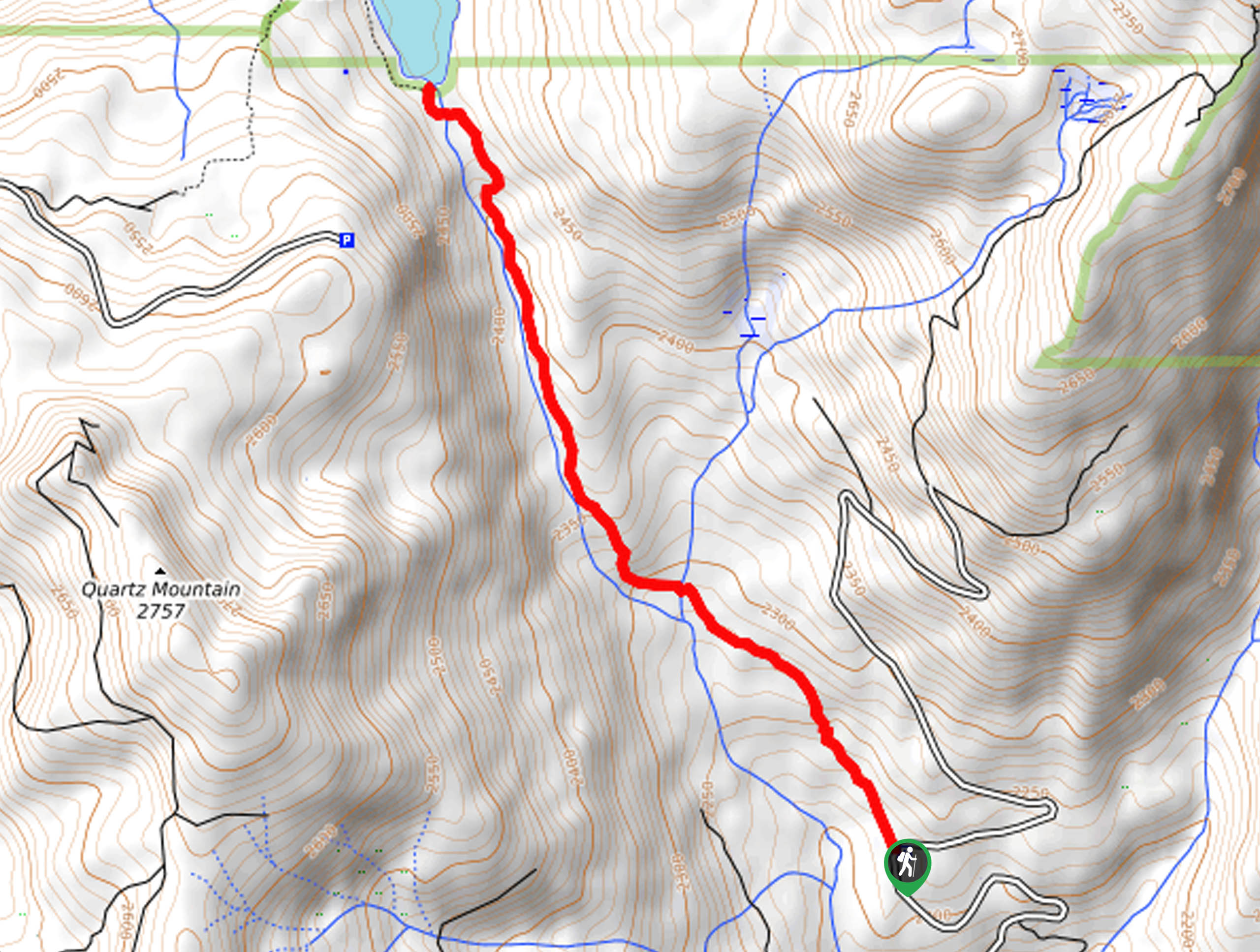
Maxson Trailhead to Hobler Lake Hike
View Photos
Maxson Trailhead to Hobler Lake Hike
Difficulty Rating:
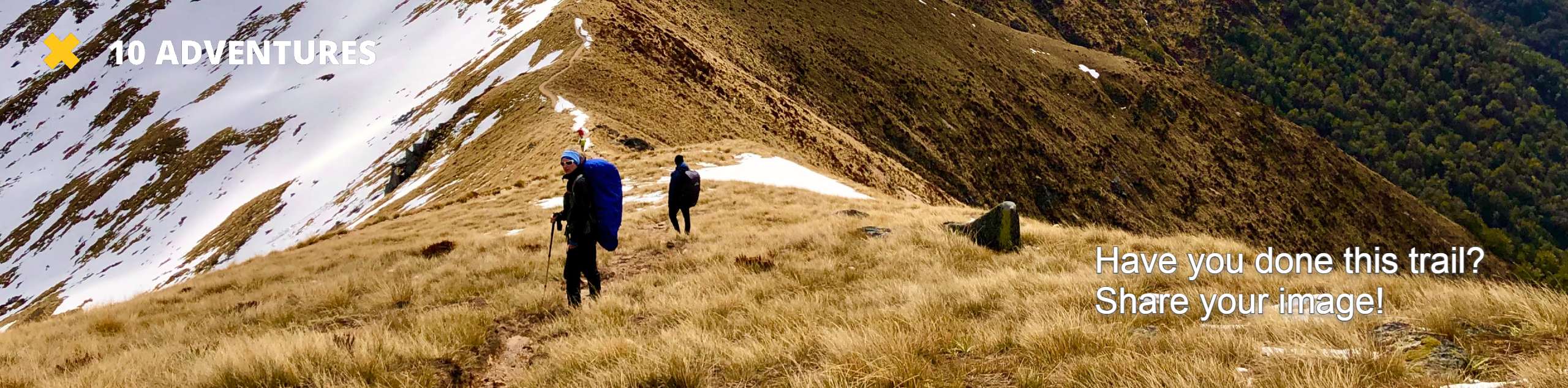
Immerse yourself in the enchanting woodlands along the Maxson Trailhead to Hobler Lake Hike. This scenic adventure demands the navigation of boardwalks and granite outcrops up to the charming alpine lake nestled amongst towering pines.
Getting there
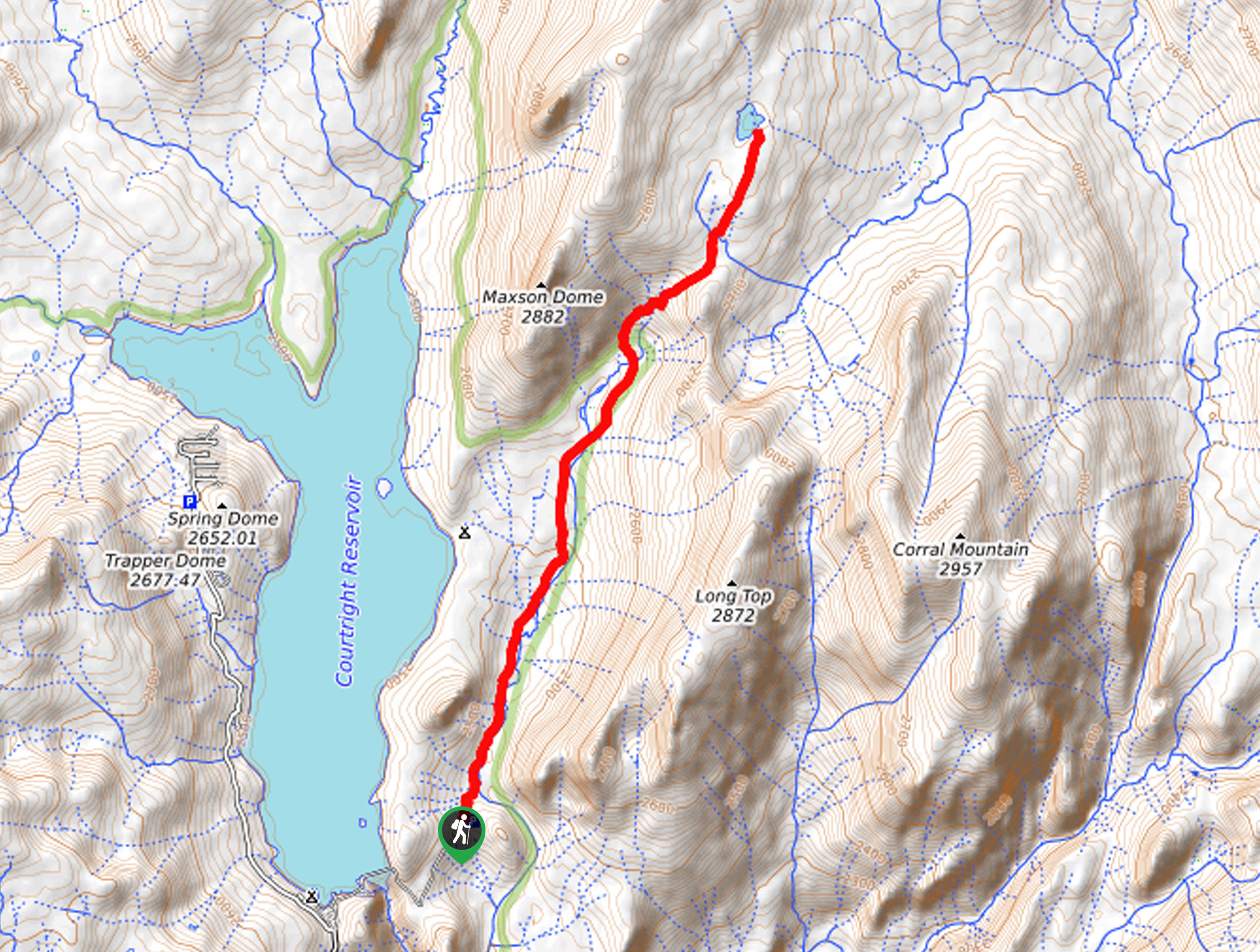
The Maxson Trailhead to Hobler Lake is located off Courtright Way.

About
| Backcountry Campground | Backcountry Camping, wilderness permit required. |
| When to do | June-October |
| Pets allowed | Yes - On Leash |
| Family friendly | Older Children only |
| Route Signage | Average |
| Crowd Levels | Moderate |
| Route Type | Out and back |
Maxson Trailhead to Hobler Lake Hike
Elevation Graph
Weather
Maxson Trailhead to Hobler Lake Hike Description
The Maxson Trailhead to Hobler Lake Hike is an intermediate hike in the Sierra Nation Forest that demands endurance and a comfy pair of footwear. Wander through mixed forestlands bounded by the sheer granite cliffsides of Long Top Peak and Maxson Dome. Much of this route travels over uneven terrain, including a log boardwalk, so we recommend a pair of ankles bracing footwear! Note that this path travels to high elevations, so be sure to acclimate to the area and check the forecast to avoid an afternoon storm!
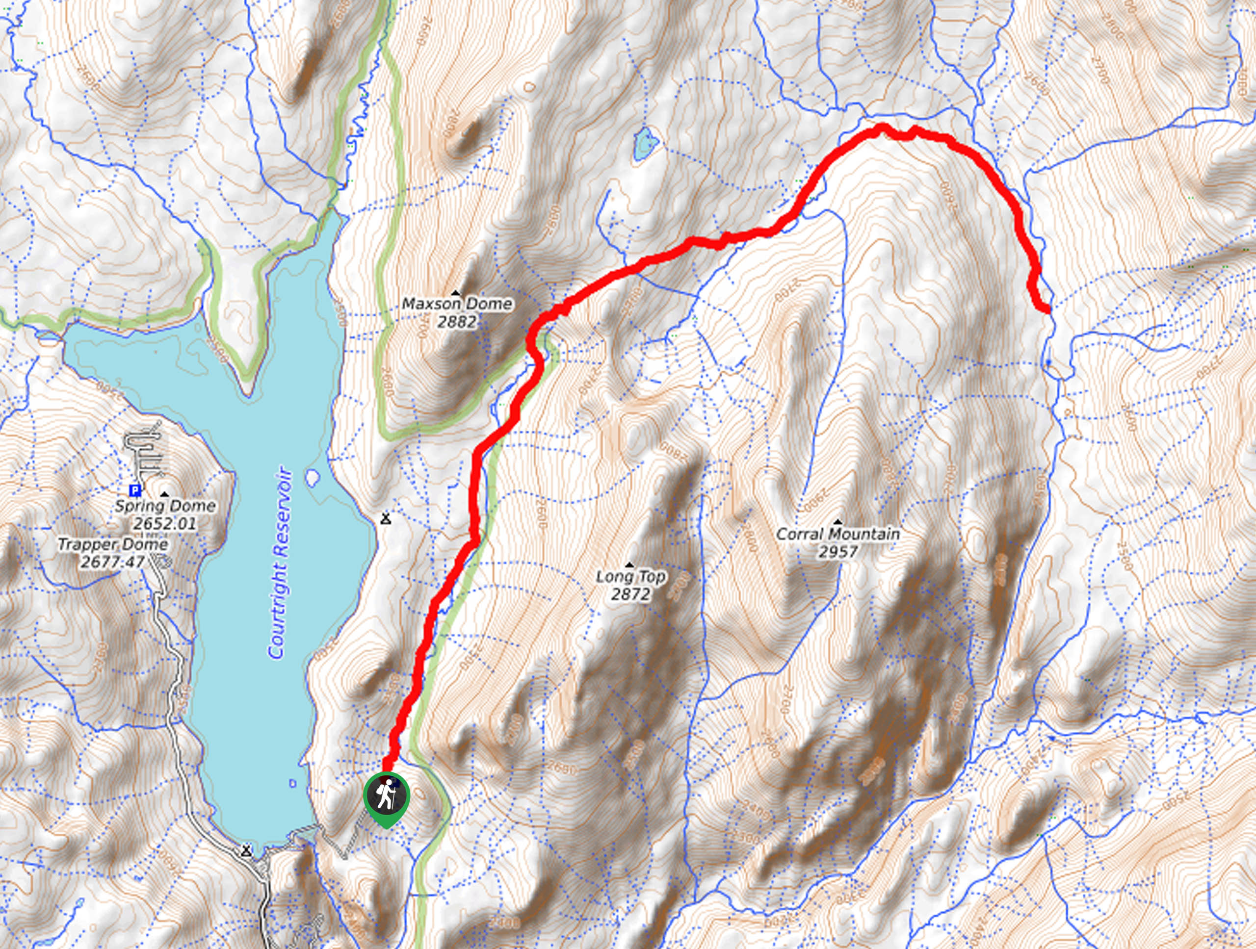
Setting out from the trailhead, the Maxson Trailhead to Hobler Lake Hike follows the Dusy Ershim OHV Route. You will eventually reach an intersection while wandering along a snowmelt stream hemmed by granite bluffs and looming trees. Here, veer right, and you will be diverted onto the Blackcap Trail. Trekking northeast between Maxson Dome and Long Top Peak, the path will increase in intensity, guiding you to another junction. At this point, you will want to keep left, merging onto the Hobler Lake Trail.
This path will guide you up to the shore of the charming alpine lake. Appreciate the beauty of the shimmering waters encircled by lush evergreens. Rest, rehydrate, and retrace your footing along the path back to the trailhead when you are ready.
Similar hikes to the Maxson Trailhead to Hobler Lake Hike hike
Post Corral Meadows Trail
A popular backpacking route turned epic day hike, the Post Corral Meadows Trail is an epic back-country expedition. Hike amongst…
Chiquito Pass Trail
The Chiquito Pass Trail is arguably one of the most scenic adventures in the Sierra National Forest. Wander up through…
Wuh-Ki'o Trail
The Wuh-Ki'o Trail is an unassumingly picturesque adventure in the Sierra National Forest. Traveling through meadowlands, brush, over bridges, and…
Comments