Wuh-Ki'o Trail
View Photos
Wuh-Ki'o Trail
Difficulty Rating:
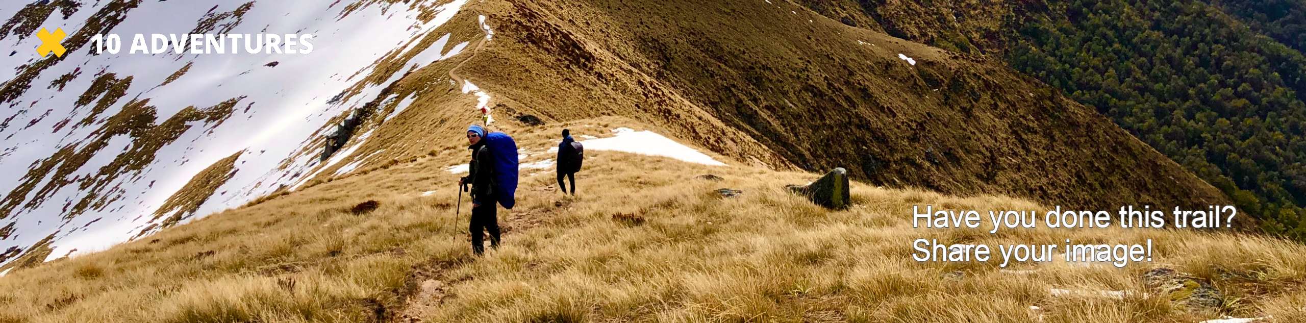
The Wuh-Ki'o Trail is an unassumingly picturesque adventure in the Sierra National Forest. Traveling through meadowlands, brush, over bridges, and mossy terrain, there is no shortage of stunning scenery to indulge along the way.
Getting there
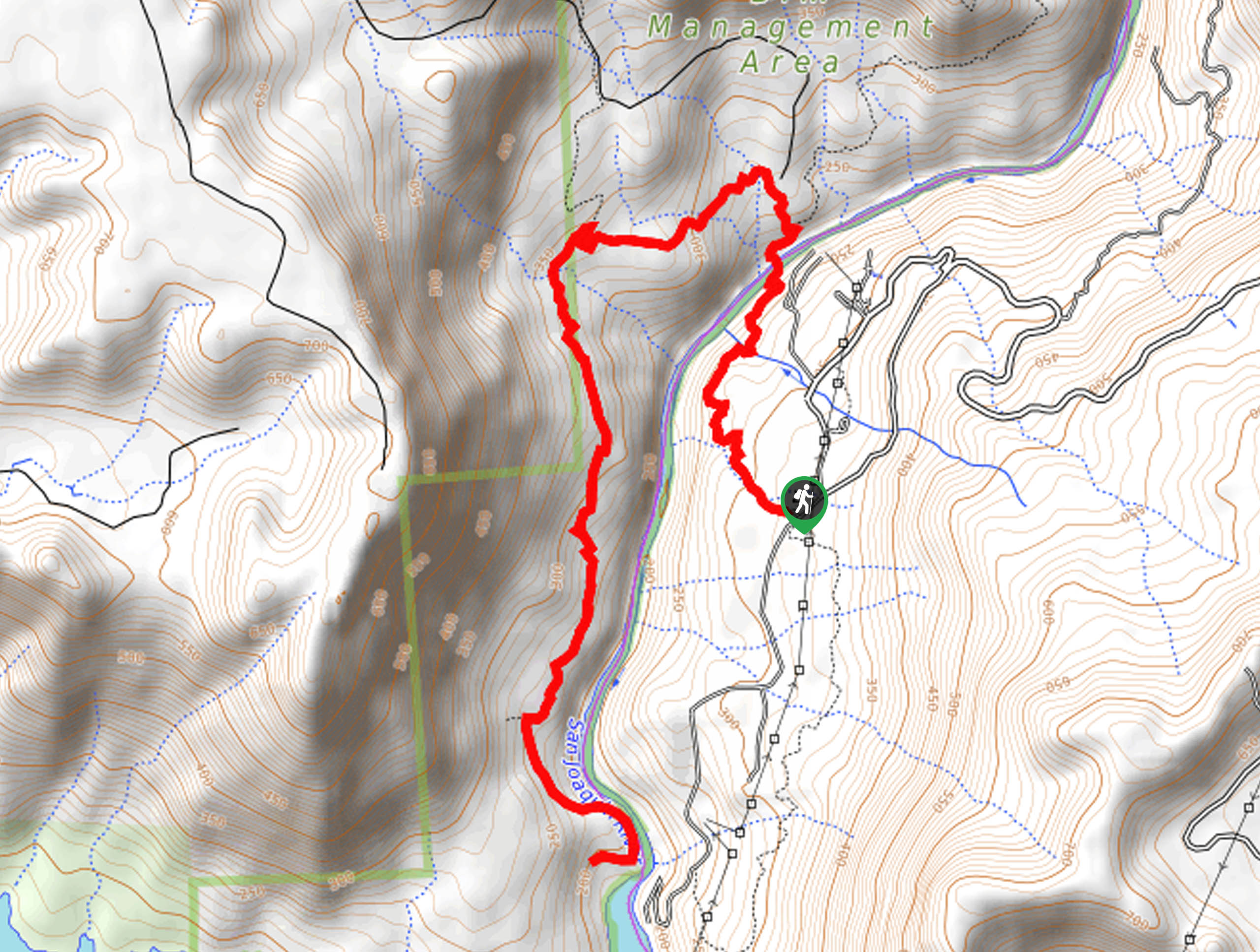
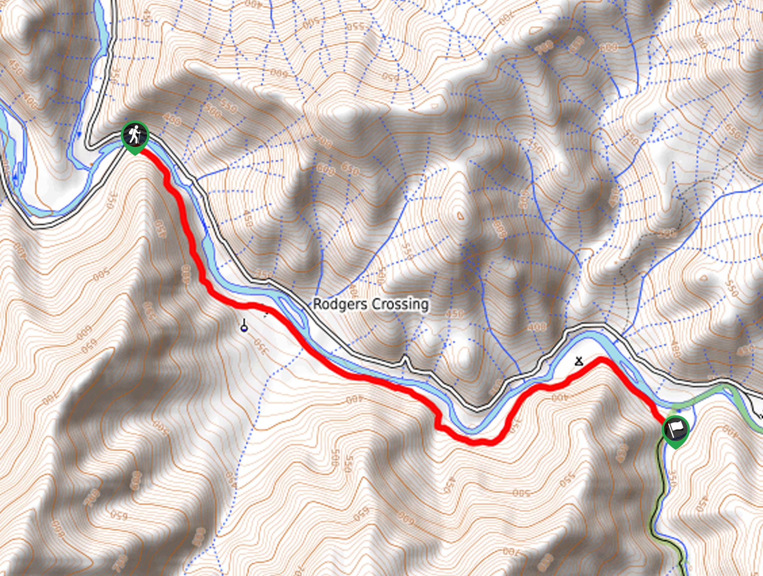
The Wuh-Ki'o Trail departs from the Pa’san Ridge Trail off Smalley Road.

About
| Backcountry Campground | No |
| When to do | Year-round |
| Pets allowed | Yes - On Leash |
| Family friendly | Yes |
| Route Signage | Average |
| Crowd Levels | Moderate |
| Route Type | Out and back |
Wuh-Ki'o Trail
Elevation Graph
Weather
Wuh-Ki'o Trail Description
The Wuh-Ki’o Trail is a charming nature walk through the hillsides and through the corridor of the San Joaquin Valley. This scenic provides a great workout, motivating you with High Sierra views along the way. Note much of this path is exposed, and in the summer months, the vegetation dries, making for an unbearably hot hike in the summer heat. When tackling this route in the warmer months, we encourage you to head out early to beat the heat and the crowds! Pack plenty of water to stay hydrated along the route.
Setting out from the trailhead, the Wuh-Ki’o Hike follows the Pas’san Ridge Trail northwest down into the river valley. Following the dirt route, you will intersect with a few snowmelt streams before reaching the bridge over the San Joaquin River. From here, revel in the views of the granite-lined river bounded by the grassy mountains. Continue hiking over the bridge, and the Pa’san Ridge Trail will divert you southwest. At the next intersection, merge onto the Wuh-Ki’o Trail along the opposite side of the river, revealing views of the Sierra Nevada Mountains in the south.
Eventually, you will reach the trail’s end at the banks of the San Joaquin River. From here, begin your return back to the trailhead, retracing your steps the entire way.
Similar hikes to the Wuh-Ki'o Trail hike
Post Corral Meadows Trail
A popular backpacking route turned epic day hike, the Post Corral Meadows Trail is an epic back-country expedition. Hike amongst…
Chiquito Pass Trail
The Chiquito Pass Trail is arguably one of the most scenic adventures in the Sierra National Forest. Wander up through…
Davis Flat Trail
Experience the grandeur of the Sierra Nevada Mountains as you hike through the Kings River Valley, bounded by rolling hills.…
Comments