
Mono Creek Trail
View Photos
Mono Creek Trail
Difficulty Rating:
Seeking a demanding, yet rewarding adventure in the Sierra National Park? The Mono Creek Trail is an awesome hike that while demands stamina, offers incredible scenery in return—motivating even the most discouraged hikers along the way.
Getting there
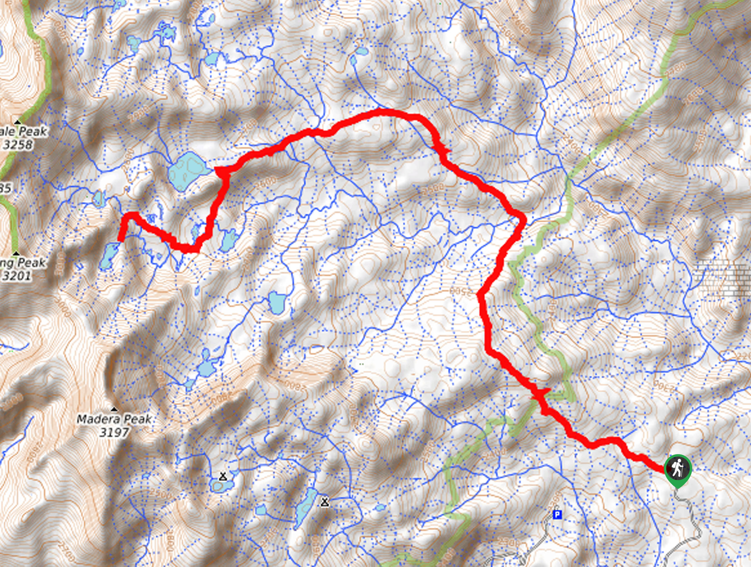
The Mono Creek Trail departs from the High Sierra Pack Station Trailhead off Kaiser Pass Road.

About
| Backcountry Campground | Backcountry Camping, wilderness permit required. |
| When to do | June-October |
| Pets allowed | Yes - On Leash |
| Family friendly | No |
| Route Signage | Average |
| Crowd Levels | Low |
| Route Type | Out and back |
Mono Creek Trail
Elevation Graph
Weather
Mono Creek Trail Description
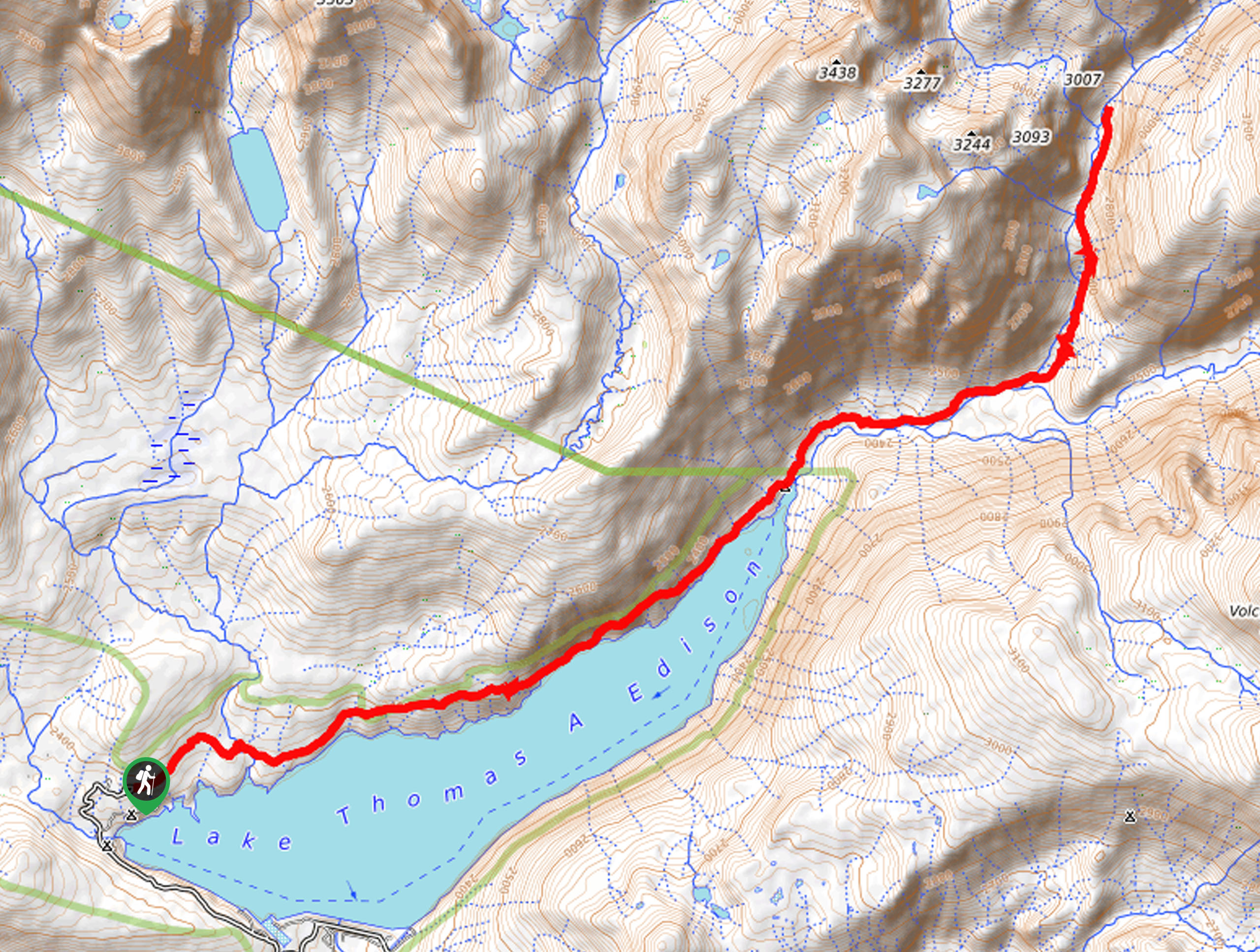
The Mono Creek Trail is a secluded adventure that boasts a relaxing experience—hike through enchanting woodlands, over snowmelt streams, boardwalks, and along the shores of Lake Thomas A. Edison. This hike is long, so make sure you head out in the early morning if you plan to tackle this trek as a day hike. Additionally, as this route travels through diverse terrains, we encourage you to dress in layers as the conditions at high altitudes are ever-changing.
Setting out from the trailhead, the Mono Creek Hike follows the High Sierra Pack Station Trail through the woodlands. Wander through the lush forestlands, and soon the path will guide you along a shoreline cliff. You will be granted views of the encompassing mountains and the Vermillion Ferry tugging along the waters through the tree breaks as you hike. Eventually, the path will guide you along the shores of Lake Thomas A. Edison. Soon the path will leave the lake and through the valley of Mono Creek.
Soon, you will reach an intersection where you will merge onto the John Muir Trail/ PCT, which will gradually climb further into the wilderness. You will ultimately reach your turnaround point at the junction with the Mott Lake Trail. From here, head back and retrace your footing along the path back to the trailhead.
Similar hikes to the Mono Creek Trail hike
Post Corral Meadows Trail
A popular backpacking route turned epic day hike, the Post Corral Meadows Trail is an epic back-country expedition. Hike amongst…
Wuh-Ki'o Trail
The Wuh-Ki'o Trail is an unassumingly picturesque adventure in the Sierra National Forest. Traveling through meadowlands, brush, over bridges, and…
Chittenden Lake Hike
The Chittenden Lake Hike exhibits the beauty and grandeur of the High Sierra. Explore mixed pine forests, meadowlands, granite gardens,…
Comments