Uncompahgre Riverwalk Trail
View Photos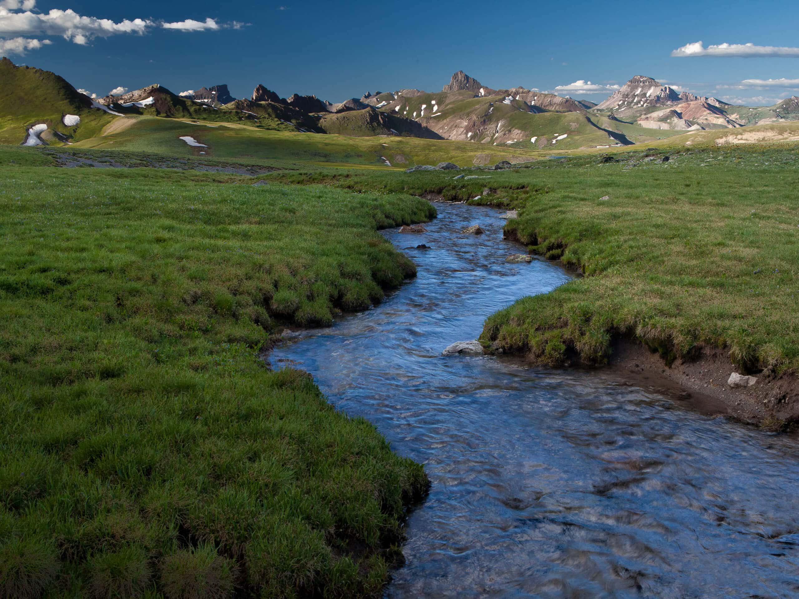
Uncompahgre Riverwalk Trail
Difficulty Rating:
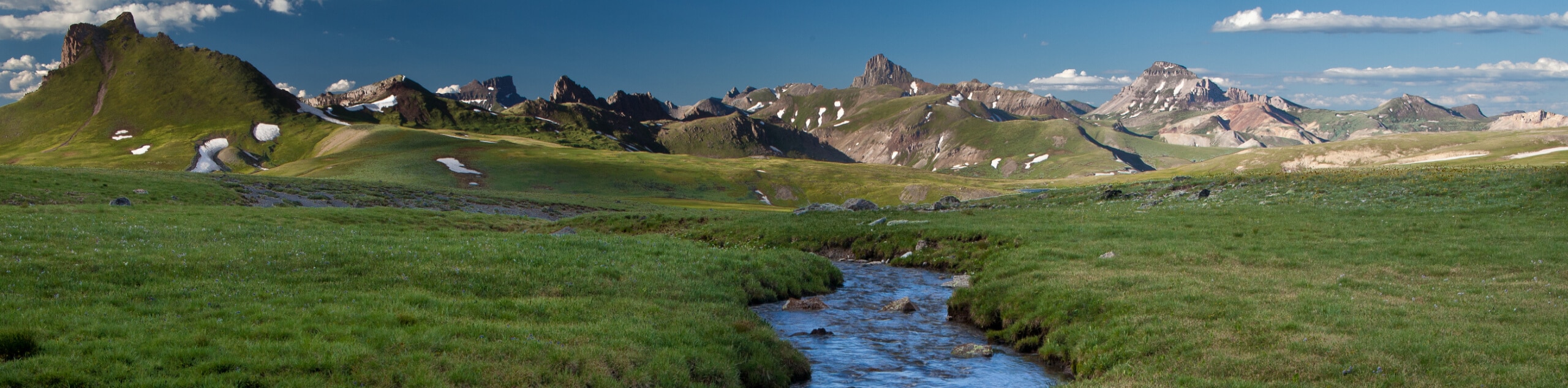
The Uncompahgre Riverwalk Trail is a fantastic hiking route in Ridgway, Colorado that will take you through a state park for beautifully scenic views. While out hiking the trail, you will pass through the town of Ridgway and meander along the banks of the Uncompahgre River, before entering into Ridgway State Park to hike along the shores of the Ridgway Reservoir. Hikers should take note that this is a one-way trail, meaning that you will need to either make travel arrangements to be picked up at the end of the hike or double the overall distance.
Getting there
The trailhead for the Uncompahgre Riverwalk Trail can be found at the parking lot on the banks of the Uncompahgre River, just off Sherman Street.

About
| Backcountry Campground | Dutch Charlie Campground, Pa-Co-Chu-Puk Campground |
| When to do | March-November |
| Pets allowed | Yes |
| Family friendly | Yes |
| Route Signage | Average |
| Crowd Levels | Moderate |
| Route Type | One Way |
Uncompahgre Riverwalk Trail
Elevation Graph
Weather
Uncompahgre Riverwalk Trail Description
If you have a few spare hours on the weekend and feel like taking a relaxing and scenic adventure through Ridgway State Park, then the Uncompahgre Riverwalk Trail is a great option to explore the natural beauty of the Colorado landscape.
Setting out from the trailhead, you will cut through the town of Ridgway to reach the banks of the Uncompahgre River and use the bridge to cross over to the opposite side. Once there, you will meander along the water’s edge towards the north, taking in the beautiful views of the surrounding landscape as you work your way into the boundaries of Ridgway State Park.
Here, you will skirt around the shores of the Ridgway Reservoir and its recreation areas as you make your way to the northwest. After passing by the dam wall, you will briefly descend a series of switchbacks through the forest, before arriving at the endpoint of the hike near the Pa-Co-Chu-Puk Campground. From here, you can either wait for your ride or backtrack along the trail for a lengthy return leg.
Similar hikes to the Uncompahgre Riverwalk Trail hike

Twin Buttes and Lightner Creek Loop Trail
The Twin Buttes and Lightner Creek Loop Trail is a great hiking route in Durango, Colorado that features some challenging…

Meadow Loop via Horse Gulch Trail
The Meadow Loop via Horse Gulch Trail is a great hiking route in Durango that will take you uphill for…

The Ridge Trail
The Ridge Trail - also known as Raiders Ridge Trail - is an amazing hiking route in Durango, Colorado that…
Comments