
Sheep Creek Hot Springs Hike
View Photos
Sheep Creek Hot Springs Hike
Difficulty Rating:
The Sheep Creek Hot Springs Hike is a great family-friendly adventure in the San Juan Mountains of Colorado that will lead you through the forest to a series of hot springs. While out hiking the trail, you will meander through the forest and follow along the winding banks of the Piedra River, before arriving at the lovely riverside hot springs. Don’t forget your swimsuit if you are hoping to take a relaxing dip in the thermal pools!
Getting there
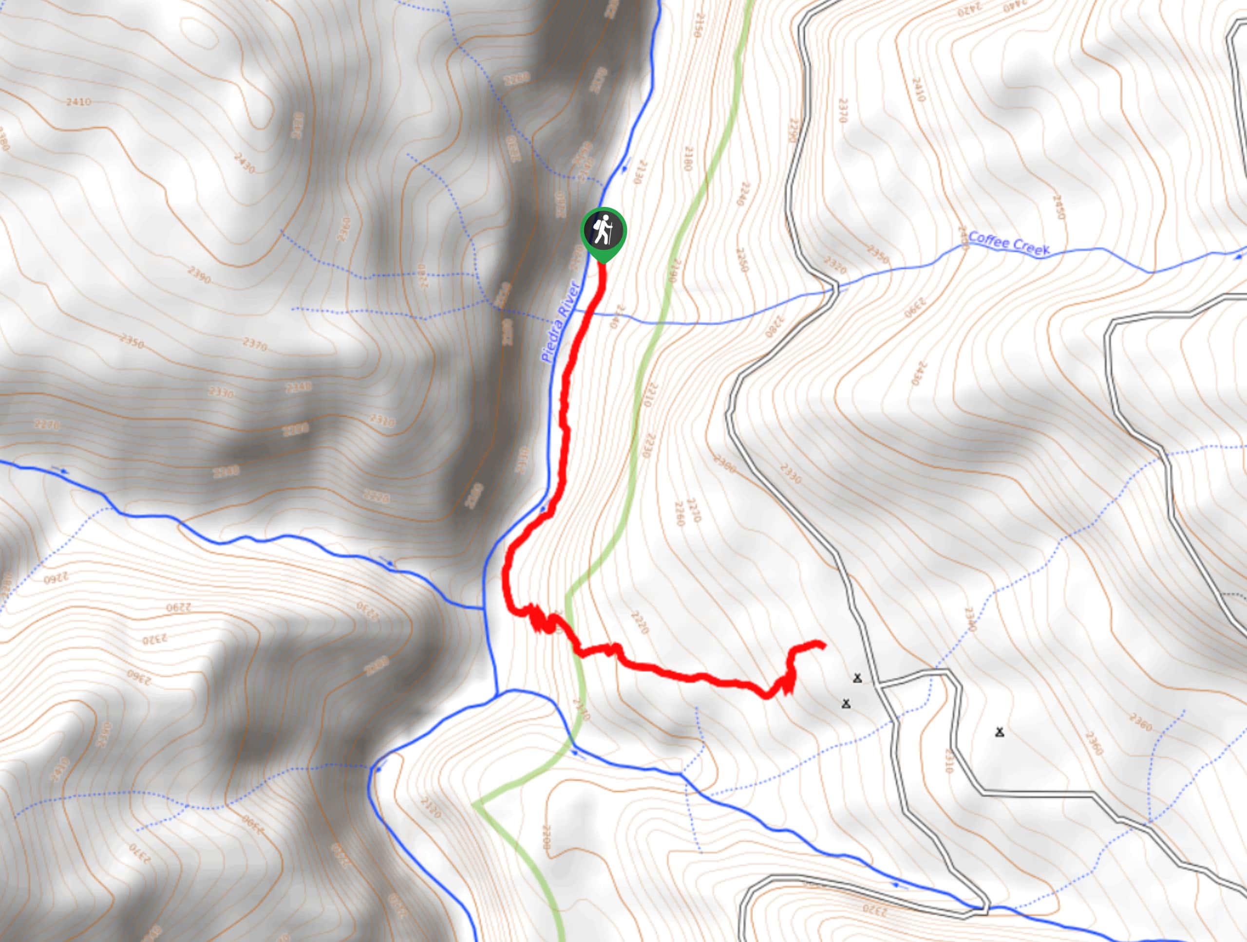
The trailhead for the Sheep Creek Hot Springs Hike can be found along County Road 166 at Piedra Camp 2.

About
| Backcountry Campground | Piedra Camps 1,2, and 3 |
| When to do | April-November |
| Pets allowed | Yes |
| Family friendly | Yes |
| Route Signage | Average |
| Crowd Levels | Moderate |
| Route Type | Out and back |
Sheep Creek Hot Springs Hike
Elevation Graph
Weather
Sheep Creek Hot Springs Hike Description
Whether you are looking for a bit of solitude and relaxation while soaking in the thermal pools, or are taking the kids out on a fun adventure capped off with a swim, the Sheep Creek Hot Springs Hike is a fantastic excursion that will make for a few hours of enjoyment outdoors.
Setting out from the trailhead, you will head west and follow the path as it leads downhill towards the banks of the Piedra River. From here, you will follow the water’s edge to the northeast until you arrive at the site of the Sheep Creek Hot Springs. Take some time here to soak in the warm water while enjoying the beautiful views of the surrounding landscape, before heading back along the same trail.
Similar hikes to the Sheep Creek Hot Springs Hike hike

Twin Buttes and Lightner Creek Loop Trail
The Twin Buttes and Lightner Creek Loop Trail is a great hiking route in Durango, Colorado that features some challenging…

Meadow Loop via Horse Gulch Trail
The Meadow Loop via Horse Gulch Trail is a great hiking route in Durango that will take you uphill for…

The Ridge Trail
The Ridge Trail - also known as Raiders Ridge Trail - is an amazing hiking route in Durango, Colorado that…
Comments