
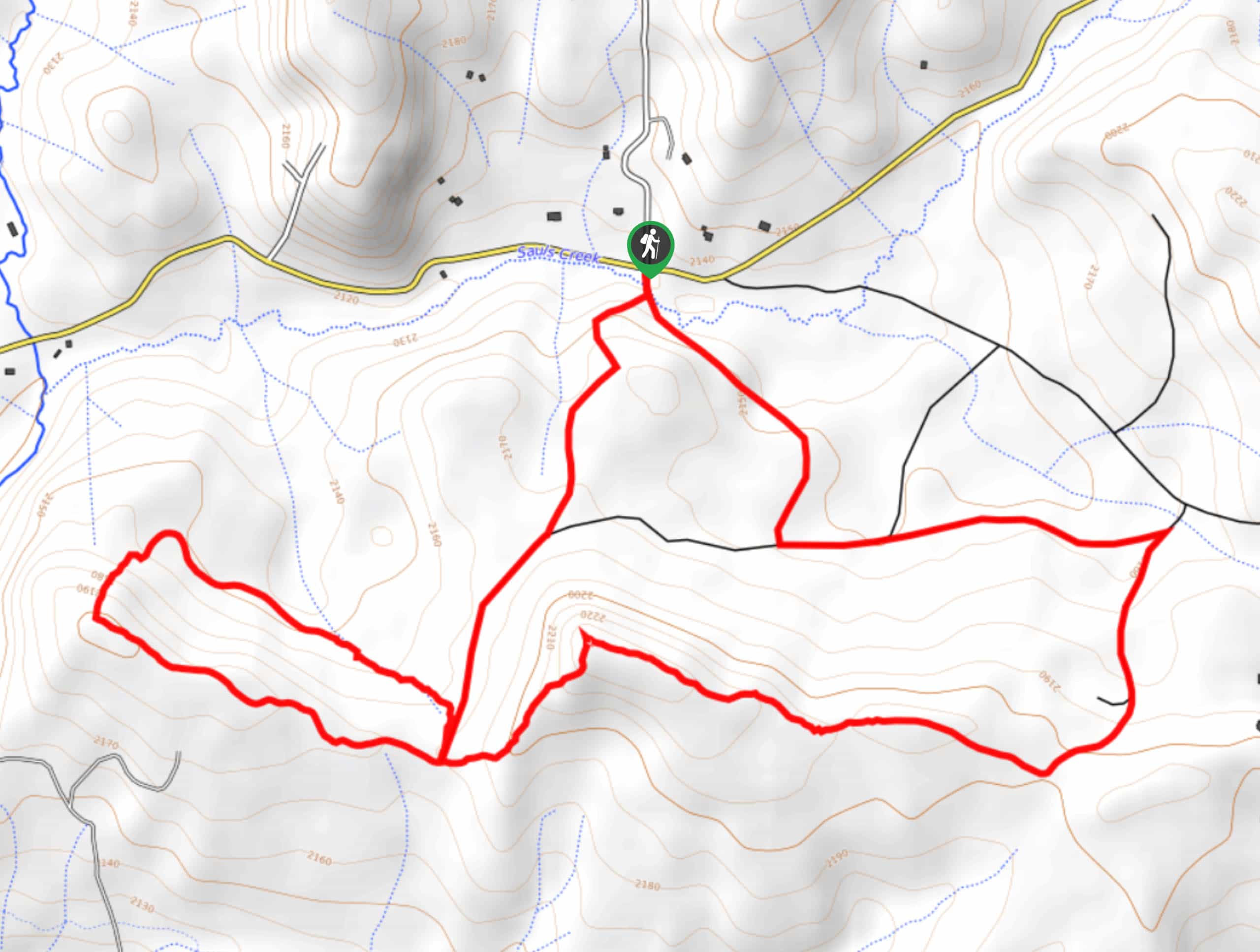
Sauls Creek Trail
View Photos
Sauls Creek Trail
Difficulty Rating:
The Sauls Creek Trail is a great family-friendly excursion near Bayfield, Colorado that will take you through some woodland terrain for views of the surrounding landscape. While out on the trail, you will cross over the banks of Sauls Creek and climb uphill through the forest to reach a ridge with wonderful views across the undulating landscape, before looping back around to the trailhead. Although it is not a challenging route, you may want to bring a GPS or trail map along for this hike, as some of the trails are not very well marked.
Getting there
The starting point for the Sauls Creek Trail can be found at a roadside parking area along County Road 527, just 3.0mi northeast of Bayfield.

About
| Backcountry Campground | No |
| When to do | March-October |
| Pets allowed | Yes |
| Family friendly | Yes |
| Route Signage | Poor |
| Crowd Levels | Moderate |
| Route Type | Lollipop |
Sauls Creek Trail
Elevation Graph
Weather
Sauls Creek Trail Description
Whether you are after a relaxing adventure to explore the Colorado landscape in solitude or want to take the entire family out for a fun adventure, the Sauls Creek trail is an excellent route that will enable you to do so while reconnecting with nature.
Setting out from the trailhead, you will makler your way to the south across Sauls Creek and bear left at the fork in the trail. Here, you will gradually climb uphill through the forest landscape, eventually arriving at the top of a small ridge with sweeping views across the hilly landscape.
Here, you will follow the ridge to the west and take in the beautiful views, before beginning a descent of the hillside. After looping back around through the forest, you will come to the initial junction in the path and head left to cross back over Sauls Creek on the return to the parking area.
Similar hikes to the Sauls Creek Trail hike

Twin Buttes and Lightner Creek Loop Trail
The Twin Buttes and Lightner Creek Loop Trail is a great hiking route in Durango, Colorado that features some challenging…

Meadow Loop via Horse Gulch Trail
The Meadow Loop via Horse Gulch Trail is a great hiking route in Durango that will take you uphill for…
Skyline Trail from Jenkins Ranch Road
Hiking the Skyline Trail from Jenkins Ranch Road is a great outdoor experience in Durango, Colorado that offers scenic views…
Comments