Ridgway Reservoir Trail
View Photos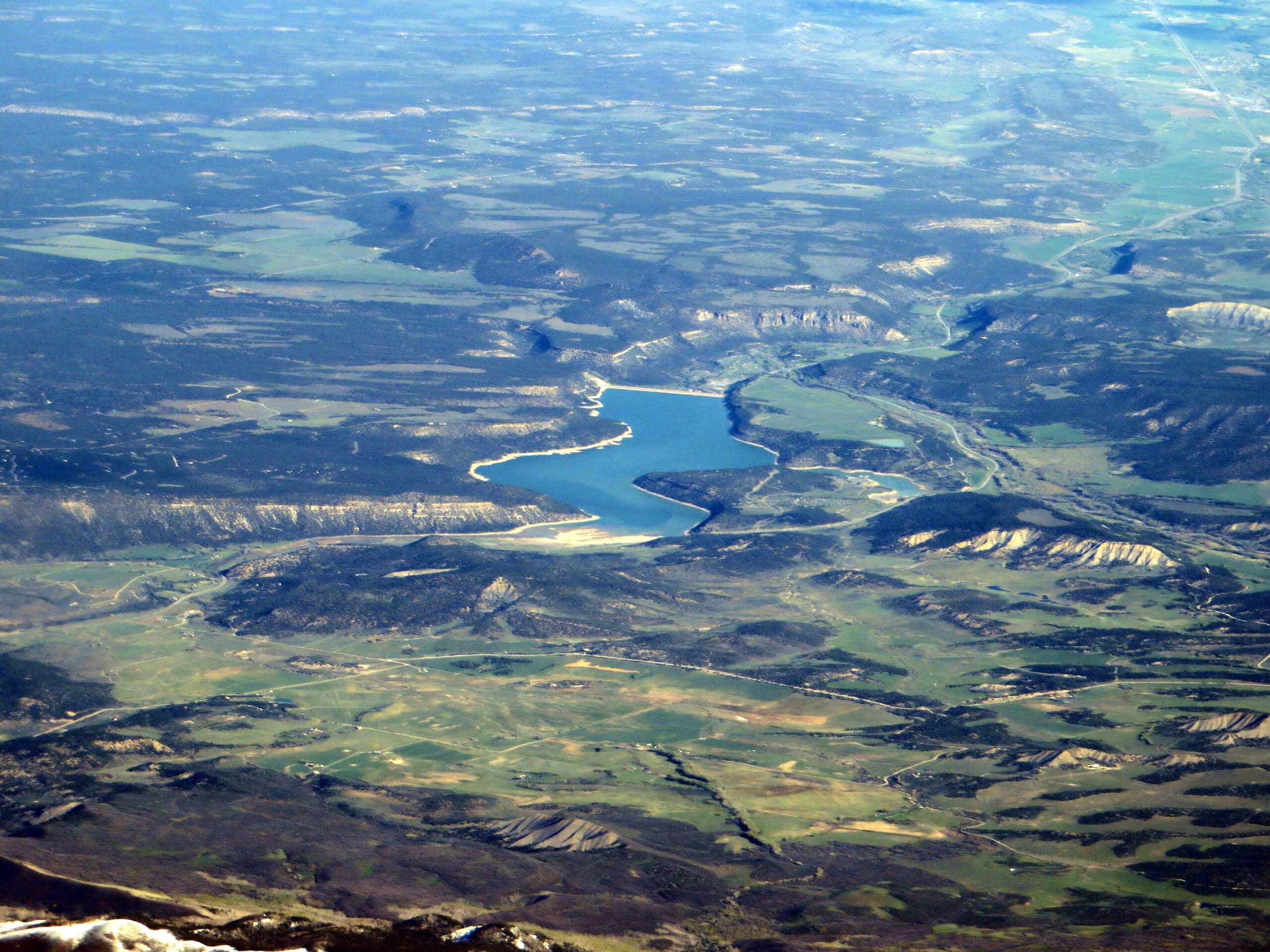
Ridgway Reservoir Trail
Difficulty Rating:
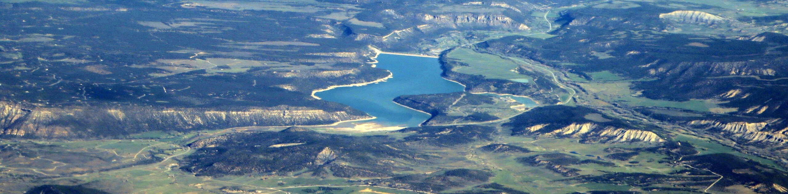
The Ridgway Reservoir Trail is a lovely hiking route in Ridgway State Park that will take you along the edge of the water for beautiful views of the surrounding area. While out hiking the trail, you will work your way around the eastern shore of the Ridgway Reservoir, passing through open terrain and some loose tree cover, before passing by the dam wall and turning abc on the return leg. This is a great hike to pair with an afternoon of swimming and relaxing by the water’s edge.
Getting there
The starting point for the Ridgway Reservoir Trail can be found at the roundabout along Shoreline Road, just south of the Ridgway Swim Beach.

About
| Backcountry Campground | Dutch Charlie Campground |
| When to do | April-September |
| Pets allowed | Yes |
| Family friendly | Yes |
| Route Signage | Average |
| Crowd Levels | Moderate |
| Route Type | Out and back |
Ridgway Reservoir Trail
Elevation Graph
Weather
Ridgway Reservoir Trail Description
Although the Ridgway Reservoir Trail isn’t overly difficult, you will still want to wear comfortable footwear in order to better traverse the trail. As this is a popular destination for a wide variety of outdoor enthusiasts, you will also want to arrive early to secure parking.
Featuring an intermediate overall distance, fairly laidback terrain, and scenic views of the surrounding mountains, the Ridgway Reservoir trail is a fantastic hiking route to enjoy with the entire family. Don’t forget to pack your swimsuit and towel so that you can take advantage of the beach and go for a refreshing dip in the lake!
Setting out from the roundabout on Shoreline Road, you will head to the southeast and keep left along the water’s edge for 0.2mi, following the trail as it turns north and crosses over Alkali Creek. Here, you will continue along the eastern shoreline of the Ridgway Reservoir, following the path as it turns to the northwest and passes through some lightly wooded terrain.
Take some time to appreciate the amazing views across the surface of the lake, looking out on the boaters, anglers, and swimmers that will no doubt be enjoying the recreation area on a hot summer’s day. After 2.8mi of hiking along the trail, you will pass by the dam wall of the reservoir and continue on to the northwest for another 0.8mi, descending a series of switchbacks through the forest to arrive at the endpoint of the hike.
After pausing for a quick rest, you will turn back along the trail and climb back up through the switchbacks, following the exact same route and enjoying the views across the Ridgway Reservoir on the return leg into the trailhead.
Trail Highlights
Ridgway Reservoir
Situated just north of the town of Ridgway within Ridgway State Park, the Ridgway Reservoir is a man-made lake along the Uncompahgre River that was filled in 1990 to help with flood control. The lake is a popular place for recreation activities such as swimming, boating, and fishing.
Frequently Asked Questions
Can you swim in Ridgway Reservoir?
Yes, it is possible to swim in Ridgway Reservoir when the swim beach is open during the summer months.
What kind of fish are in Ridgway Reservoir?
Kokanee salmon, rainbow trout, brown trout, splake, and yellow perch can be found in Ridgway Reservoir.
Insider Hints
Wear comfortable walking shoes.
Toilet facilities can be found near the Ridgway Swim Beach.
Don’t forget to bring your swimsuit if you want to relax by the water after your hike.
Similar hikes to the Ridgway Reservoir Trail hike

Twin Buttes and Lightner Creek Loop Trail
The Twin Buttes and Lightner Creek Loop Trail is a great hiking route in Durango, Colorado that features some challenging…

Meadow Loop via Horse Gulch Trail
The Meadow Loop via Horse Gulch Trail is a great hiking route in Durango that will take you uphill for…

The Ridge Trail
The Ridge Trail - also known as Raiders Ridge Trail - is an amazing hiking route in Durango, Colorado that…
Comments