
Purgatory Trail
View Photos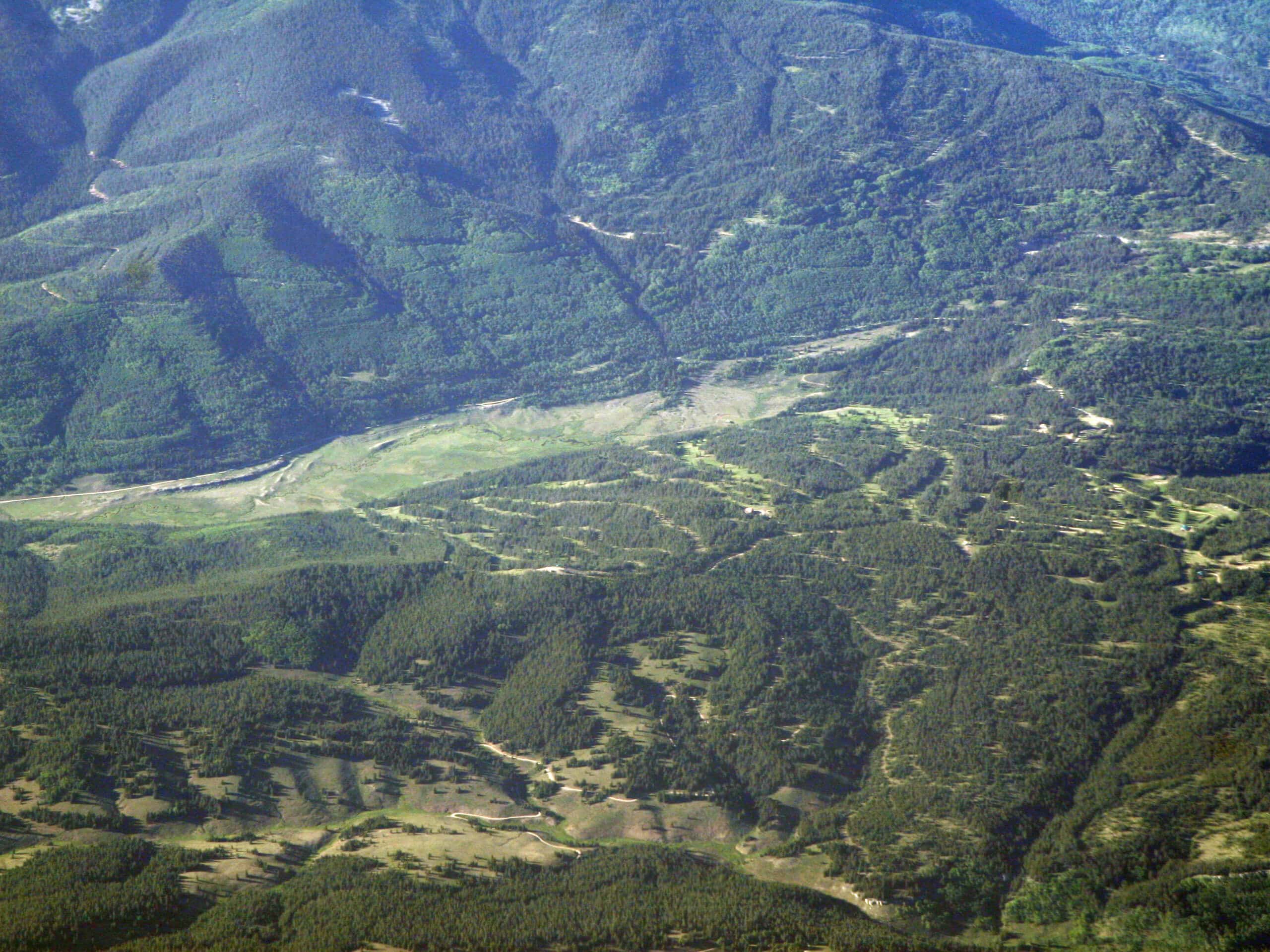
Purgatory Trail
Difficulty Rating:
The Purgatory Trail is a fantastic outdoor adventure in Colorado that will take you through a forested gulch alongside several winding creeks. While out hiking the trail, you will descend through the forest alongside Purgatory Creek to reach the banks of Cascade Creek, following as it winds to the southeast through the sloping woodland landscape. This is an amazing hiking route to pair with a fun weekend of camping in the area.
Getting there
The starting point for the Purgatory Trail can be found at the car park along Tacoma Drive, near the junction with US-550.

About
| Backcountry Campground | Cascade Creek |
| When to do | March-October |
| Pets allowed | Yes |
| Family friendly | Yes |
| Route Signage | Average |
| Crowd Levels | High |
| Route Type | Lollipop |
Purgatory Trail
Elevation Graph
Weather
Purgatory Trail Description
While it is not an overly challenging trail, the Purgatory Trail does feature a bit of elevation gain and a fairly lengthy overall distance that will be tough for some less experienced hikers to traverse. Be sure to bring bear spray and make plenty of noise along the trail, as bears are often spotted with their cubs in the vicinity.
If you enjoy scenic hikes through the forest and camping out in the beauty of nature, then the Purgatory Trail is sure to be right up your alley. This fun hiking route descends into a woodland gulch, offering plenty of beautiful views of flowing creeks and rushing rivers that will certainly make you feel at peace with the world. Whether you are heading out on your own or are looking to take your family on a fun day of hiking, this route will not disappoint.
Setting out from the parking area off Tacoma Drive, you will follow the Purgatory Trail to the east as it descends alongside Purgatory Creek. Here, you will pass through a beautifully serene stretch of woodland landscape that will offer a great sense of relaxation, before eventually arriving at Purgatory Flat after 1.1mi.
Follow the trail as it bends to the south and brings you to the point where Purgatory Creek joins with Cascade Creek. At this point, you will continue along the banks of Cascade Creek as it winds to the southeast through the forest gulch.
As you make your way through the woodland terrain, you will traverse the slopes of the gulch and take in some pleasant views of the mountainous landscape around you. Eventually, you will come to a bridge crossing over the rushing waters of the Animas River. After making your way over to the opposite bank, you can explore the landscape by taking a short loop around the rail tracks, before turning back along the trail to cross back over the river.
Here, you will follow the same route that you previously traversed. Take some time here to appreciate the natural beauty of the forest landscape around you, as you head back into the trailhead and wrap up your time on the Purgatory Trail.
Frequently Asked Questions
How long is the Purgatory Trail?
The Purgatory Trail follows a 10.3mi route.
Where is the Purgatory Trail?
The Purgatory Trail can be found north of Durango, close to the Purgatory Resort.
Insider Hints
Wear proper hiking boots with good support for this hike.
Be sure to bring bear spray and exercise all necessary precautions when hiking in the area.
Similar hikes to the Purgatory Trail hike

Twin Buttes and Lightner Creek Loop Trail
The Twin Buttes and Lightner Creek Loop Trail is a great hiking route in Durango, Colorado that features some challenging…

Meadow Loop via Horse Gulch Trail
The Meadow Loop via Horse Gulch Trail is a great hiking route in Durango that will take you uphill for…

The Ridge Trail
The Ridge Trail - also known as Raiders Ridge Trail - is an amazing hiking route in Durango, Colorado that…
Comments