
Middle Frisco Trail
View Photos
Middle Frisco Trail
Difficulty Rating:
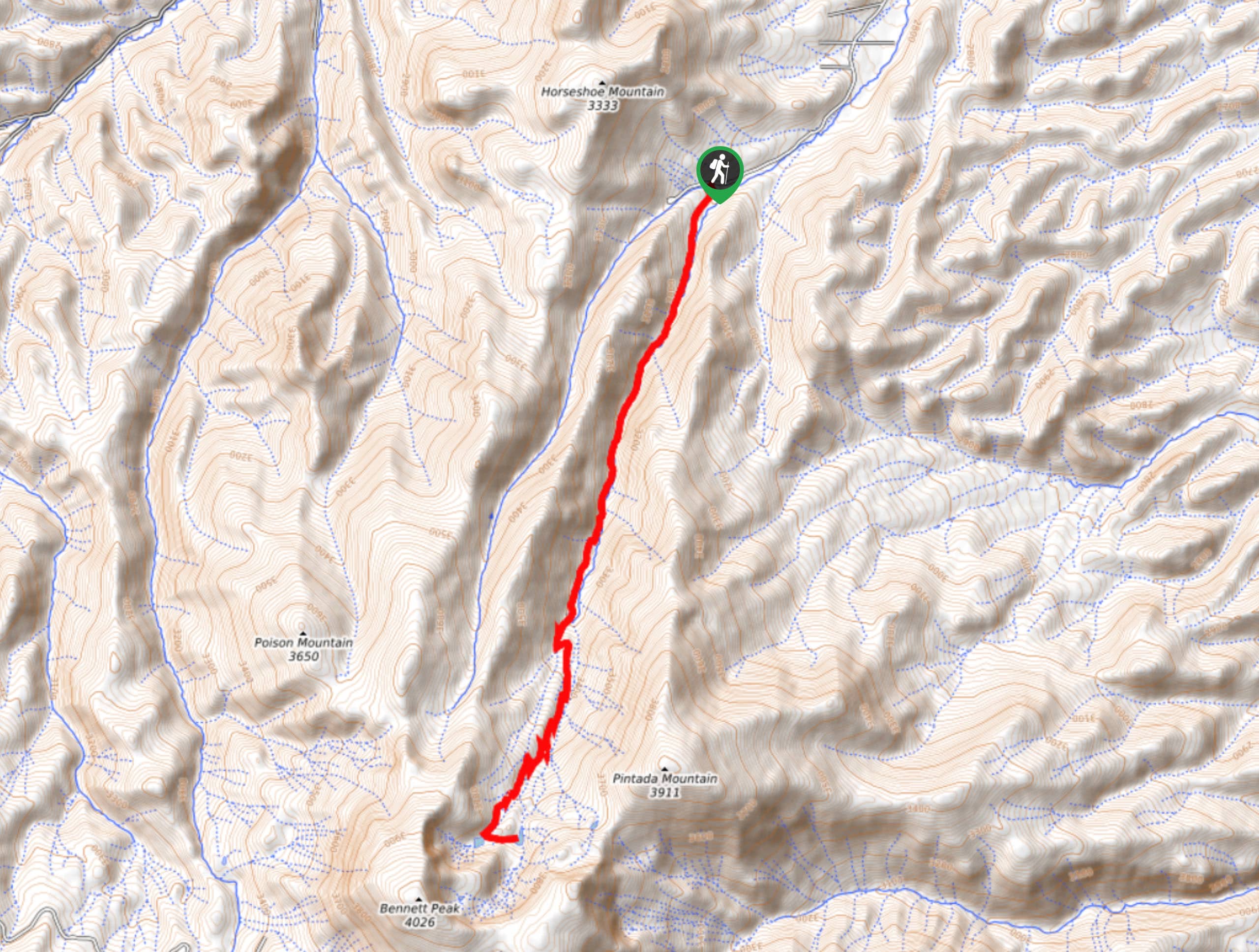
The Middle Frisco Trail is a wonderful adventure in the San Juan Mountains that will take you uphill alongside a creek to reach a series of alpine lakes. While out on the trail, you will follow along the winding banks of Middle Fork San Francisco Creek, steadily gaining elevation before arriving at the beautifully scenic shores of the San Francisco Lakes. This is a long journey with a fair amount of elevation gain, so be sure to bring plenty of water and wear proper hiking boots with good support.
Getting there
The starting point for the Middle Frisco Trail can be found at the Middle Frisco Trailhead on San Francisco Creek Road.

About
| Backcountry Campground | No |
| When to do | May-October |
| Pets allowed | Yes |
| Family friendly | No |
| Route Signage | Average |
| Crowd Levels | Low |
| Route Type | Out and back |
Middle Frisco Trail
Elevation Graph
Weather
Middle Frisco Trail Description
If you are in the mood for a long and arduous journey into the backcountry that features a large amount of elevation gain, beautiful woodland scenery, and the chance to relax beside several alpine lakes, then you will be sure to enjoy the Middle Frisco Trail.
Setting out from the trailhead, you will make your way to the south and follow the path as it l;eads into the dense cover of the forest. Here, you will quickly meet up with the banks of Middle Fork San Francisco Creek and follow them as you gain elevation along the trail.
After climbing uphill through the forest and passing through intermittent meadows, you will break free of the tree cover and enter into the alpine landscape. Take some time here to explore the area surrounding the San Francisco Lakes and revel in the natural beauty of the mountainous landscape, before heading back downhill on the long return leg of the hike.
Similar hikes to the Middle Frisco Trail hike

Twin Buttes and Lightner Creek Loop Trail
The Twin Buttes and Lightner Creek Loop Trail is a great hiking route in Durango, Colorado that features some challenging…

Meadow Loop via Horse Gulch Trail
The Meadow Loop via Horse Gulch Trail is a great hiking route in Durango that will take you uphill for…

The Ridge Trail
The Ridge Trail - also known as Raiders Ridge Trail - is an amazing hiking route in Durango, Colorado that…
Comments