
Limekiln Peak Trail
View Photos
Limekiln Peak Trail
Difficulty Rating:
The Limekiln Peak Trail is a fun afternoon hiking trip near Del Norte, Colorado that will take you through some hilly desert terrain with pleasant views. While out hiking the trail, you will climb uphill through the desert hills and cliffs to the southeast of the town, looping around and visiting a small hilltop summit for sweeping views across the Colorado landscape. Hikers should take note that this area is popular with mountain bike enthusiasts, so keep an eye out and remember to share the trail with passing bikers.
Getting there
The trailhead for the Limekiln Peak Trail can be found 6.3mi southeast of Del Norte, just off US-160 at North County Road 5.

About
| Backcountry Campground | No |
| When to do | May-October |
| Pets allowed | Yes - On Leash |
| Family friendly | Older Children only |
| Route Signage | Average |
| Crowd Levels | Low |
| Route Type | Lollipop |
Limekiln Peak Trail
Elevation Graph
Weather
Limekiln Peak Trail Description
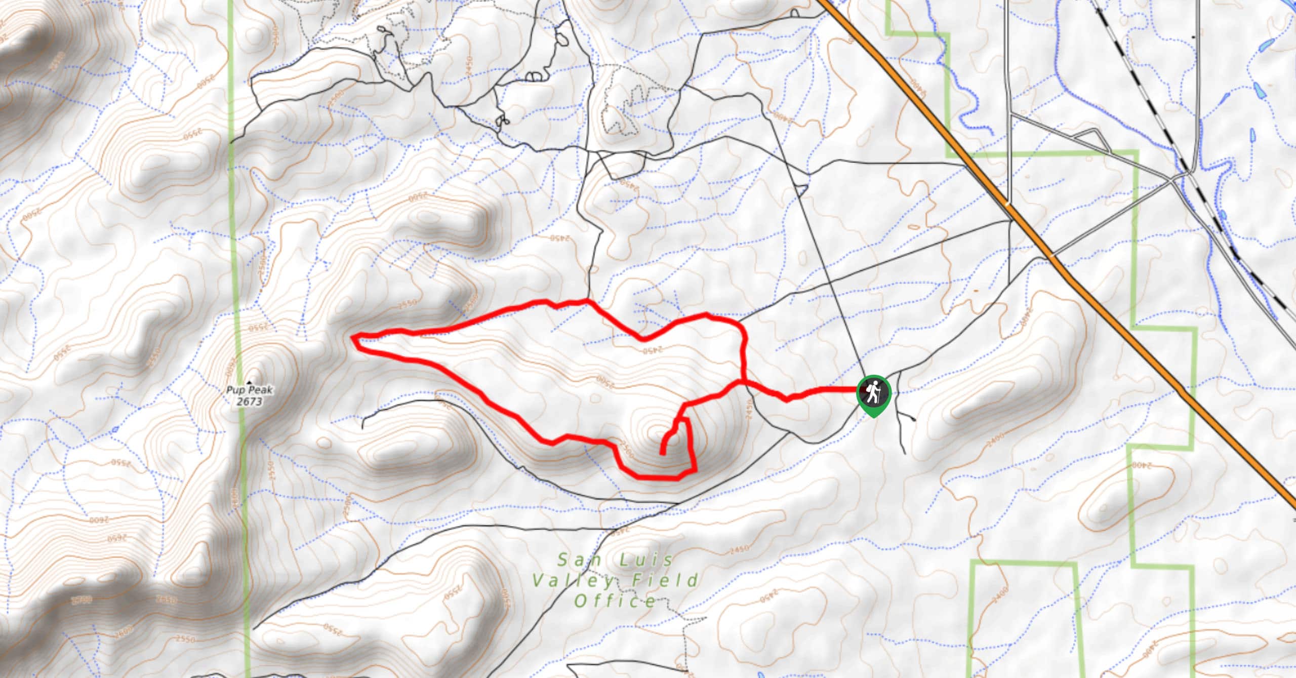
If you find yourself in the Del norte area and don’t want to fill up your entire day with driving into the mountains to find a trailhead, the Limekiln Peak Trail is a great option that isn’t too far from town and still offers some fun terrain and scenic views.
Setting out from the trailhead, you will make your way west across the open desert landscape until you reach a fork, at which point, you will follow the trail branching off to the right. Here, you will continue on to the west and gain a bit of elevation, before following the trail as it turns back to the southeast.
Here, you will follow along the edge of a small cliff and take in the views of the surrounding area, before making a short push up to the summit of Limekiln Peak, which offers an even better sightline over the surrounding landscape. After taking in the views, simply head back downhill to the northeast and follow the path back to the trailhead where you started.
Similar hikes to the Limekiln Peak Trail hike

Twin Buttes and Lightner Creek Loop Trail
The Twin Buttes and Lightner Creek Loop Trail is a great hiking route in Durango, Colorado that features some challenging…

Meadow Loop via Horse Gulch Trail
The Meadow Loop via Horse Gulch Trail is a great hiking route in Durango that will take you uphill for…

The Ridge Trail
The Ridge Trail - also known as Raiders Ridge Trail - is an amazing hiking route in Durango, Colorado that…
Comments