
Lobo Overlook Hike
View Photos
Lobo Overlook Hike
Difficulty Rating:
The Lobo Overlook Hike is a fantastic adventure in Colorado that offers scenic views of the surrounding landscape and is suitable for the entire family. While out on the trail, you will take in some spectacular views of the San Juan Mountains from the Lobo Overlook, before hiking along an elevated position through meadows and stretches of woodland. This is an excellent trail if you are simply looking to get outside and experience the beautiful Colorado scenery.
Getting there
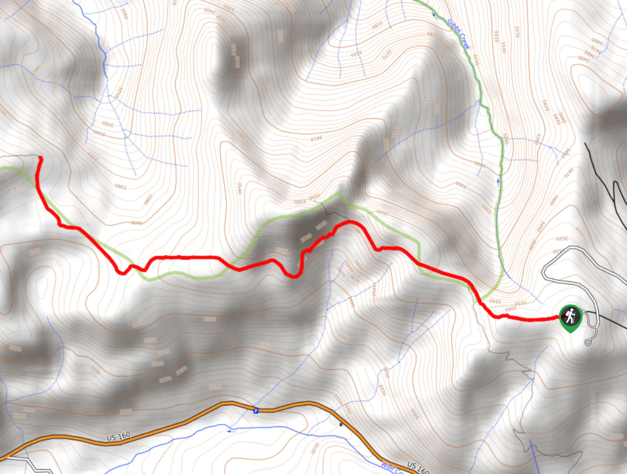
The trailhead for the Lobo Overlook Hike can be found along Forest Service Road 402 at the Lobo Overlook viewpoint.

About
| Backcountry Campground | No |
| When to do | June-September |
| Pets allowed | Yes - On Leash |
| Family friendly | Yes |
| Route Signage | Average |
| Crowd Levels | Moderate |
| Route Type | Out and back |
Lobo Overlook Hike
Elevation Graph
Weather
Lobo Overlook Hike Description
Whether you are after an easy-going solo hike or have your sights on a fun family adventure outdoors, the Lobo Overlook Hike is an amazing route that will provide you with hours of fun and a plentiful amount of scenic views.
Setting out from the trailhead, you will first take in the amazing views of the surrounding mountain terrain from the Lobo Overlook viewpoint, before heading west along the trail. Here, you will traverse an elevated position made up of rocky terrain, meadows, and small stretches of forest, while taking in some more beautiful views of the surrounding landscape. After reaching the endpoint of the route along the Continental Divide Trail, you will turn back along the same route and follow it back to your starting point at the Lobo Overlook Hike.
Similar hikes to the Lobo Overlook Hike hike

Twin Buttes and Lightner Creek Loop Trail
The Twin Buttes and Lightner Creek Loop Trail is a great hiking route in Durango, Colorado that features some challenging…

Meadow Loop via Horse Gulch Trail
The Meadow Loop via Horse Gulch Trail is a great hiking route in Durango that will take you uphill for…

The Ridge Trail
The Ridge Trail - also known as Raiders Ridge Trail - is an amazing hiking route in Durango, Colorado that…
Comments