
Archuleta Trail and Big Meadows Trail
View Photos
Archuleta Trail and Big Meadows Trail
Difficulty Rating:
The Archuleta Trail and Big Meadows Trail is a fantastic hiking adventure in the San Juan Mountains that provides beautifully scenic views of a nearby reservoir and river. While out on the trail, you will make your way along the shores of Big Meadows Reservoir, before hiking alongside the South Fork of the Rio Grande for views over the rapids. Be sure to wear proper hiking boots and watch your footing while traversing the narrow trails on the edge of the rushing river.
Getting there
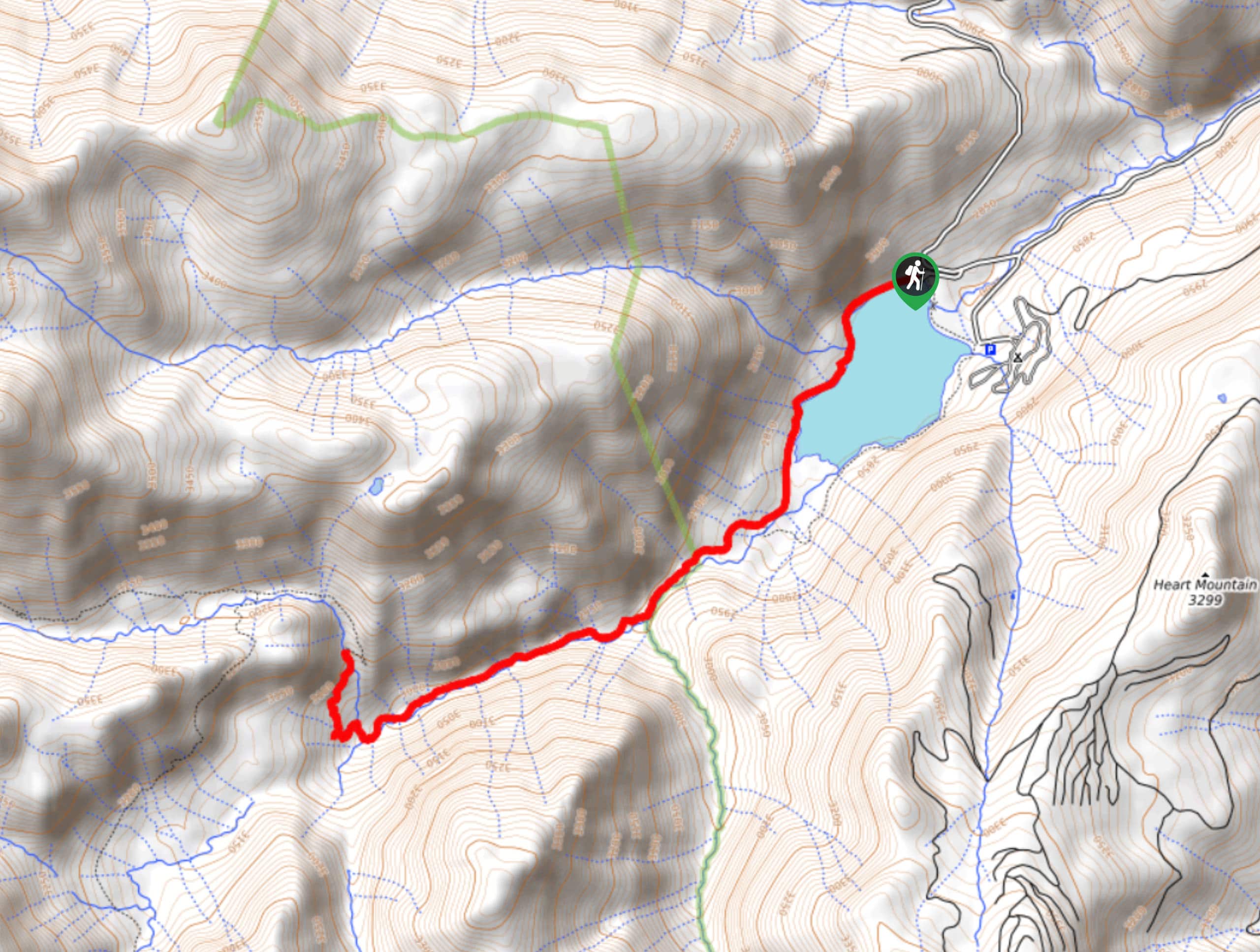
The starting point for the Archuleta Trail and Big Meadows Trail can be found at the Big Meadows Reservoir Boating Site off Forest Service Road 430.

About
| Backcountry Campground | Big Meadows Campground |
| When to do | May-October |
| Pets allowed | Yes - On Leash |
| Family friendly | Older Children only |
| Route Signage | Average |
| Crowd Levels | Moderate |
| Route Type | Out and back |
Archuleta Trail and Big Meadows Trail
Elevation Graph
Weather
Archuleta Trail and Big Meadows Trail Description
For those adventurers who want to experience the natural beauty of the Colorado landscape without the killer elevation that often goes along with it, the Archuleta Trail and Big Meadows Trail is a great route that will take you along the water’s edge to experience a different kind of scenery in the San Juan Mountains.
Setting out from the trailhead, you will make your way to the southwest and skirt along the shores of Big Meadows Reservoir while taking in the beautiful views across the water. Eventually, you will leave behind the shores of the reservoir and continue on to the southwest, where you will arrive at the banks of the Rio Grande.
Continuing on in the same direction, you will gradually climb uphill alongside the riverbank, exercising caution as the trail narrows at the edge of the rushing water. After walking along the forested river bank, the trail will bend to the north for a short distance alongside Archuleta Creek, before arriving at the endpoint of the route. From here, simply turn back and follow the same path past the reservoir to arrive at the trailhead where you began your adventure.
Similar hikes to the Archuleta Trail and Big Meadows Trail hike

Twin Buttes and Lightner Creek Loop Trail
The Twin Buttes and Lightner Creek Loop Trail is a great hiking route in Durango, Colorado that features some challenging…

Meadow Loop via Horse Gulch Trail
The Meadow Loop via Horse Gulch Trail is a great hiking route in Durango that will take you uphill for…

The Ridge Trail
The Ridge Trail - also known as Raiders Ridge Trail - is an amazing hiking route in Durango, Colorado that…
Comments