
Skyline and Metcalf Meadow Loop Trail
View Photos
Skyline and Metcalf Meadow Loop Trail
Difficulty Rating:
The Skyline and Metcalf Meadow Loop Trail is a great moderate length hiking route in Southern California that will take you to a scenic viewpoint. While out on the trail, you will meander through stretches of forest terrain and peaceful meadows, before arriving at a viewpoint overlooking the Santa Ana River Valley. Hikers should take note that there is no real parking at the trailhead, meaning that you will need to park at the roadside. You will also need a valid adventure pass displayed in your vehicle.
Getting there
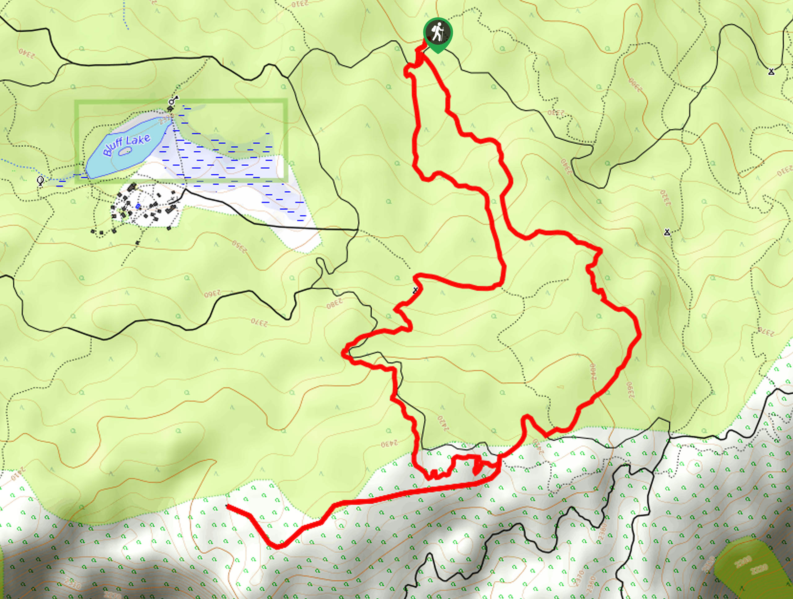
The starting point for the Skyline and Metcalf Meadow Loop Trail can be found 1.3mi northeast of Bluff Lake along Mill Creek Road.

About
| Backcountry Campground | Yellow Post #27 |
| When to do | May-November |
| Pets allowed | Yes - On Leash |
| Family friendly | Yes |
| Route Signage | Average |
| Crowd Levels | Low |
| Route Type | Lollipop |
Skyline and Metcalf Meadow Loop Trail
Elevation Graph
Weather
Skyline and Metcalf Meadow Loop Trail Description
Featuring some peaceful woodland terrain and scenic views, the Skyline and Metcalf Meadow Loop Trail is a great adventure if you are hoping to explore the SoCal landscape in a relatively easy manner. If you want to further explore the area after your hike, check out the nearby Plantation Trail to Grand View Point for a longer and more scenic adventure.
Setting out from the trailhead, you will enter into the tree cover and follow the path through the forest in a southeastern direction. After climbing uphill, you will eventually come to the Skyline Ridge, which will offer some beautiful views overlooking the Santa Ana River Valley.
Here, you will continue on to the southwest to a viewpoint with even more scenic views, before backtracking for the return leg. Turning more to the north, you will continue through the woodland landscape and descend past the Yellow Post #27 campsite, before eventually arriving back at the trailhead where you began.
Similar hikes to the Skyline and Metcalf Meadow Loop Trail hike

Bluff Mesa Hike
The Bluff Mesa Hike is a fantastic adventure in Southern California that features a lovely woodland setting and can be…

Palm View Peak Trail
The Palm View Peak Trail is a great hiking route in the San Bernardino National Forest that features a solid…

Cram Peak Ridge Trail
The Cram Peak Ridge Trail is a fantastic, albeit difficult, hiking route in the San Bernardino National Forest that will…
Comments