Nairn Falls Trail
View Photos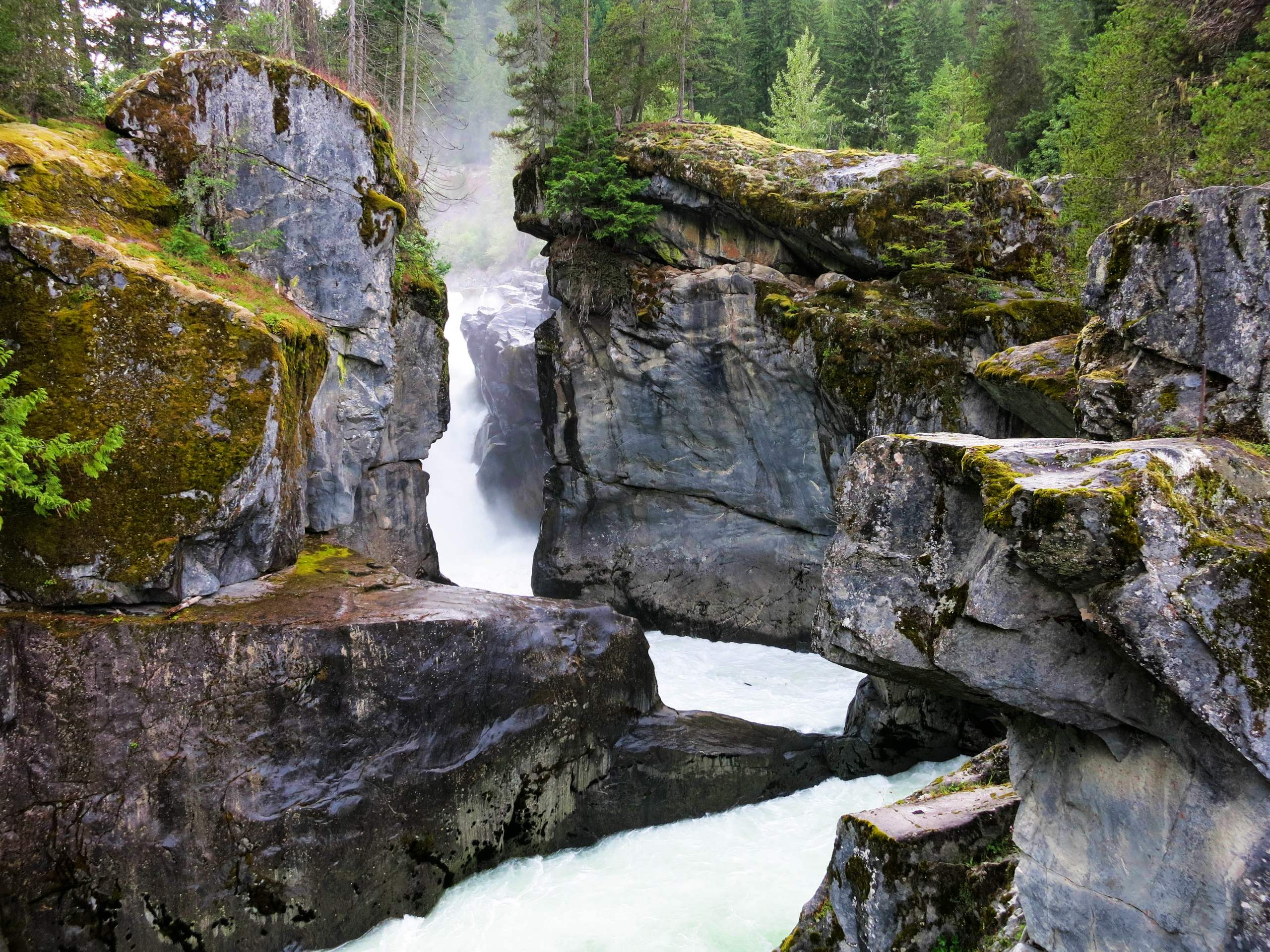
Nairn Falls Trail
Difficulty Rating:
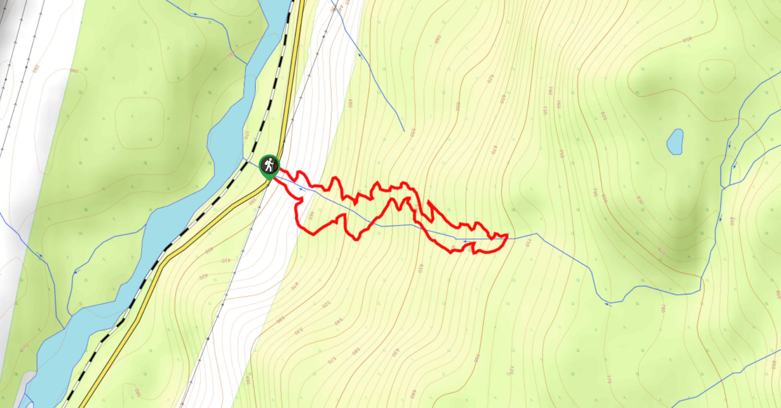
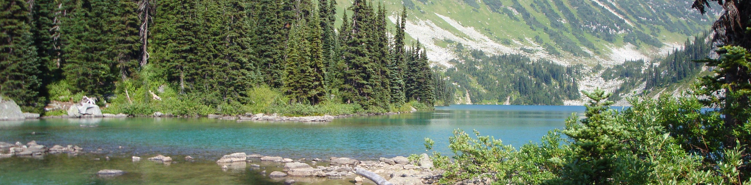
The Nairn Falls hike is a 1.6mi out-and-back route through Nairn Falls Provincial Park that follows closely along the banks of the Green River and ends up at the picturesque falls. This short trail will take hikers along a forested trail within earshot of the rushing waters of the river and visit several vantage points overlooking the cascading falls. This scenic route just off the highway is a great hiking option that the entire family will enjoy.
Getting there
To reach the parking area for the Nairn Falls Trail from Whistler, drive northeast on BC-99 N for 18.0mi and make a right turn onto Nairn Falls Park Road, where you will find the parking lot on your right.

About
| When to do | March-November |
| Backcountry Campsites | Nairn Falls Campground |
| Pets allowed | Yes - On Leash |
| Family friendly | Yes |
| Route Signage | Average |
| Crowd Levels | High |
| Route Type | Out and back |
Nairn Falls Trail
Elevation Graph
Weather
Nairn Falls Trail Description:
The Nairn Falls Trail is conveniently located just off the Sea to Sky Highway and the proximity of the falls to the parking area makes this a popular attraction with hikers of all skill levels. This, combined with the trail’s location next to the Nairn Falls Campground, means that the route can become populated with high levels of foot traffic. Make sure to arrive early enough if you want to secure a parking spot and beat the crowds to the scenic vantage points over the falls.
Even with the high volume of hikers along the trail, this quick hike is a great way to get off the road to stretch your legs and experience some of the beautiful sights that British Columbia has to offer. Hiking along this 1.6mi trail will provide you with some amazing woodland scenery as you make your way along the forested trail. Follow closely alongside the banks of the Green River with its torrenting water before experiencing the awesome sights of the rock formations that make up Nairn Falls. If you’re driving through the area, make sure to stop and check out this scenic hike near Pemberton.
Setting out on the trail from the parking area, make your way through the trees to the south to arrive at a junction in the trail. Follow this to the right to set out on a path towards the falls, keeping Green River on your left side. As you make your way along the densely forested trail, you will be able to hear the rushing water of the river as it courses beside you.
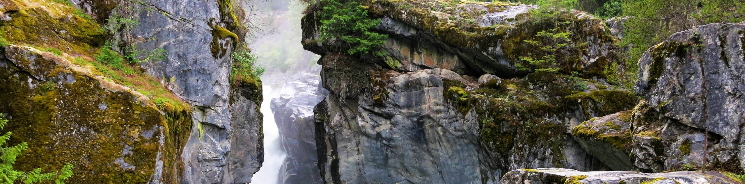
After crossing over two creeks, you will come to a rocky area that offers the first views of the upper portion of Nairn Falls. Make your way up to the platform to catch a glimpse of the rock formations before working your way down the rocky area towards a chain-link fence. To the left of the fence, you will find a path that allows you to access a lower viewing area for the falls. From here, you will be able to witness the rushing water as it cascades over the falls and into the canyon below. After taking in the views of the majestic Nairn Falls, make your way back along the same trail to return to the parking lot.
Hiking Route Highlights
Nairn Falls Provincial Park
Established in 1966, this 170 hectare park was created to protect and enhance visitor access to Nairn Falls. This rocky formation is a tiered waterfall that stands at 130ft tall with an average width of 30ft.
Frequently Asked Questions
Can you swim at Nairn Falls?
This stretch of the Green River is powerful and flows quickly, making it not suitable for swimming.
How far is Nairn Falls from Whistler?
Nairn Falls is located 18.0mi northeast of Whistler along BC-99.
Insider Hints
Arrive early to ensure you get a parking space and beat the crowds.
The terrain is fairly level but can become slippery, so remember to watch your footing.
The nearby Nairn Falls Campground is a great place to spend the weekend and enjoy the network of trails near the Pemberton Wetlands Wildlife Management Area.
Washrooms can be found next to the parking area.
Similar hikes to the Nairn Falls Trail hike
Cool Creek Canyon Hike
The Cool Creek Canyon Hike is a 1.3mi loop route near Pemberton that features spectacular mountain views and…
One Mile Lake Trail
Hiking around One Mile Lake will take you on a 4.3mi trek through the woodlands south of Pemberton.…
Hike to Rohr Lake
The hike to Rohr Lake is a fun 5.3mi out-and-back trail that traverses a variety of terrain, including…
Comments