Mount Currie Trail
View PhotosMount Currie Trail
Difficulty Rating:
The Mount Currie Trail is a tough uphill grind that will take hikers through a series of gruelling switchbacks before a technical scramble to the summit. This 12.3mi out-and-back trail leads through beautiful forests and spectacular alpine terrain, capping off with unbeatable mountaintop views from the summit of this rugged peak. This route is physically exhausting, so remember to pack lots of water for the journey.
Getting there
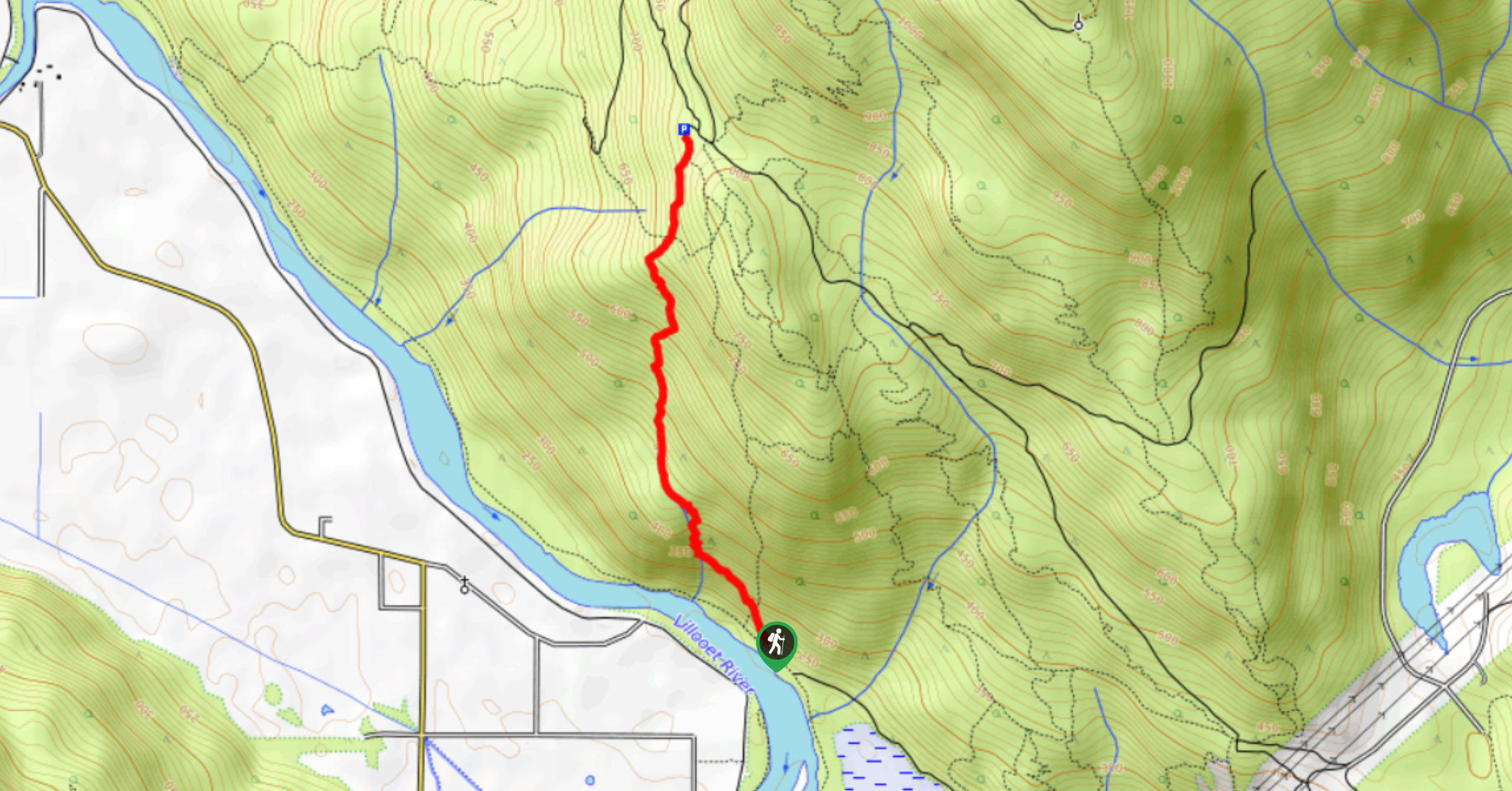
To get to the trailhead for the Mount Currie Trail from Pemberton, head southwest on BC-99 S for 5.7mi and turn left into the Green River MX Park. Keep right and follow the dirt road south as it skirts around the Pemberton Speedway. Continue straight along the dirt road and into the forest, where you will soon arrive at a bridge over the Green River. Park your vehicle here and cross over the bridge to find the trailhead off to the left.

About
| When to do | June–October |
| Backcountry Campsites | No |
| Pets allowed | No |
| Family friendly | No |
| Route Signage | Average |
| Crowd Levels | Low |
| Route Type | Out and back |
Mount Currie Trail
Elevation Graph
Weather
Mount Currie Trail Description
The Mount Currie Trail is a challenging full-day hiking route near Pemberton that climbs fiercely uphill along a series of switchbacks before a technical and exhausting scramble to the summit. Hikers should make sure to bring plenty of water along the trail, as there are few sources, especially after leaving the forest and entering the alpine landscape. The upper portions of the trail contain loose rock and large boulders that will slow your travel time. Make sure to wear sturdy hiking footwear and bring any equipment, such as hiking poles or microspikes, to help traverse the technical terrain. Additionally, this trail can be extremely buggy, with black flies being prominent in the alpine terrain. Bring bug spray and wear adequate clothing to protect yourself from being bitten.
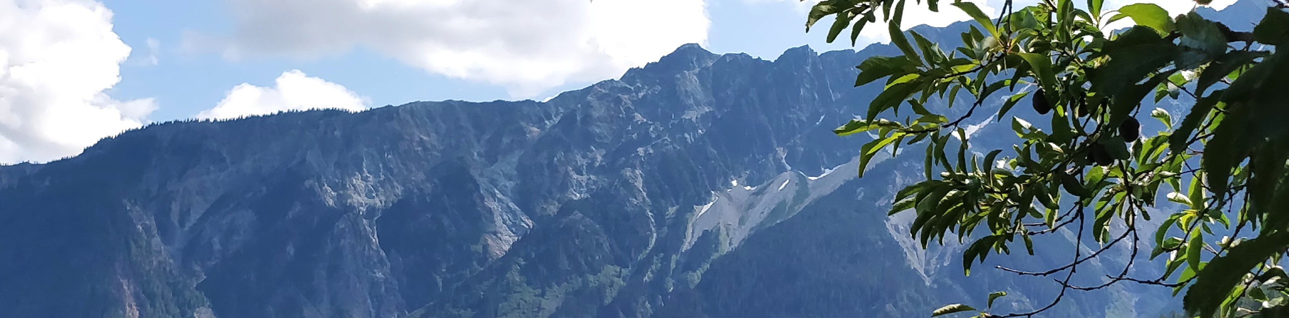
Although this trail is long, difficult, and physically demanding, the views from the summit are absolutely breathtaking. As you set out on the trail, you’ll climb through the beautiful West Coast forest on a series of switchbacks to gain a large chunk of elevation. After breaking through the tree cover and entering into alpine terrain, you’ll experience scenic views that stretch across the valley to the south and west, as well as the rugged mountain ranges to the north and east. From this point on the trail, you’ll traverse some more technical terrain on an intense scramble past the false summit on the way to the breathtaking peak of Mount Currie. From this eagle’s perch high in the mountains, you will have views that stretch out in every direction and provide you with a better perspective of the rugged expanse of southwest British Columbia’s natural beauty. This is a truly unfathomable hike that you won’t want to miss out on.
From the parking area, set out on the trail as it crosses over a creek and winds through the forest to the north before turning east. Here, the trail will climb sharply uphill through a series of switchbacks that will see you gain a lot of elevation until you break out into the alpine. At this point, you will have some pretty awesome views of the valley to the south and west and rugged mountains to the north and east. Continuing on the trail, you will skirt around the western edge of the first false summit known as Currie W1. Keep an eye on your GPS for this upper portion of the trail, as the route gets a bit more technical and difficult to navigate.
As you make your way across the rocky terrain, you will eventually come to a ridge leading straight up to the summit of Mount Currie. With your goal straight ahead of you, begin your ascent of the steeply inclined ridge as you climb up through the beautiful alpine landscape. This route will be physically demanding, and the trail is fairly technical, with large boilers and loose rock scattered along the ridge. There is no correct route to the summit, so keep along the ridge and take the easiest route to navigate your way to the top.
When you reach the summit of Mount Currie, you will be inundated with panoramic views that stretch out over the surrounding wilderness and paint an unbelievable picture of the rugged BC landscape. After taking in the spectacular views of the mountain ranges surrounding Pemberton and Garibaldi Provincial Park to the south, head back down the Mount Currie Trail to return to the parking area next to Green River.
Trail Highlights
Mount Currie
Named after John Currie, the first non-indigenous settler in the Pemberton Valley, at 8501ft Mount Currie dominates the skyline in the area and can even be seen from as far away as the Whistler-Blackcomb Ski Area. The Mountain stands as the northernmost summit of the Garibaldi Ranges.
Insider Hints
Bring plenty of water, as there are few sources along the trail.
Bring microspikes or crampons to help with any icy conditions on the scramble to the summit.
Bring bug spray, as flies can be terrible once you reach the alpine.
Similar hikes to the Mount Currie Trail hike
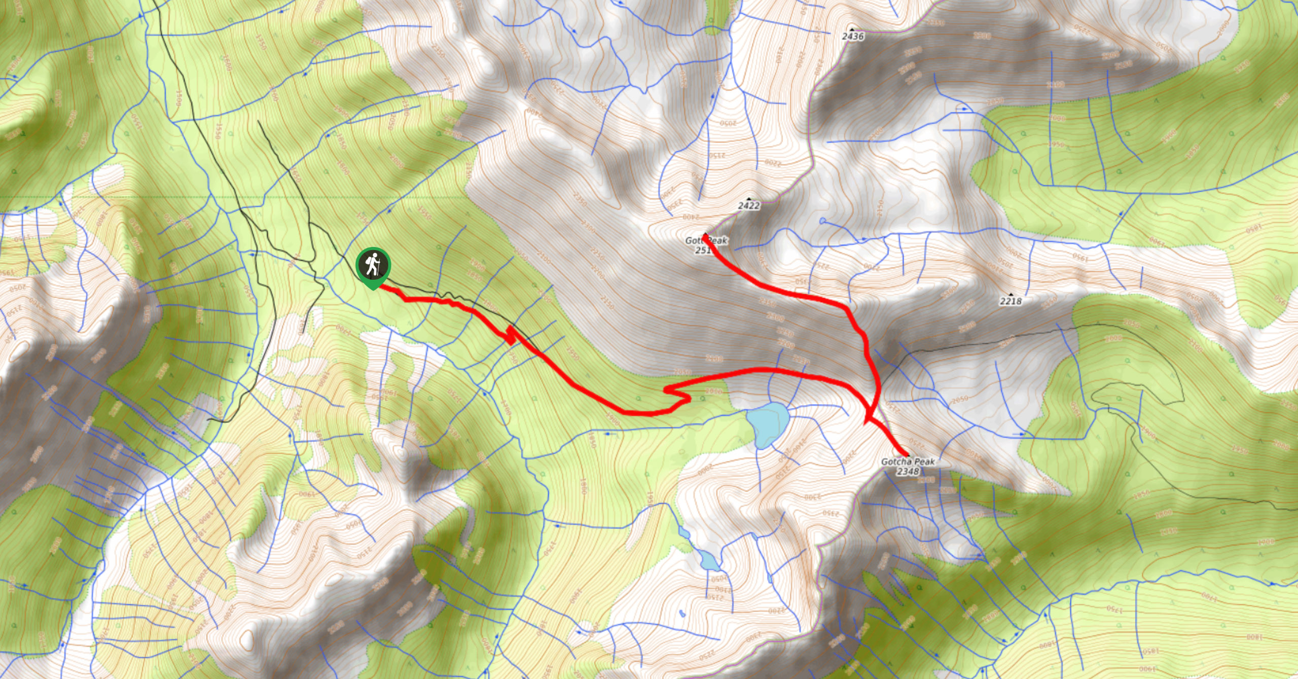
Blowdown Pass to Gott Peak
Blowdown Pass to Gott Peak is a difficult out-and-back trail that climbs uphill to summit Gotcha and Gott Peaks. Along…
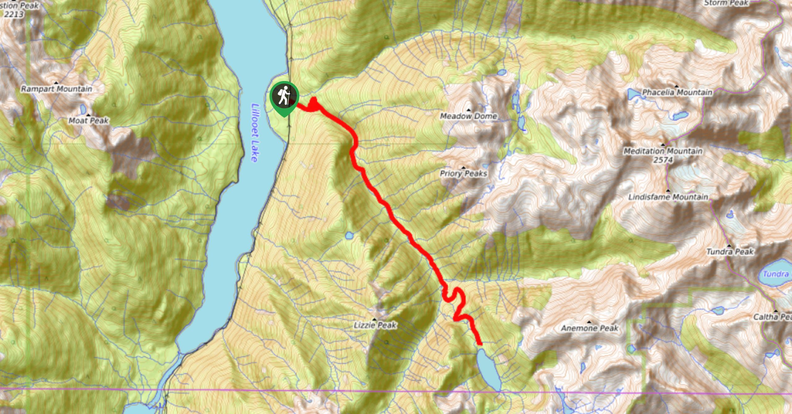
Lizzie Lake Trail
The Lizzie Lake Trail is a 14.7mi out-and-back hiking route southeast of Pemberton, BC, that climbs uphill through…
Cloudbase Grind
The Cloudbase grind is a difficult uphill hiking route northeast of Pemberton that can be likened to Vancouver’s Grouse Grind…
Comments