
Cloudbase Grind
View PhotosCloudbase Grind
Difficulty Rating:
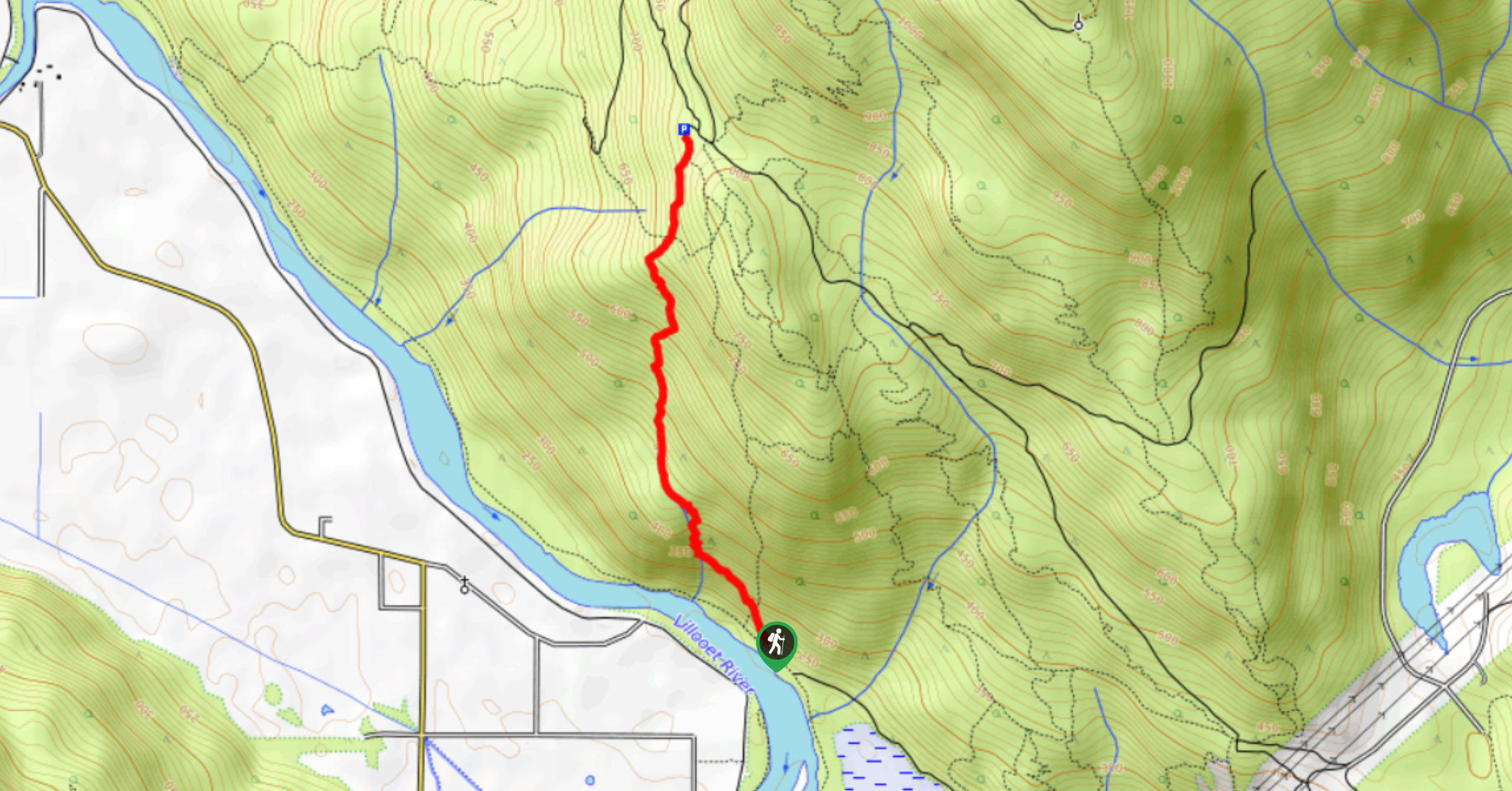
The Cloudbase grind is a difficult uphill hiking route northeast of Pemberton that can be likened to Vancouver’s Grouse Grind in its intensity. The point-to-point trail climbs sharply uphill through the forest to provide amazingly scenic views over the valley from a paragliding launch point. Make sure to bring lots of water for this leg burner of a trail.
Getting there
To reach the trailhead for the Cloudbase Grind from Pemberton, drive northeast on Aspen Blvd for 919ft and turn right onto Oak St. Continue for 1312ft, where you will make a left onto Urdal Road. Finding the parking area on your right, you’ll then travel on foot to reach the trailhead. Follow the path to the east to cross over the river. After making your way over the bridge, take the first trail to the left to make your way along the Mackenzie Basin Loop, where you’ll find the Cloudbase Grind trailhead in roughly 1969ft.

About
| When to do | May–October |
| Backcountry Campsites | No |
| Pets allowed | Yes - On Leash |
| Family friendly | No |
| Route Signage | Poor |
| Crowd Levels | Low |
| Route Type | One Way |
Cloudbase Grind
Elevation Graph
Weather
Cloudbase Grind Trail Description
The Cloudbase Grind is a short 1.5mi hiking route north of Pemberton that climbs sharply uphill from the banks of the Lillooet River to a beautiful viewpoint overlooking the valley. Originally created as an access route for paragliders to reach their launch point, the route is also used as a point-to-point hiking route and should not be attempted as a downhill bike trail due to the steep grade.
This hike is similar to Vancouver’s famous Grouse Grind in that it packs quite a large elevation gain of 1752ft into a very short distance. Due to the trail’s steepness, this route is not recommended for young or beginner hikers, and those looking to utilize the trail should make sure to wear proper hiking footwear. This trail is a bit tough on the legs, but the views from the top are definitely worth the effort.
Similar hikes to the Cloudbase Grind hike
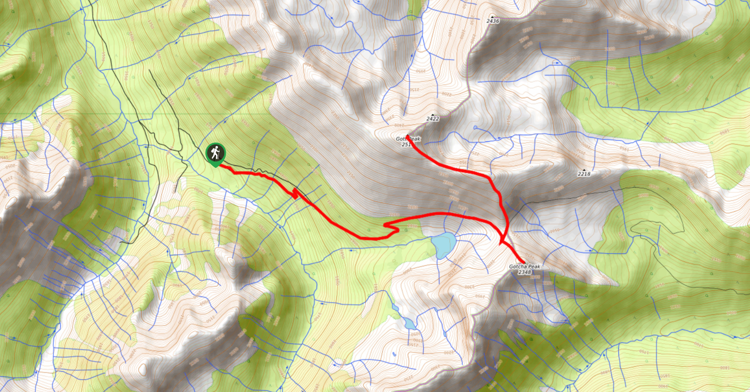
Blowdown Pass to Gott Peak
Blowdown Pass to Gott Peak is a difficult out-and-back trail that climbs uphill to summit Gotcha and Gott Peaks. Along…
Cool Creek Canyon Hike
The Cool Creek Canyon Hike is a 1.3mi loop route near Pemberton that features spectacular mountain views and…
One Mile Lake Trail
Hiking around One Mile Lake will take you on a 4.3mi trek through the woodlands south of Pemberton.…
Comments