Cheviot Hills Circular Walk
View Photos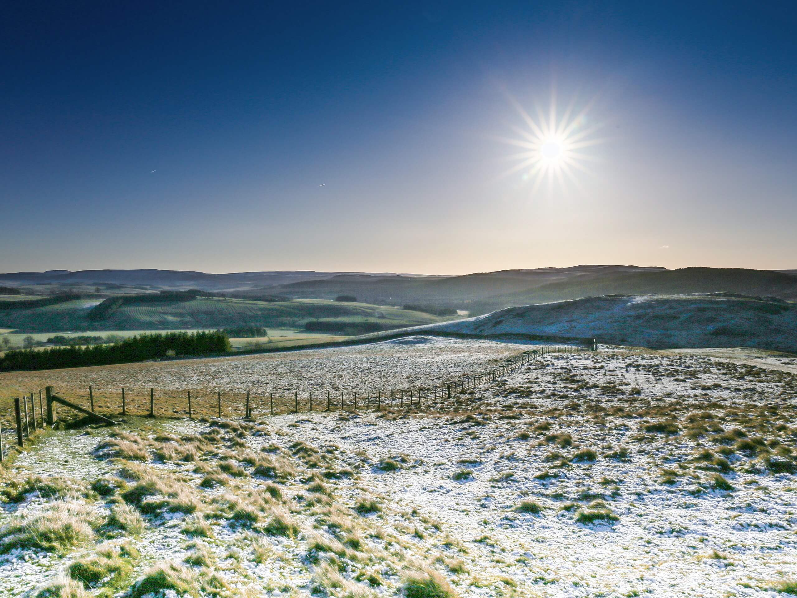
Cheviot Hills Circular Walk
Difficulty Rating:
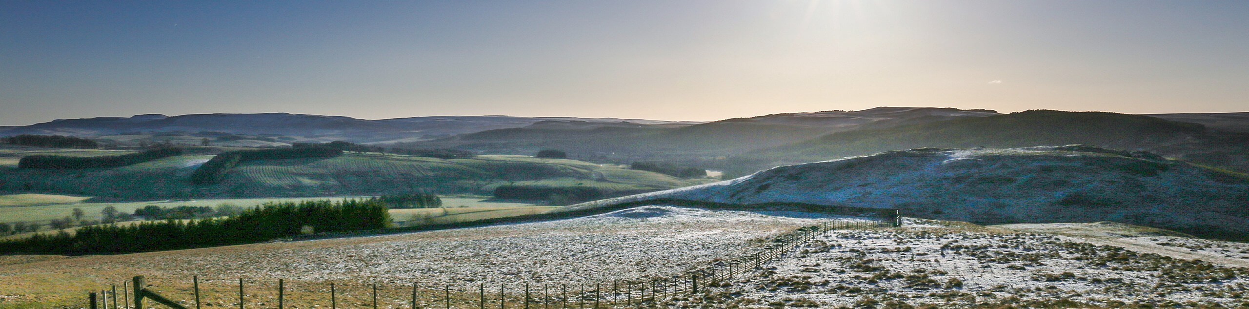
The Cheviot Hills Circular Walk is an absolutely breathtaking adventure that will take you through a rugged stretch of upland terrain in Northumberland. While out walking the trail, you will climb uphill in order to traverse a number of summits including Scald Hill, The Cheviot, and Cairn Hill, where you will experience jaw-dropping views of the surrounding landscape of Northumberland National Park. Walkers should take note that the terrain here can be quite boggy, so be sure to wear proper waterproof walking boots.
Getting there
The trailhead for the Cheviot Hills Circular Walk can be found 3.1mi southwest of Middleton hall, at a roadside car park next to Harthope Burn.

About
| Backcountry Campground | No |
| When to do | Year-Round |
| Pets allowed | Yes - On Leash |
| Family friendly | No |
| Route Signage | Average |
| Crowd Levels | High |
| Route Type | Circuit |
Cheviot Hills Circular Walk
Elevation Graph
Weather
Cheviot Hills Circular Walk Description
Featuring some steep, rugged, and often wet terrain, the Cheviot Hills Circular Walk will definitely require you to wear proper walking boots, preferably a pari that are waterproof. While the trail is fairly well laid out and straight forward, you might want to bring a GPS or trail map in the event that you lose your way. Lastly, be sure to bring plenty of water and snacks, as this is a lengthy trail that can be quite physically demanding at times.
If you fancy a rugged adventure that will take you across an extinct stratovolcano that doubles as the highest point in Northumberland County, then the Cheviot Hills Circular Walk will be the perfect route for you. In addition to trekking through some challenging terrain, you will also experience some breathtaking views across the north of England, making for a memorable, albeit challenging day on the trails.
Setting out from the car park alongside Harthope Burn, you will head to the southwest along the road for 0.2mi, before picking up the footpath on your right. Taking the left path at the first fork, you will begin climbing up the hillside for the next 1.5mi, where you will eventually come to the summit of Scald Hill. Here, you will enjoy sweeping views across the valley, before continuing on to the southwest towards The Cheviot.
After climbing slightly further uphill, you will come to the top of what was once a Stratovolcano that erupted during the Devonian Period, roughly 419 million years ago.Continuing to the southwest across the plateau that makes up the summit of The Cheviot, you will eventually traverse Cairn Hill, heading left at the fork in the path to begin making your way down the hillside.
Here, you will keep right along the path as it bends to the east and climbs gently back uphill, bringing you to the top of Comb Fell. This final leg of the walk will see you traverse some undulating terrain, as you make your way to the northeast across the rugged expanse of Hedgehope Hill. Once you have descended the opposite side, you will continue on to the northeast to traverse the open landscape, eventually crossing over Harthope Burn to return to the car park where you began the Cheviot Hills Circular Walk.
Trail Highlights
The Cheviot
Situated in the rugged northern section of Northumberland County, The Cheviot is an extinct stratovolcano and the highest summit of the Cheviot Hills at 2674ft above sea level. Terrain atop the triangular plateau of the hill is fairly rough as it is covered largely in peat quagmires, and the views form the summit are somewhat obscured due to the flat nature of the plateau. The Cheviot is the last major summit along the Pennine Way, before crossing over the Scottish border and descending into Kirk Yetholm.
Frequently Asked Questions
Was the Cheviot a volcano?
Yes, the Cheviot is an extinct stratovolcano that erupted sometime during the early Devonian Period.
Are the Cheviot Hills in Scotland or England?
A rugged highland range that extends over 30 miles, the Cheviot Hills denote the border between Scotland and England.
Insider Hints
Arrive early, as parking at the trailhead can be limited.
Wear waterproof walking boots, as a good portion of the terrain is boggy.
Bring plenty of water and snacks to stay fuelled on your adventure.
Similar hikes to the Cheviot Hills Circular Walk hike

Hadrian’s Wall: Steel Rigg to Lanercost
Walking Hadrian’s Wall: Steel Rigg to lanercost is a fantastic - albeit lengthy - adventure that will lead you across…

Hadrian’s Wall: Wallsend to Heddon on the Wall
Hadrian’s Wall: Wallsend to Heddon on the Wall is the first section of the long distance Hadrian’s Wall Path walking…
Devil’s Water Circular Walk
The Devil’s Water Circular Walk is a laidback excursion in Northumberland that will take you through the countryside surrounding a…
Comments