Thrunton Wood Extended Circular Walk
View Photos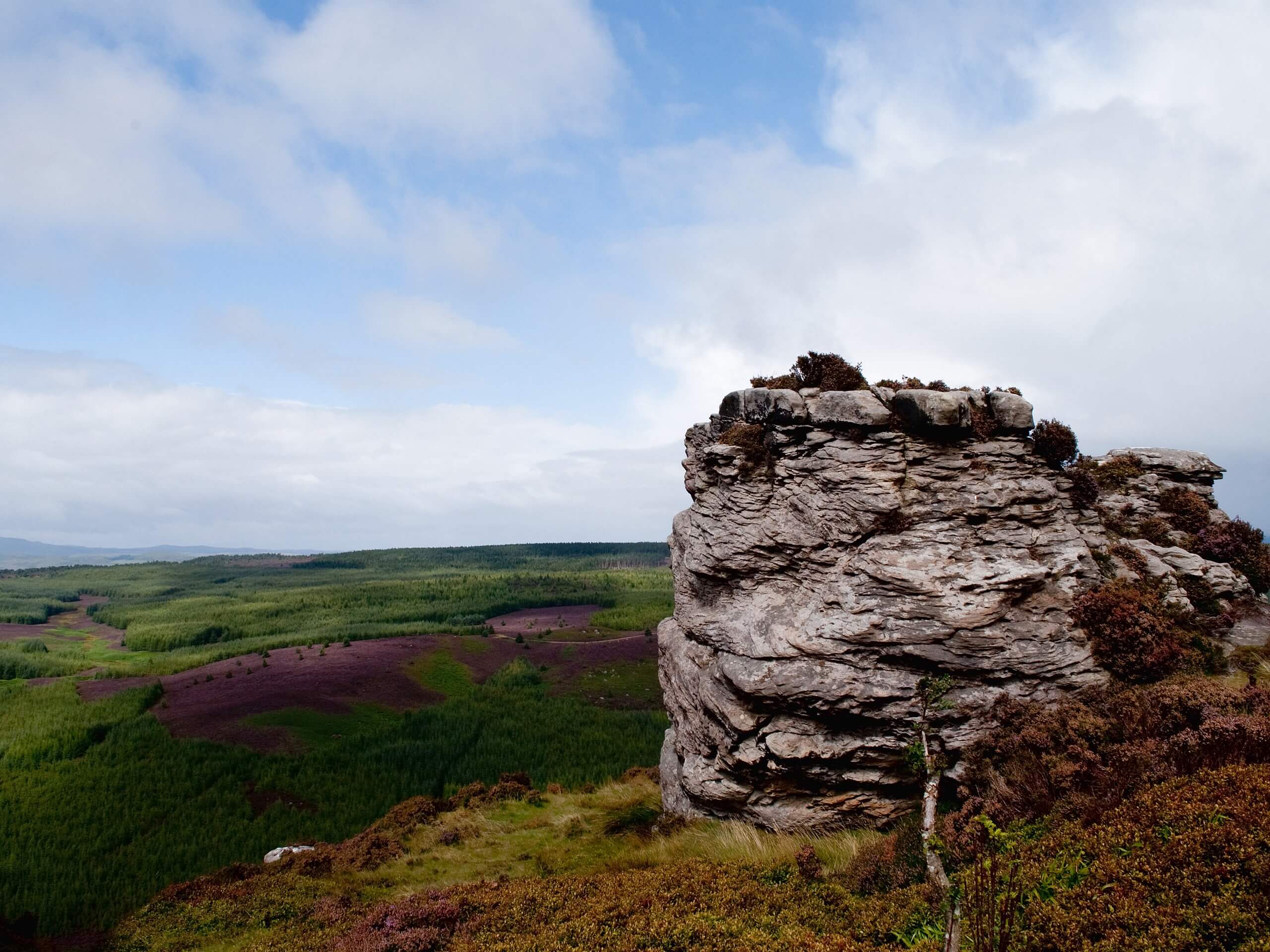
Thrunton Wood Extended Circular Walk
Difficulty Rating:
The Thrunton Wood Extended Circular Walk is a laidback intermediate length trail in Northumberland that will lead you through a charming stretch of woodland terrain that will allow you to reconnect with nature. While out walking the trail, you will stroll along tree lined pathways while taking in the peaceful atmosphere and plentiful wildlife of Thrunton Wood. This is an excellent walking route for those who aren’t overly concerned with breathtaking vistas and care more about staying in tune with the outdoors.
Getting there
The trailhead for the Thrunton Wood Extended Circular Walk can be found at the Thrunton Wood car park, just 3.1mi southeast of Whittingham.

About
| Backcountry Campground | No |
| When to do | Year-Round |
| Pets allowed | Yes - On Leash |
| Family friendly | Yes |
| Route Signage | Average |
| Crowd Levels | Moderate |
| Route Type | Circuit |
Thrunton Wood Extended Circular Walk
Elevation Graph
Weather
Thrunton Wood Extended Circular Walk Description
While the Thrunton Wood Extended Circular Walk isn’t an overly challenging adventure, it does feature some forest terrain that can be rocky and uneven at times. Be sure to wear proper walking footwear, particularly water-resistant shoes if you are completing the walk after a period of heavy rainfall.
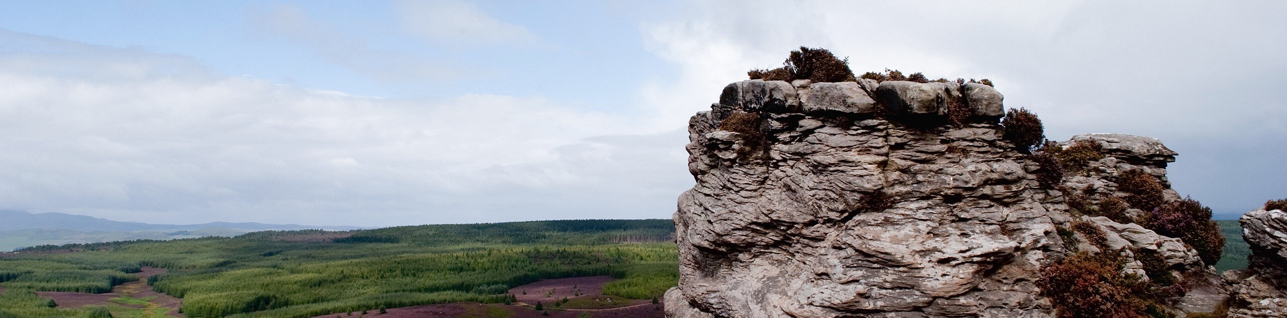
With such a tranquil woodland setting and a few pleasant views from the top of the hill, the Thrunton Wood Extended Circular Walk should definitely be a more popular adventure; however, as it currently stands, the low volumes of foot traffic really do add to the lovely nature of this trail. If you are looking to escape the chaos of the outside world and soak up a bit of nature, then this is a great route for you.
Setting out from the car park, you will head west into the dense cover of the forest and follow the trail to the north for 0.4mi to arrive at a junction. Here, you will pass straight through and gently descend the hillside, keeping left in order to work your way around the forested slope of the hill.
After 1.7mi along this route, the path will bend to the southeast and climb back uphill, bringing you out of the forest for some lovely views of the surrounding Northumberland landscape. Continuing on to the southeast, you will enter back into the tree cover and follow the path south, where you will meet up with a winding stream that flows downhill to meet Cow Burn.
Here, you will follow the path as it turns to the east and runs parallel to the banks of the burn, winding through the wonderfully atmospheric forest to the sound of flowing water. After 0.7mi of walking along the water’s edge, ther trail will bend to the north to continue to the forest.
Keeping right for the next 0.8mi, be sure to take your time and appreciate the natural beauty of the forest, as you will soon arrive back at the edge of the road for the final leg of the walk. Turning left along the road, you will follow it north past the Thrunton Woods Tea Room, continuing on for 0.6mi to arrive back at the car park where you started your journey along the Thrunton Wood Extended Circular Walk.
Insider Hints
Wear proper walking boots, as there are a few inclines and rocky sections along the trail.
The Thrunton Woods Tea Room near the end of the trail is a great place for some post-walk refreshments.
Similar hikes to the Thrunton Wood Extended Circular Walk hike

Hadrian’s Wall: Steel Rigg to Lanercost
Walking Hadrian’s Wall: Steel Rigg to lanercost is a fantastic - albeit lengthy - adventure that will lead you across…

Hadrian’s Wall: Wallsend to Heddon on the Wall
Hadrian’s Wall: Wallsend to Heddon on the Wall is the first section of the long distance Hadrian’s Wall Path walking…

Scotch Gill Woods Walk
The Scotch Gill Woods Walk is a short and easy-going adventure in Morpeth, Northumberland that will take you through a…
Comments