
Wykeham Forest Trail
View Photos
Wykeham Forest Trail
Difficulty Rating:
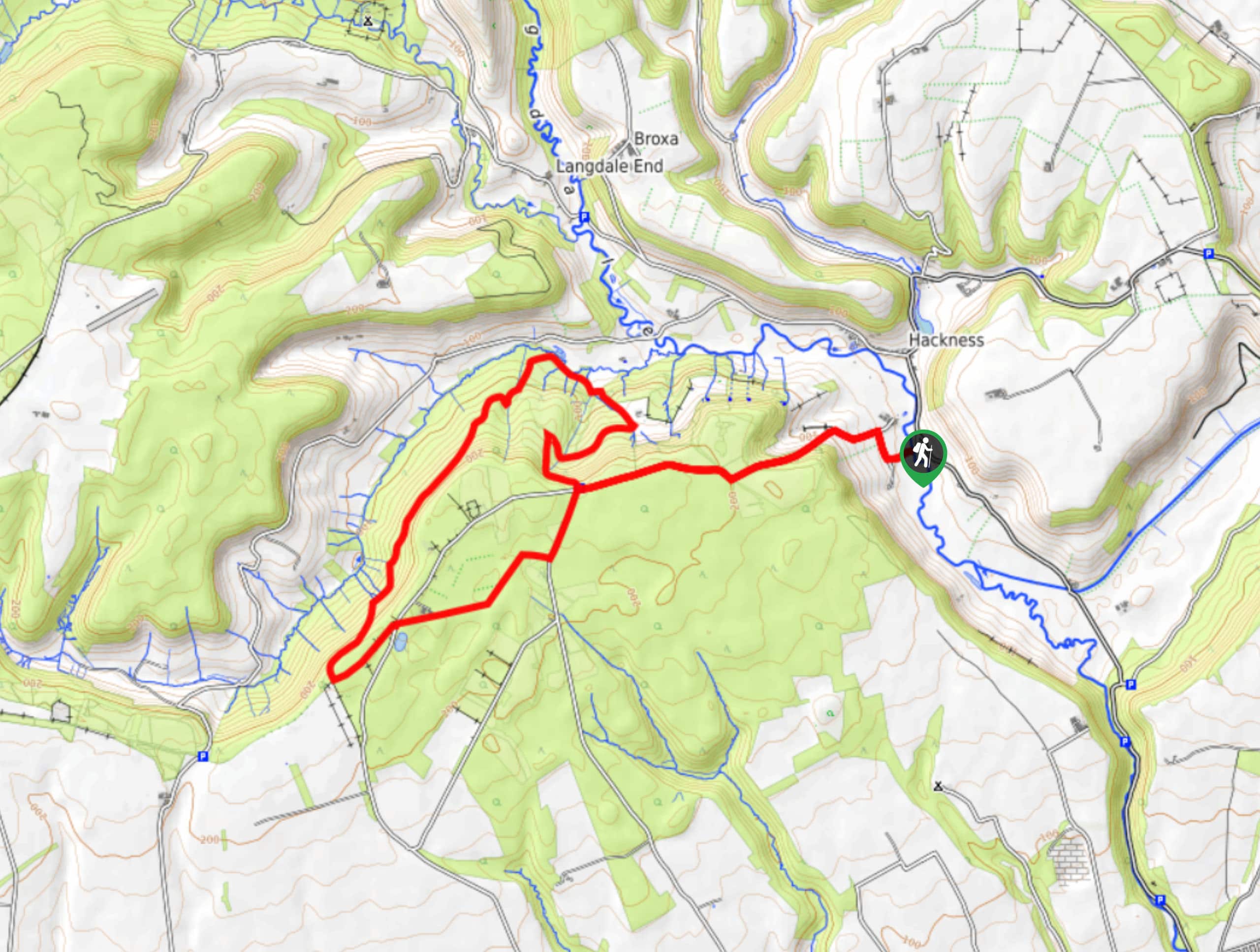
The Wykeham Forest Trail is a fantastic walking route in the southeast corner of North York Moors National Park that will lead you through a tranquil stretch of woodland terrain. Along the trail, you will pass through peaceful forests and traverse the undulating landscape, getting a good amount of exercise while staying under the shade of the tree cover. While there are some climbs and descent throughout the route, this is a great walk for both beginners and seasoned explorers alike.
Getting there
To reach the trailhead for the Wykeham Forest Trail from East Ayton, head north on Castlegate for 0.1mi and keep straight onto Seavegate for another 1.6mi. Make a left onto Mowthorpe Road and follow it for 1.6mi before making another left. Continue on for 0.1mi to find a layby for parking.

About
| Backcountry Campground | No |
| When to do | Year-Round |
| Pets allowed | Yes - On Leash |
| Family friendly | Older Children only |
| Route Signage | Average |
| Crowd Levels | Moderate |
| Route Type | Lollipop |
Wykeham Forest Trail
Elevation Graph
Weather
Wykeham Forest Trail Description
As the name implies, the Wykeham Forest Trail will take you through a vast stretch of woodland terrain that limits the chance of any truly scenic views. What it does offer though is the chance to explore the tranquil forests of the North York Moors and still get a good amount of exercise while traversing the undulating terrain that can be found here.
Setting out from the trailhead, you will head to the west along the Lang Gate and climb uphill to enter into the cover of the forest. After reaching the viewpoint at Highwood Brow, head left along Cross Lane and follow it through the forest to reach the southwest corner of the route.
From here, you will make your way to the northeast along the edge of the hillside, before making your way downhill to explore a particularly dense area of the woods. Climbing back uphill, you will once again pass by Highwood Brow, turning to the east along your initial route to follow it back to the trailhead where you began the Wykeham Forest Trail.
Similar hikes to the Wykeham Forest Trail hike

Kirkbymoorside and Gillamoor Walk
The Kirkbymoorside and Gillamoor Walk is a great outdoor excursion along the southern edge of North York Moors National Park…

Farndale Railway Walk to Blakey Ridge
The Farndale Railway Walk to Blakey Ridge is a lengthy but easy-going route that will allow you to experience the…

Botton and Blakey Ridge Circular Walk
The Botton and Blakey Ridge Circular Walk is a rugged and beautiful adventure that will allow you to experience the…
Comments