Staithes and Port Mulgrave Walk
View Photos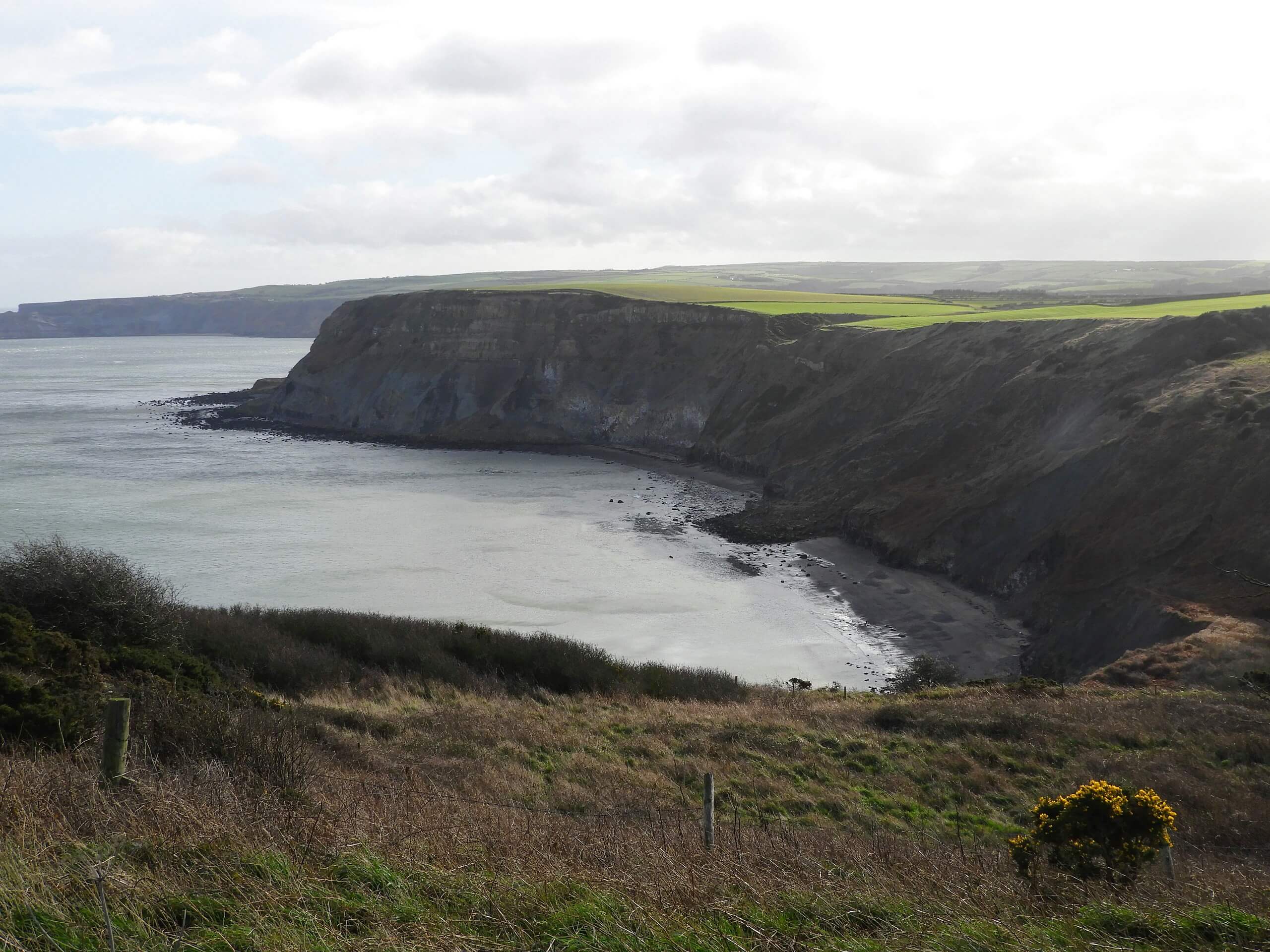
Staithes and Port Mulgrave Walk
Difficulty Rating:
The Staithes and Port Mulgrave Walk is a fun circular walking route that offers some beautiful views of the coastal areas of North York Moors National Park. While out walking the trail, you will pass through the historic seaside village of Staithes and walk along the coast to enjoy views of the North Sea, before passing through Port Mulgrave and traversing the open countryside. This is a fantastic walk that is suitable for walkers of nearly every skill level.
Getting there
The trailhead for the Staithes and Port Mulgrave Walk can be found along Staithes Lane, just before entering the old village. The Bank Top car park can be found close by.

About
| Backcountry Campground | No |
| When to do | Year-Round |
| Pets allowed | Yes - On Leash |
| Family friendly | Yes |
| Route Signage | Average |
| Crowd Levels | Moderate |
| Route Type | Circuit |
Staithes and Port Mulgrave Walk
Elevation Graph
Weather
Staithes and Port Mulgrave Walk Description
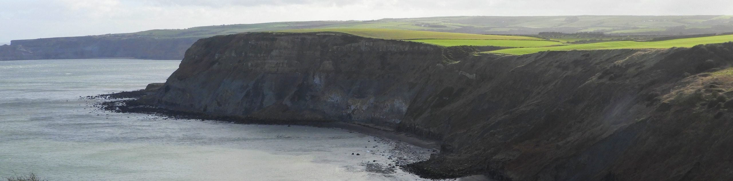
If you are looking for a pleasant coastal walk within North York Moors National Park that features some amazing views of the North Sea in addition to historic seaside villages, then the Staithes and Port Mulgrave Walk is a fantastic option to get out and explore the outdoors.
Setting out from the trailhead, you will make your way to the north and pass through the charming old village of Staithes, enjoying the views of the historic buildings, shops, and harbour, before turning to the southeast along the Cleveland Way. Here, you will traverse open fields and take in some beautiful North Sea views along the rugged coastal terrain on the way to Port Mulgrave.
After reaching the small village, you will turn to the west and once again pass through some picturesque farm fields to eventually arrive at the wooded expanse of the Oakridge Wood Nature Reserve. Continue on to the northwest and make your way through the reserve, relaxing in the tranquil forest atmosphere until you reach the bridge at Roxby Lane. From here, you will turn to the northeast and make your way through Staithes to return to the trailhead where you began.
Similar hikes to the Staithes and Port Mulgrave Walk hike

Kirkbymoorside and Gillamoor Walk
The Kirkbymoorside and Gillamoor Walk is a great outdoor excursion along the southern edge of North York Moors National Park…

Farndale Railway Walk to Blakey Ridge
The Farndale Railway Walk to Blakey Ridge is a lengthy but easy-going route that will allow you to experience the…

Botton and Blakey Ridge Circular Walk
The Botton and Blakey Ridge Circular Walk is a rugged and beautiful adventure that will allow you to experience the…
Comments