
Roseberry Topping Circular Walk
View Photos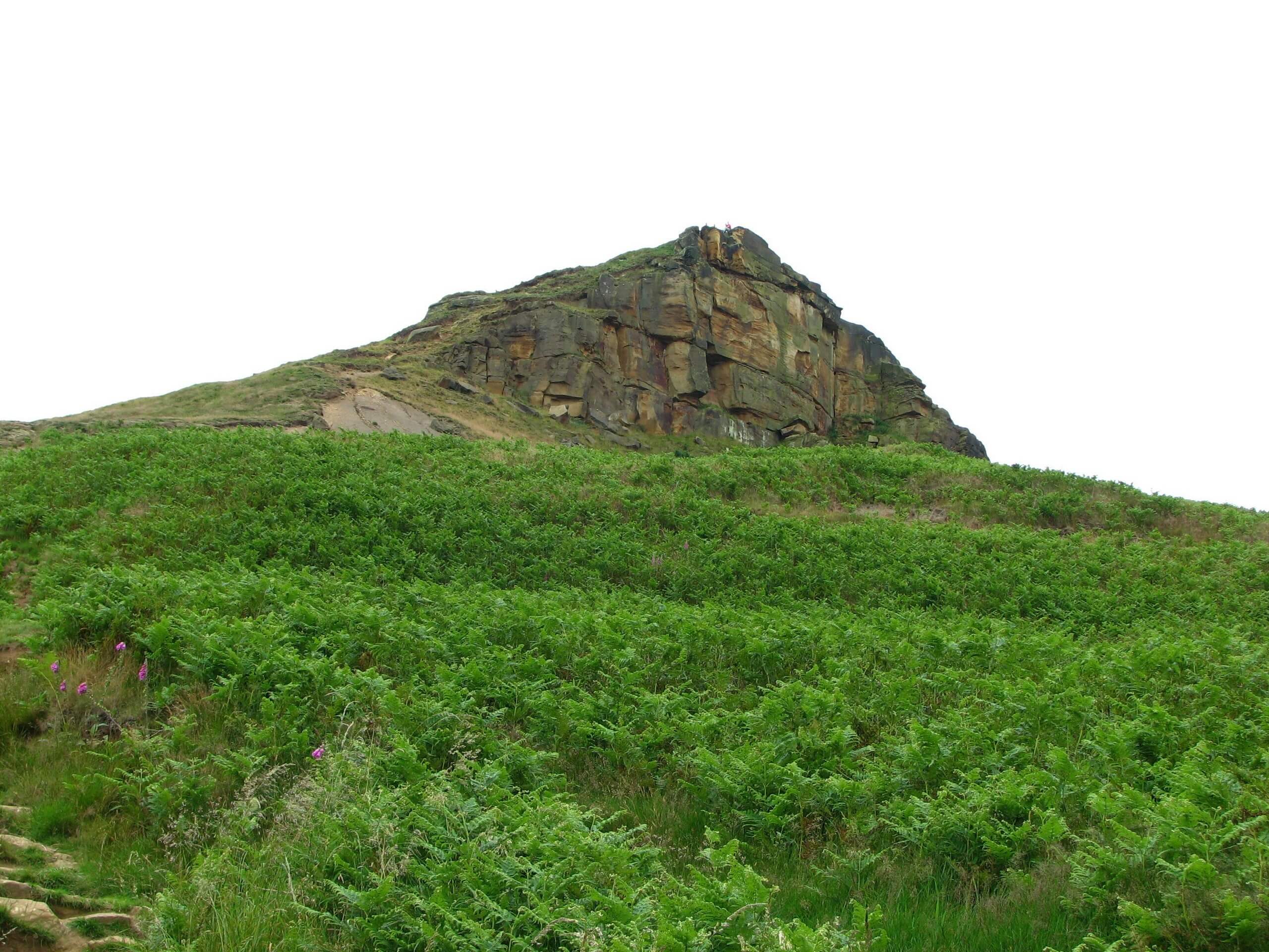
Roseberry Topping Circular Walk
Difficulty Rating:
The Roseberry Topping Circular Walk is a spectacular excursion in the North York Moors that will take you uphill for some breathtaking views across the surrounding area. While out walking the trail, you will work your way uphill along the slopes of this instantly recognizable and much-loved local landmark to enjoy sweeping views across the moors from the summit. This walk is a great childhood memory for many people in the area, including the famous Captain Cook who was born on a farm nearby in 1736.
Getting there
To reach the trailhead for the Roseberry Topping Circular Walk from Great Ayton, head north on Guisborough Road for 0.6mi and take the first exit at the roundabout onto Newton Road. Follow this for 1mi and turn right to enter the car park.

About
| Backcountry Campground | No |
| When to do | March-October |
| Pets allowed | Yes - On Leash |
| Family friendly | Older Children only |
| Route Signage | Average |
| Crowd Levels | Moderate |
| Route Type | Lollipop |
Roseberry Topping Circular Walk
Elevation Graph
Weather
Roseberry Topping Circular Walk Description:
Offering picturesque views across Middlesbrough and the North York Moors, the Roseberry Topping Circular Walk is a local favourite for many outdoor enthusiasts, and while the route is short, there are a few things to consider before setting out. It is a fairly steep climb up to the summit of the hill and its slopes can become very muddy/slippery after a good rainfall, so make sure to exercise caution in these conditions and wear sturdy walking footwear. Additionally, there are a number of intersecting paths along the route that allow you to choose your way up to the summit; however, they can also be confusing at times. Bring a trail map to stay on the correct path. Lastly, parking at the trailhead can fill up early, so be sure to arrive early to secure a space.
Even with all of this in mind, this is a spectacular walking route that will allow you to fully appreciate the natural beauty of the North York Moors and the surrounding landscape. While some sections are steep, overall the paths are well-maintained and are suitable for all ages, making this a great option to get the entire family together to explore the outdoors.
Setting out from the car park, you will head to the east along Roseberry Lane in order to reach the foot of the hill. Head through the kissing gate and make your way through Newton Wood, climbing uphill along the steps and heading south for a short distance, before pushing up to the summit of the hill.
Take some time to enjoy the broad views that sweep across the moor and north towards Middlesbrough, before heading east to descend the hillside over Little Roseberry, continuing on a bit further to the southeast for some awesome views across the moor. From here, you will turn back to the northwest to continue your descent of the hillside, traversing the sparsely forested lower slopes of Roseberry Topping to arrive back at Newton Wood. Make your way through the kissing gate and follow the lane back to the car park where you began the Roseberry Topping Circular Walk.
Trail Highlights
Roseberry Topping Hill
At 1050ft high, Roseberry Topping isn’t the tallest point in the North York Moors; however, it is one of the most distinctive. Its instantly recognizable shape is the result of a geological fault and a 1912 mining collapse that caused a landslip. It is also an historically important site in the area, with both Bronze and Iron Age remains having been found along its slopes.
Insider Hints
There are a number of intersecting paths along the slope of the hill, allowing you to choose your own route up to the summit.
Paths can be very slippery/muddy after a good rainfall.
Arrive early, as parking can be limited at the trailhead.
Toilet facilities can be found next to the car park.
Similar hikes to the Roseberry Topping Circular Walk hike

Kirkbymoorside and Gillamoor Walk
The Kirkbymoorside and Gillamoor Walk is a great outdoor excursion along the southern edge of North York Moors National Park…

Farndale Railway Walk to Blakey Ridge
The Farndale Railway Walk to Blakey Ridge is a lengthy but easy-going route that will allow you to experience the…

Botton and Blakey Ridge Circular Walk
The Botton and Blakey Ridge Circular Walk is a rugged and beautiful adventure that will allow you to experience the…
Comments