
Mount MacPherson
View Photos
Mount MacPherson
Difficulty Rating:
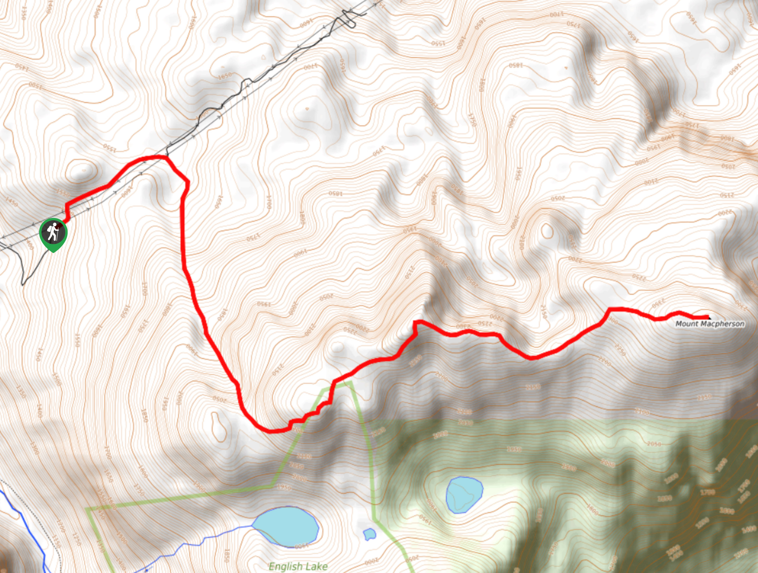
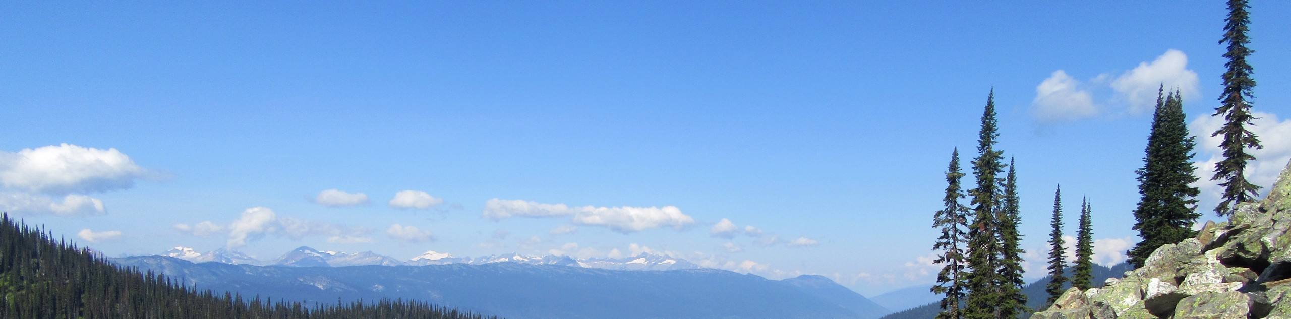
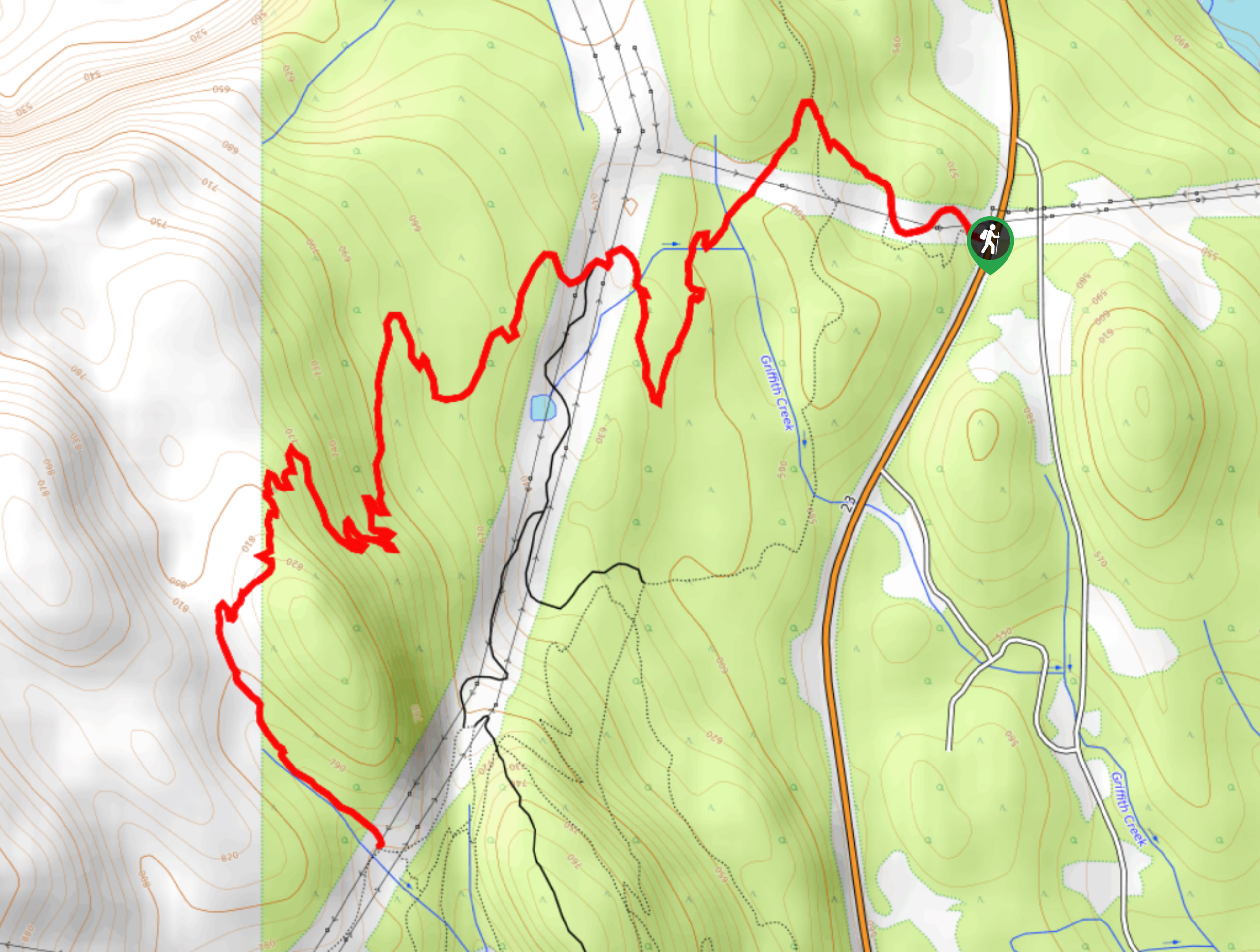
The trek up Mount MacPherson is a challenging 9.8mi hiking route that will see you traverse exposed sections of trail and climb up false summits to reach the peak overlooking the Revelstoke area. Due to the technical nature of the upper portion of the trail, this route should only be attempted by experienced hikers. From the summit, you will have amazing views to the east overlooking Mount Revelstoke National Park and Upper Arrow Lake, as well as the mountainous landscape to the north and west.
Getting there
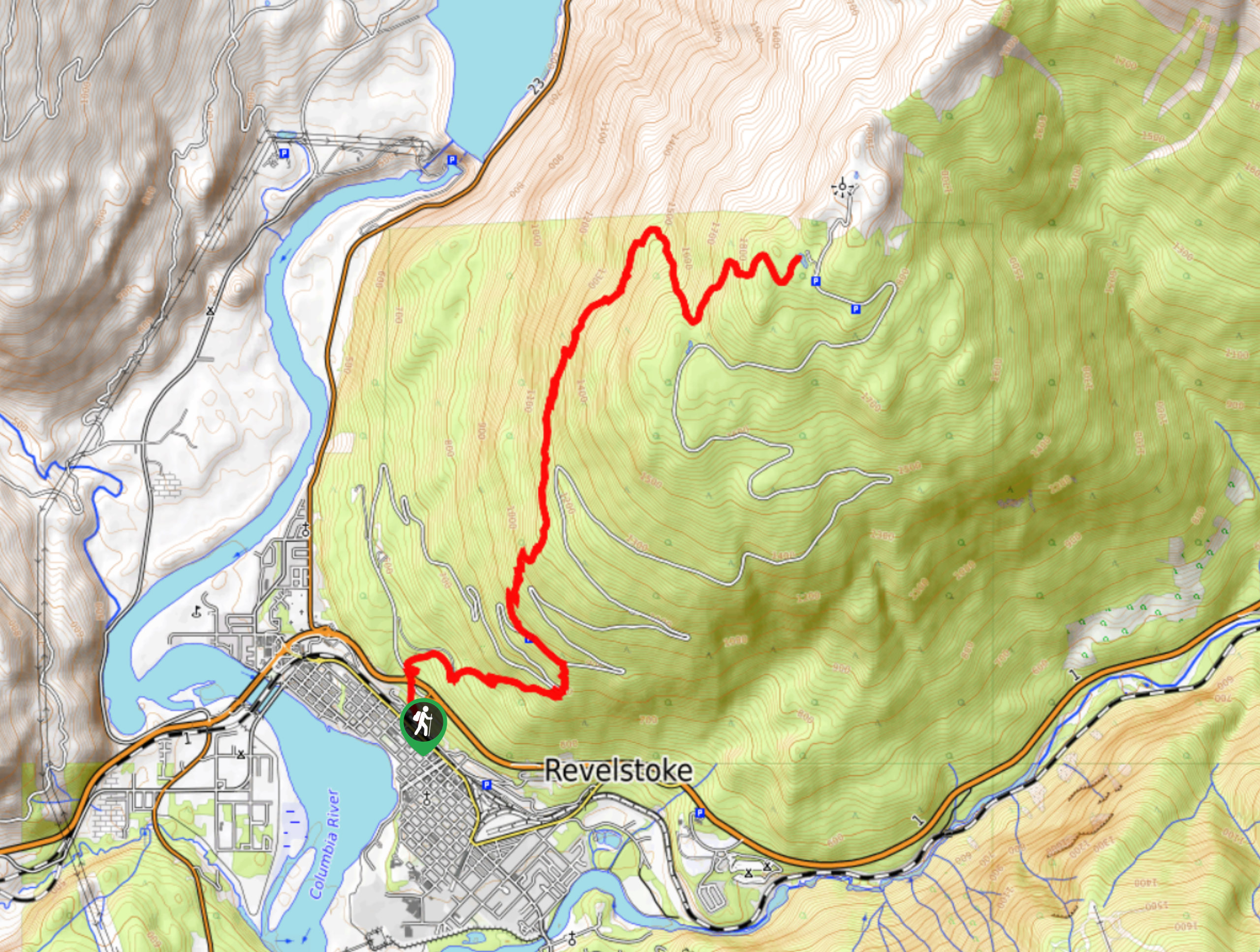
To reach the trailhead for Mount MacPherson from Revelstoke, head west on BC-1 for 10.6mi and turn left onto Three Valley-Victor FSR. Continue on for 6.5mi and you will arrive at a small parking area on the left.

About
| When to do | May-October |
| Backcountry Campsites | No |
| Pets allowed | No |
| Family friendly | No |
| Route Signage | Average |
| Crowd Levels | Moderate |
| Route Type | Out and back |
Mount MacPherson
Elevation Graph
Weather
Mount MacPherson Description
The Mount MacPherson Trail is a difficult hike that will take you through dense forests and across exposed false summits before the final push up the peak. Most of the elevation gain will be focussed on the forest half of the route, with the second half being largely made up of exposed scrambles along the saddle. Make sure to bring enough water and fuel for the journey, as it is a long one.
Setting out from the trailhead, hike up the forest service road until you come across the trail clearly marked by a pole with coloured tags. Take this route to the right to set out on a path towards the mountain. From here, you will climb uphill through the thick forest cover until you start to reach more rocky and technical terrain. Here, the trail will turn east to lead you over the false summits and across the saddle, allowing you to make the final ascent of the peak. From the top of Mount MacPherson, you will be able to enjoy a bird’s eye view of the surrounding area, including the town of Revelstoke and the Upper Arrow Lake in the valley far below. When you’ve finished with the sights, head back down the same trail to return to your vehicle.
Similar hikes to the Mount MacPherson hike
Eva Lake Trail
The Eva Lake Trail is a 9.3mi out-and-back hiking route in Mount Revelstoke National Park that sets out…
Lindmark Trail
The Lindemark Trail is a 13.7mi long hiking route that climbs up the slopes of Mount Revelstoke and…
Flowdown Trail
The Flowdown Trail is an 7.0mi multi-use trail near Revelstoke, BC, that is popular with hikers and mountain…
Comments