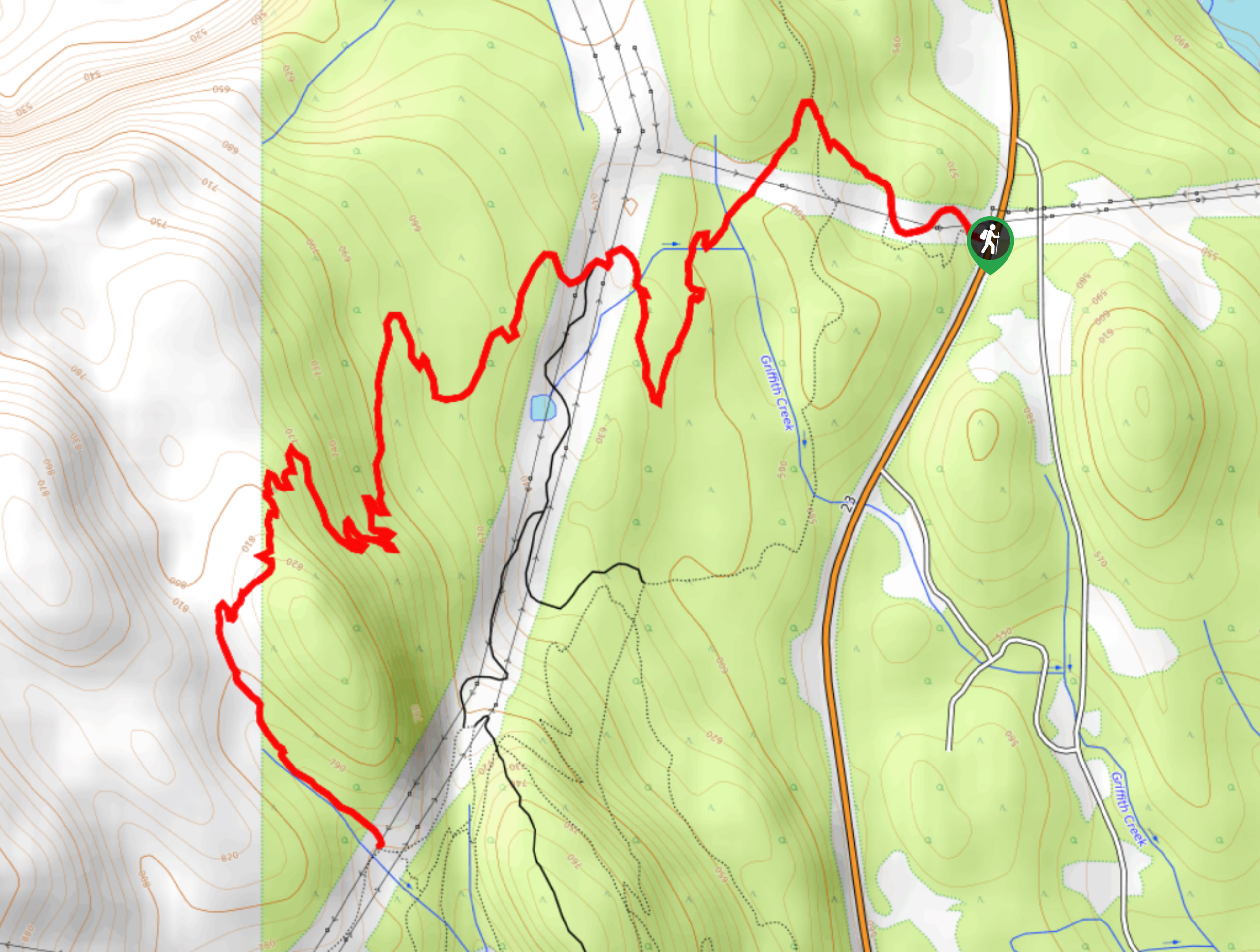
Lindmark Trail
View Photos
Lindmark Trail
Difficulty Rating:
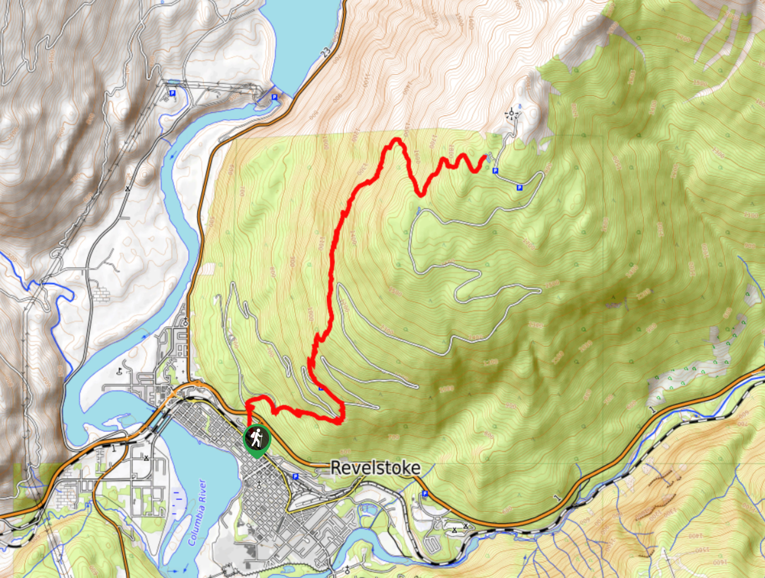
The Lindemark Trail is a 13.7mi long hiking route that climbs up the slopes of Mount Revelstoke and offers amazing views that look out across the valley and the Columbia River. This steep trail passes through a beautiful stretch of forest and several scenic lookouts before arriving at the shores of Balsam Lake. Hikers should note that dogs can only use the lower portion of the trail.
Getting there
To reach the trailhead for the Lindmark Trail from BC-1 in Revelstoke, head northwest on the highway and turn left onto Victoria Road. In 984ft, you will reach a roundabout. Take the second exit to continue on Victoria Road for another 3117ft. Turn left here onto Long Avenue and follow it right, where you will find the trailhead in 558ft on the left side.

About
| When to do | June-October |
| Backcountry Campsites | No |
| Pets allowed | No |
| Family friendly | No |
| Route Signage | Average |
| Crowd Levels | Low |
| Route Type | Out and back |
Lindmark Trail
Elevation Graph
Weather
Lindmark Trail Description
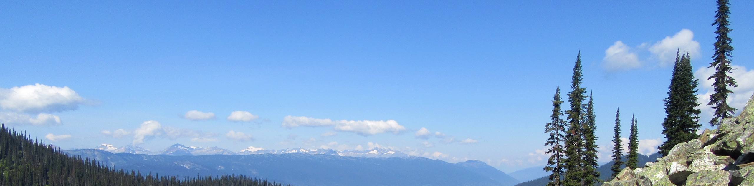
Hiking along the Lindmark Trail is an awesome outdoor experience in Mount Revelstoke National Park that will take you on a long uphill climb through the beautiful forests of the area to reach the wooded shores of Balsam Lake. As this is a strenuous route, hikers should make sure to come prepared with proper hiking footwear and enough snacks and water to stay fueled along the trail. Additionally, dogs can use the lower portion of the Lindmark Trail up to the Columbia Viewpoint; however, frequent interactions with bears now restrict them from being able to access the area around the summit of Mount Revelstoke any backcountry areas.
The trail sets out from the edge of the city and enters into the forest along the mountain’s lower slopes. From here, the trail splits off from the Summit Trail on a path to the west that climbs steeply uphill. Hikers will be able to catch some awesome views of the valley and surrounding mountains from the Monashee and Eagle Pass viewpoints before continuing their climb through the dense tree cover. The route will pass through a series of switchbacks before arriving at the tranquil waters of Balsam Lake. From here, hikers can either opt to push on to the summit to explore the area or return along the same path back to the trailhead.
Similar hikes to the Lindmark Trail hike
Eva Lake Trail
The Eva Lake Trail is a 9.3mi out-and-back hiking route in Mount Revelstoke National Park that sets out…
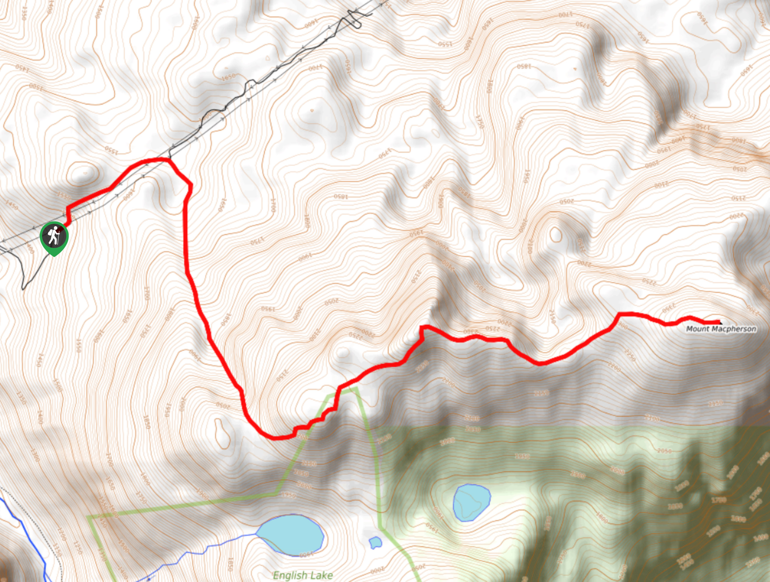
Mount MacPherson
The trek up Mount MacPherson is a challenging 9.8mi hiking route that will see you traverse exposed sections…
Flowdown Trail
The Flowdown Trail is an 7.0mi multi-use trail near Revelstoke, BC, that is popular with hikers and mountain…
Comments