Nels Nelson Trail
View Photos
Nels Nelson Trail
Difficulty Rating:
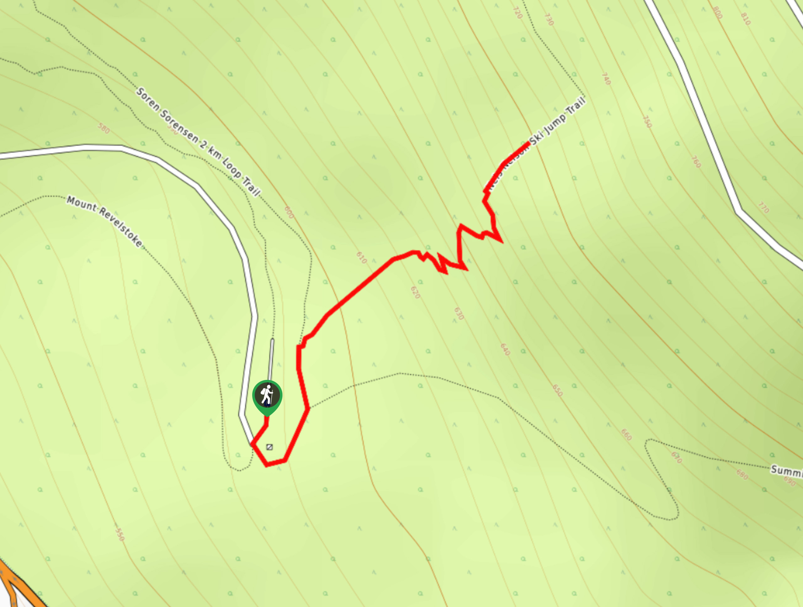
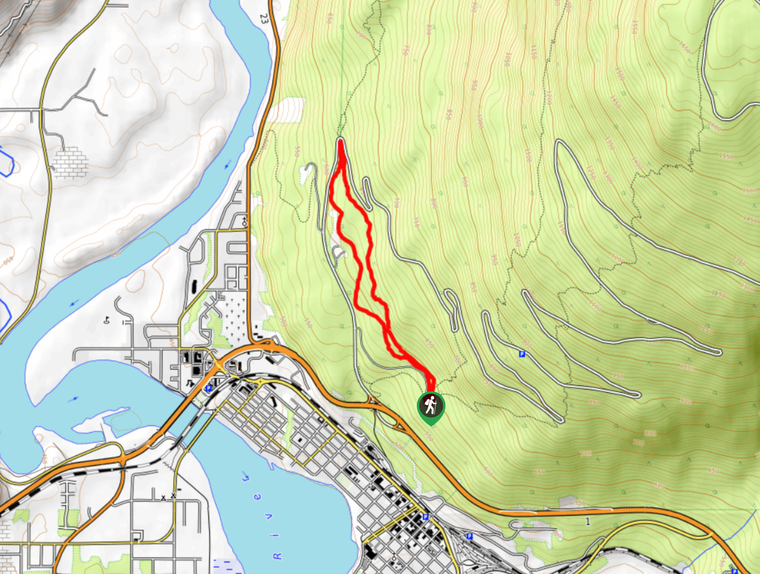
The Nels Nelson Trail is a 0.7mi hiking route on the lower slopes of Mount Revelstoke that climbs uphill along an old ski jumping route named after the famous Norwegian-Canadian ski jumper Nels Nelson. While it is no longer used for skiing, the route is still put to good use as a part of the strong network of hiking routes that can be found on the mountain. From the top of the trail, hikers will be able to take in views of the surrounding area and appreciate the steep slope of the ski jump.
Getting there
To get to the parking lot for the Nels Nelson Trail from the BC-1 Highway in Revelstoke, take the exit for Mount Revelstoke NP and drive along the Meadows in the Sky Parkway for 1804ft. Make a right turn and you will reach the parking lot in 2953ft.

About
| When to do | May-October |
| Backcountry Campsites | No |
| Pets allowed | Yes - On Leash |
| Family friendly | Older Children only |
| Route Signage | Average |
| Crowd Levels | Moderate |
| Route Type | Out and back |
Nels Nelson Trail
Elevation Graph
Weather
Nels Nelson Trail Description
Hiking the Nels Nelson Trail is a quick exercise that will give you a good workout and an appreciation for the adventurous nature of ski jumpers, as you climb up to the top of the famous ski run where Nels Nelson set two world records. Although the hill has not been used for skiing since 1975 and has since fallen into disrepair, hikers can make use of the area and its surrounding trails to explore the wooded slopes of Mount Revelstoke. Along the trail, you will climb through the forest and traverse several switchbacks to reach the top of the ski hill. From there, you will have some nice views that overlook the city of Revelstoke and the surrounding valley. Hikers that are looking for a longer route can follow the summit trail from the bottom of the ski run on a route to the east that will take them up Mount Revelstoke.
Similar hikes to the Nels Nelson Trail hike
Eva Lake Trail
The Eva Lake Trail is a 9.3mi out-and-back hiking route in Mount Revelstoke National Park that sets out…
Flowdown Trail
The Flowdown Trail is an 7.0mi multi-use trail near Revelstoke, BC, that is popular with hikers and mountain…
Sorenson Trail Loop
The Sorenson Trail Loop is a 3.2mi hiking route through Mount Revelstoke National Park that passes through a…
Comments