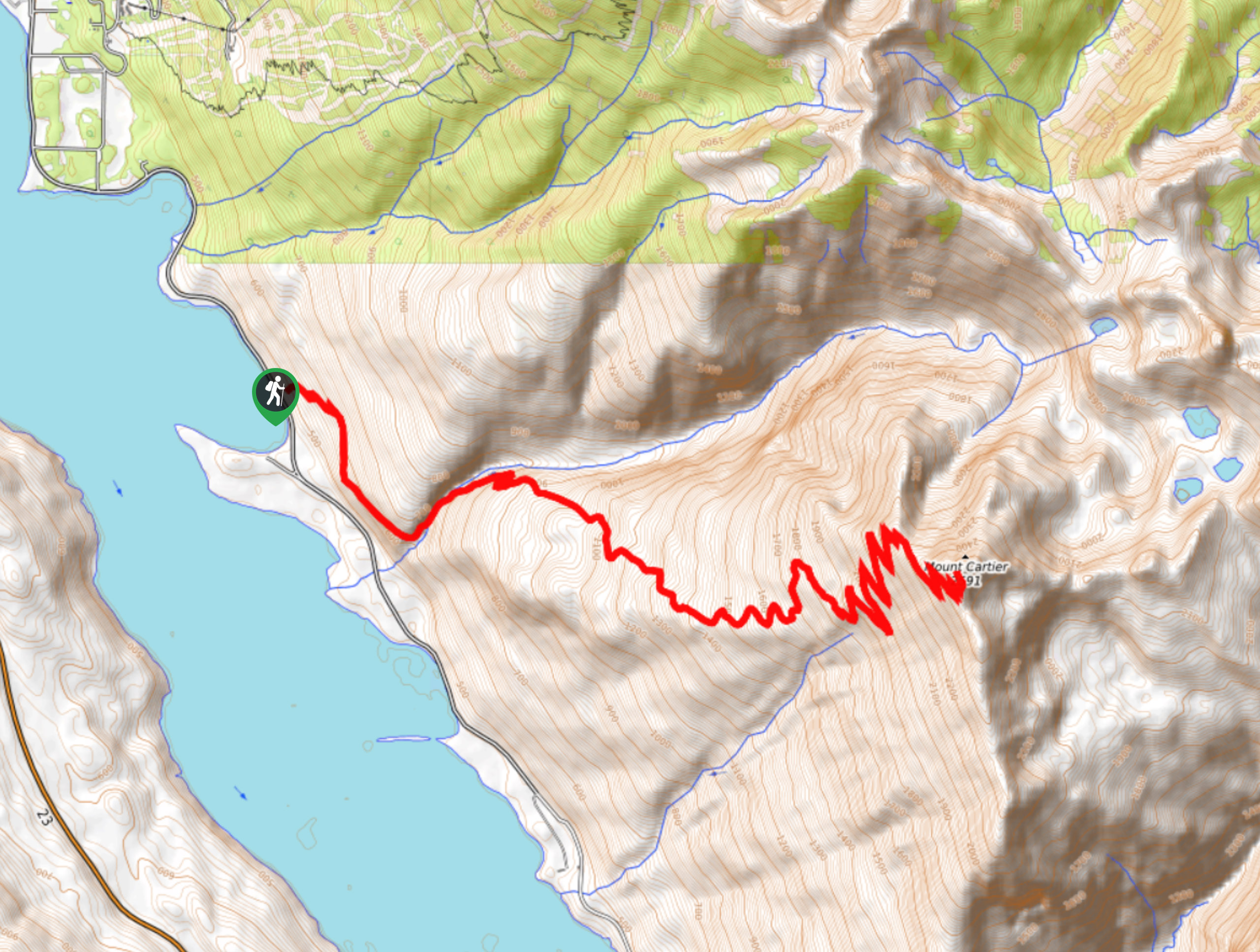
Mount Cartier Peak Trail
View Photos
Mount Cartier Peak Trail
Difficulty Rating:
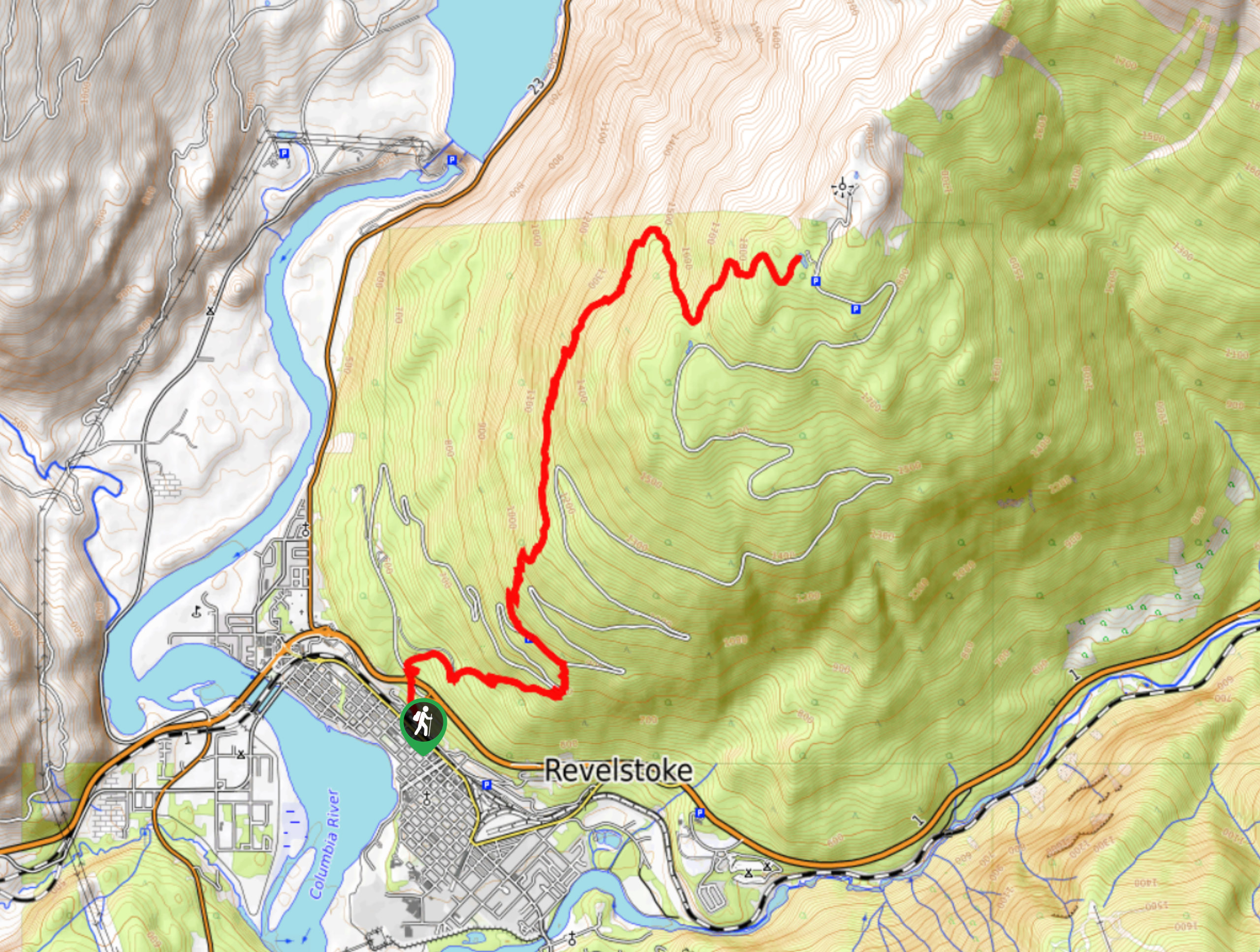
The Mount Cartier Peak Trail is a challenging 17.9mi out-and-back hiking route near Revelstoke, BC, that climbs a series of steep switchbacks through the forest to reach the summit. Due to the length, difficulty, and technical nature of the route, it should only be attempted by seasoned hikers. Those that are able to make it to the summit will be rewarded with amazing views that stretch out across the rugged mountainous landscape.
Getting there
To get to the Mount Cartier trailhead from the Revelstoke Airport, drive south on Airport Way for 3.5mi and the trailhead will be on the left side of the road.

About
| When to do | June-October |
| Backcountry Campsites | No |
| Pets allowed | No |
| Family friendly | No |
| Route Signage | Average |
| Crowd Levels | Low |
| Route Type | Out and back |
Mount Cartier Peak Trail
Elevation Graph
Weather
Mount Cartier Peak Trail Description
Hiking up the Mount Cartier Peak is a difficult and physically demanding exercise that requires a good deal of experience and preparation to complete. The route features a large elevation gain of 7175ft, which is mostly concentrated along a steep series of switchbacks and scrambles around the summit. To make things more challenging, past the 4.3mi mark, there are no water sources, meaning that you will need to pack everything that you need for the duration of the hike. Make sure to wear proper hiking footwear and bring hiking poles to save your knees along the steep descent.
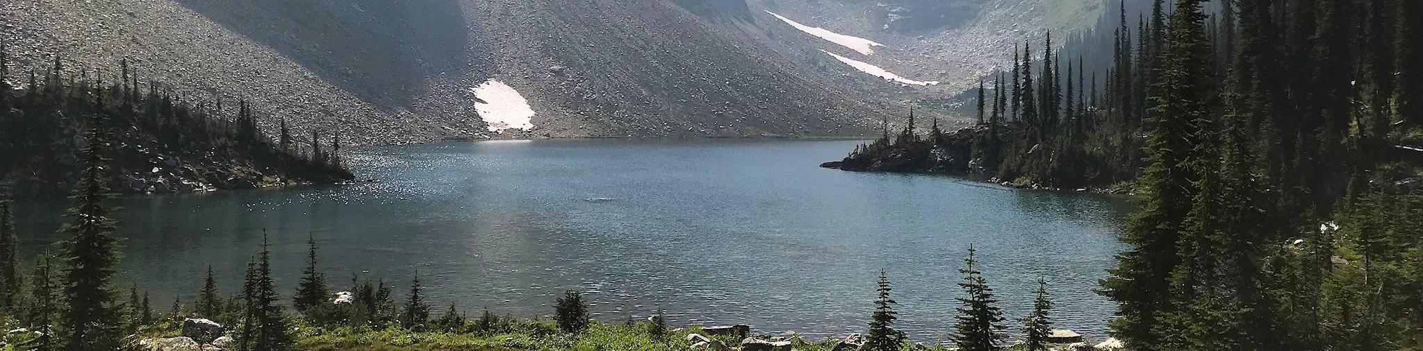
Most of the hike will be contained within a dense forest covering until you break out into the alpine terrain. From here, the trail will turn more sharply to the east as you begin your climb up the steep switchbacks to the summit. After this, you will traverse some exposed sections of rock that are very technical before arriving at the summit for some breathtaking views of the mountainous terrain.
Similar hikes to the Mount Cartier Peak Trail hike
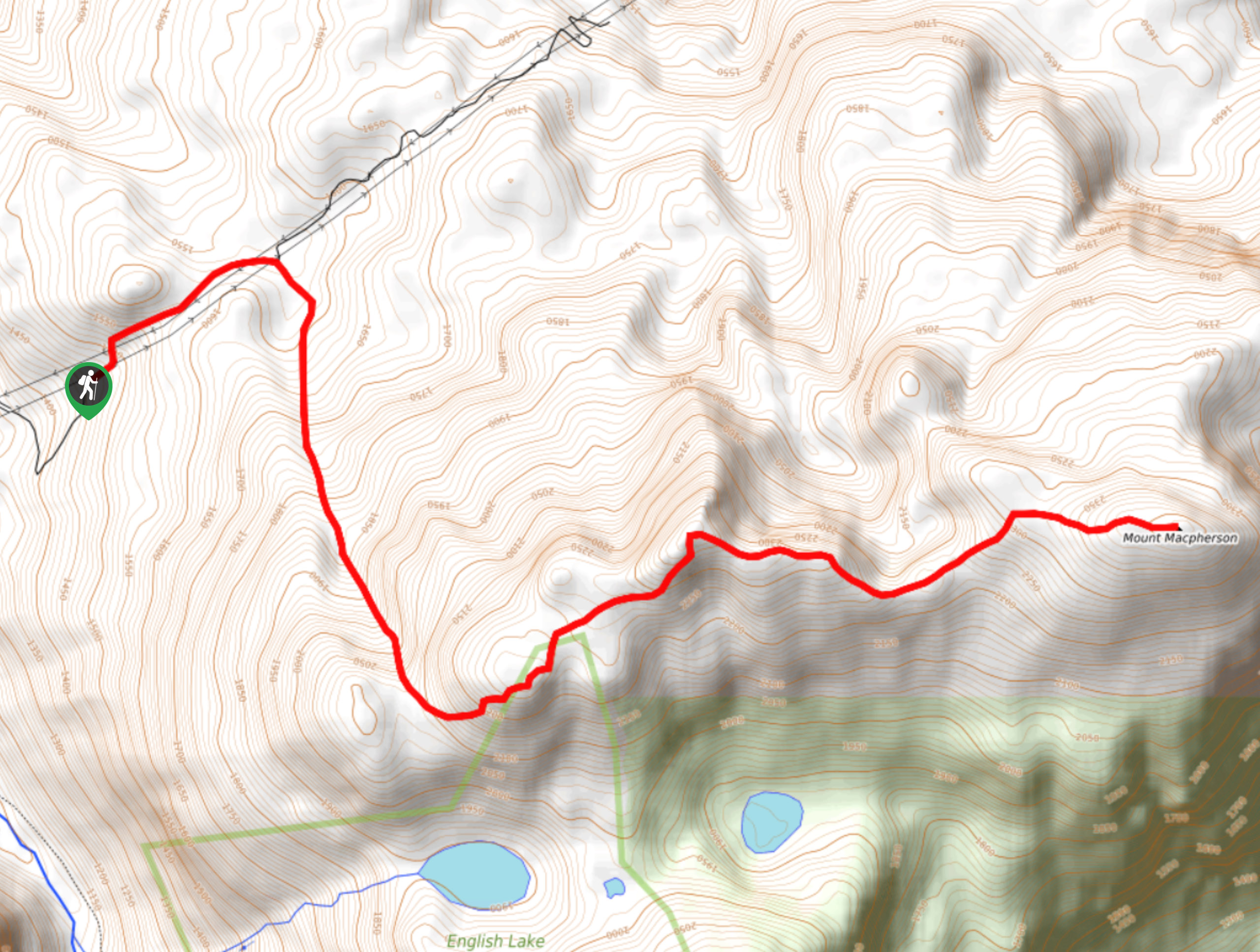
Mount MacPherson
The trek up Mount MacPherson is a challenging 9.8mi hiking route that will see you traverse exposed sections…
Lindmark Trail
The Lindemark Trail is a 13.7mi long hiking route that climbs up the slopes of Mount Revelstoke and…
Jade Lakes Trail
The Jade Lakes Trail is a 12.5mi out-and-back hiking route that sets out from the summit of Mount…
Comments