
Mount McCrae Lake Trail
View Photos
Mount McCrae Lake Trail
Difficulty Rating:
The Mount McCrae Lake Trail is a 4.2mi out-and-back hiking route that can be found to the southeast of Revelstoke and traverses a variety of terrain on the way to the subalpine lake. Known as one of the best high-altitude hiking spots in the region, you can be sure that this trek into the alpine terrain will be full of spectacular highlights. Experience hiking through beautiful meadows full of wildflowers and take in the sights of rocky mountain peaks along this moderately difficult trail.
Getting there
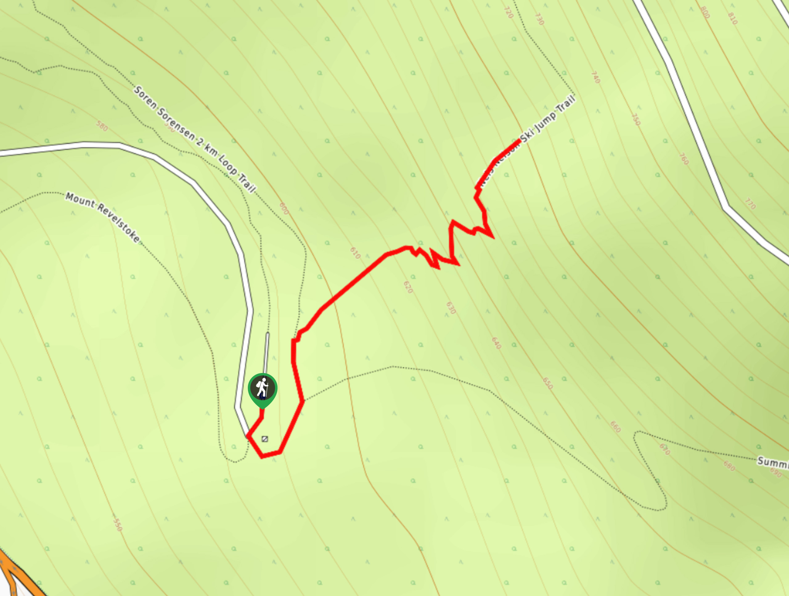
To reach the parking area for the Mount McCrae Lake Trail from the Revelstoke Airport, drive south along Airport Way for 7.6mi and make a left at the fork in the road. Continue on for 4.5mi and go right at the next fork. After 1.7mi, make a sharp right turn followed by a left in 3.0mi. Continue uphill for 5.4mi and go right at the fork and you will find the parking area on the left in 0.7mi.

About
| When to do | June-October |
| Backcountry Campsites | McCrae Lake Recreation Site |
| Pets allowed | Yes - On Leash |
| Family friendly | Older Children only |
| Route Signage | Average |
| Crowd Levels | Moderate |
| Route Type | Out and back |
Mount McCrae Lake Trail
Elevation Graph
Weather
Mount McCrae Lake Trail Description
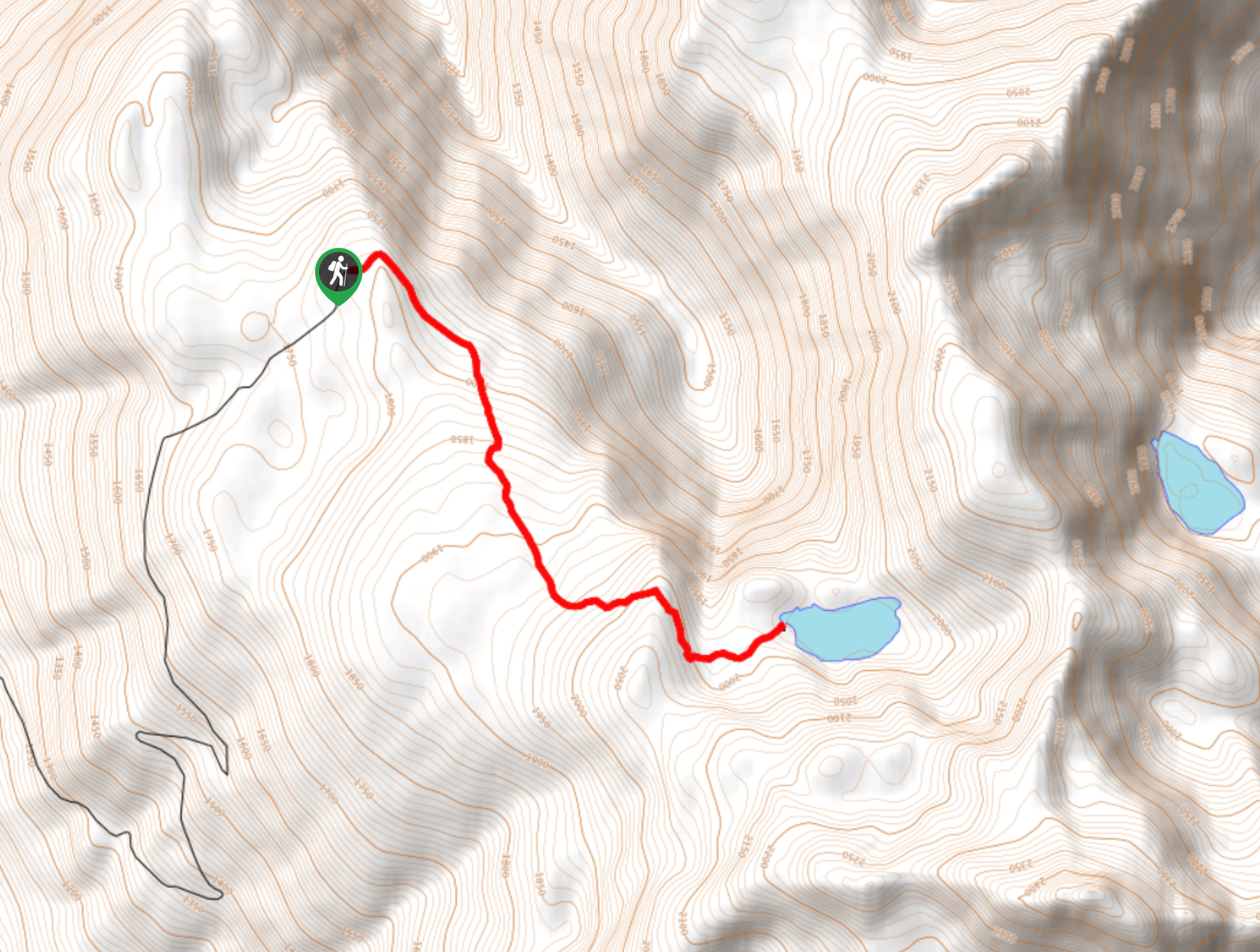
The hike up to Mount McCrae Lake is a scenic trek into a beautiful stretch of subalpine terrain that features a recreation site next to the lake for any hikers that would like to spend a few days exploring this mountainous area. The trail to the lake breaks off from the main route leading up to Mount McCrae, which leads to the route only having a moderate elevation gain of 1437ft. The manageable changes in elevation and relatively easy terrain along the trail make for a fun hike through the subalpine that can be enjoyed by both casual and experienced hikers alike.
Setting out from the parking area, the trail heads to the southeast along a dirt path that is surrounded by forest on both slides. Eventually, you will enter into the dense forest cover as you continue to make your way toward the lake. Through the tree cover, you will be able to catch glimpses of the surrounding alpine landscape before breaking out into a beautiful meadow that will be blanketed by wildflowers in the late summer. At this point in the hike with Mount McCrae in front of you, the trail will break off to the east and you will begin a short descent down to the serene waters of Mount McCrae Lake. Enjoy the picturesque views of the small subalpine lake as it sits below the imposing mountain peak before setting up camp for the night or heading back down the trail to return to your vehicle.
Similar hikes to the Mount McCrae Lake Trail hike
Eva Lake Trail
The Eva Lake Trail is a 9.3mi out-and-back hiking route in Mount Revelstoke National Park that sets out…
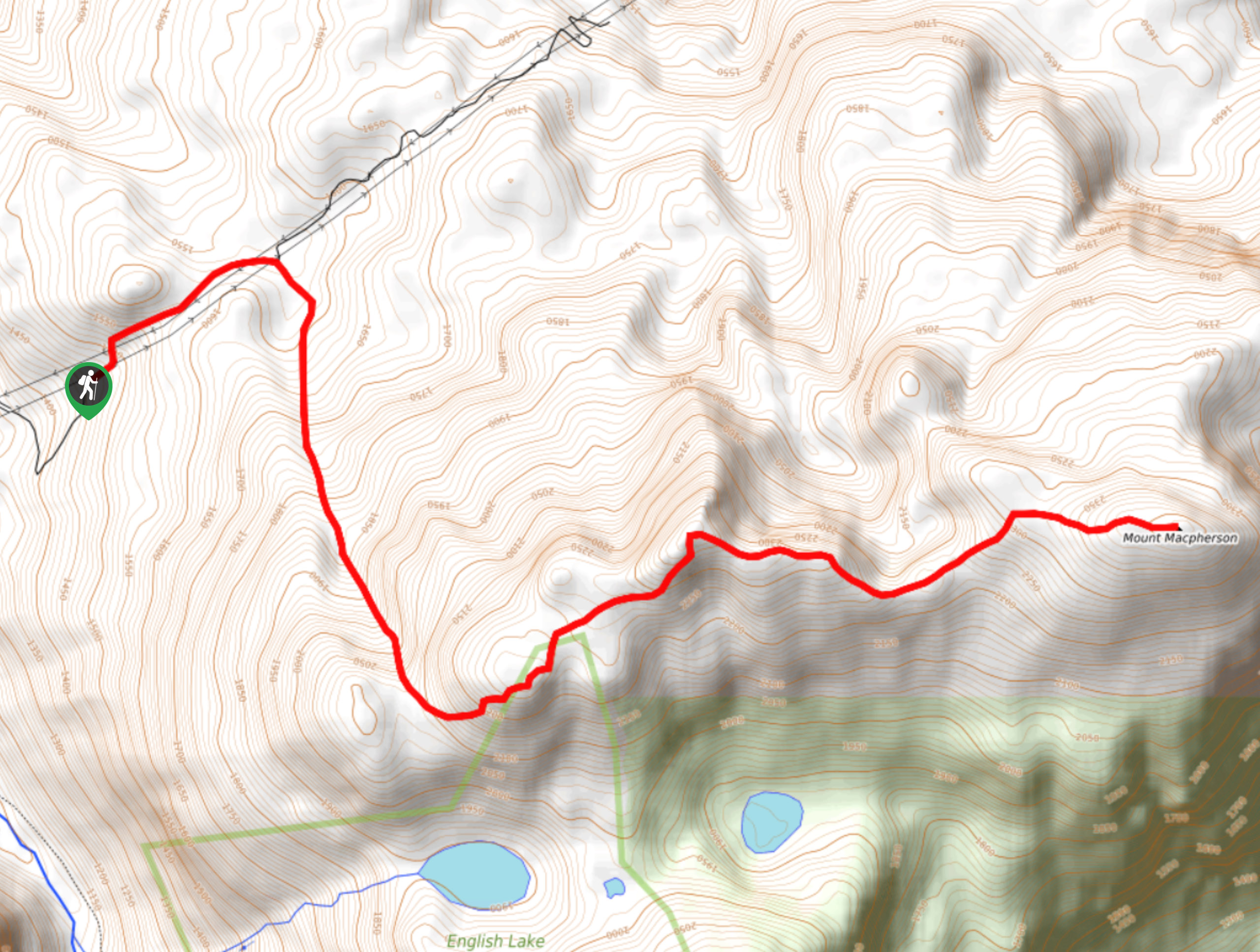
Mount MacPherson
The trek up Mount MacPherson is a challenging 9.8mi hiking route that will see you traverse exposed sections…
Nels Nelson Trail
The Nels Nelson Trail is a 0.7mi hiking route on the lower slopes of Mount Revelstoke that climbs…
Comments