Tent Ridge Horseshoe hike
View Photos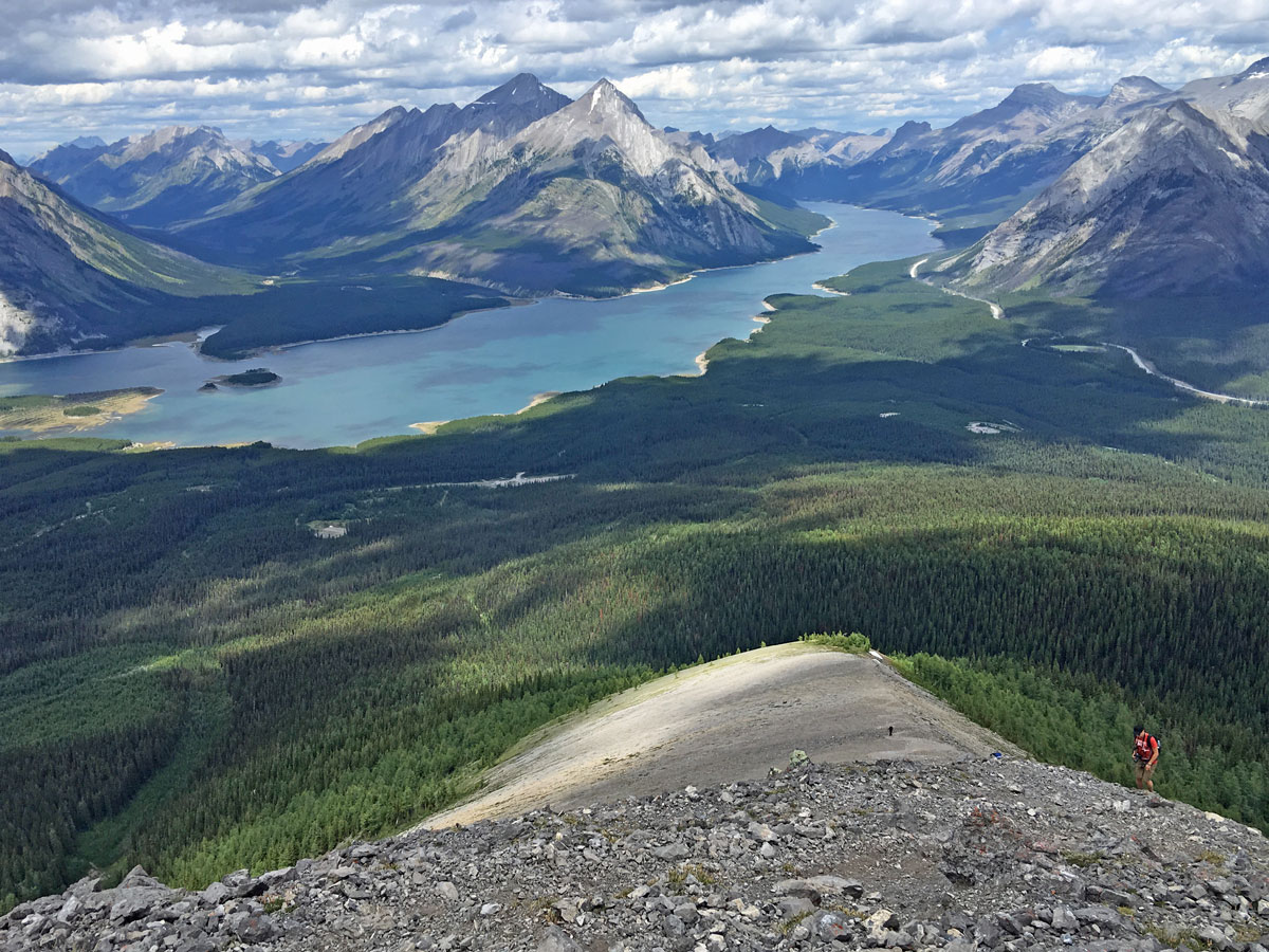
Tent Ridge Horseshoe hike
Difficulty Rating:
The Tent Ridge hike is spectacular. Tent Ridge is the location for many of the incredible photos you regularly see on social media, showing stunning peaks over the Spray Lakes. Tent Ridge is a wonderful hike, though there is a bit of a scramble on the way up Tent Ridge that some hikers don’t like, which is why we rate this as a 4/5 instead of a 3/5.
Getting there
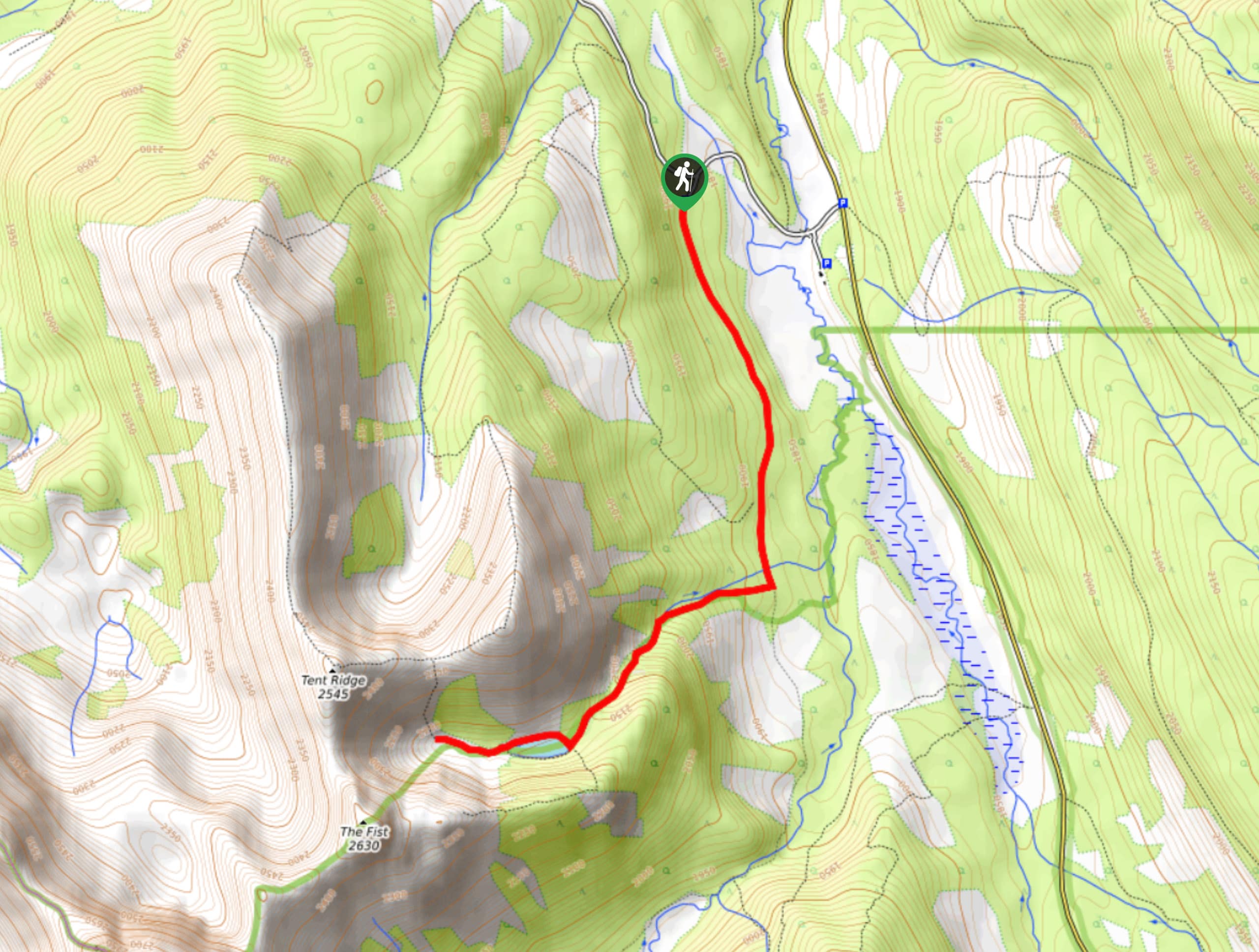
From the Canmore Nordic Centre, continue west on the Smith-Dorrien (Hwy 742) as it winds up into the Spray Valley for 22.1mi. You’ll notice a turn-off to your right for Mount Engadine Lodge. Take this turnoff, and follow this road for 1.1mi, past the lodge, on a road that is headed for Mount Shark. You’ll see a parking lot on your right.

About
| When to do | June - October |
| Backcountry Campsites | No |
| Toilets | None |
| Family friendly | No |
| Route Signage | None |
| Crowd Levels | Moderate |
| Route Type | Circuit |
Tent Ridge Horseshoe
Elevation Graph
Weather
Route Description for Tent Ridge Horseshoe
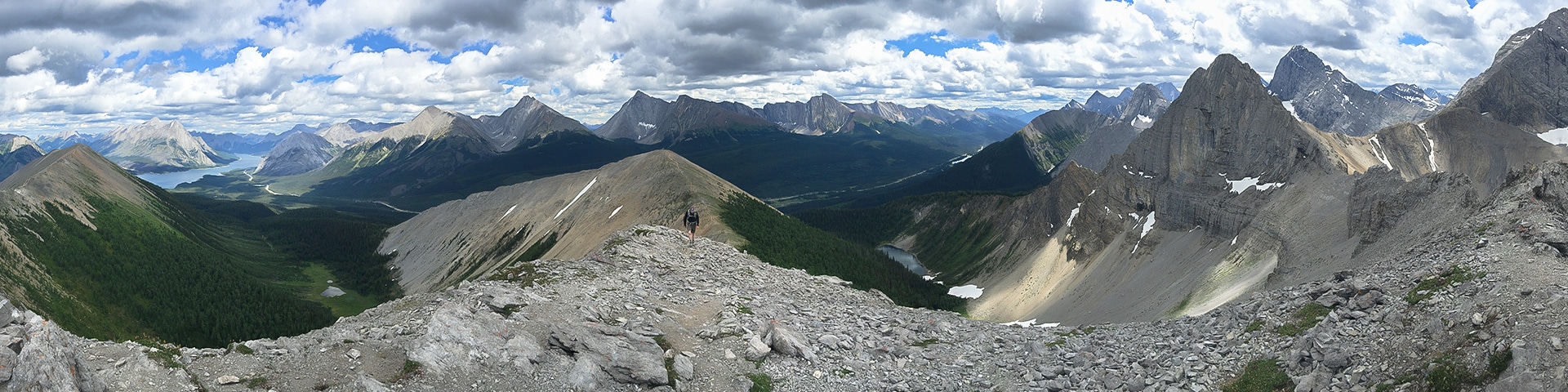
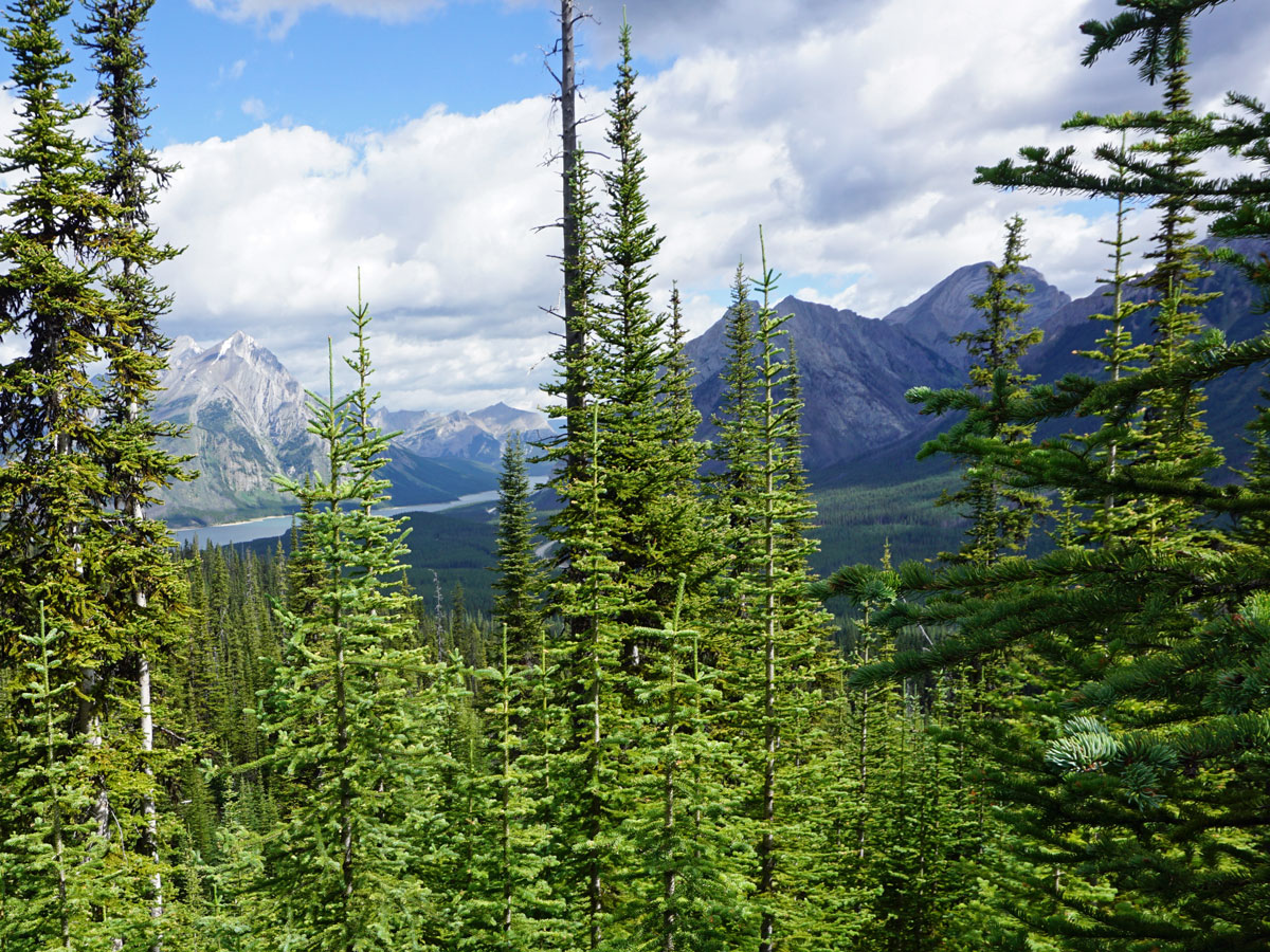
From the parking lot, cross the road and walk to your left, looking for a trailhead that goes up through the trees. You’ll be hiking along this trail, through the trees, for about 45 minutes. This is a pleasant walk, though the highlights start once you pop out of the forest, as you get a beautiful panorama as you cross a stream.
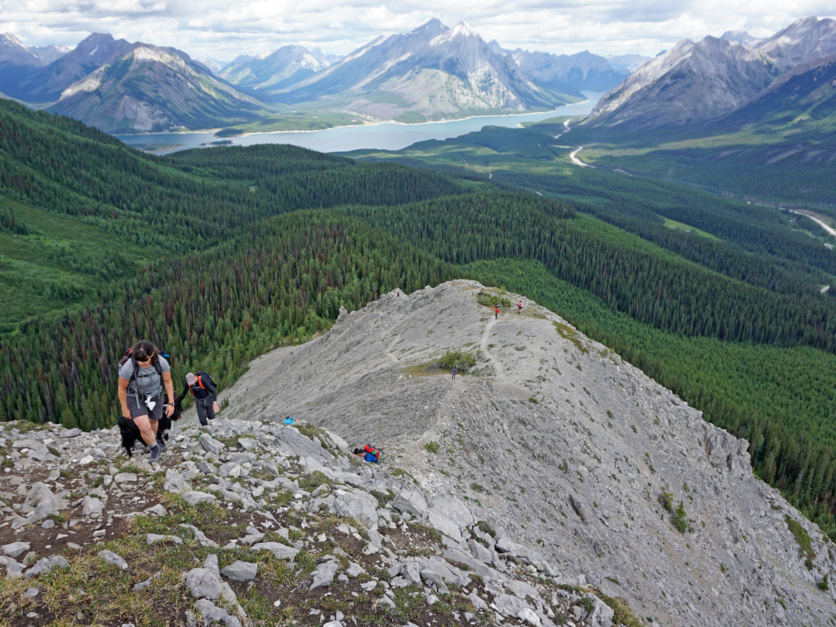
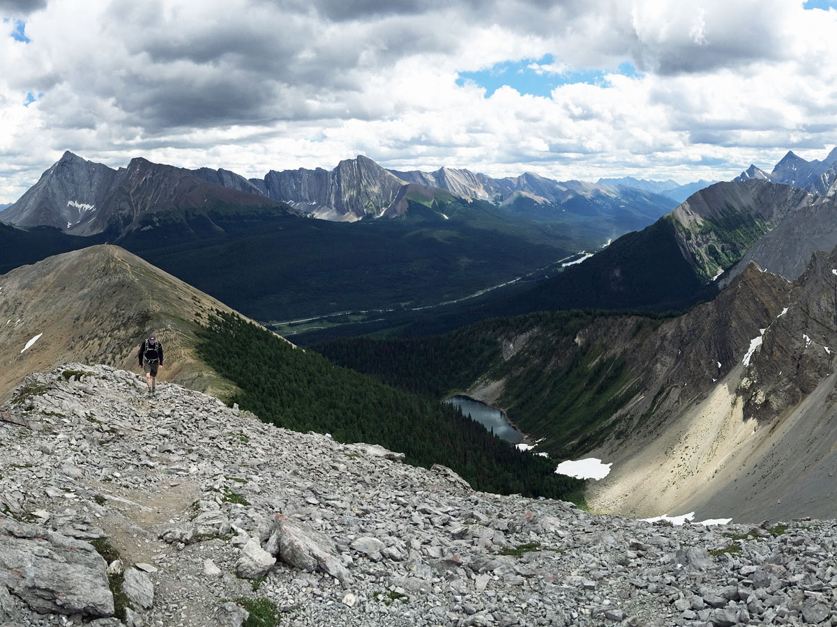
Soon after crossing the stream you’ll come to a basin from where you’ll be able to see the entire Tent Ridge Horseshoe towering above you. The path goes to the left and then up through the forest.
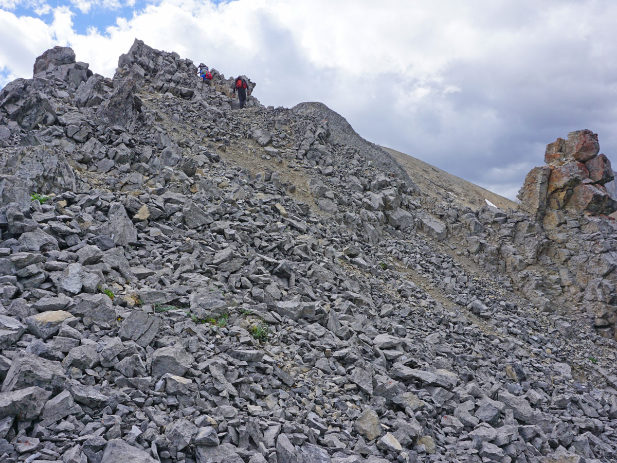
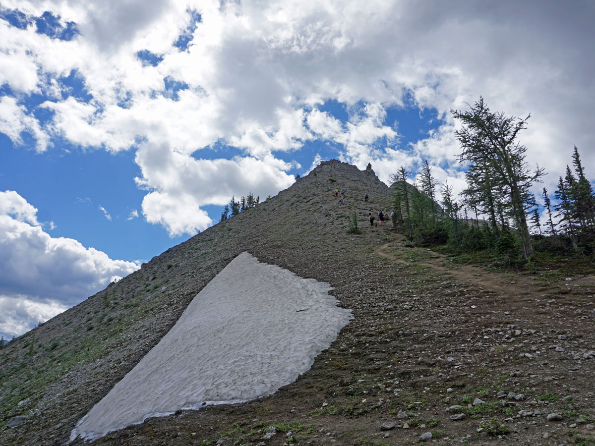
Coming out of the forest you get to a steep trail up some scree. Follow this up.
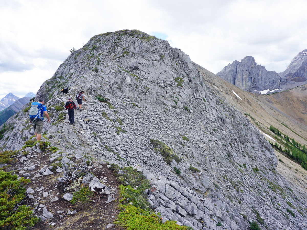
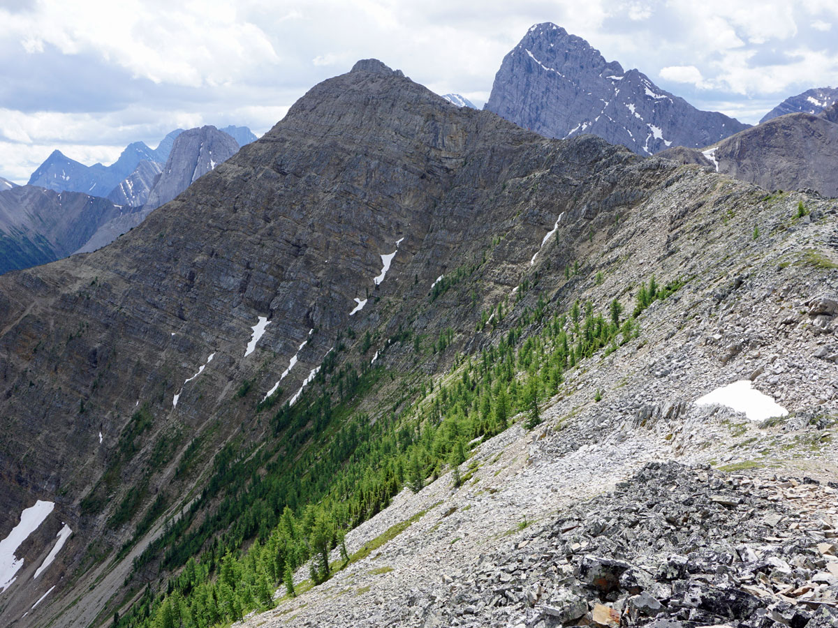
You soon come to a rock band where you can navigate around to the left on a narrow path or scramble straight up. Both options have some exposure, so caution should be taken regardless of your choice. Some people really don’t like this part of the path, and if the path is wet or icy, it can be challenging and consider choosing a different hike.
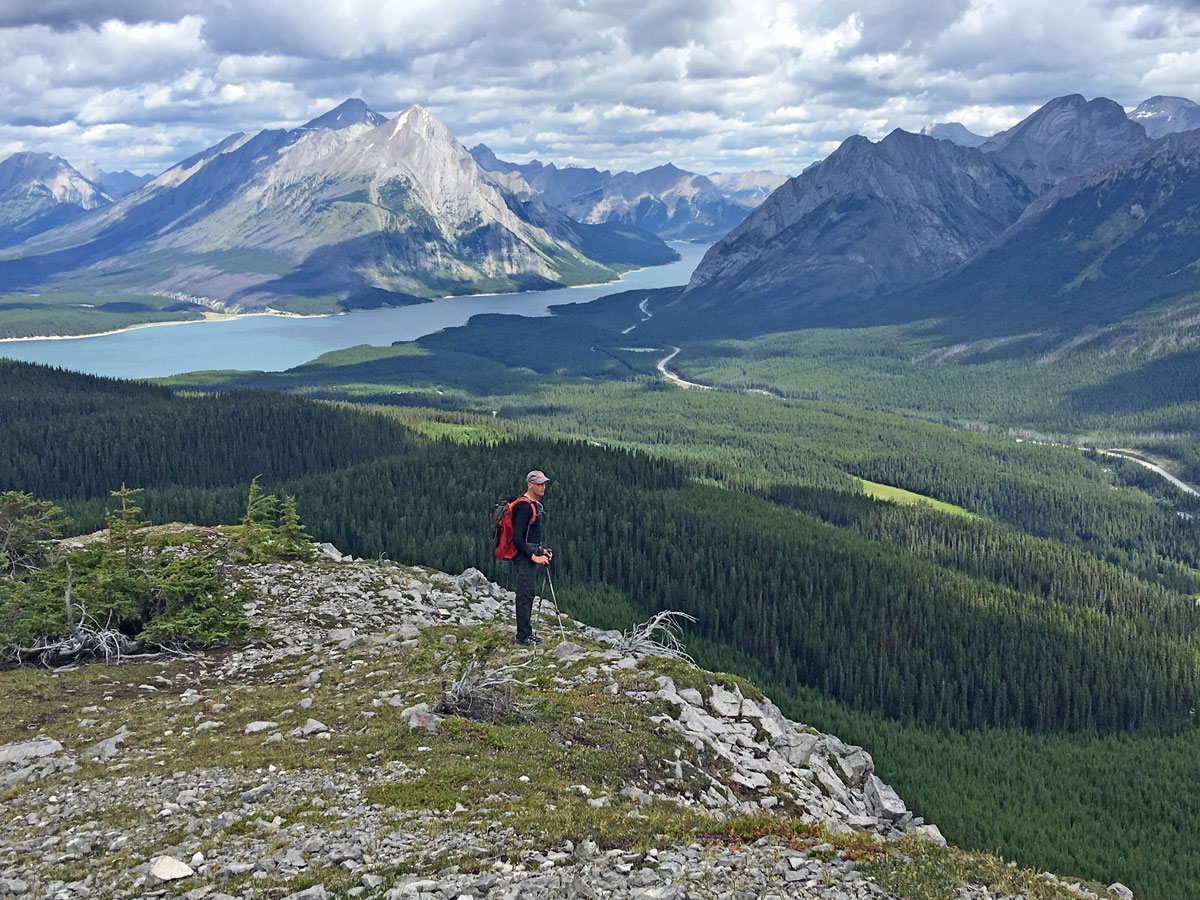
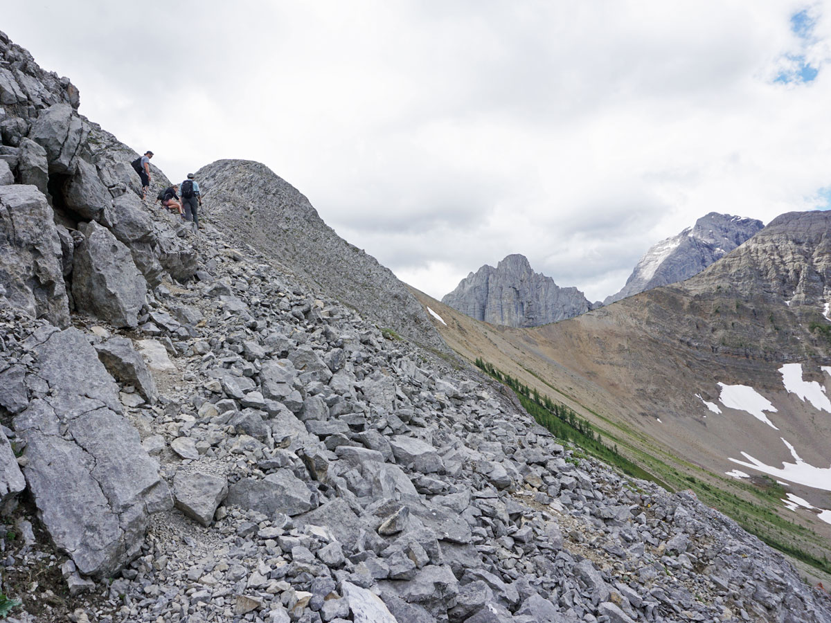
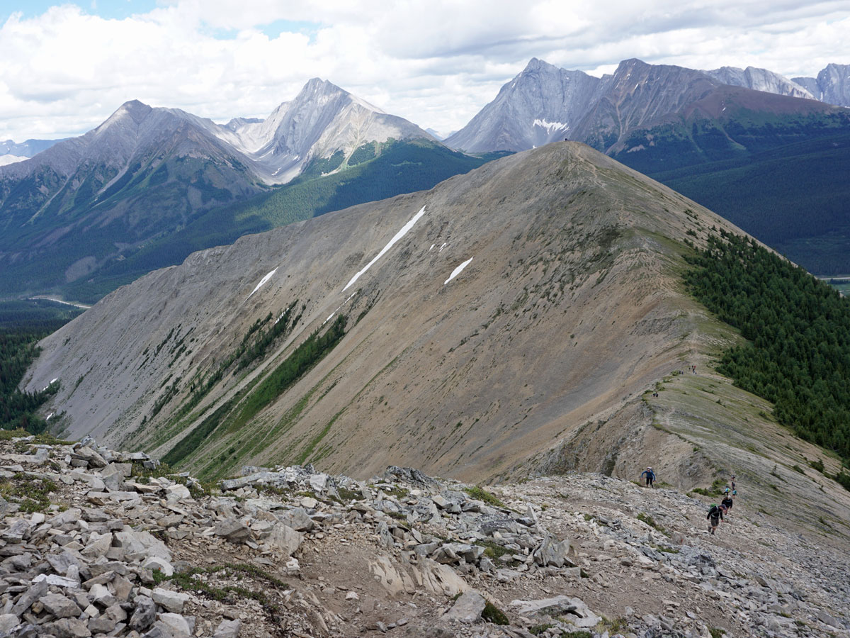
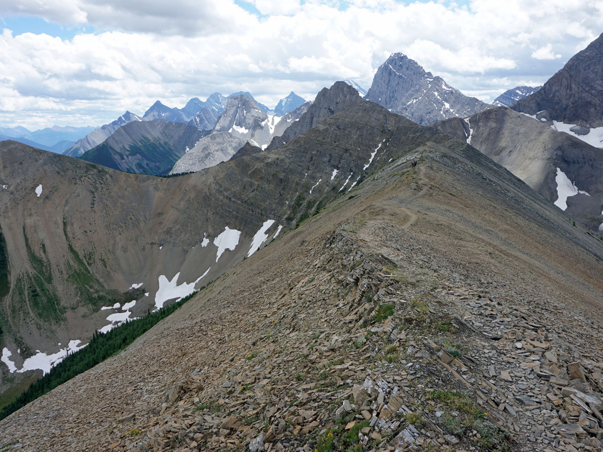
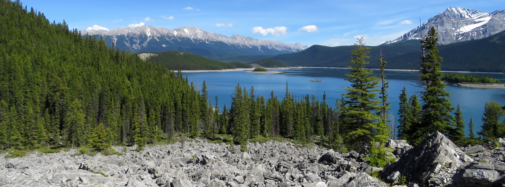
Continue to follow the ridge up. It can feel exposed at times and there are places where you may need to use your hand to steady yourself. Remember to stop to look behind you, as the views of the Spray Lakes Reservoir are incredible, while the expanse of peaks visible in all directions is outstanding.
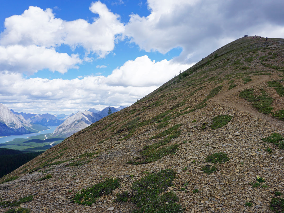
After more ascent you’ll reach a weather station. The station is a great stop for lunch and a welcome break from the wind. You can see your path along the ridge for the rest of the day.
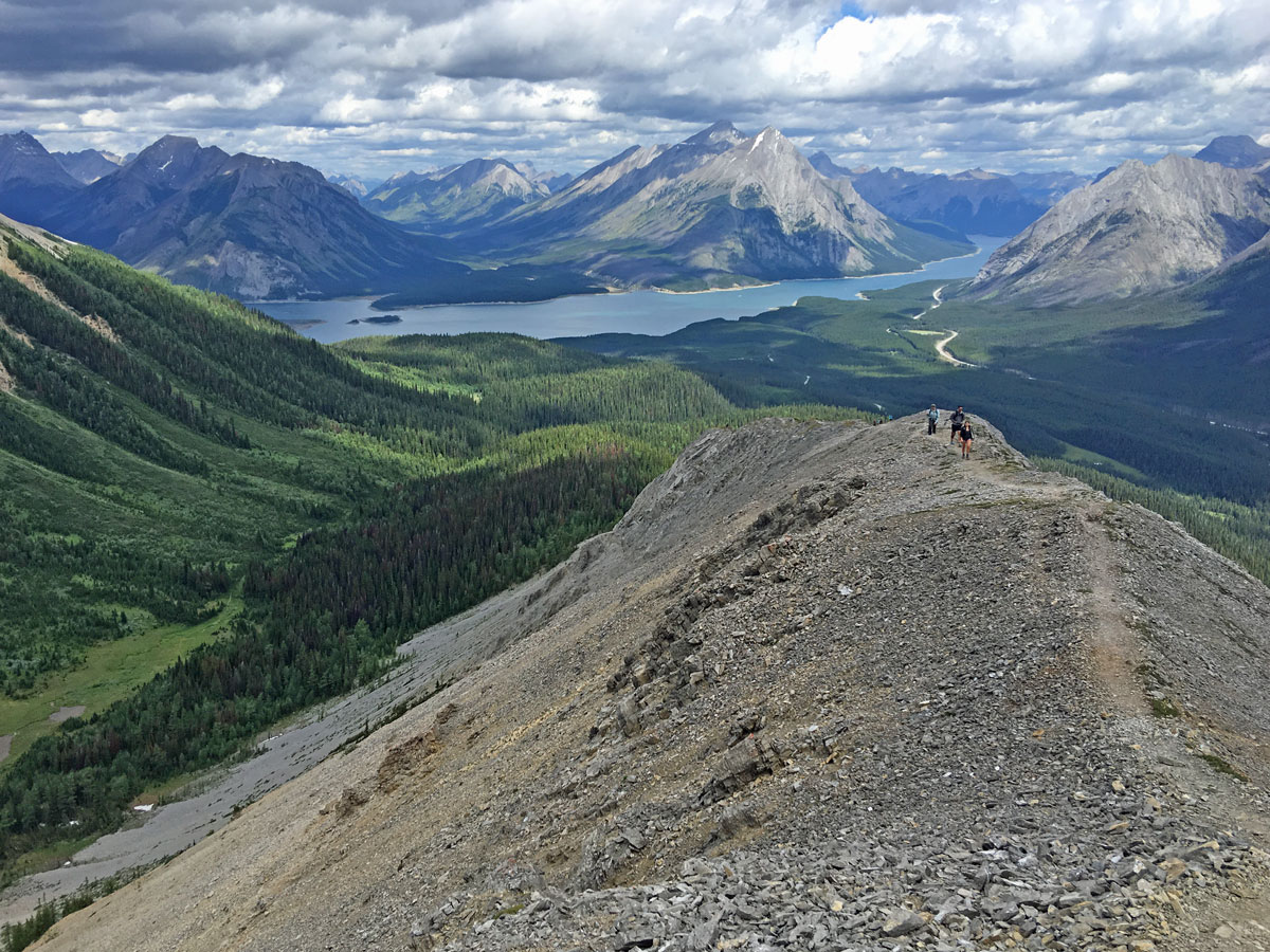
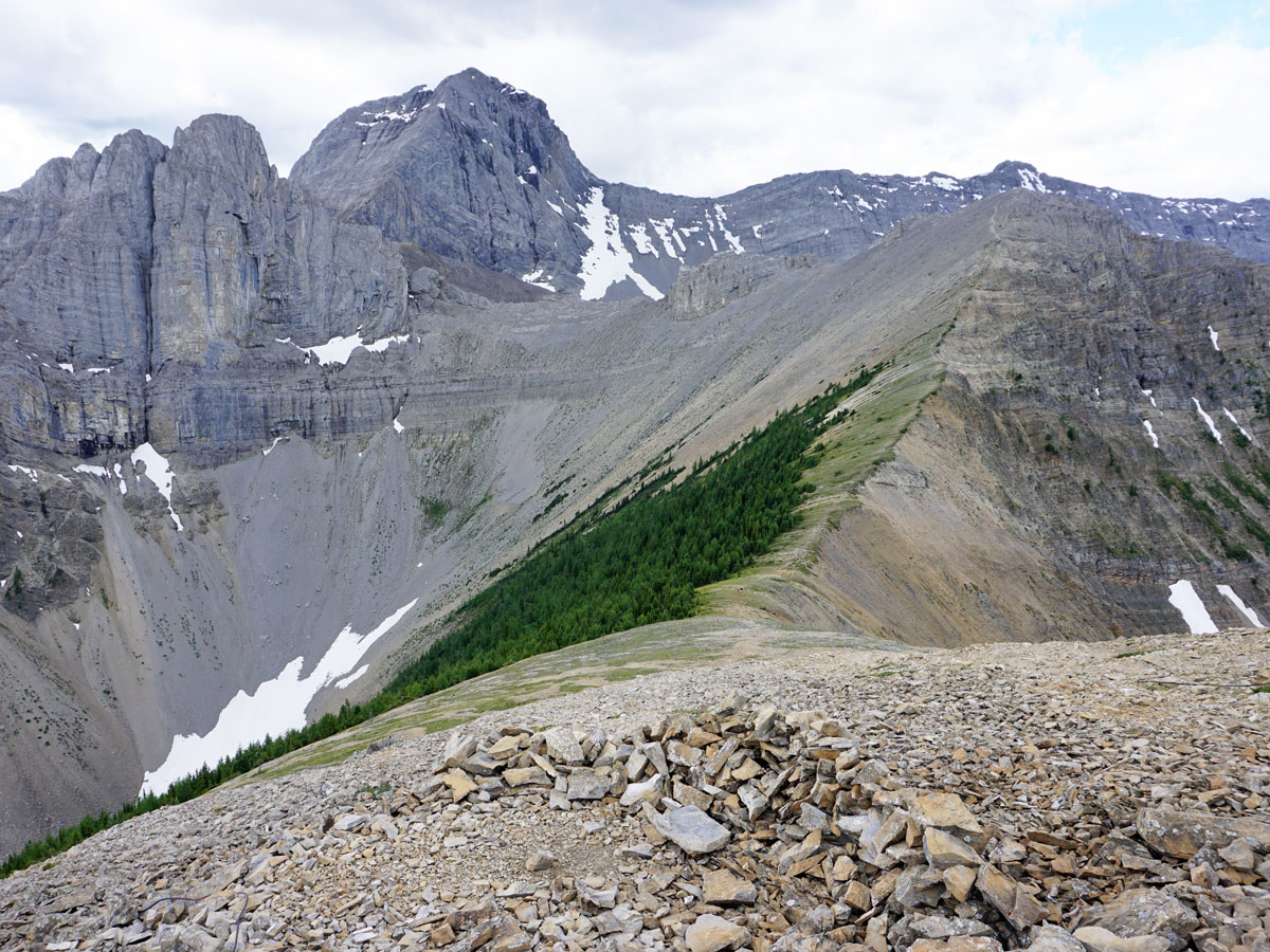
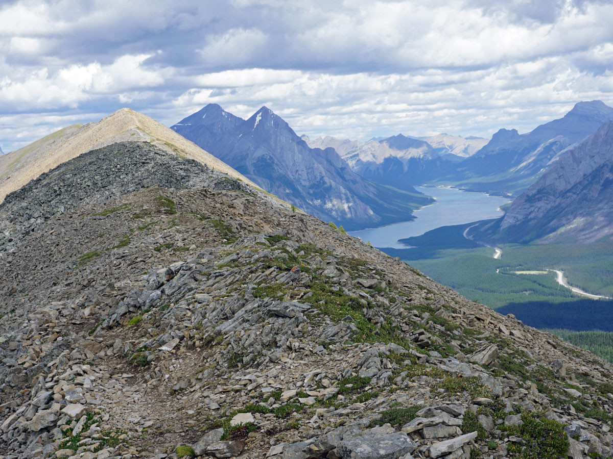
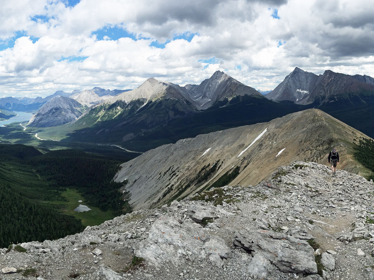
From the weather station, take the path that goes down and then back up the other side on a scree trail. If you look back, you can see the phenomenal Buller Pass.
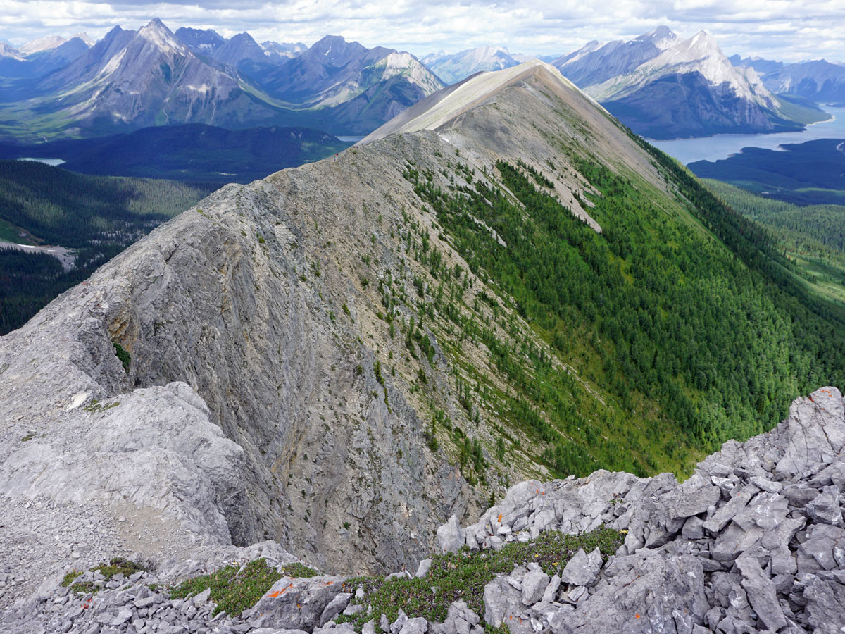
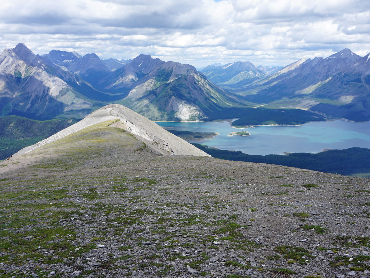
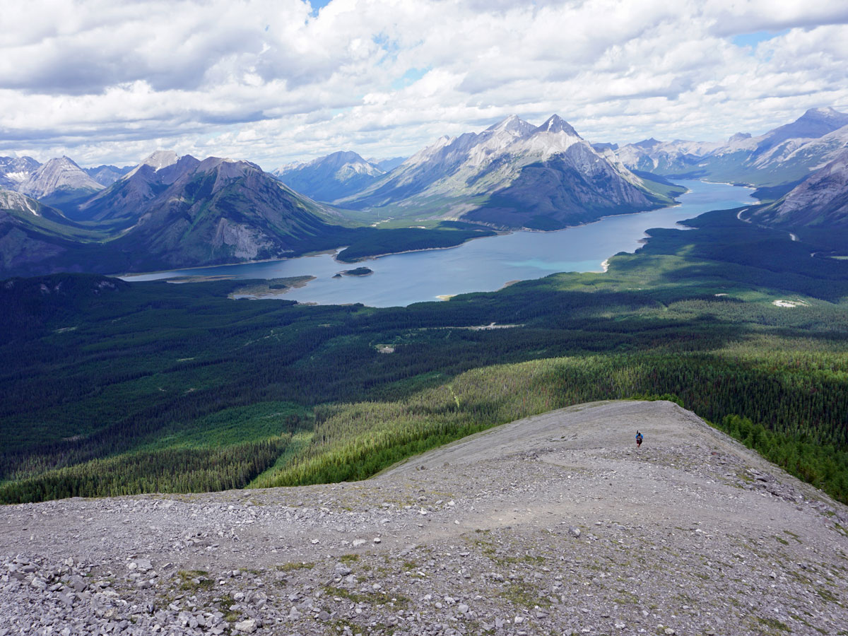
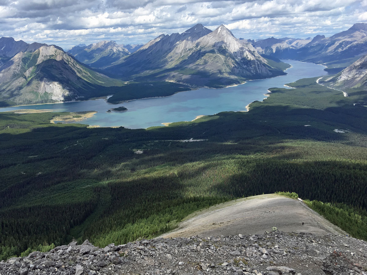
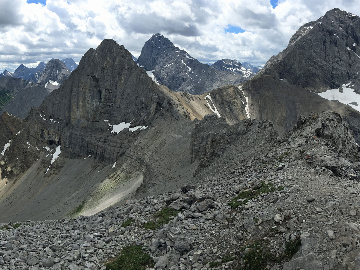
The path that heads up to the highest peak on Tent Ridge is steep, but once you’re on top there are wonderful views. Come down the other side on a steep trail and take care to remain on the path, it’s easy to get off path. As you look ahead you’ll see the wide valley that leads to the Assiniboine region. Assiniboine Provincial Park offers some of the best hiking in the Canadian Rockies.
The ridge walk at the end of this hike is spectacular. Look in any direction and your jaw will drop! The views are sublime. You also start to see people who hike up from the parking lot in reverse just to get these views, and don’t do the entire Horseshoe along the ridge.
As you come down, you head into an avalanche path above a forest. Don’t be tempted to go too far right. When you see a crossing path go down and meet up with a trail that is visible. This trail takes you through the forest following the path.
Eventually you hit a large 4×4 trail. Go right here back towards your car.
Check out other amazing hikes in Kananaskis – Smith Dorrien:
Insider Hints
If you don’t want to do the entire hike, or you want to avoid the scrambly bit on the route described here, you can do the hike in reverse, getting some great views on the hike up.
Hiking up Tent Ridge is a rocky trail and is very tough in icy or wet conditions. Take microspikes if it is icy and consider a different trail if it is wet.
Poles are really helpful for this trail.
Consider stopping in at the delightful Mount Engadine Lodge for a snack on the way back. They have a variety of options for hikers, and their weekend brunch is great.

Similar hikes to the Tent Ridge Horseshoe hike
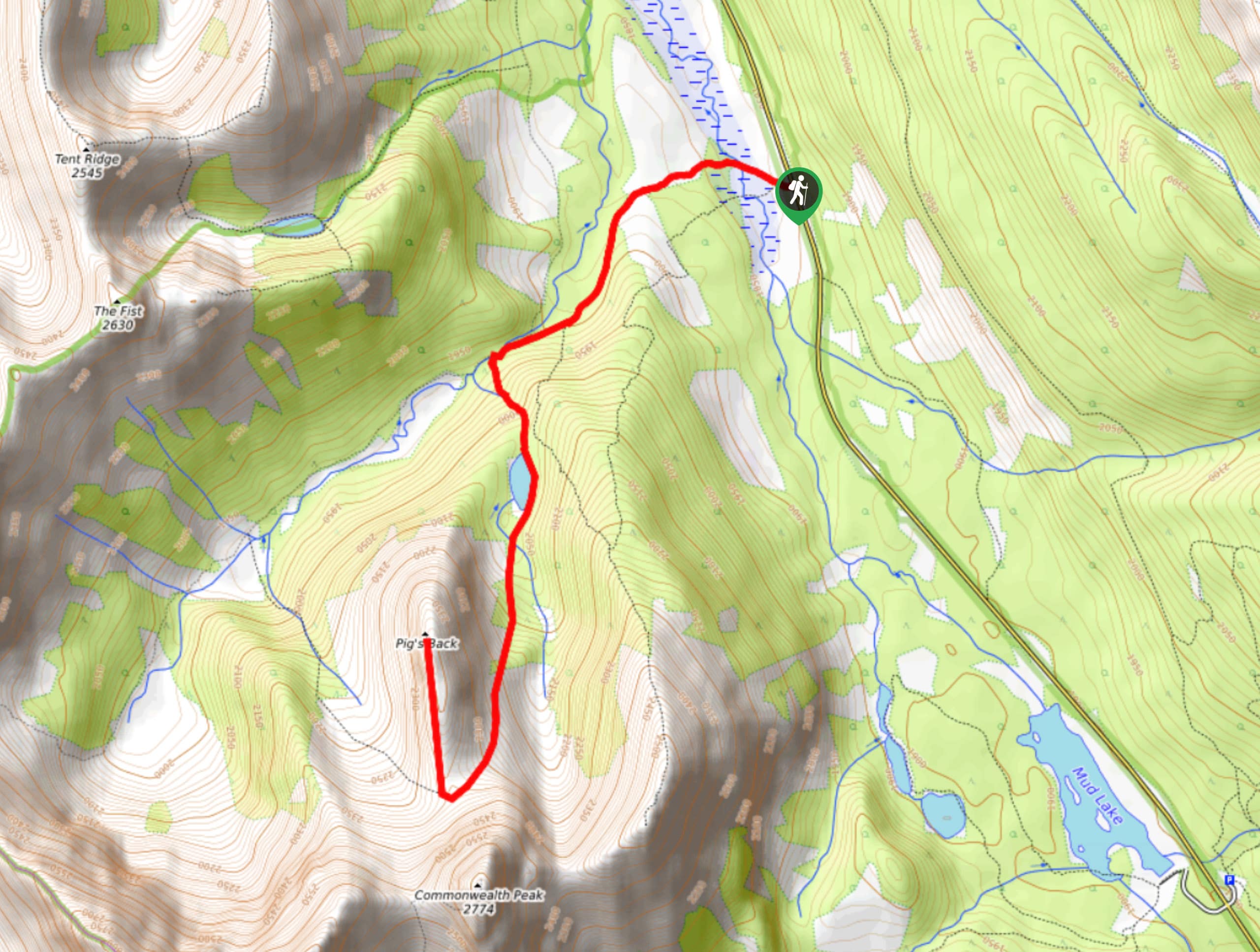
Pig’s Back Trail
The Pig’s Back is a route to a prominent feature along the Commonwealth Ridge Traverse. You will hike up Commonwealth…
Tryst Lake Trail
The trail to Tryst Lake is used year-round by many different types of adventurers. The summer trail is easy to…
Hidden Lake Trail
There’s an element of uncontained excitement when making your way to a destination with the name Hidden Lake. Just hearing…
mallorykirzinger 4 years ago
I'd definitely recommend doing this clockwise, as the scramble section at the start would be way too hard to downclimb. That being said, if you're not comfortable with exposure or hands-on climbing for some extended sections, pass this one up for now. It's a bit intimidating! Once actually on the ridge, the views were some of the best I've seen in the Rockies. So good. Note that if you're going clockwise, you should be watching on your right for a faint trail directly perpendicular that goes into the trees not long into the hike. You leave the well-defined trail but it's the right way- currently marked with orange flagging tape.
Greenlife 4 years ago
Spectacular views are waiting at the peak.
MayP 4 years ago
There are a few steep trail ascending, but we enjoyed it.
PeterHopkins 4 years ago
I had a spectacular adventure here surrounded by marvelous nature.
Willow F. 4 years ago
The ridge walk at the end of this hike was spectacular. Bringing a pole will definitely help you a lot. One of the memorable hikes I've done so far.
Jeremy R. 4 years ago
Sublime beauty. This hike is a must-do! Glad my friends invited me to hike with them. I'm just so happy to explore this side of Kananaskis.
Chris F. 4 years ago
Walking through the ridge was quite challenging for us, but we are glad we made it.
noraliu 4 years ago
It was deemed as one of the best hikes on the Kananaskis! The scenery certainly deserves that accolade.
Harry S. 5 years ago
Once you pop out of the forest, you'll get to see nice panoramic views! So relaxing. Definitely worth your visit.
NotMichaelScott 5 years ago
Scramble wasn't too bad, great views. You're exposed so it can get hot, windy, cold... the works. Classic hike.