Wilmer Wetlands
View Photos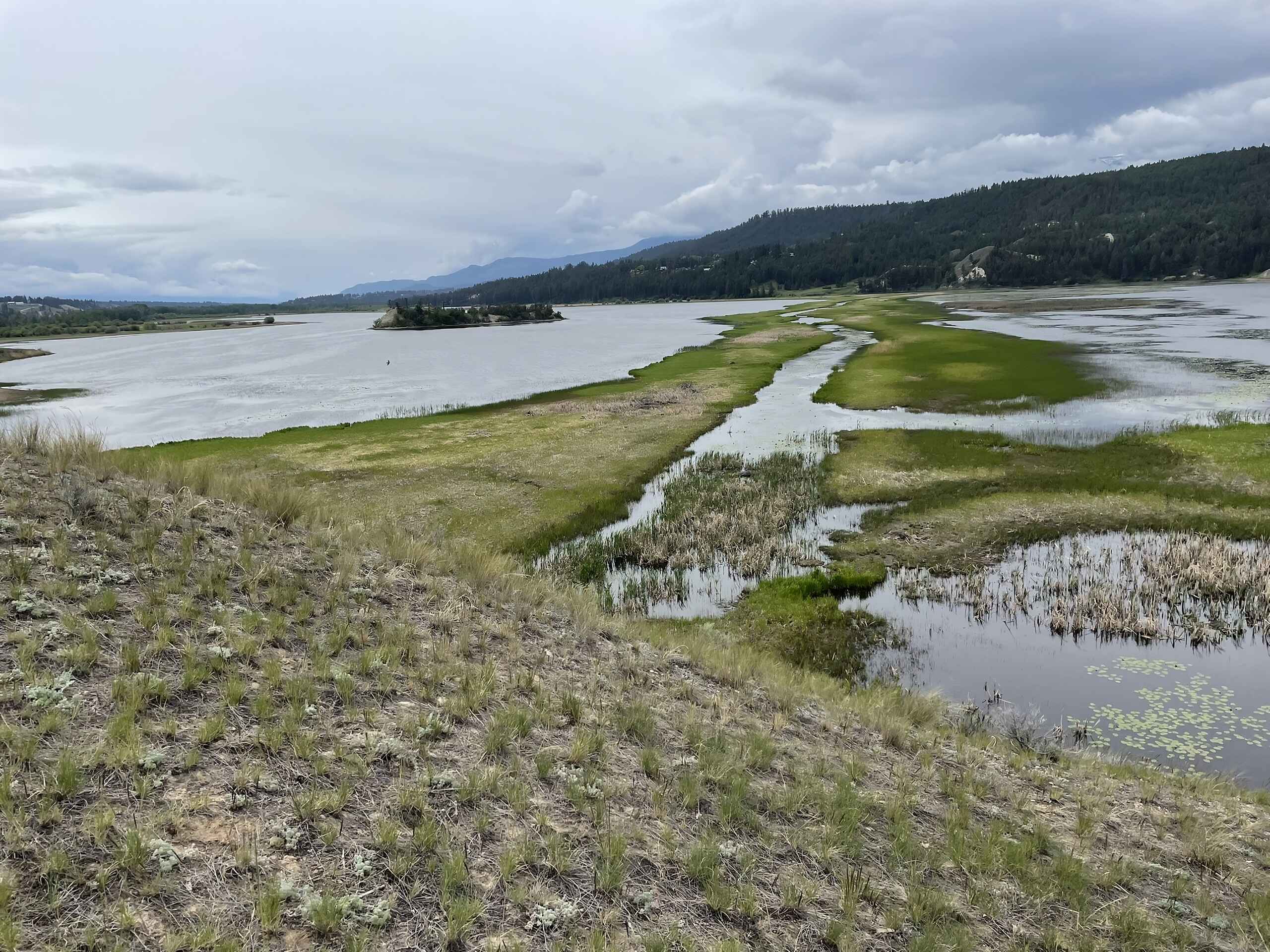
Wilmer Wetlands
Difficulty Rating:
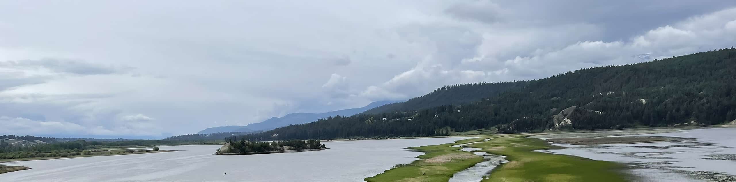
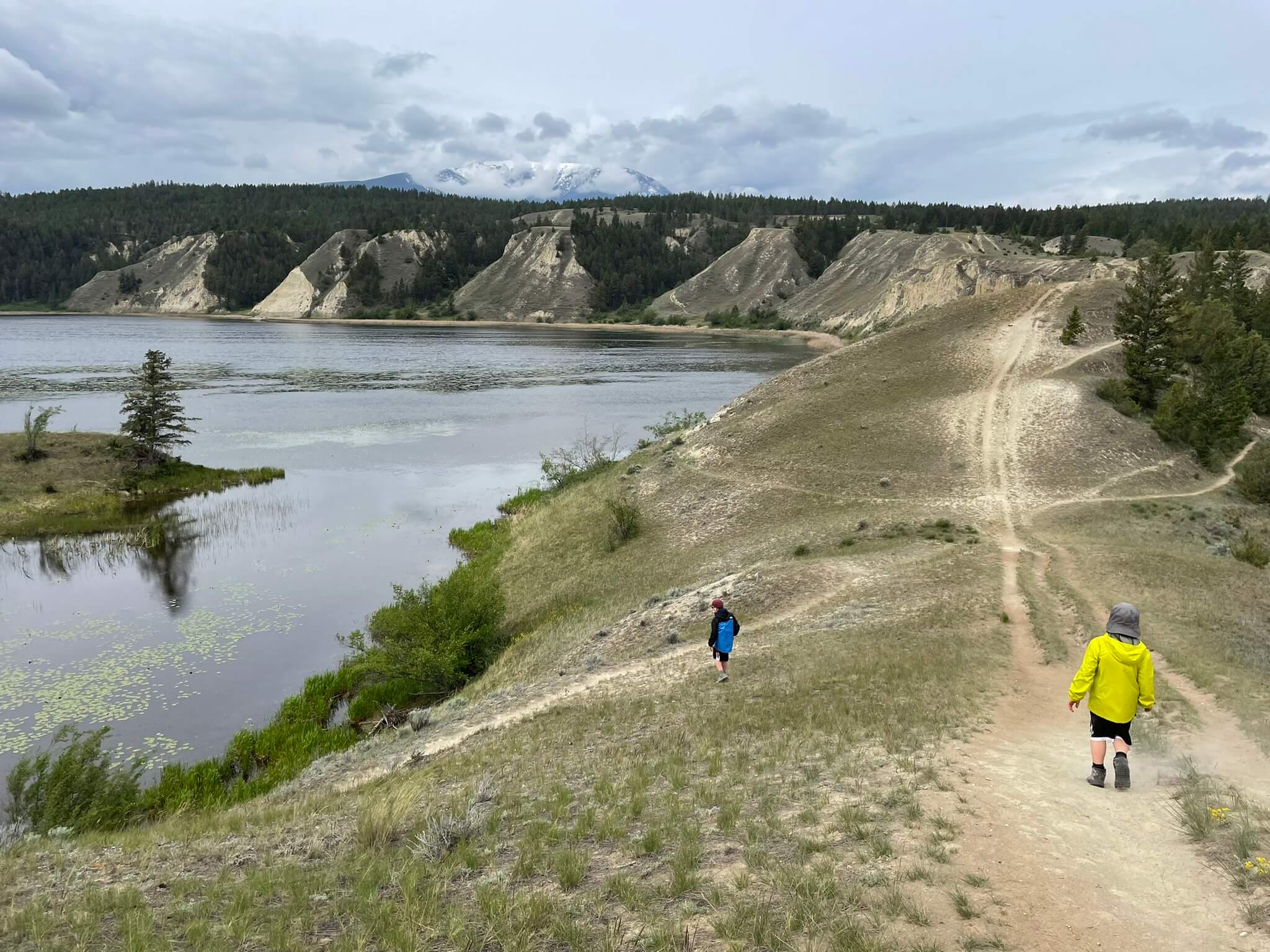
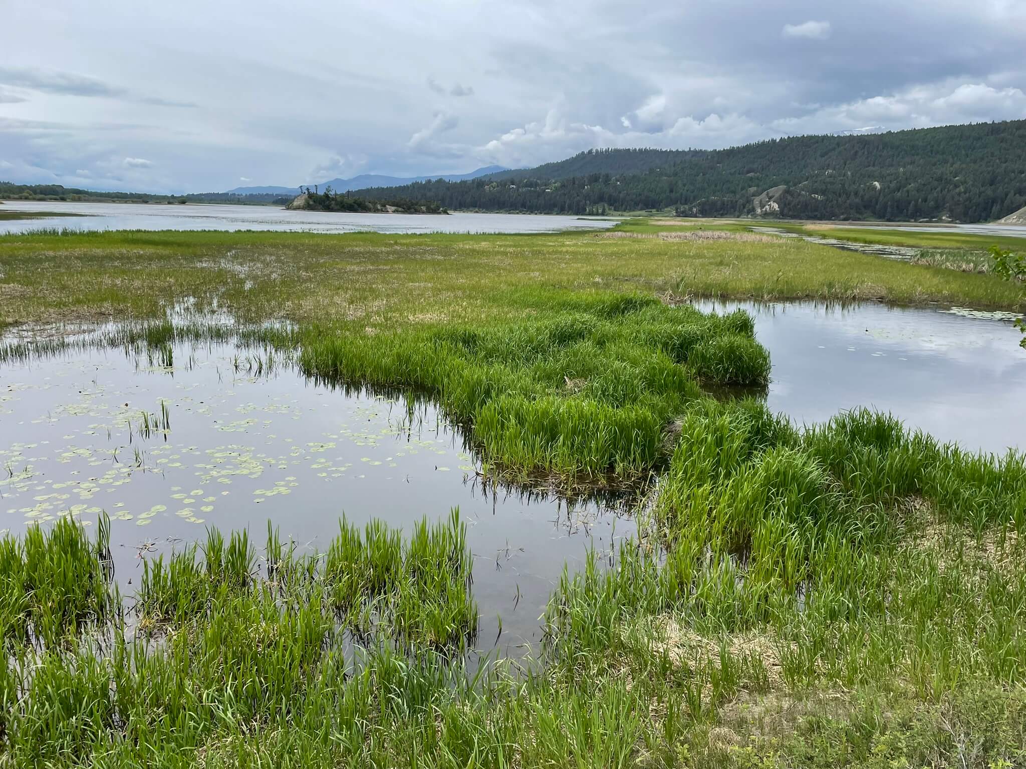
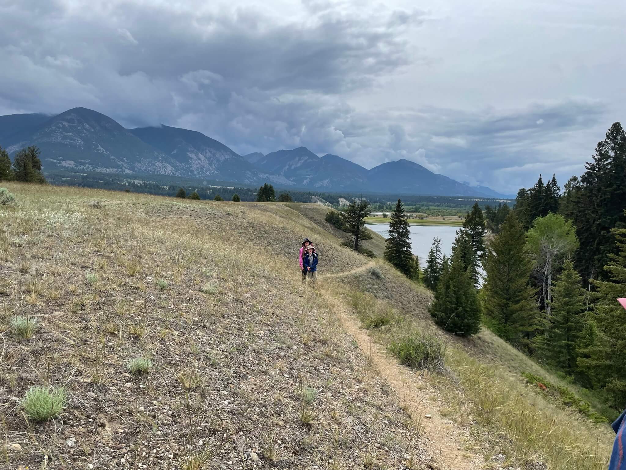
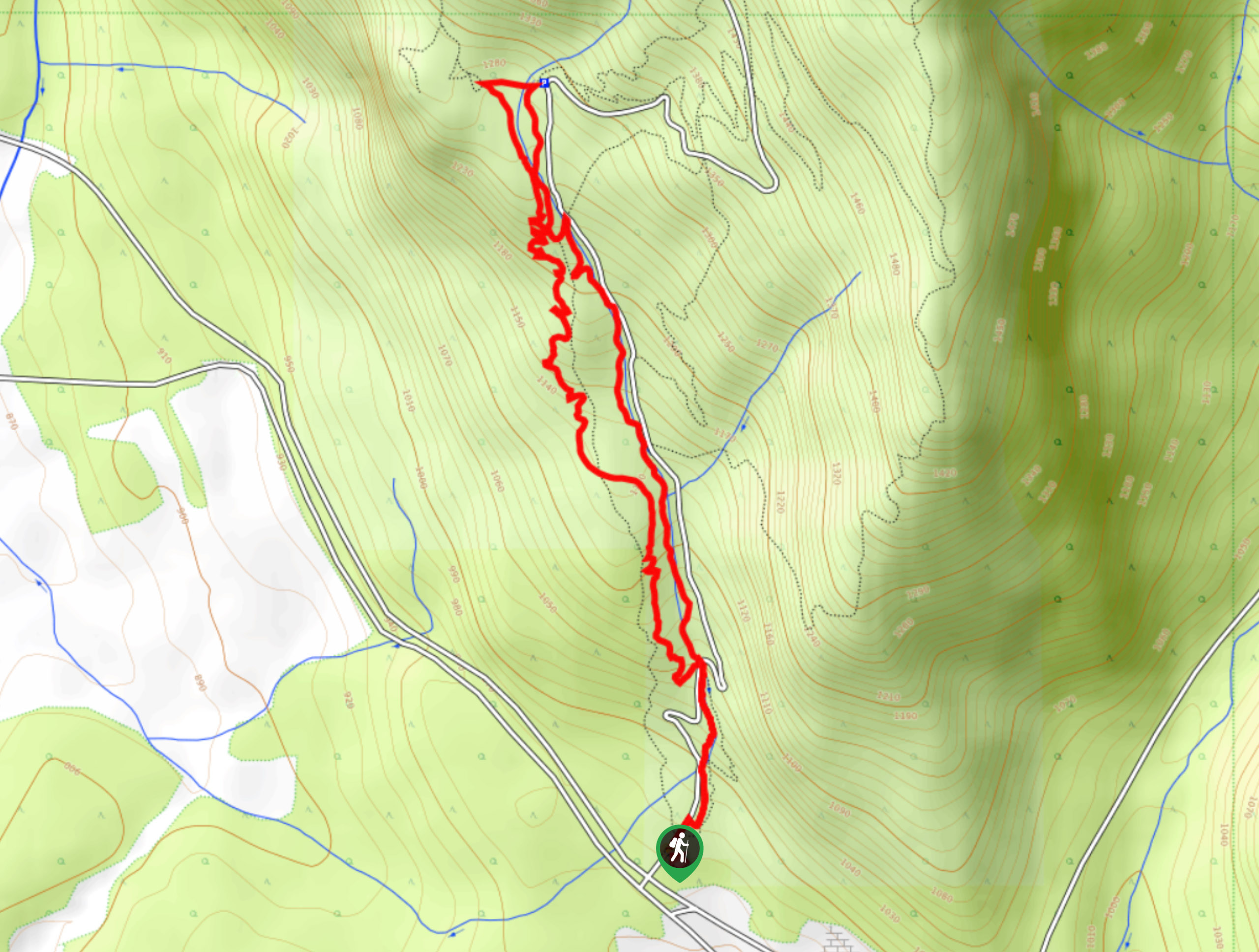
The trail through the Wilmer Wetlands is a 2.3mi circuit that loops around the edge of the wetland landscape and provides hikers with the opportunity to view various local wildlife species. The trail itself is relatively flat; however, there is a hilly portion at the end of the hike, which might reduce mobility for some hikers. Bring a pair of binoculars for an up-close view of the different animals in the area.
Getting there
To reach the parking area for the Wilmer Wetlands from Wilmer, head north on Main Avenue for 1640ft and continue to Westside Road. After 1.2mi, you will find the parking area and the trailhead on the right.

About
| When to do | May–October |
| Backcountry Campsites | No |
| Pets allowed | Yes - On Leash |
| Family friendly | Yes |
| Route Signage | Average |
| Crowd Levels | Moderate |
| Route Type | Lollipop |
Wilmer Wetlands
Elevation Graph
Weather
Wilmer Wetlands Description
Hiking through the Wilmer Wetlands is a fun experience that hikers of all skill levels and ages can enjoy. The trail follows closely alongside the edge of the wetland terrain found within the Columbia Valley and is beautifully framed by the Rocky Mountains to the east and the Purcell Mountains to the west.
As you hike along this loop trail, you will likely spot several animal species, including various types of birds, deer, and maybe even a coyote. There are some hilly portions of this hike, and one section follows along a steep cliffside drop-off, so watch your footing when out on the trail. This hidden gem of a hike is the perfect outing to enjoy the outdoors with family and friends.
Similar hikes to the Wilmer Wetlands hike
Mount Swansea Tower
Mount Swansea Tower is a 3.8mi lollipop hiking route in the Swansea Mountain Recreation Site near Invermere that…
Lower Bugaboo Falls
Lower Bugaboo Falls is a 1.6mi out-and-back hiking route northwest of Invermere that will allow hikers to experience…
Hale Hut via Placer Trail
Hale Hut via the Placer Trail is a 4.2mi out-and-back hiking route at the Panorama Mountain Resort near…
Comments