Rendezvous Mountain Trail
View Photos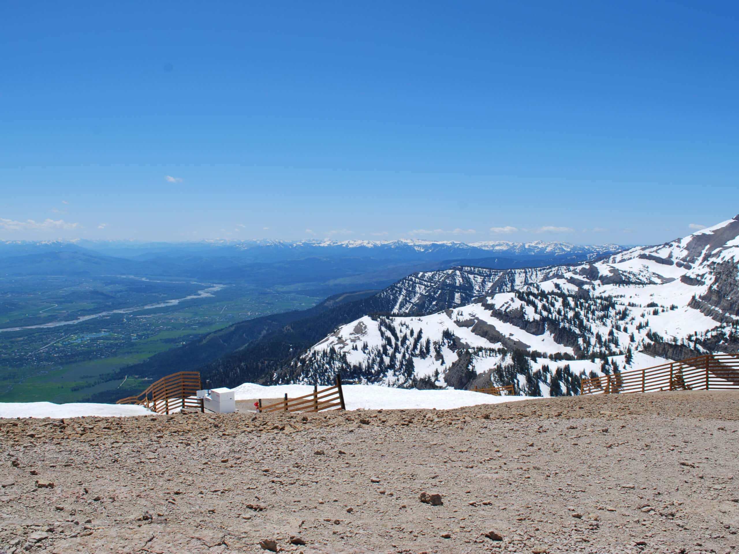
Rendezvous Mountain Trail
Difficulty Rating:
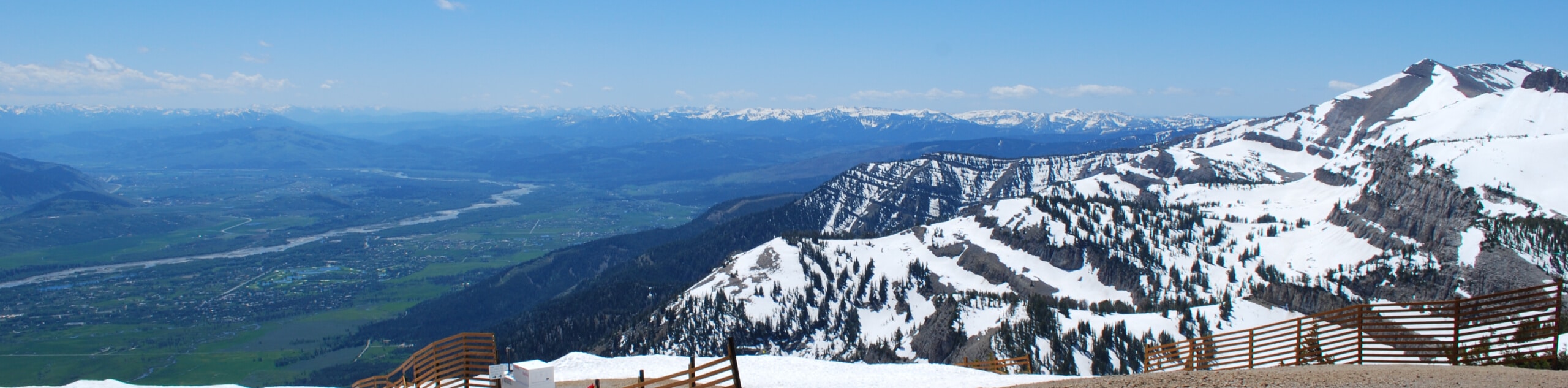
The Rendezvous Mountain Trail boasts a fun experience. Take the Aerial Tram up to the summit of the Teton Mountain and revel in the panoramic views of the majestic mountain range before immersing yourself amongst the craggy peaks. We love this high-country hike, and you likely will too.
Getting there
Access this hike via the Aerial Tramway in the Jackson Hole Mountain Resort off Teton Village Road.

About
| Backcountry Campground | Backcountry Camping, wilderness permit required. |
| When to do | April-October |
| Pets allowed | No |
| Family friendly | Older Children only |
| Route Signage | Average |
| Crowd Levels | Moderate |
| Route Type | Out and back |
Rendezvous Mountain Trail
Elevation Graph
Weather
Rendezvous Mountain Trail Description
The Rendezvous Mountain Hike is a dynamic trek that grants incredible views, exhibiting the mountains’ magnificence. While the ride down the Aerial Tramway is free, those taking the gondola up will have to purchase a ticket. Check out the Jackson Hole Mountain Resort website for updated pricing and hours. If you wish not to take the tramway up the mountain, add on a few miles by hiking the Wildflower Trail up to the trailhead. Don’t forget your canister of bear spray; this route explores bear country! Note the Grand Teton National Park charges an entrance fee; refer to the NPS website for additional information.
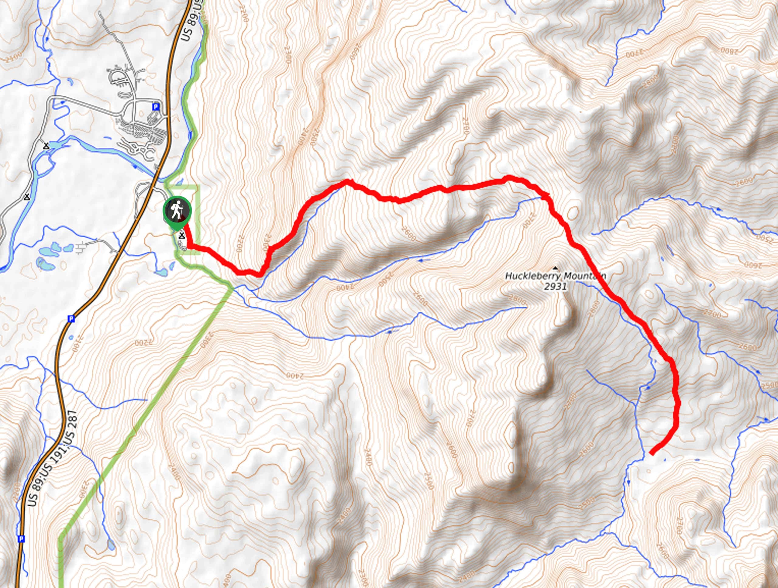
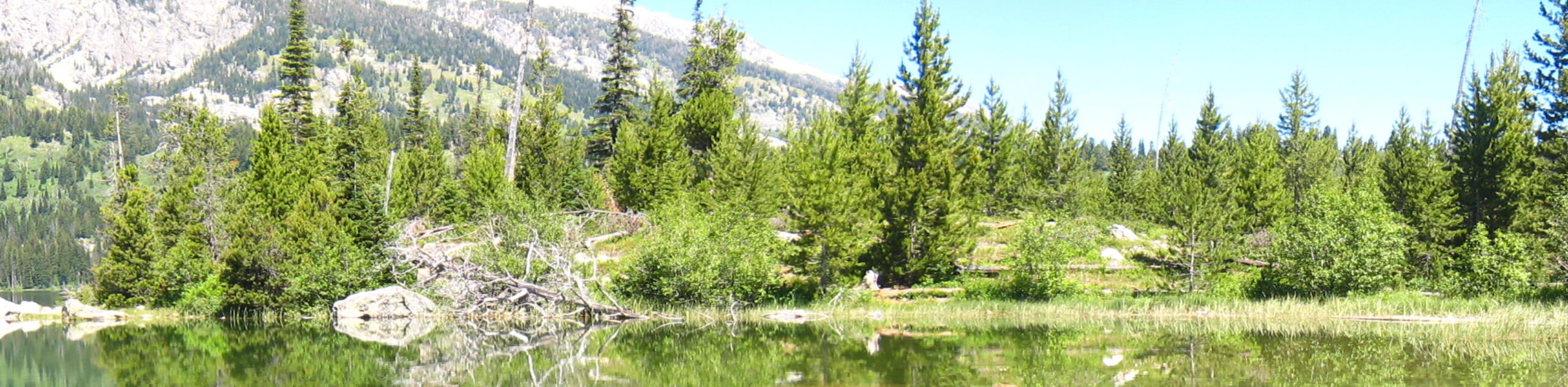
After your spectacular gondola ride up to the summit of Rendezvous Mountain, you will find a trailhead signposted as the Top of the World Loop. Take this route heading southwestwardly, and you will soon confront an intersection with the Rendezvous Mountain Trail, veer right here. This scenic route travels via switchback down the rocky terrain through tree stands and montane meadows. Tracking westwardly, you will be motivated by inspiring views of the nearby craggy peaks.
Following the Rendezvous Mountain Trail, you will eventually intersect with the South Fork Granite Creek. Just beyond this point, you will reach the backcountry campsites, which mark your turnaround point. From here, simply retrace your footing along the path and take the tram back down the mountainside.
Similar hikes to the Rendezvous Mountain Trail hike
Sheffield Creek Trail
Located on the border of the Yellowstone and the Grand Tetons National Parks, the Sheffield Creek Trail has remained relatively…
South Landing Trail
Hiking the South Landing Trail is a pleasant experience. This lovely footpath traces the southeastern shore of Jackson Lake, boasting…
Delta Lake via Taggart Lake Hike
Rise and shine, it's time to climb! The Delta Lake via Taggart Lake Hike is a marvelous adventure into the…
Comments