
Poia Lake Trail
View Photos
Poia Lake Trail
Difficulty Rating:
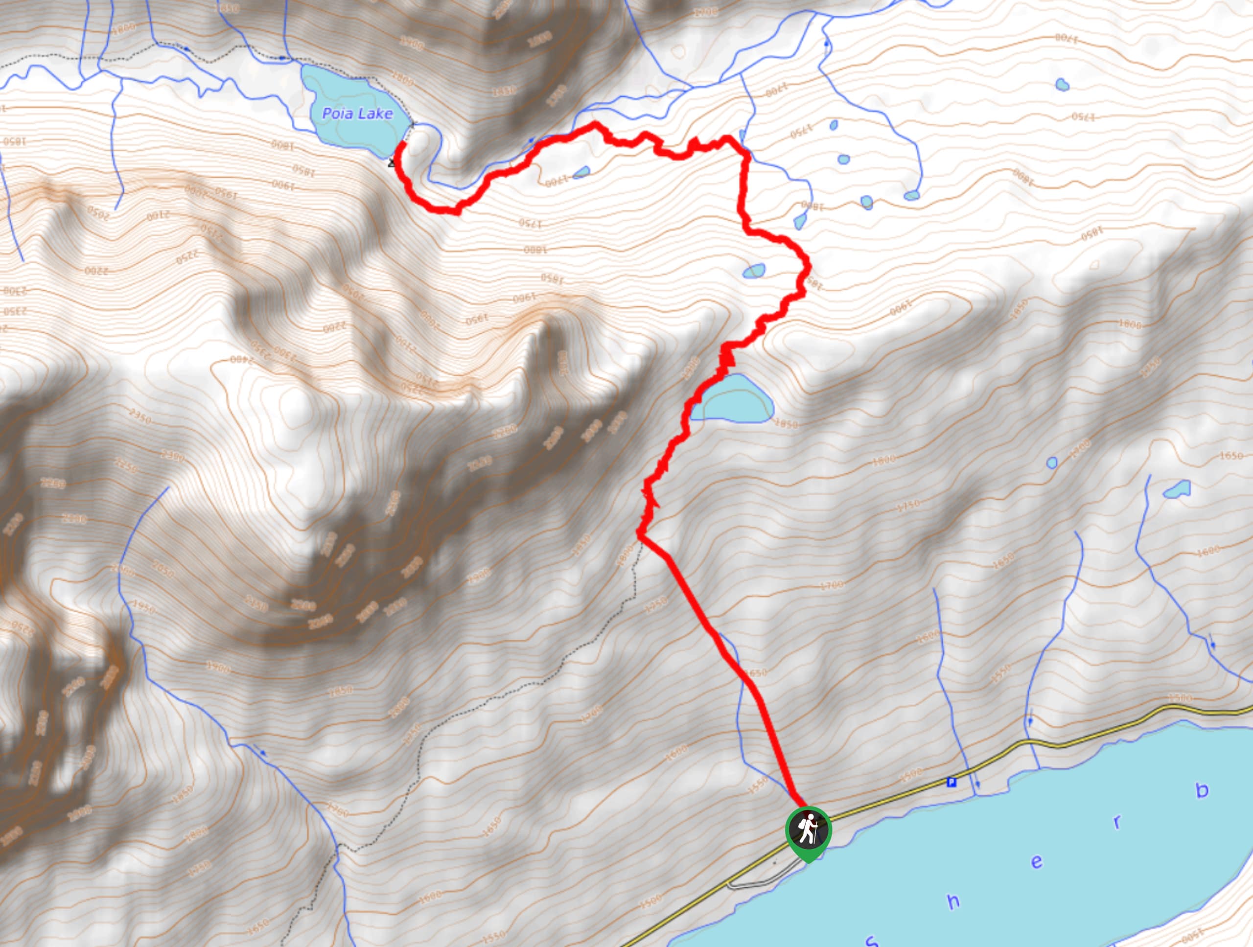
Poia Lake Trail is a scenic trail that takes you through limestone mountains, climbing ridges and exploring Poia Lake’s pebble beach. This trail has some elevation to it, so wear some sturdy hiking shoes. As you wander through Poia Lake Trail, be aware of your surroundings as bears frequent this area.
Getting there
To get to Poia Lake Trail from Babb, head East toward US-89 South and turn right. Turn right onto Route 3, and after 7.5mi, turn right to reach your destination.

About
| When to do | June - September |
| Backcountry Campsites | No |
| Pets allowed | No |
| Family friendly | No |
| Route Signage | Average |
| Crowd Levels | Moderate |
| Route Type | Out and back |
Poia Lake Trail
Elevation Graph
Weather
Poia Lake Trail Description
Poia Lake Trail is full of beautiful scenery that follows you throughout the whole trail. Starting at the Apikuni Trailhead, follow the path through meadows of aspen trees and begin climbing up ridges. The forest turns to pine trees, and you will come across a small lake. Continue on, and following the Kennedy Creek drainage, walk down the steep trail to get to Poia Lake. This lake has a pebble beach where you can enjoy lunch and a swim in the summer months. This is an out-and-back trail, so when you are ready, head back the way you came.
Find more epic hikes in Glacier National Park
Similar hikes to the Poia Lake Trail hike

Fish Lake Trail
Fish Lake Trail is a mix between relaxing and heart pumping. The start of the trail takes you through a…

Quartz Creek Trail
Quartz Creek Trail is a relaxing hike on a remote trail in Glacier National Park. The hike takes you through…

Snyder Ridge Trail
Hiking through Snyder Ridge Trail takes you through a forest for most of the trail that follows the ridge along…
Comments