
Rogers Meadow Trail
View Photos
Rogers Meadow Trail
Difficulty Rating:
Rogers Meadow Trail is a journey into the wilderness, where few hikers ever travel. To get to this trail, you have to go through a sometimes almost impassable road, but you will be rewarded with the beautiful views that surround this area of Glacier National Park. This trail is also home to many bears, wolves, beavers and moose, so keep your eyes peeled for wildlife when hiking.
Getting there
To get to Rogers Meadow Trail, you have to travel to Inside North Fork Road, where you follow this one lane.The road leading to the trailhead can be daunting as it has many potholes.

About
| When to do | Year-round |
| Backcountry Campsites | No |
| Pets allowed | No |
| Family friendly | No |
| Route Signage | Poor |
| Crowd Levels | Low |
| Route Type | Out and back |
Rogers Meadow Trail
Elevation Graph
Weather
Rogers Meadow Trail Description
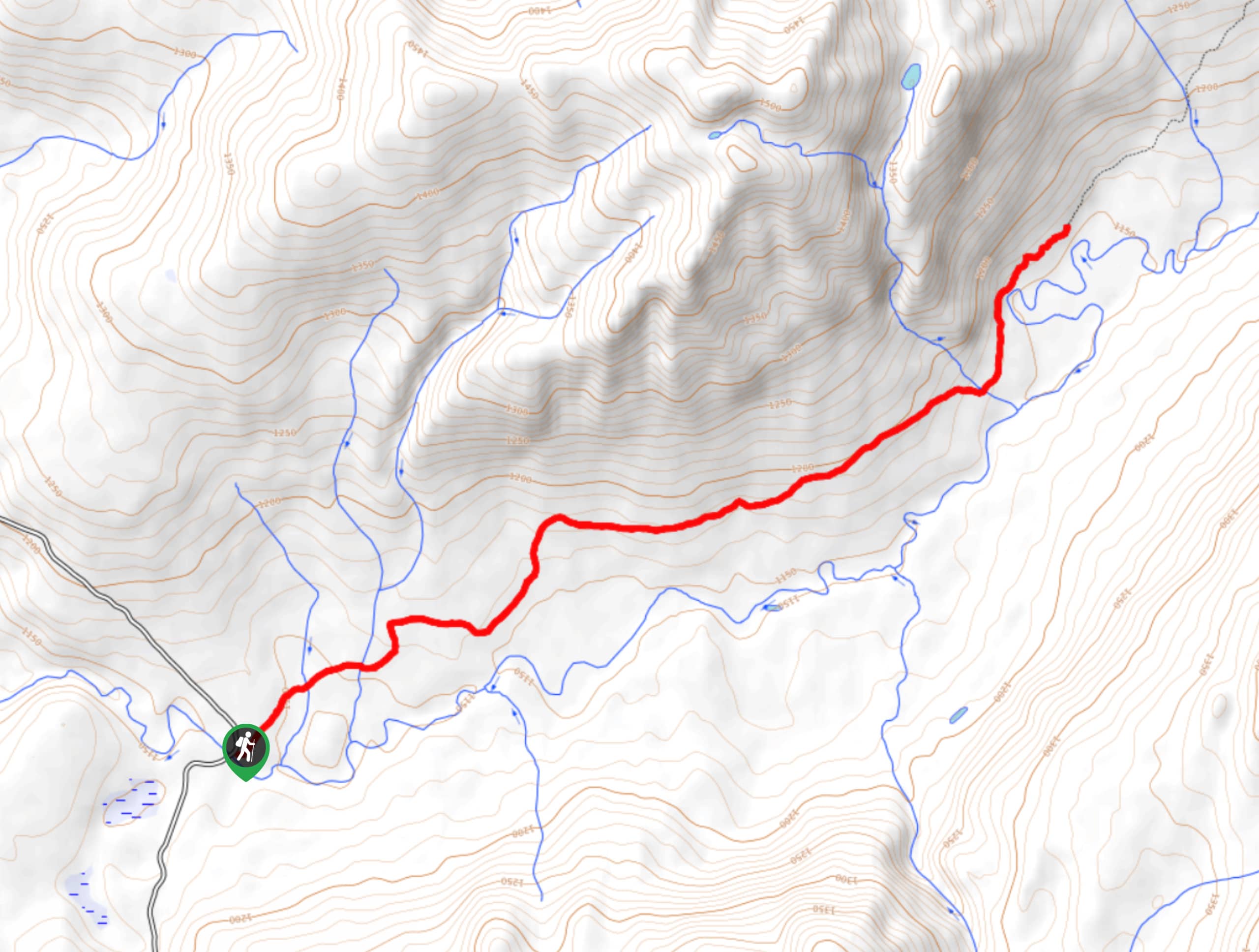
The Rogers Meadow Trail is a hike in Glacier National Park that few people ever get to. This trail is full of stunning scenery and wildlife. Follow the trail up Camas Creek while you take in views of Stanton Mountain, Mount Vaught, Heavens Peak and Rogers Peak.At 3.2mi, you will find yourself in Rogers Meadow. After enjoying the scenery, head back the way you came as this is an out-and-back trail.
Find more epic hikes in Glacier National Park
Similar hikes to the Rogers Meadow Trail hike

Fish Lake Trail
Fish Lake Trail is a mix between relaxing and heart pumping. The start of the trail takes you through a…

Quartz Creek Trail
Quartz Creek Trail is a relaxing hike on a remote trail in Glacier National Park. The hike takes you through…

Snyder Ridge Trail
Hiking through Snyder Ridge Trail takes you through a forest for most of the trail that follows the ridge along…
Comments