
Akokala Lake Trail
View Photos
Akokala Lake Trail
Difficulty Rating:
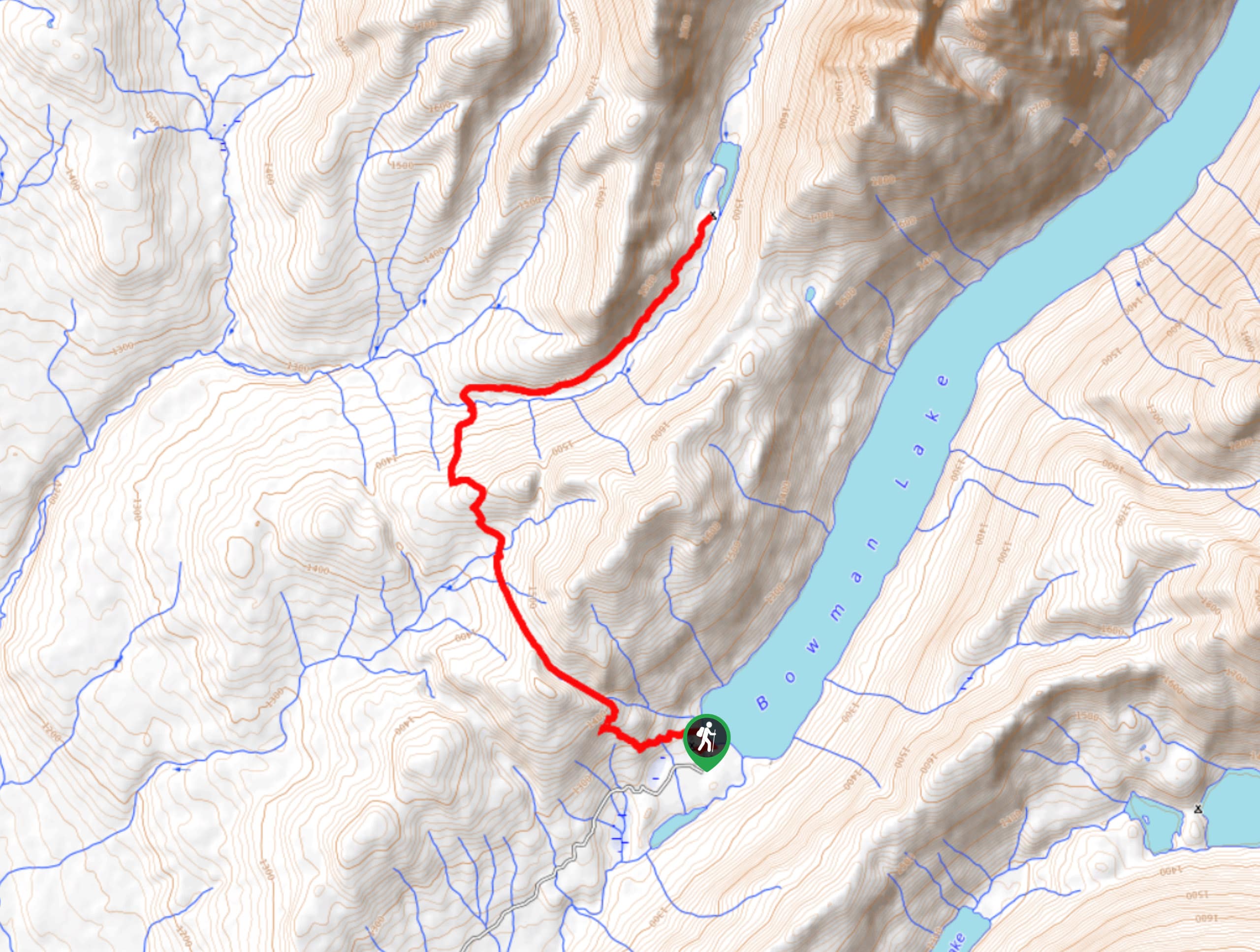
Akokala Lake Trail is a serene destination in Glacier National Park that houses on the six highest peaks in the park. Kintla Peak towers over you as you make your way towards Akokala Lake. There are many open areas of the forest that were damaged by the fire spread throughout the park, so you can see glimpses of the spectacular views as you hike through the forest.
Getting there
Getting to Akokala Lake Trail (the Bowman Lake Campground) from the Polebridge Ranger Station, head northeast toward Glacier Drive and turn right. Turn right onto North Folk Road and after 0.2mi, turn right onto Bowman Lake Road. Arrive at Bowman Lake Campground after 5.4mi.

About
| When to do | May - October |
| Backcountry Campsites | Bowman Campground |
| Pets allowed | No |
| Family friendly | No |
| Route Signage | Average |
| Crowd Levels | Low |
| Route Type | Out and back |
Akokala Lake Trail
Elevation Graph
Weather
Akokala Lake Trail Description
Akokala Lake Trail is a stunning hike that houses one of the six highest peaks in Glacier National Park, towering over at 10000ft in height. This hike begins at the foot of Bowman Lake; you’ll find the Akokala Lake Trailhead in the campground. As you continue to hike, you will come across Numa Ridge, where dense forest awaits. Eventually, you will arrive at Akokala Lake and will have beautiful views of Kintla Peak.
Find more epic hikes in Glacier National Park
Similar hikes to the Akokala Lake Trail hike

Fish Lake Trail
Fish Lake Trail is a mix between relaxing and heart pumping. The start of the trail takes you through a…

Quartz Creek Trail
Quartz Creek Trail is a relaxing hike on a remote trail in Glacier National Park. The hike takes you through…

Snyder Ridge Trail
Hiking through Snyder Ridge Trail takes you through a forest for most of the trail that follows the ridge along…
Comments