
Snyder Lake Trail
View Photos
Snyder Lake Trail
Difficulty Rating:
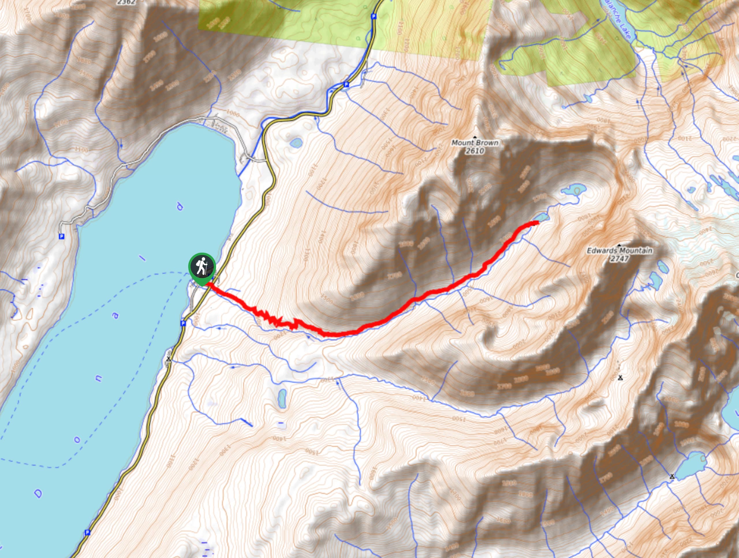
Snyder Lake Trail is a beautiful hike that showcases Mt Brown and Edwards Mountains flanking Snyder Lake. You will see the regrowth through the forest that has taken place due to the Sprague Fire that took place in 2017. If you look close enough, you will also spot waterfalls cascading down the sides of the mountains.
Getting there
To get to Snyder Lake Trail from Agpar, head North toward Apgar Loop/Lake View Drive and turn right. Turn left onto Glacier Route 1 Road/Going-to-the-Sun Road and after 11.0mi you will arrive at your destination.

About
| When to do | May - September |
| Backcountry Campsites | No |
| Pets allowed | No |
| Family friendly | No |
| Route Signage | Average |
| Crowd Levels | Moderate |
| Route Type | Out and back |
Snyder Lake Trail
Elevation Graph
Weather
Snyder Lake Trail Description
The Snyder Lake Trail is a beautiful hike that reminds us of our wilderness’s strength when you see the aftermath of the Sprague Fire and how nature has rebuilt. Beginning the hike at the Sperry Trailhead, it quickly becomes Gunsight Pass Trail and has a steep climb. At 1.7mi from the trailhead, turn left at the Snyder Lake Trail junction and follow Snyder Creek. Most of this trail area flows through high vegetation, so make sure you make a lot of noise and carry your bear spray. Another steep climb will come your way before you descend down to Snyder Lake. Take your time and then follow the trail back the way you came as this is an out-and-back trail.
Find more epic hikes in Glacier National Park
Similar hikes to the Snyder Lake Trail hike

Fish Lake Trail
Fish Lake Trail is a mix between relaxing and heart pumping. The start of the trail takes you through a…

Quartz Creek Trail
Quartz Creek Trail is a relaxing hike on a remote trail in Glacier National Park. The hike takes you through…

Snyder Ridge Trail
Hiking through Snyder Ridge Trail takes you through a forest for most of the trail that follows the ridge along…
Comments