
Perley Rock Trail
View Photos
Perley Rock Trail
Difficulty Rating:
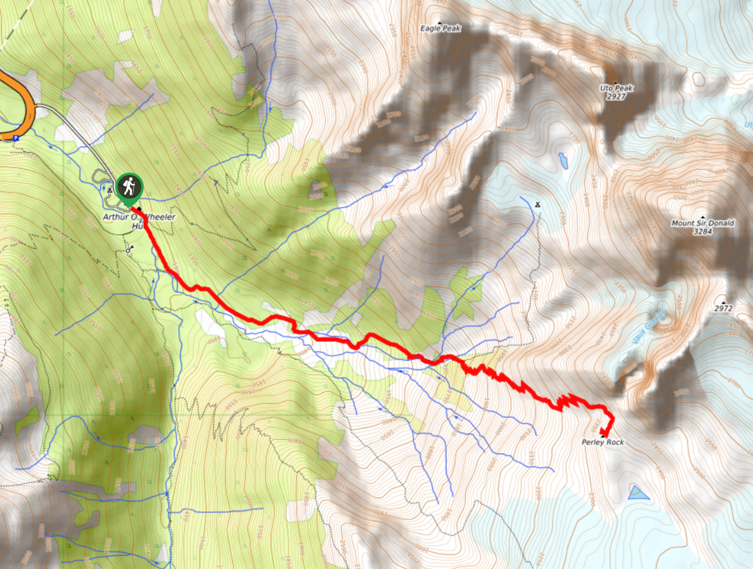
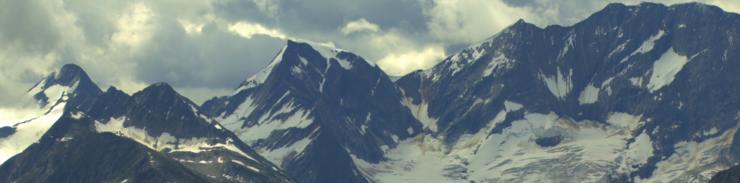
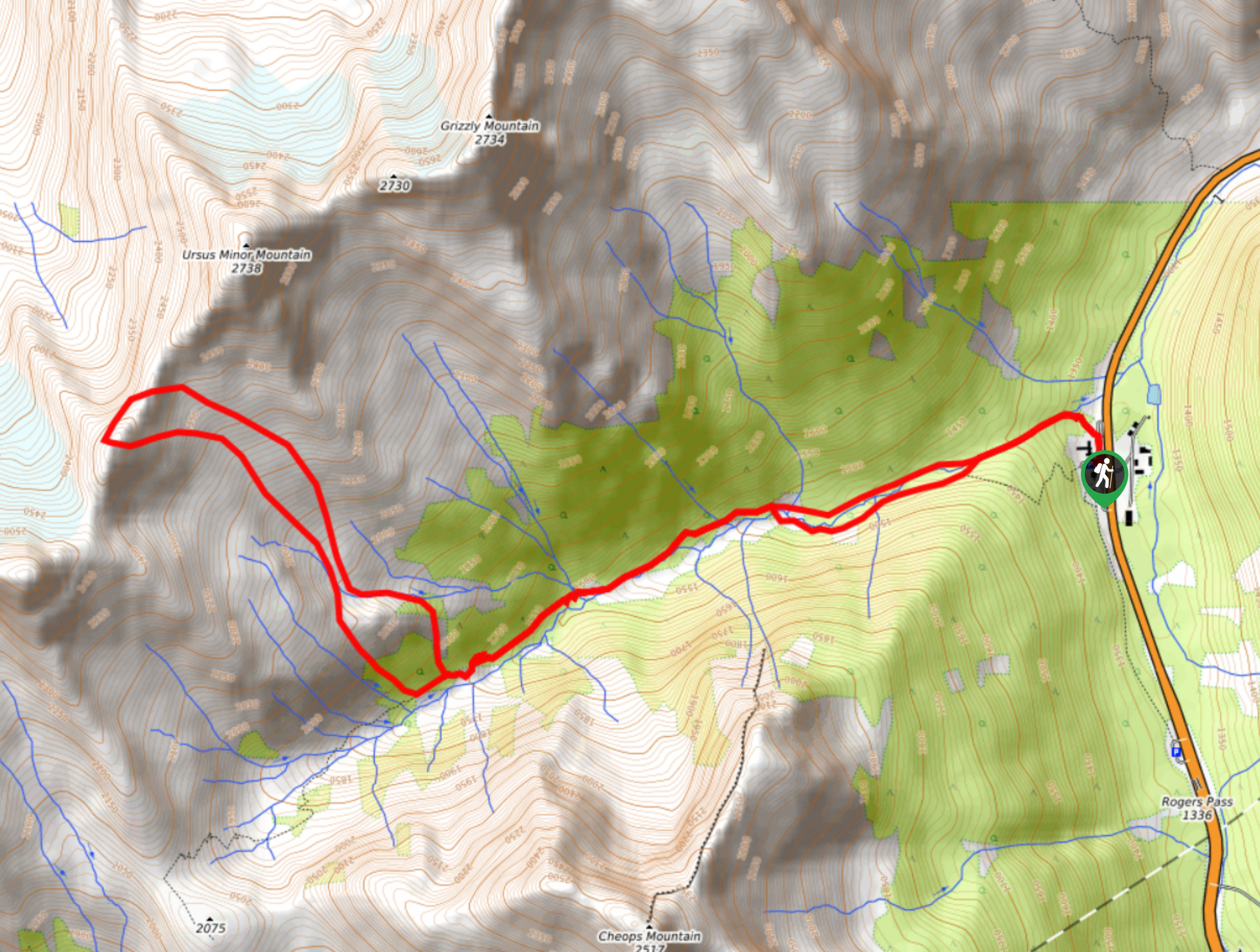
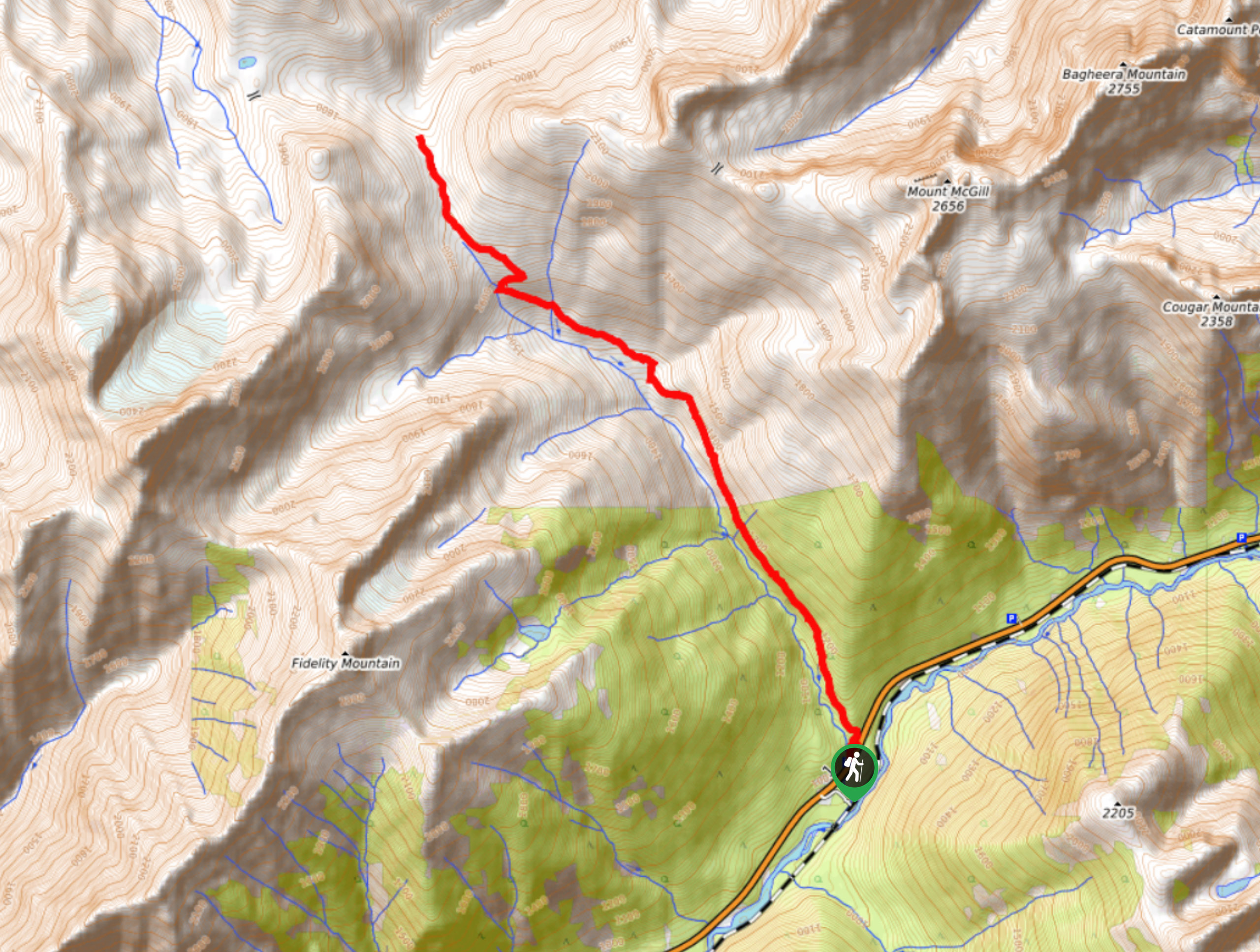
The Perley Rock Trail is a tough uphill hiking route in Glacier National Park that crosses over several rivers and streams on the way to a ridge that offers a viewpoint over the immense Illecillewaet Glacier. Along the trail, you will experience beautifully scenic views of the valley and surrounding mountains before visiting the glacier for an up-close view of its frosty surface and unique ice caves. Make sure to pack adequate layers, as it can be very chilly up by the glacier.
Getting there
To access the parking area for the Perley Rock Trail from Revelstoke, head east along BC-1 E for a distance of 37.9mi and make a right turn toward the Illecillewaet Campground, where you will find parking and the trailhead.

About
| When to do | June-October |
| Backcountry Campsites | Illecillewaet Campground |
| Pets allowed | Yes - On Leash |
| Family friendly | No |
| Route Signage | Average |
| Crowd Levels | Moderate |
| Route Type | Out and back |
Perley Rock Trail
Elevation Graph
Weather
Perley Rock Trail Desktop
The Perley Rock Trail is a challenging out-and-back hiking route in Glacier National Park that features river crossings and amazing glacier views. The trail climbs uphill over 6.2mi with an elevation gain of 3963ft, making this route a bit of a grind. This is definitely offset by the stunning views over the alpine valley surrounded by rugged mountains, as well as the opportunity to hike a bit beyond the end of the trail to visit the imposing mass of the Illecillewaet Glacier up-close. This route is one of the best in the area and should be added to your list if you are planning a trip to Glacier National Park.
Similar hikes to the Perley Rock Trail hike
Hermit Trail
Hike along the Hermit Trail for a physically demanding but ultimately rewarding journey up to an alpine campsite in Glacier…
Video Peak Trail
The Video Peak Trail is a scenic 8.4mi hiking route in Glacier National Park that takes you through…
Bostock Creek Trail
The Bostock Creek Trail is a 9.5mi out-and-back hiking route that climbs uphill alongside the rushing waters of…
Comments