Meeting of the Waters
View Photos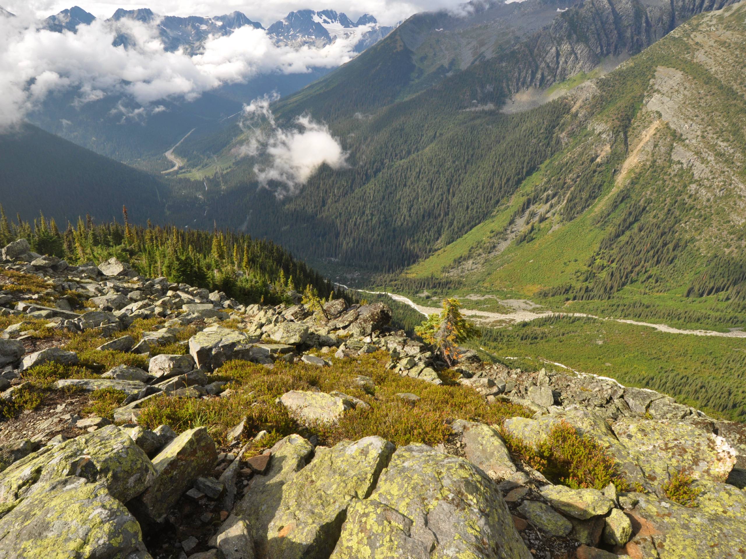
Meeting of the Waters
Difficulty Rating:
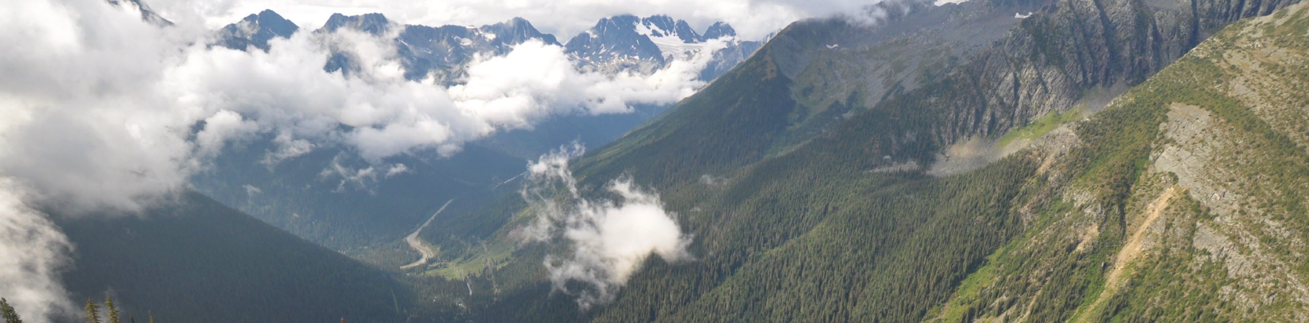
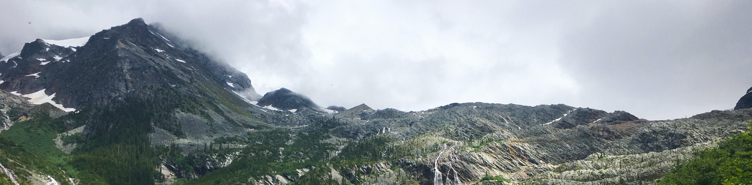
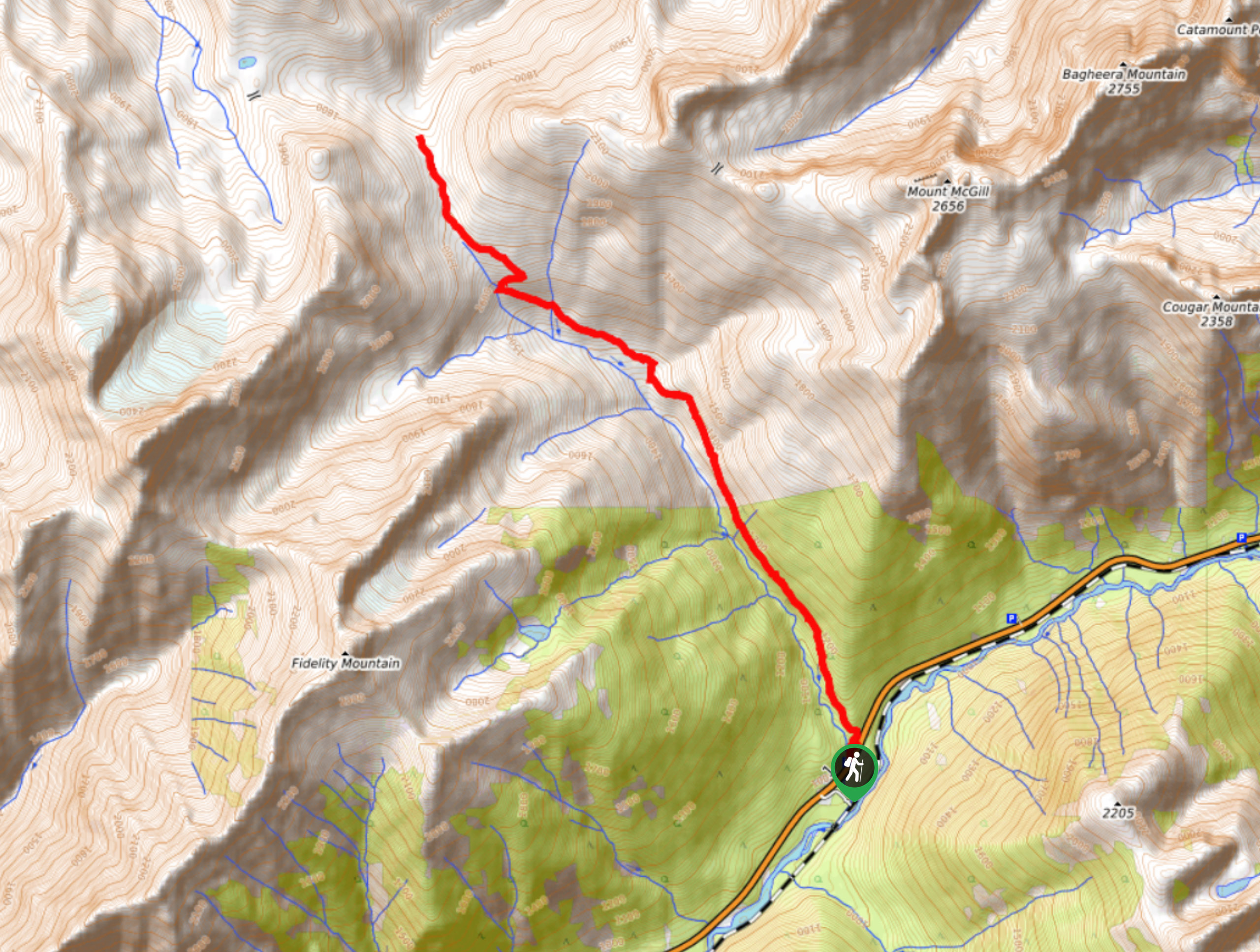
The Meeting of the Waters is a 3.8mi hiking route through Glacier National Park that climbs uphill along the Illecillewaet River to experience a majestic waterfall. Along the trail, hikers will be exposed to some amazing views overlooking the entire watershed and its surrounding mountains. This is a great medium-length hike in the park that the entire family is sure to love.
Getting there
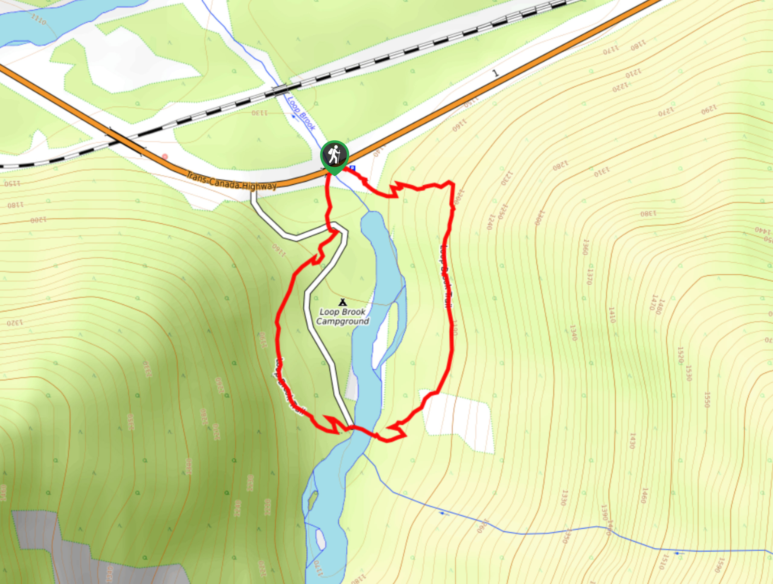
To access the Meeting of the Waters trailhead from Revelstoke, head east along BC-1 E for 37.9mi, making a right-hand turn to pull into the parking area at the Illecillewaet Campground. From here, you will find the trailhead just beyond the parking area to the southeast.

About
| When to do | June-October |
| Backcountry Campsites | Illecillewaet Campground |
| Pets allowed | No |
| Family friendly | Yes |
| Route Signage | Average |
| Crowd Levels | Moderate |
| Route Type | Lollipop |
Meeting of the Waters
Elevation Graph
Weather
Meeting of the Waters Description
The Meeting of the Waters is a moderately trafficked hiking route in Glacier National Park that climbs uphill alongside the Illecillewaet River to provide some amazingly scenic views over the entire watershed. This trail is well-marked and climbs gradually uphill through the alpine terrain to some picturesque views of nearby waterfalls, making this a perfect route for hikers of all skill levels, including families. As the route does pass through bear country, it is best to travel in groups, make lots of noise, and bring bear spray when utilizing this trail.
Setting out from the parking area, follow the path past Wheeler Hut and pass through the four-way intersection, heading right at the junction immediately after it. Follow the trail as it hugs alongside the Illecillewaet River before turning right at the junction to cross over its rushing waters. After making your way over the river, head left at the next junction to steadily climb uphill along the forested trail. Along the entirety of the route, you will be able to hear the sound of the coursing water of the river beside you, until you reach a viewpoint looking out to the majestic falls. Having taken in the amazing views, head back down the trail, continuing straight through the junction to pass by Great Glacier House on your return journey to the Meeting of the Waters trailhead.
Similar hikes to the Meeting of the Waters hike
Loop Brook Trail
The Loop Brook Trail is a short, informative hiking route that will take you through the scenic valley to visit…
Great Glacier Trail
The Great Glacier Trail is an 4.9mi out-and back hiking route in Glacier National Park that features waterfalls,…
Bostock Creek Trail
The Bostock Creek Trail is a 9.5mi out-and-back hiking route that climbs uphill alongside the rushing waters of…
Comments